May 10 2023
Wednesday Morning Update
Yesterday turned out to be a pleasant surprise. We did get our rain and cool temps and then the sky cleared for a pleasant end to the day. This symbolized the model bias for weather systems. The timing often ends up faster, which is soothing to consider as we look ahead.
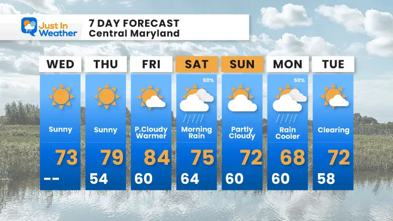
The next few days will be sunny and quiet, but there is still weather to talk about. Temps will be warming each day. Then we will track the rain expected this weekend. At this point it looks like a Saturday event, but if the timing ends up faster (again), we may get that to push out before the end of the day.
That timing issue can also be applied to the following system which is expected to be on Monday (for now).
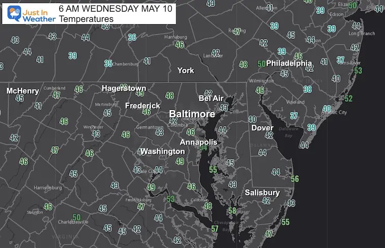
Morning Temperatures
With the clear sky, most of our region has settled uniformly in the 40s.
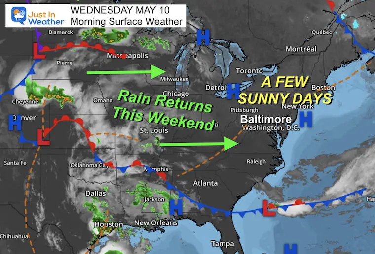
Morning Surface Weather
High Pressure is in control and will remain for a few days. This means a stretch of sunny days and a warming trend.
The next weather system is expected to reach us by Saturday morning.
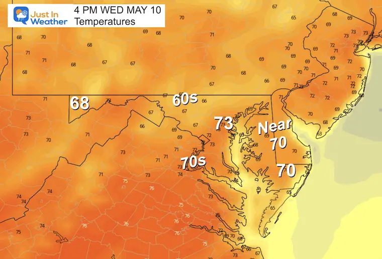
Afternoon Temperatures
Subscribe for eMail Alerts
CLIMATE DATA
TODAY May 10
Normal Low in Baltimore: 52ºF
Record 33ºF in 1983
Normal High in Baltimore: 74ºF
Record 96ºF 1896
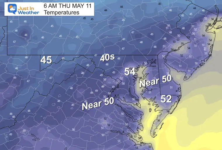
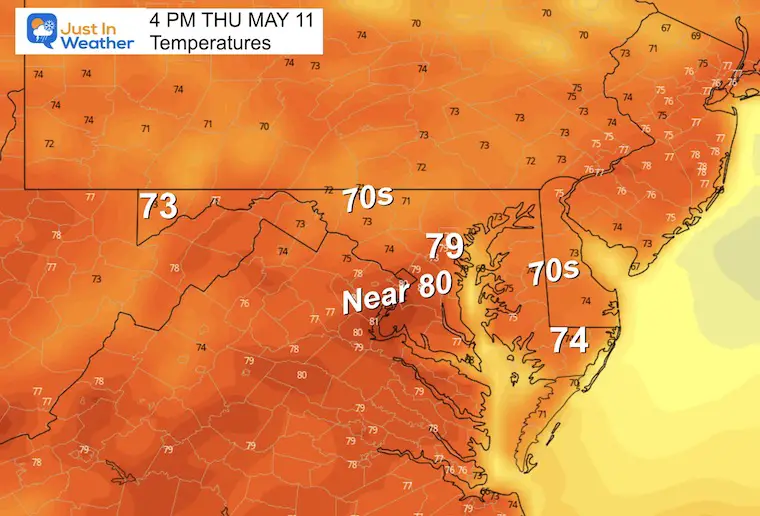
Thursday Temperatures
Morning
Afternoon
Storm Animations
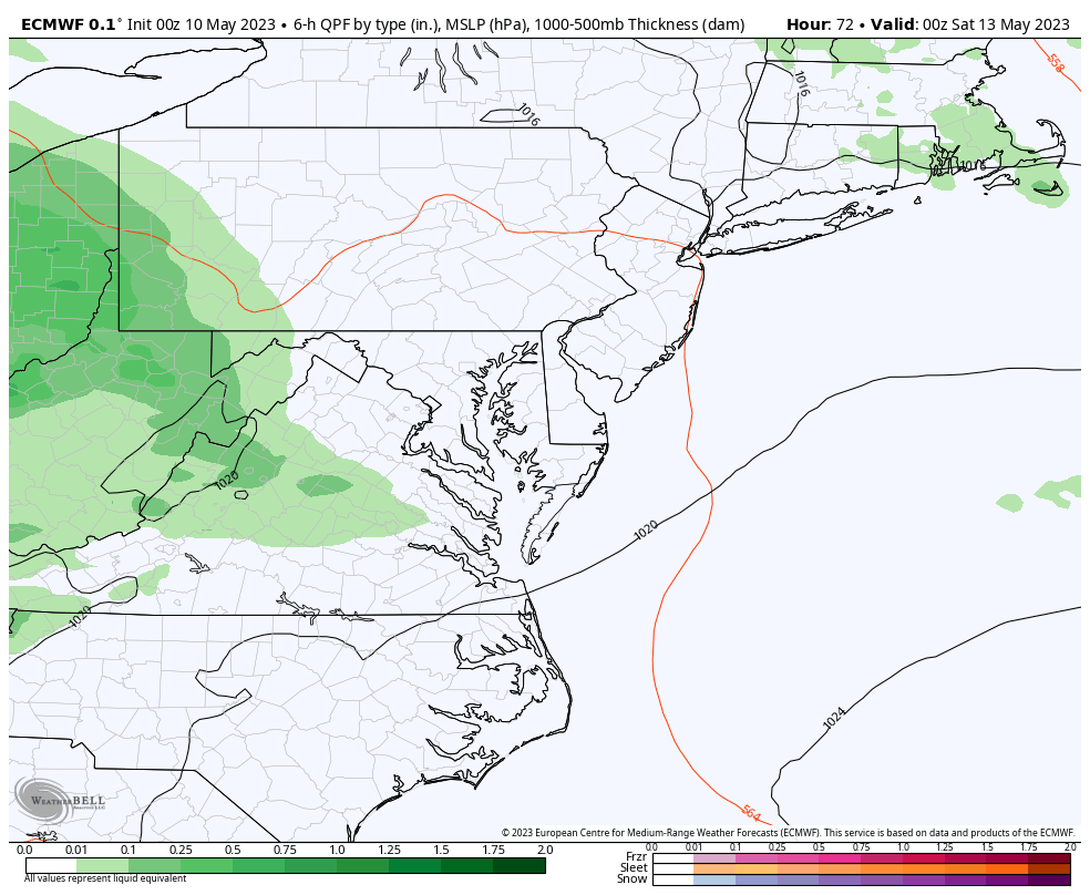
ECMWF Model
After a sunny and warm Friday, the clouds will arrive late followed by rain overnight. We can expect the rain to be with us on Saturday morning. While this shows a wet day overall, I want to consider the speed and timing bias of the modeling. That would suggest this may arrive and then depart faster.
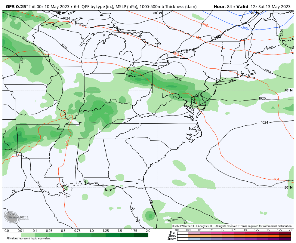
GFS Model – Saturday through Tuesday Morning
The latest solution shows two separate weather systems. The first will be Saturday, with a break for Sunday. Then another for Monday.
7 Day Forecast
With the sunny days, we will have a warming trend to get us back to the 80s by Friday.
The next weather system looks like it will be concentrated on Saturday morning with rain. We may improve later in the day, and most of Sunday. The following system will arrive for a wet Monday.
OTHER REPORTS:
NEW:

STEM Assemblies/In School Fields Trips Are Back
Click to see more and ‘Book’ a visit to your school

Please share your thoughts, best weather pics/videos, or just keep in touch via social media
RESTATING MY MESSAGE ABOUT DYSLEXIA
I am aware there are some spelling and grammar typos, and occasional other glitches. I take responsibility for my mistakes, and even the computer glitches I may miss. I have made a few public statements over the years, but if you are new here you may have missed it: I have dyslexia, and found out during my second year at Cornell University. It didn’t stop me from getting my meteorology degree, and being first to get the AMS CBM in the Baltimore/Washington region. One of my professors told me that I had made it that far without knowing, and to not let it be a crutch going forward. That was Mark Wysocki and he was absolutely correct! I do miss my mistakes in my own proofreading. The autocorrect spell check on my computer sometimes does an injustice to make it worse. I also can make mistakes in forecasting. No one is perfect predicting the future. All of the maps and information are accurate. The ‘wordy’ stuff can get sticky. There has been no editor that can check my work when I needed it and have it ready to send out in a newsworthy timeline. Barbara Werner is a member of the web team that helps me maintain this site. She has taken it upon herself to edit typos, when she is able. That could be AFTER you read this. I accept this and perhaps proves what you read is really from me… It’s part of my charm.
#FITF
Subscribe for eMail Alerts


