


May 17 Clouding Up Ahead Of A Soggy Preakness Saturday Then We Warm Up
Friday May 17 Morning Report Today may end up mild, but it will bring an increase in clouds ahead of our next storm. If you are heading to the mountains,…
April 21, 2023
Friday Afternoon Update
Our summer heat is about to come to an abrupt end, and right on cue like the other weather events…. during the weekend. Saturday will start off dry, but the afternoon will bring in showers and thunderstorms that are likely to affect outdoor plans. To compound this, there is a risk that some storms may turn severe.
As you compare the timeline for your location and plans, I want to emphasize that there will be scattered thunderstorms but not all will turn severe. There will also be an expected period of rain lasting a few hours. I cannot say for sure if the Orioles Game will be delayed or postponed because there are other factors that can affect their call.
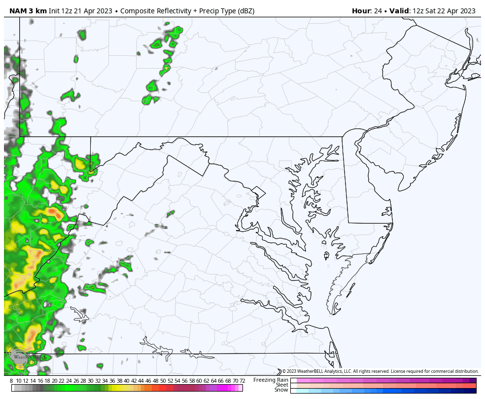
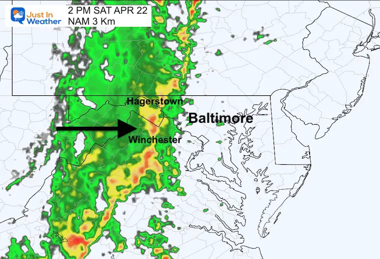
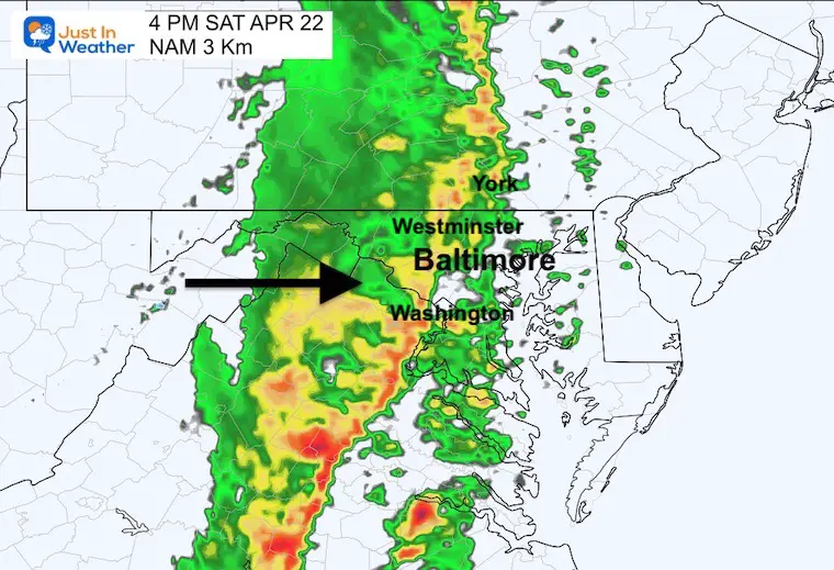
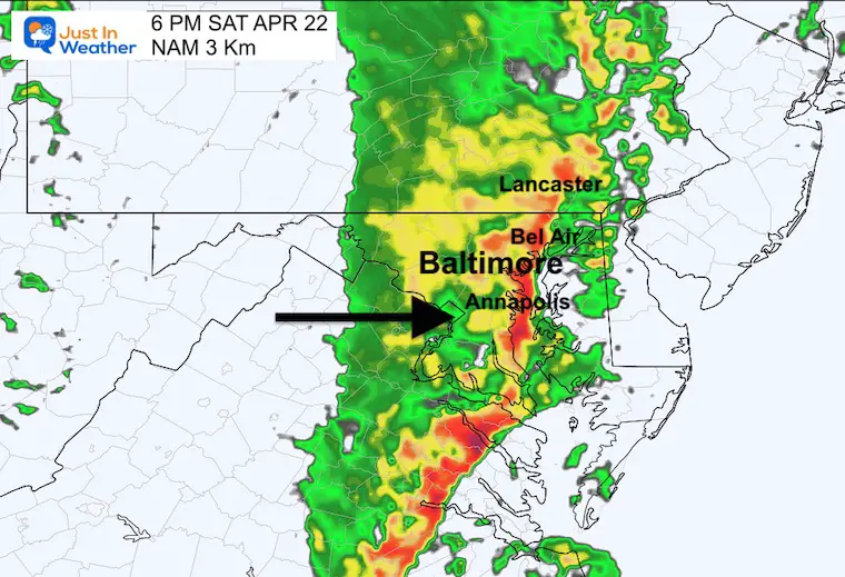
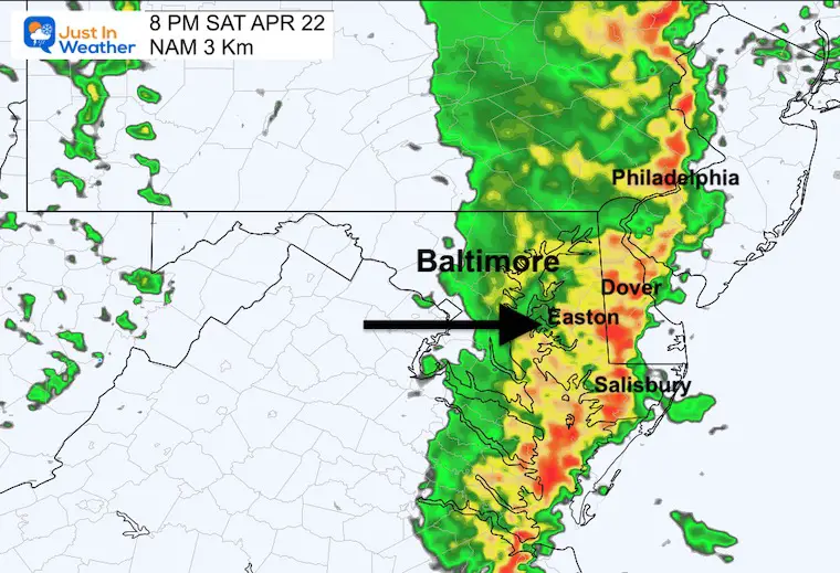
Here is a look at the set up and then the radar simulation. I included a radar loop AND snapshots for key time frames to help highlight where and when the worst may hit.
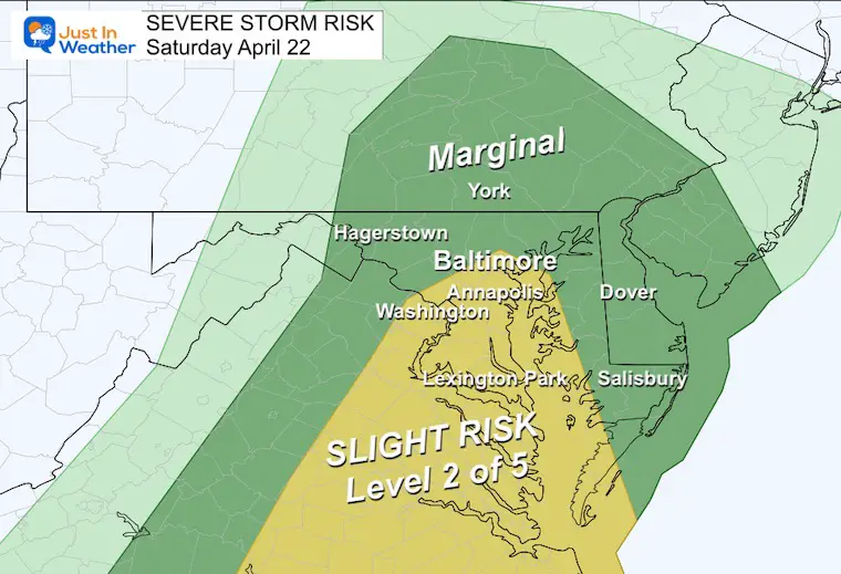
NOAA Severe Thunderstorm Risk
The Slight Risk or Level 2 of 5 includes Baltimore and southward. However, the wind direction may work to counter that.
Severe Storms Can Include:
The intensity of the storms may be determined by temperatures, and it looks like we may stay a little cooler than earlier thought, which can help.
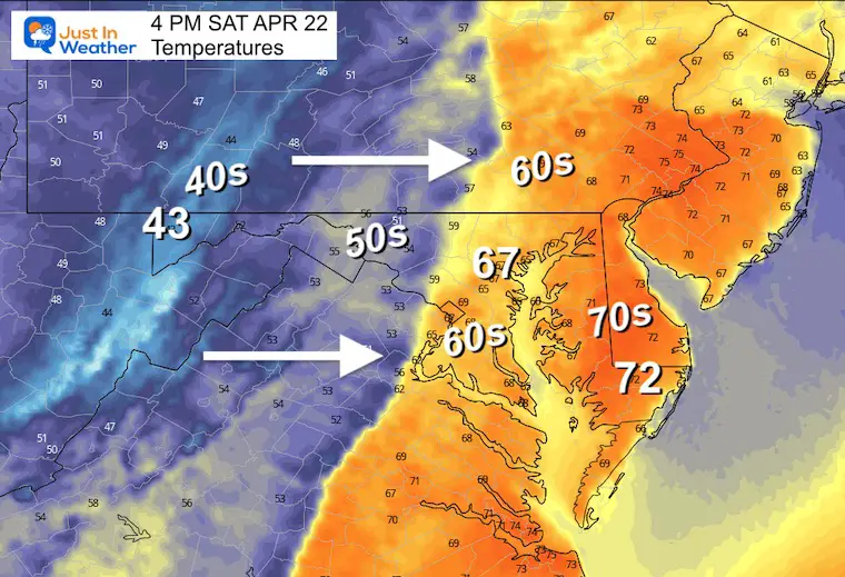
This may counter the cooler air. When winds are FROM the Southeast in central Maryland, it can enhance storm lines in metro areas between Baltimore and Annapolis.
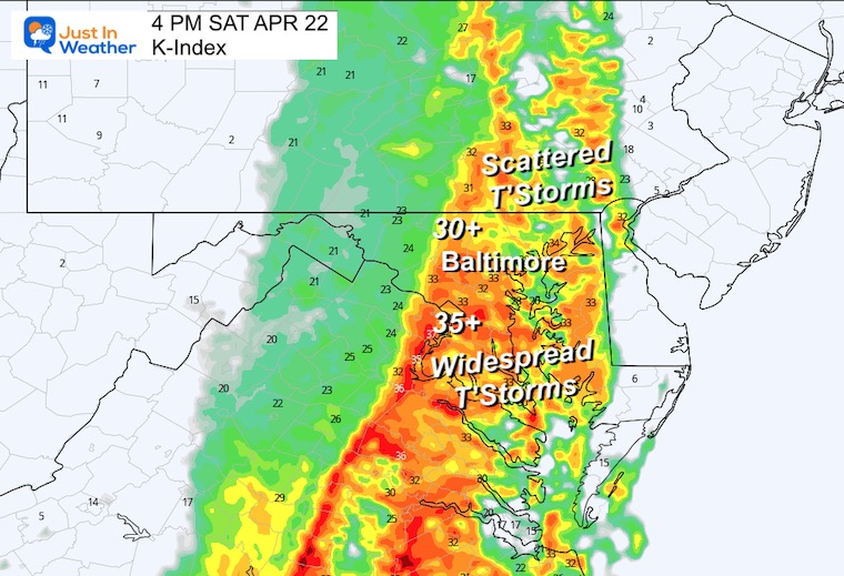
This is a measurement of thunderstorm activity. Where the value is 30 or higher, we see scattered thunderstorms NORTH of Baltimore.
Where the value is 35 or higher, we see more widespread thunderstorms SOUTH of Baltimore.
The risk increases where the numbers are above 1. This appears to be near and SOUTH of Washington, DC. The highest risk will be in Southeast Virginia.
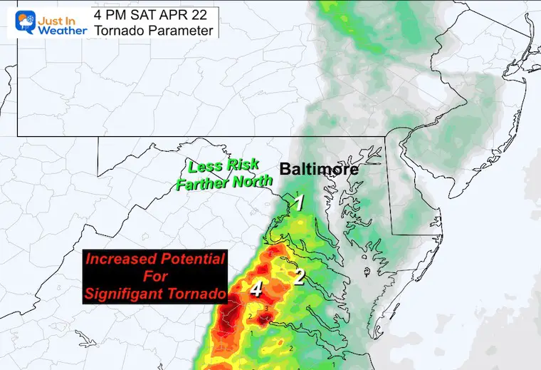
If you are planning outdoor events, this is a guide, but not a promise. I would allow for a 1 to 2 hour buffer, even a little earlier than shown here. I will have more high resolution model guidance to be more precise in my next report.
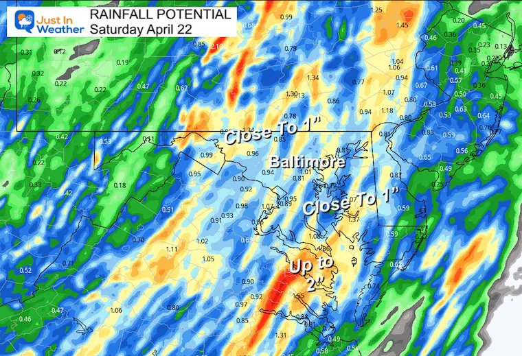
This potential is for many areas to possibly get close to 1 inch. This may range from 1/2 inch to over 1.5” depending on where the storm cells line up. No matter what you get, it will be welcomed by your lawn and plants.
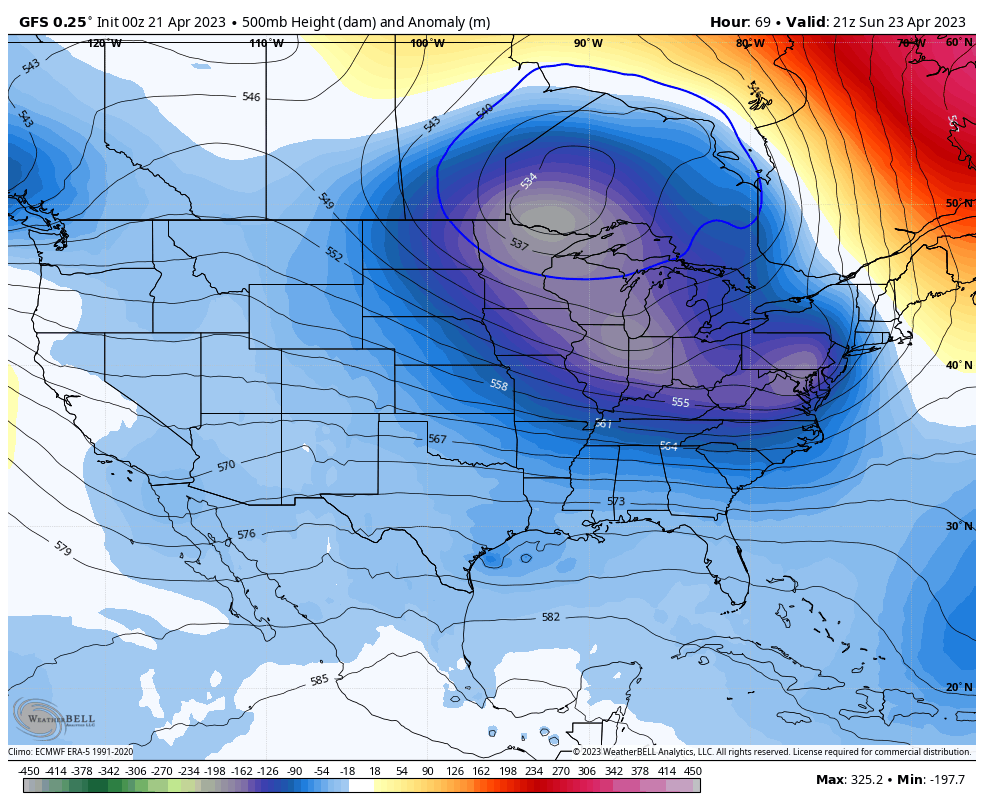
The jet stream will be flipping to a colder pattern next week and will keep our temperatures around 10 degrees below average in the lower 60s.
Click to see more and ‘Book’ a visit to your school

I am aware there are some spelling and grammar typos, and occasional other glitches. I take responsibility for my mistakes, and even the computer glitches I may miss. I have made a few public statements over the years, but if you are new here you may have missed it: I have dyslexia, and found out during my second year at Cornell University. It didn’t stop me from getting my meteorology degree, and being first to get the AMS CBM in the Baltimore/Washington region. One of my professors told me that I had made it that far without knowing, and to not let it be a crutch going forward. That was Mark Wysocki and he was absolutely correct! I do miss my mistakes in my own proofreading. The autocorrect spell check on my computer sometimes does an injustice to make it worse. I also can make mistakes in forecasting. No one is perfect predicting the future. All of the maps and information are accurate. The ‘wordy’ stuff can get sticky. There has been no editor that can check my work when I needed it and have it ready to send out in a newsworthy timeline. Barbara Werner is a member of the web team that helps me maintain this site. She has taken it upon herself to edit typos, when she is able. That could be AFTER you read this. I accept this and perhaps proves what you read is really from me… It’s part of my charm.
#FITF