March 18, 2023
Saturday Morning
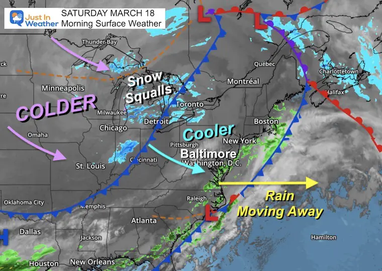
The most noticeable pattern we have repeated just about every week this winter has been a WARM Thursday, followed by a windy and colder weekend. So, here we are again. WE have already cooled down from the past two days as the rain is moving away. A cooler breeze will be felt today, with stronger and colder winds Sunday.
The push of that colder air may support a snow squall line into the western mountains this afternoon and possibly carry into the northern suburbs tonight.
The work week will be calm and warm up, however, a few mornings below freezing may compromise the early spring buds and flowers.
Our next warm up will come with rain for the back half of the work week.
Morning Surface Weather
The rain maker we had yesterday is pushing to the coast, and will be moving away today. We will be in transition between the next front that will arrive tonight. So today will be breezy and cooler, then windy and colder behind the next system on Sunday.
That strong cold front will be sending snow showers into the higher mountains, with a chance a squall line crosses east tonight.
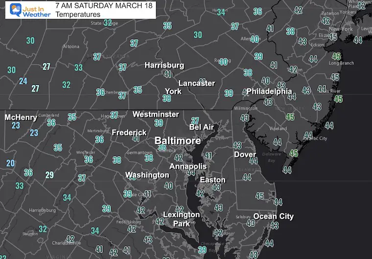
Morning Temperatures
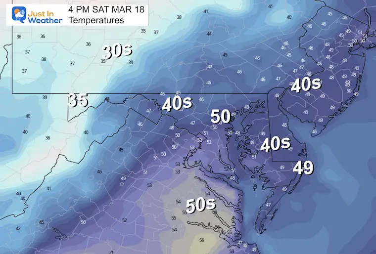
Afternoon Temperatures
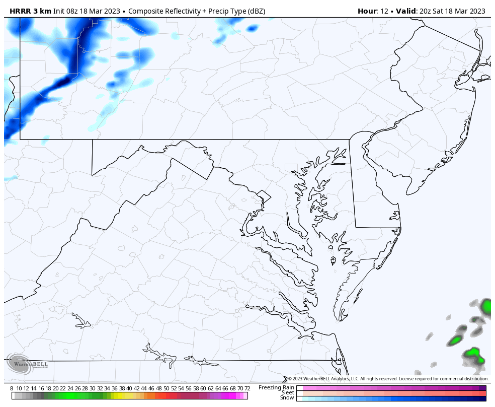
Radar Simulation
4 PM to 10 PM
A squall line with snow will cross the mountains, and may reach east of Frederick. If so, it might bring snow showers to north central Maryland (north of Baltimore) and PA between Gettysburg, York, and maybe Lancaster.
Subscribe for eMail Alerts
REPORT: La Niña Has Ended. El Niño May Return By Fall
CLIMATE DATA
TODAY March 18
Normal Low in Baltimore: 34ºF
Record 9ºF in 1877
SNOW: 12” in 1892
Normal High in Baltimore: 55ºF
Record 81ºF in 2011
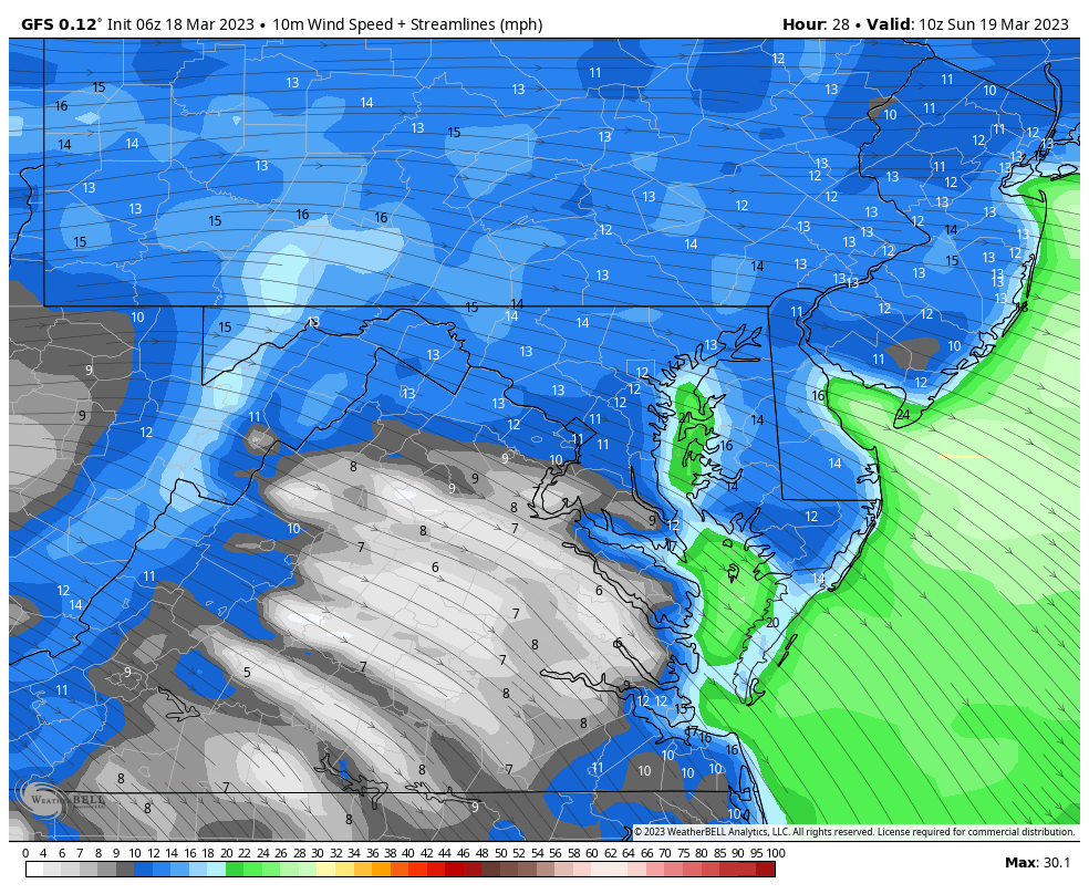
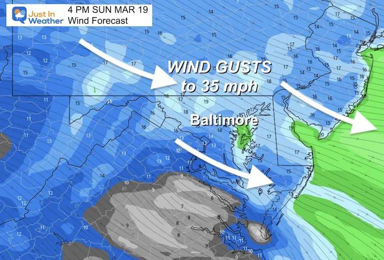
Sunday Wind Forecast
Steady winds 15 to 25 mph, with gusts to 35 mph.
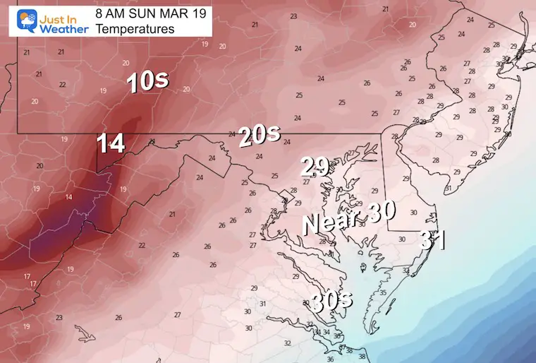
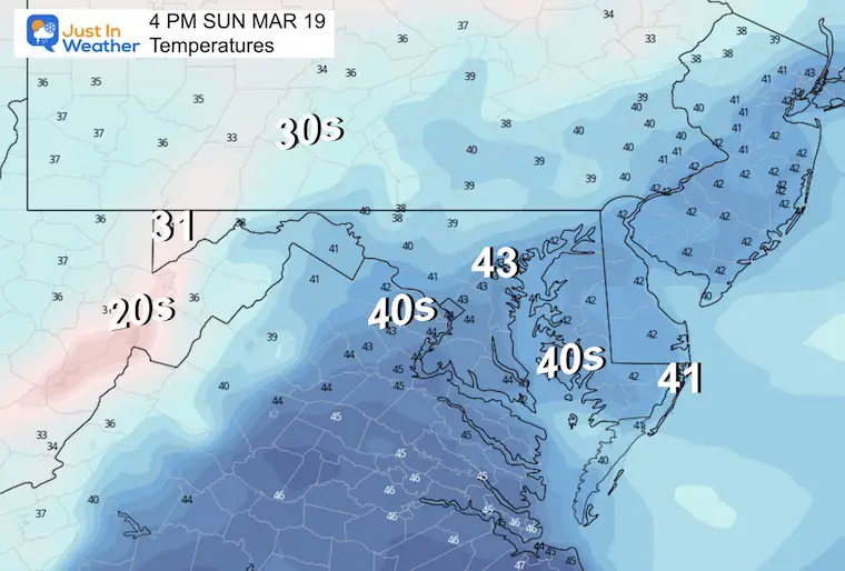
Sunday Morning Temperatures
Many areas will drop below freezing.
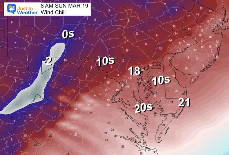
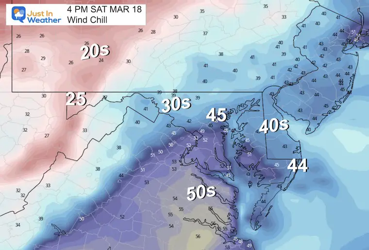
Wind Chill
Afternoon Wind Forecast
Temperatures
Wind Chill
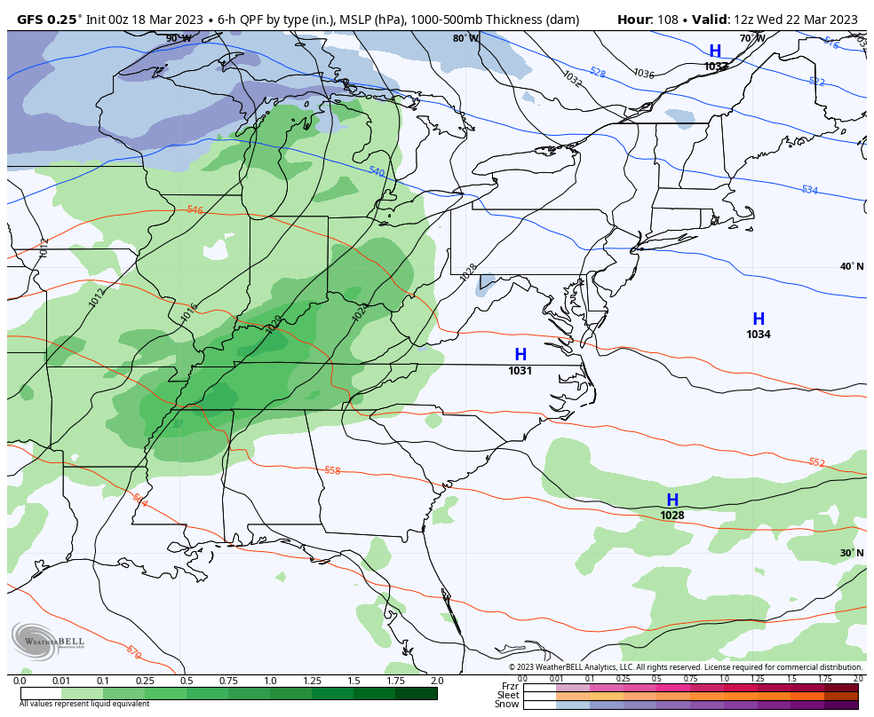
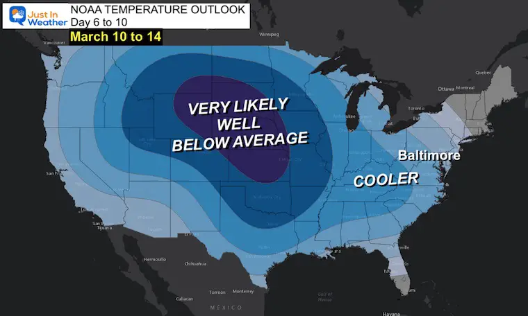
Looking Ahead
Wednesday Morning To Sunday Morning
This is the same storm track we have had ALL WINTER.
As Low Pressure moves into the Western Great Lakes, warm winds and rain will spread ahead… we may get into periodic ‘rain showers’, but it will not be a steady washout.
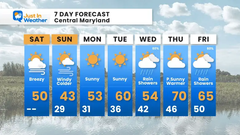
7 Day Forecast
This weekend will be windy and chilly!
A few mornings below freezing! As we warm up, there will be a larger storm bringing in rain showers for the back half of next week.
Subscribe for eMail Alerts
IN CASE YOU MISSED IT
My REALISTIC Expectations for the COLD OUTLOOK
Winter History: Low Snow And Late Starts
See my research based on Baltimore data since 1883.

RESTATING MY MESSAGE ABOUT DYSLEXIA
I am aware there are some spelling and grammar typos, and occasional other glitches. I take responsibility for my mistakes, and even the computer glitches I may miss.
I have made a few public statements over the years, but if you are new here you may have missed it:
I have dyslexia, and found out during my second year at Cornell University. It didn’t stop me from getting my meteorology degree, and being first to get the AMS CBM in the Baltimore/Washington region. One of my professors told me that I had made it that far without knowing, and to not let it be a crutch going forward. That was Mark Wysocki and he was absolutely correct!
I do miss my mistakes in my own proofreading. The autocorrect spell check on my computer sometimes does an injustice to make it worse. I also can make mistakes in forecasting. No one is perfect predicting the future.
All of the maps and information are accurate. The ‘wordy’ stuff can get sticky.
There has been no editor that can check my work when I needed it and have it ready to send out in a newsworthy timeline. Barbara Werner is a member of the web team that helps me maintain this site. She has taken it upon herself to edit typos, when she is able. That could be AFTER you read this.
I accept this and perhaps proves what you read is really from me…
It’s part of my charm.
#FITF
STEM Assemblies/In School Fields Trips Are Back
Click to see more and ‘Book’ a visit to your school

My Winter Outlook: Not A Typical La Niña!
I see many factors to support colder influence with multiple systems. Early and later in winter. Check it out. https://justinweather.com/2022/11/22/winter-outlook-2023-for-snow-not-typical-la-nina-plus-polar-vortex-disruption/
Also See The Winter Outlook Series:
https://justinweather.com/2022/11/20/atmospheric-memory-suggests-active-winter-storm-pattern-outlook/
https://justinweather.com/2022/10/21/winter-outlook-2023-from-noaa-very-different-than-farmers-almanacs/
Farmer’s Almanac Comparison
September Starts Meteorological Autumn: Weather Climate Stats For Maryland at Baltimore
Triple Dip La Niña Winter
https://justinweather.com/2022/09/09/winter-outlook-2023-la-nina-triple-dip-expectations/
CONNECTION TO WINTER?
If you want a snowy winter, this is what you might want to look for in the rest of the tropical season. https://justinweather.com/2022/08/31/record-august-for-no-named-tropical-storms-closer-look-at-snow-following/
Woolly Bear Caterpillars
https://justinweather.com/2022/10/25/winter-weather-outlook-from-the-wooly-bear-caterpillar/
Persimmon Seeds
Winter Outlook 2023 La Niña Triple Dip Expectations
Click to see Top 20 and MORE
https://justinweather.com/2022/10/28/winter-weather-folklore-top-20-and-more-outlook-signals-from-nature-for-cold-and-snow/
Normals And Records: Maryland and Baltimore Climate History

Please share your thoughts, best weather pics/videos, or just keep in touch via social media


