March 16, 2023
Thursday Night Update
As luck would have it, St. Patrick’s Day falls on a Friday. This may end up being an enhanced holiday celebration. So if you are letting your inner Irish out or just ready to enjoy the weekend, I wanted to provide a brief look at the expected rain on the way. Behind the storm, more cold wind and perhaps some snow showers for ambience.
Personally, I have family in town for a full weekend of plans, so I wanted to give them a better glimpse as well.
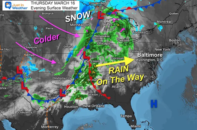
Thursday Night Surface Weather
A strong storm is stretched from east Texas to the Canadian border. It brought severe storms into the Mississippi River Valley, while a band of heavy snow is falling near and north of Minneapolis.
Here in the east, we can expect this to be our Friday weather. Some showers may arrive in the morning, but the main band looks like a midday to afternoon event.
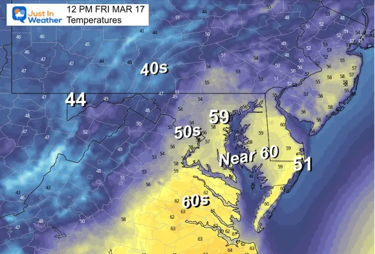
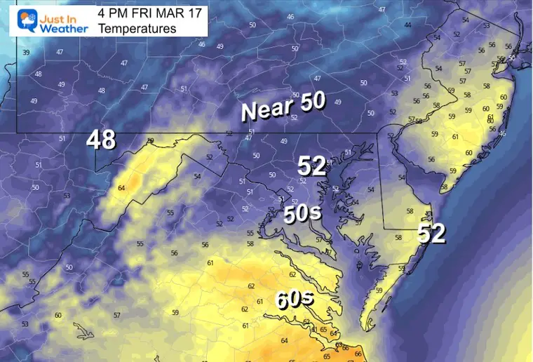
Friday Temperatures
We may reach our warmest temperature around noon. Then when the rain moves in, expect a chilly afternoon.
12 PM
4 PM
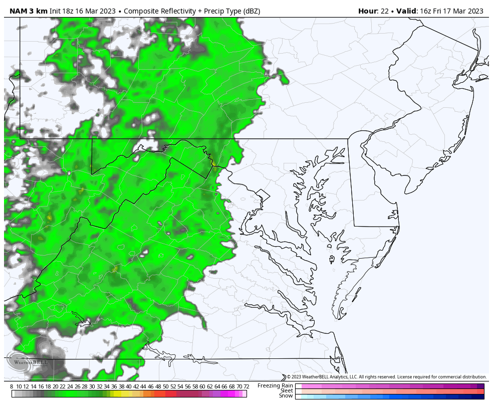
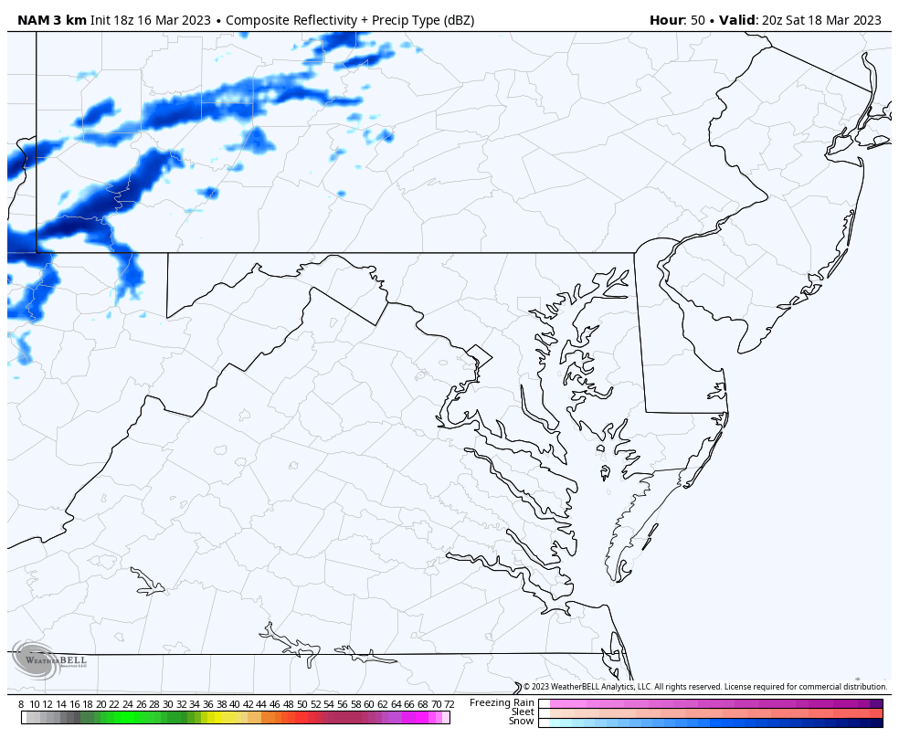
Radar Simulation
NAM 3 Km 12 PM to Midnight
There maybe some early showers, but the main rain is likely to arrive around lunchtime.
I would allow a buffer of 1 to 2 hours for any model error.
Snapshots
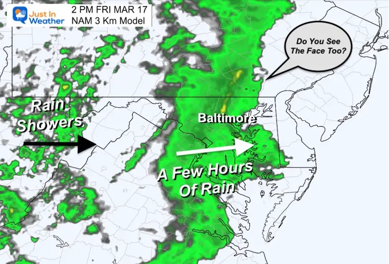
2 PM
A few hours of steady rain will be moving through. This may last 2 to 3 hours.
Do you see the face in this view? It looks a little scary, but there is nothing to fear here… except maybe some drivers. Please don’t drive if you are boozing!
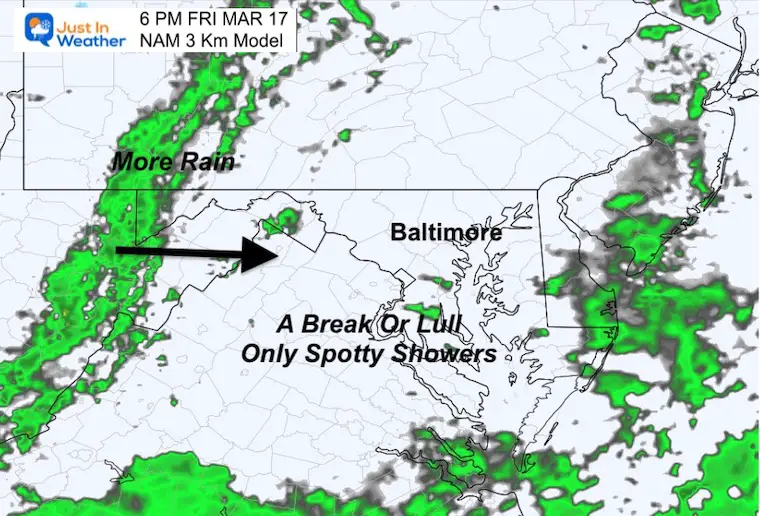
6 PM
A break or lull for a few hours. This may have some pockets of light showers or drizzle, but it will not be an all day rain.
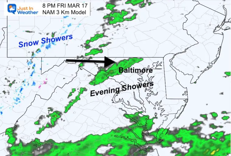
8 PM
One more push of rain showers into the evening. This will be followed by colder air and snow into the mountains.
Saturday Wind Forecast
Sat 8 AM to Midnight
Yes, it is going to be windy again. Steady winds 15 to 25 mph, gusts up to 40 mph.
Radar Simulation
Sat 4 PM to Midnight
An upper level disturbance may allow a few snow showers to cross the mountains and reach central Maryland Saturday night. If we get any, they will be scattered and only have the capacity for a light coating (similar to the other morning).
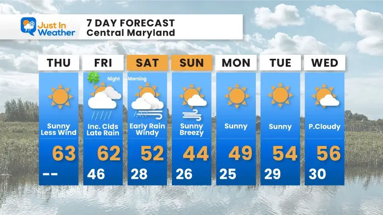
Extended Forecast
Our weekend will be chilly and windy. Most noticeable in the mornings with temps below freezing.
I will have a full forecast in the morning.
Subscribe for eMail Alerts
IN CASE YOU MISSED IT
My REALISTIC Expectations for the COLD OUTLOOK
Winter History: Low Snow And Late Starts
See my research based on Baltimore data since 1883.

RESTATING MY MESSAGE ABOUT DYSLEXIA
I am aware there are some spelling and grammar typos, and occasional other glitches. I take responsibility for my mistakes, and even the computer glitches I may miss.
I have made a few public statements over the years, but if you are new here you may have missed it:
I have dyslexia, and found out during my second year at Cornell University. It didn’t stop me from getting my meteorology degree, and being first to get the AMS CBM in the Baltimore/Washington region. One of my professors told me that I had made it that far without knowing, and to not let it be a crutch going forward. That was Mark Wysocki and he was absolutely correct!
I do miss my mistakes in my own proofreading. The autocorrect spell check on my computer sometimes does an injustice to make it worse. I also can make mistakes in forecasting. No one is perfect predicting the future.
All of the maps and information are accurate. The ‘wordy’ stuff can get sticky.
There has been no editor that can check my work when I needed it and have it ready to send out in a newsworthy timeline. Barbara Werner is a member of the web team that helps me maintain this site. She has taken it upon herself to edit typos, when she is able. That could be AFTER you read this.
I accept this and perhaps proves what you read is really from me…
It’s part of my charm.
#FITF
STEM Assemblies/In School Fields Trips Are Back
Click to see more and ‘Book’ a visit to your school

My Winter Outlook: Not A Typical La Niña!
I see many factors to support colder influence with multiple systems. Early and later in winter. Check it out. https://justinweather.com/2022/11/22/winter-outlook-2023-for-snow-not-typical-la-nina-plus-polar-vortex-disruption/
Also See The Winter Outlook Series:
https://justinweather.com/2022/11/20/atmospheric-memory-suggests-active-winter-storm-pattern-outlook/
https://justinweather.com/2022/10/21/winter-outlook-2023-from-noaa-very-different-than-farmers-almanacs/
Farmer’s Almanac Comparison
September Starts Meteorological Autumn: Weather Climate Stats For Maryland at Baltimore
Triple Dip La Niña Winter
https://justinweather.com/2022/09/09/winter-outlook-2023-la-nina-triple-dip-expectations/
CONNECTION TO WINTER?
If you want a snowy winter, this is what you might want to look for in the rest of the tropical season. https://justinweather.com/2022/08/31/record-august-for-no-named-tropical-storms-closer-look-at-snow-following/
Woolly Bear Caterpillars
https://justinweather.com/2022/10/25/winter-weather-outlook-from-the-wooly-bear-caterpillar/
Persimmon Seeds
Winter Outlook 2023 La Niña Triple Dip Expectations
Click to see Top 20 and MORE
https://justinweather.com/2022/10/28/winter-weather-folklore-top-20-and-more-outlook-signals-from-nature-for-cold-and-snow/
Normals And Records: Maryland and Baltimore Climate History

Please share your thoughts, best weather pics/videos, or just keep in touch via social media


