February 18 Cold Day Quick Warm Up And Near Record High Next Week
February 18, 2023
Saturday Morning
Talk about atmospheric memory, we have a pattern on repeat. It seems like we have our brief spurt of winter on Saturdays, only to turn mild within a day or two. Mid week rain, a surge of warm air, then turning cold again to start the next weekend.
We have that again. This time, the warm surge will approach one of the oldest records we have maintained, then a hint of winter next weekend. I remain very skeptical of the extended forecast, but I will show you below.
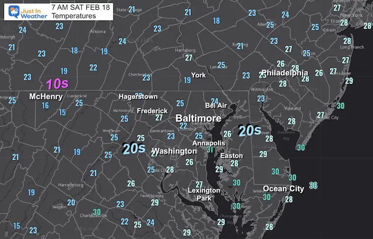
Morning Temperatures
It may seem exceptional, but these numbers below freezing are seasonally cold. This is where we belong!
Morning Surface Weather
High Pressure dominates the Eastern US. Often while is it cold on one side, it is very warm on the other. We will get into that warm up quickly after today. 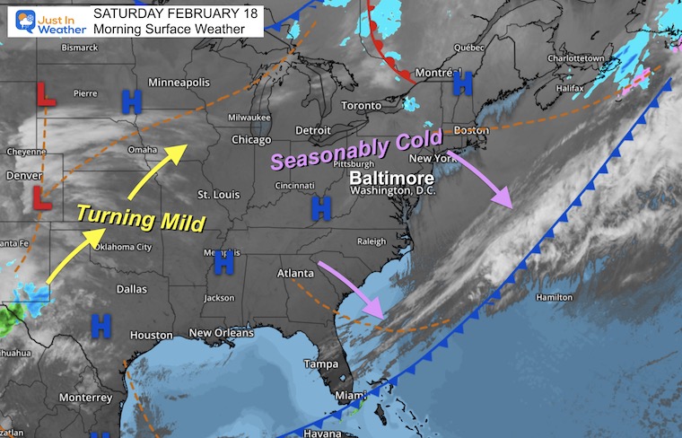
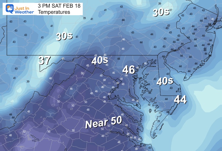
Temperatures Afternoon
Subscribe for eMail Alerts
Weather posts straight to your inbox
Sign up and be the first to know!
CLIMATE DATA
TODAY February 18
Normal Low in Baltimore: 27ºF
Record 3ºF in 1979
SNOW: 5.7” in 1964
Normal High in Baltimore: 47ºF
Record 75ºF 1976
CLIMATE TRIVIA: EXTREME FLIP in 1976
In 1976, Baltimore had a 2-day Warm Wave of Record High Temps.
- 76ºF on Feb 17
- 75ºF on Feb 18
THEN ON MARCH 9, 1976
- Record Snowfall = 7.8”
TRAIN DERAILMENT: TOXIN TRANSPORT
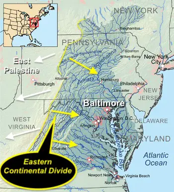
Report: Tracking Winds For Movement from the accident to the Controlled Burn Also see Videos Of Toxins in local water in East Palestine, OH.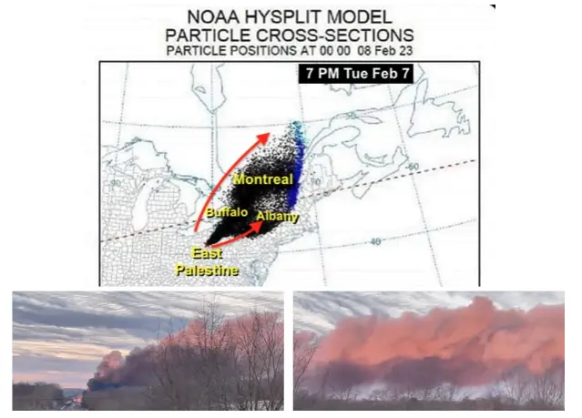
REPORT: Chesapeake Bay and Ohio Watersheds. Please click here for that report if you missed it.
Sunday Weather
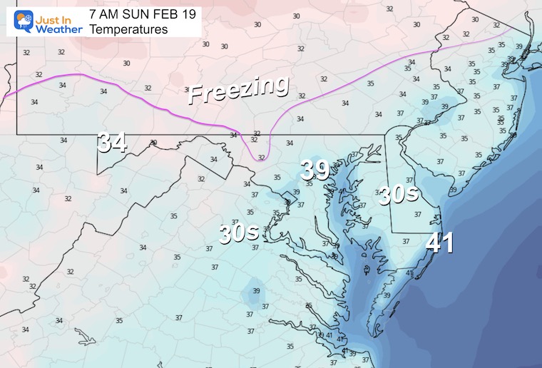
Morning
Not as cold. Freezing is normal but it will be limited as the cold air retreats north again.
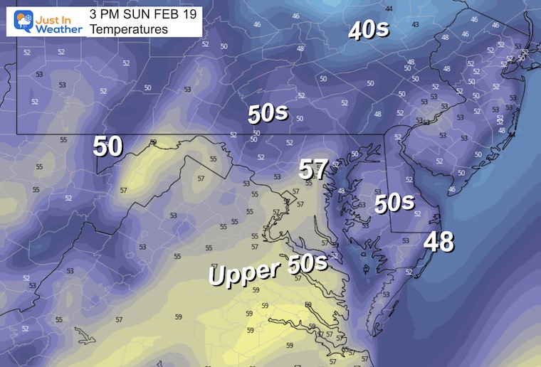
Afternoon
This will be close to a seasonal day. The theme we have had all winter has been these cold shots only lasting for a day or two. Most have been on a Saturday.
President’s Day
It doesn’t always snow, and definitely not this year! We may have scattered rain showers with the mild temps in the 50s.
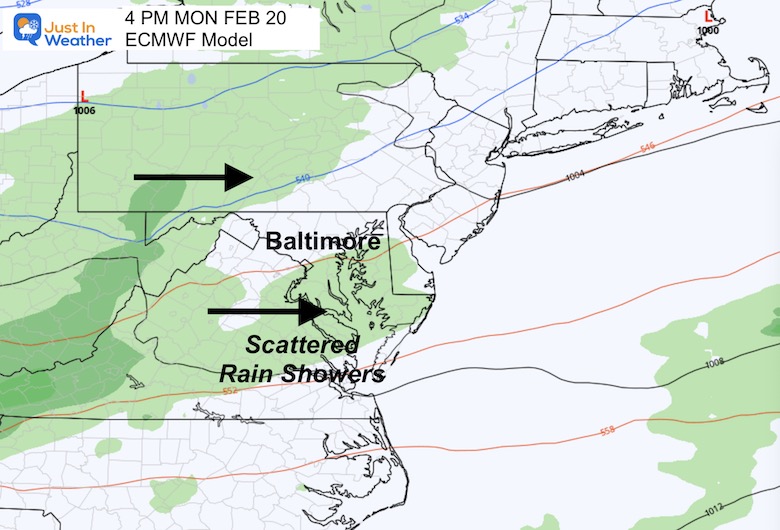
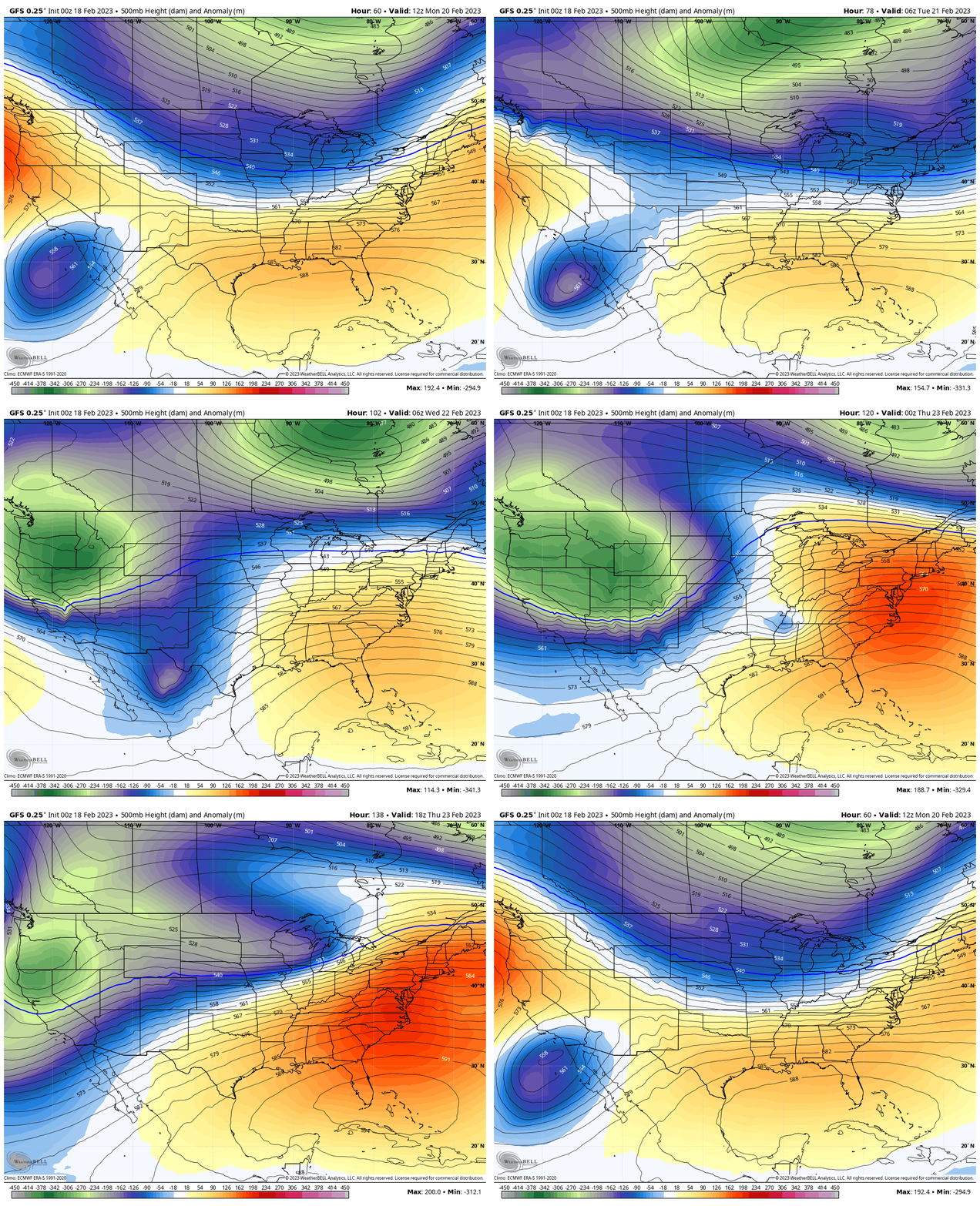
Jet Stream: Monday to Thursday
A strong Ridge will build AGAIN in the Eastern US later in the week. This will surge in very warm temperatures.
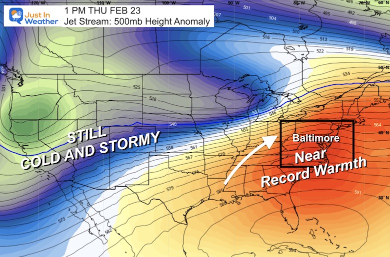
Snapshot Thursday
This strong ridge will surge in the warmest air of the year to date. It is VERY LIKELY we will reach the mid to upper 70s. There is a chance we get a record high temperature that day, and remain in the 70s on Friday before the next abrupt change… for another colder weekend.
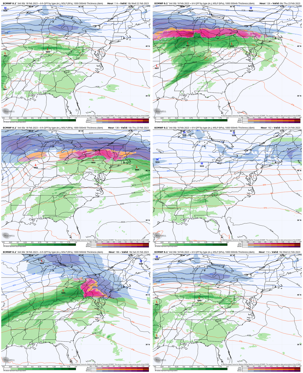
Forecast Animation: Wednesday Through Saturday
This is the European Model showing rain showers and a storm track to our north. This will bring some wintry weather to northern New England.
Saturday: We may see a period of snow or wintry mix. Note that the GFS Model is much colder with more snow, that may be showing on some of your weather apps. I do NOT buy it. We have had too many of these ‘one week away’ snow storms that trend north and don’t materialize.
You know I love snow, but I cannot bite on this yet.
Temperature Outlook
This pattern is on repeat: We seem to get one cold day on the weekend, then some mid-week rain and a VERY WARM day, only to be followed by another cold day.
These spurts of winter seem to last one to two days and have often bottomed out on a Saturday.
Next weekend is worth watching, but I won’t get too excited yet.
The Record High on Thursday is within reach. 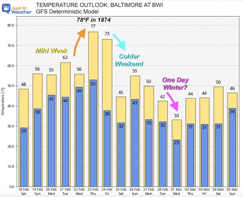
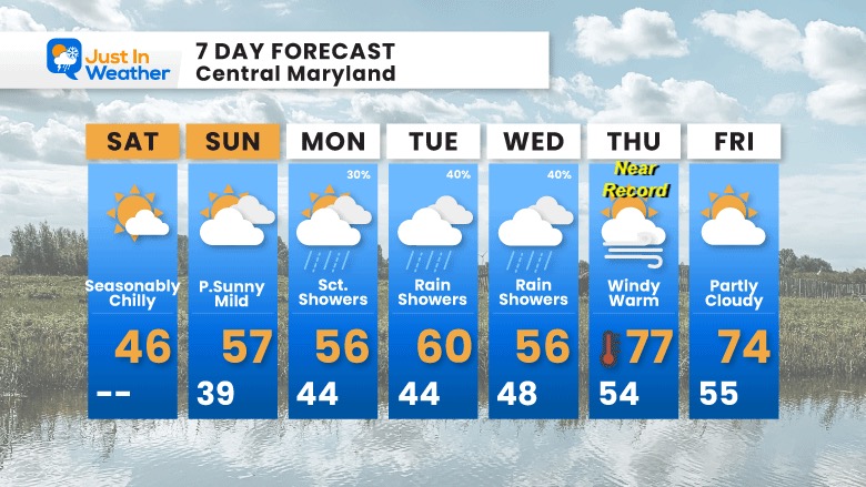
7 Day Forecast
After our chilly day, we will get mild again. The big warm up will be Thursday as temperatures will approach one of the oldest records on the books.
It was 78ºF in 1874 on Feb 23. That is the mark to watch! We often end up warmer than models forecast.
Also See:
Winter History: Low Snow And Late Starts
See my research based on Baltimore data since 1883.
Subscribe for eMail Alerts
Weather posts straight to your inbox
Sign up and be the first to know!
STEM Assemblies/In School Fields Trips Are Back
Click to see more and ‘Book’ a visit to your school 
My Winter Outlook: Not A Typical La Niña!
I see many factors to support colder influence with multiple systems. Early and later in winter. Check it out. https://justinweather.com/2022/11/22/winter-outlook-2023-for-snow-not-typical-la-nina-plus-polar-vortex-disruption/
Also See The Winter Outlook Series:
Farmer’s Almanac Comparison
September Starts Meteorological Autumn: Weather Climate Stats For Maryland at Baltimore
Triple Dip La Niña Winter
https://justinweather.com/2022/09/09/winter-outlook-2023-la-nina-triple-dip-expectations/
CONNECTION TO WINTER?
If you want a snowy winter, this is what you might want to look for in the rest of the tropical season. https://justinweather.com/2022/08/31/record-august-for-no-named-tropical-storms-closer-look-at-snow-following/
Woolly Bear Caterpillars
https://justinweather.com/2022/10/25/winter-weather-outlook-from-the-wooly-bear-caterpillar/
Persimmon Seeds
Click to see Top 20 and MORE
Normals And Records: Maryland and Baltimore Climate History
Please share your thoughts, best weather pics/videos, or just keep in touch via social media
-
-
Facebook: Justin Berk, Meteorologist
-
Twitter: @JustinWeather
-
Instagram: justinweather
-


