February 8 Warm Pattern And Blip Slushy Snow Super Bowl Sunday
February 8, 2023
Wednesday Morning
Scattered rain showers fell overnight, but the afternoon will turn sunny and mild. There is no doubt that we will be continuing a warm stretch into next week. However, a blip this weekend will bring a coastal storm on Super Bowl Sunday.
There are several reasons I have been paying so much attention to this system:
- Highlighting the computer guidance error. It pushed too far south yesterday, and has come back north similar to last week’s little snow.
- It is potential ‘slushy’ snow in a warm week.
- It will be on Super Bowl Sunday and may affect travel to parties.
Morning Surface Weather
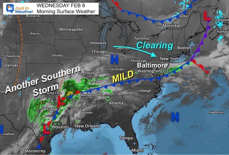
The cold front that brought rain showers overnight, will continue to move and let High Pressure build in. This will allow for a clearing sky.
To our south, a very active storm pattern will persist, and be the foundation for the ‘blip’ expected this weekend.
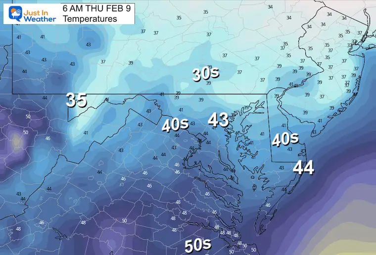
Morning Temperatures
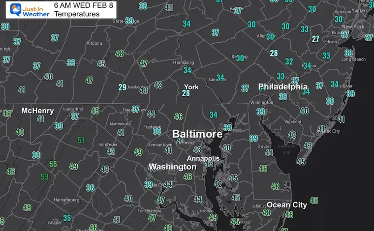
Not much cold air to be found and there will be a noticeable warm up today.
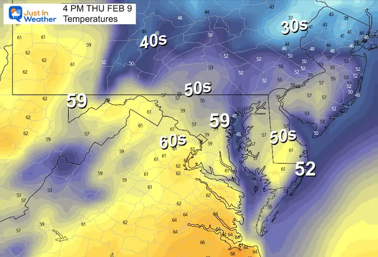
Afternoon Temperatures
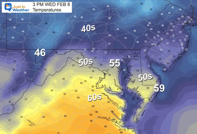
Very mild, and often we see numbers warmer than the models suggest.
Subscribe for eMail Alerts
Weather posts straight to your inbox
Sign up and be the first to know!
CLIMATE DATA
TODAY February 8
Normal Low in Baltimore: 26ºF
Record -1ºF in 1967
SNOW: 6.3” 1974
Normal High in Baltimore: 45ºF
Record 72ºF 2017
Thursday Weather
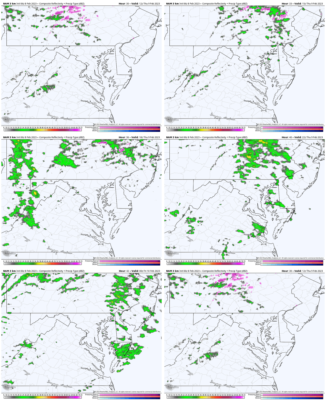
Radar Simulation: 7 AM to 7 PM
Rain showers will return. They will be scattered, but not necessarily heavy.
Thursday Morning Temperatures
Thursday Afternoon Temperatures
Most of the region will be back in the 50s or warmer. The 60s will be close, and depending on the track of showers, I expected we may see them reaching metro Baltimore. BWI often runs warmer and I will place that location above 60 degrees.
Blip Of Winter On Sunday
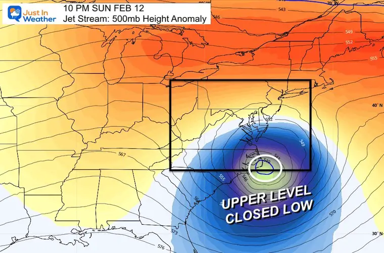
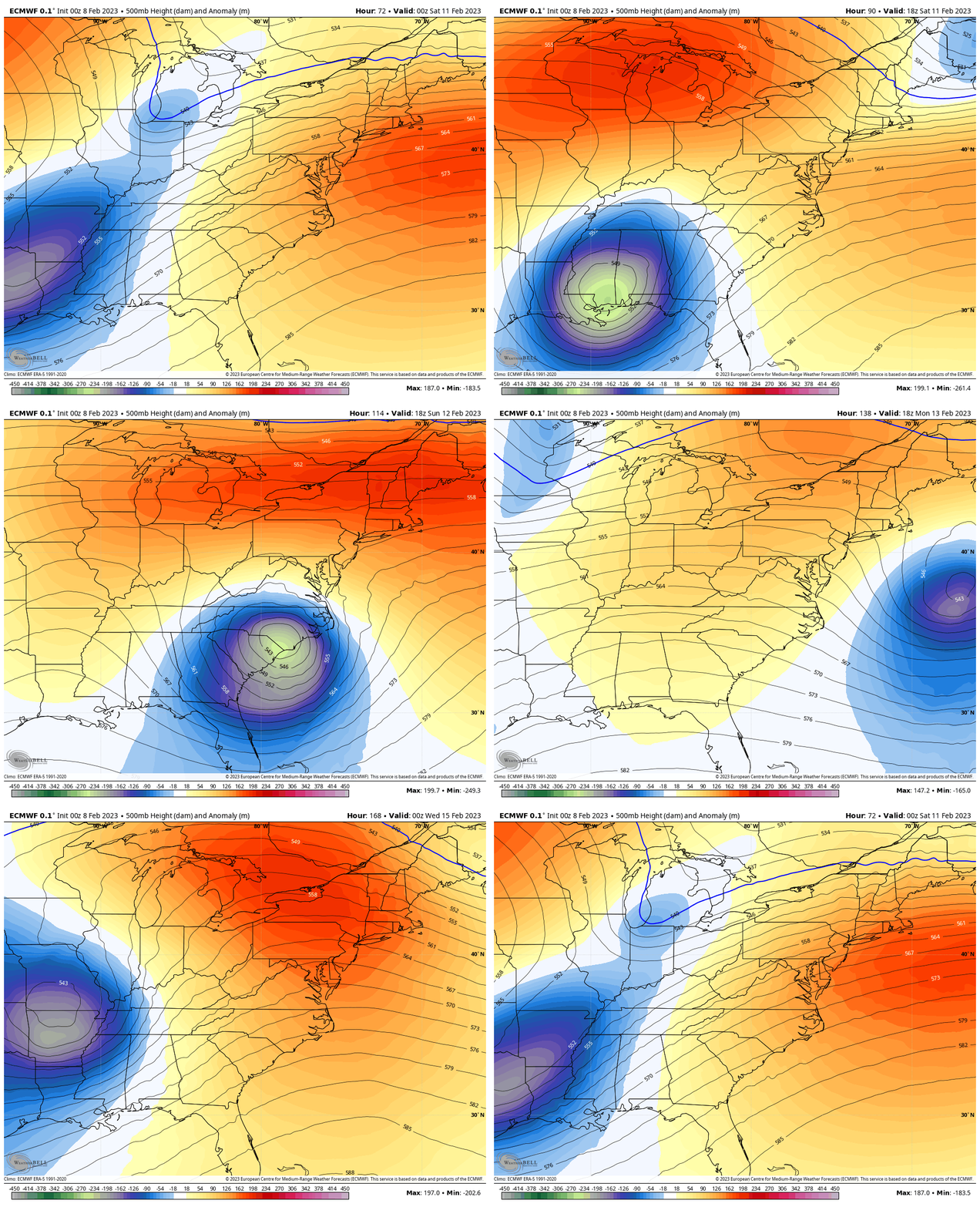
This snapshot of the jet stream shows the reason for the small, colder coastal storm. This location is the key to the track coming back in line for our Mid Atlantic region.
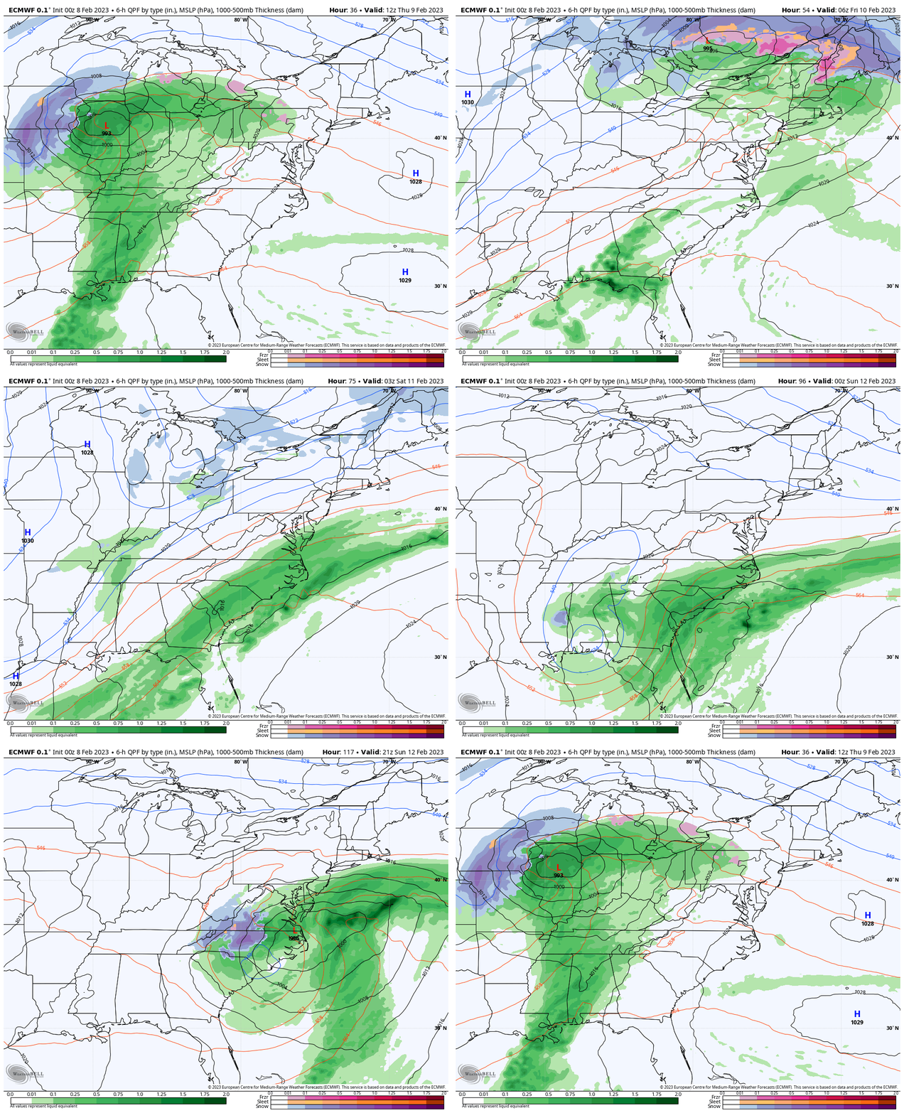
Storm Track: ECMWF Model
Thursday Night to Tuesday – Valentines Day
The main storm track will be to the Great Lakes. This is why we remain on the warm and wet side.
It’s the upper level Low tracking across the south to the Carolina’s that will produce the ‘blip’ coastal storm Sunday.
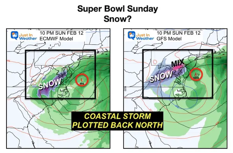
Snap Shot Comparison Sunday Night
10 PM Sunday
Comparing this European Model to the GFS Model
The Euro was too far south yesterday, and I wrote that I thought it was coming back north. It has, and expresses a slushy snow inland.
The GFS Model has had a better handle on this (and did with last week’s little snow event). Here we see that surface Low farther north. As a result, there is a larger and longer coverage of winter precipitation.
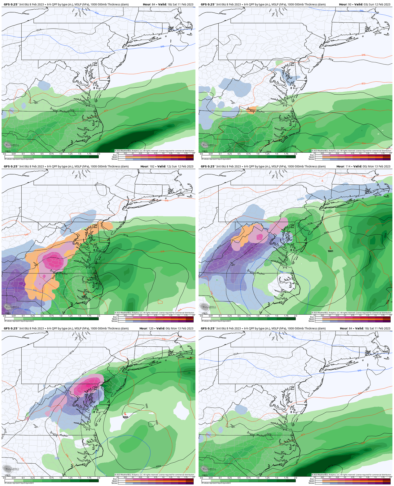
GFS Model Focus – Mid Atlantic
1 PM SAT to 1 AM MON
Watch that southern system come back NORTH and expand the winter precipitation.
Pink = Icy mix of sleet and snow. Blue = snow.
Temps will likely be marginally near freezing, so this would be a slushy and wet snow.
NOTES:
Once again, this will be on Super Bowl Sunday, so pay attention for updates on impact for travel. Temps will be near freezing, but roads likely to remain warm. A heavy wet snow can lead to slush on roads if intense enough. The timing in the evening does support that as a legitimate chance.
Jet Stream Animation:
Friday Night to Tuesday
The warm pattern has this only cluster of colder air with the closed Low. After it passes through, next week will warm up again and Valentines Day may approach 60ºF.
7 Day Forecast
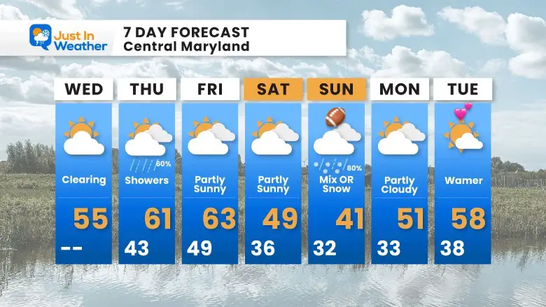
The pattern will continue to be warmer than average. Winter is having trouble showing up, but there is one blip that we see on Sunday.
Also See:
Winter History: Low Snow And Late Starts
See my research based on Baltimore data since 1883.
Subscribe for eMail Alerts
Weather posts straight to your inbox
Sign up and be the first to know!
STEM Assemblies/In School Fields Trips Are Back
Click to see more and ‘Book’ a visit to your school
My Winter Outlook: Not A Typical La Niña!
I see many factors to support colder influence with multiple systems. Early and later in winter. Check it out.
Also See The Winter Outlook Series:
Farmer’s Almanac Comparison
September Starts Meteorological Autumn: Weather Climate Stats For Maryland at Baltimore
Triple Dip La Niña Winter
https://justinweather.com/2022/09/09/winter-outlook-2023-la-nina-triple-dip-expectations/
CONNECTION TO WINTER?
If you want a snowy winter, this is what you might want to look for in the rest of the tropical season.
Rainbow Ice Cave In Mt. Rainier A Very Rare Find: Photos And Video
Wooly Bear Caterpillars
https://justinweather.com/2022/10/25/winter-weather-outlook-from-the-wooly-bear-caterpillar/
Persimmon Seeds
Click to see Top 20 and MORE
Winter Weather Folklore Top 20 And More Outlook Signals From Nature For Cold And Snow
Normals And Records: Maryland and Baltimore Climate History
Please share your thoughts, best weather pics/videos, or just keep in touch via social media
-
-
Facebook: Justin Berk, Meteorologist
-
Twitter: @JustinWeather
-
Instagram: justinweather
-


