


May 17 Clouding Up Ahead Of A Soggy Preakness Saturday Then We Warm Up
Friday May 17 Morning Report Today may end up mild, but it will bring an increase in clouds ahead of our next storm. If you are heading to the mountains,…
January 26, 2023
Thursday Mid Day Update
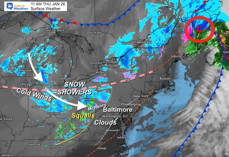
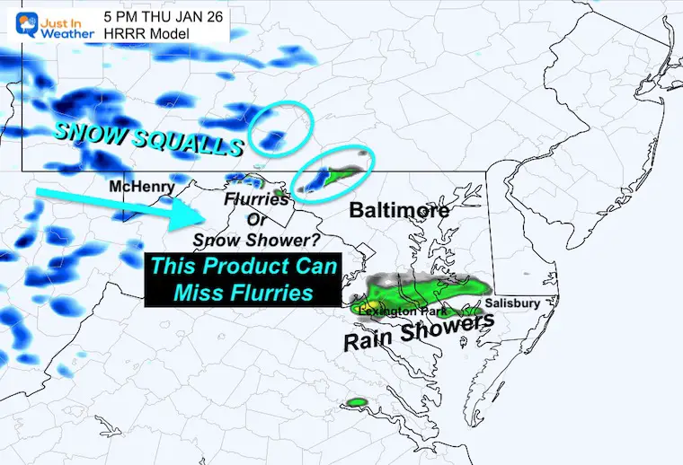
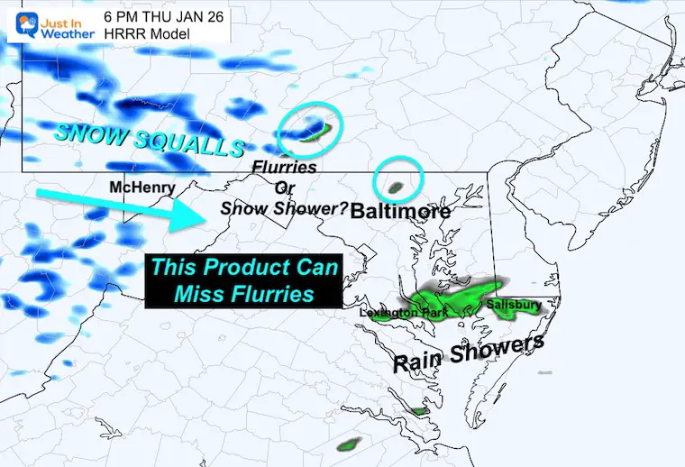
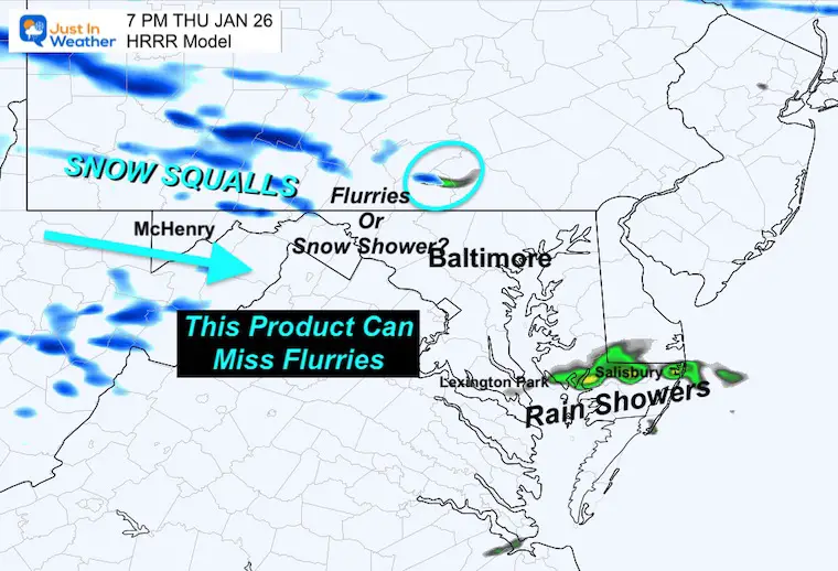
Some in our region got snow yesterday, but many did not. So mentioning it again really is a matter of perspective. We are still in a winter pattern, and the unique impact across the Mid-Atlantic topography is on full display. The net result is heavy snow squalls in the mountains. There is some support to carry flurries or snow showers over the mountains. Meanwhile, the visible satellite is truly helping to show off the Fall Line and separation during normal winter events.
Let’s take a look:
The main storm is moving away through northern New England, but a disturbance in the Ohio Valley has plenty of cold and wind with it to produce snow showers. These have reached the mountains of Western Maryland. There may be enough energy aloft to help carry some of the snow showers or flurries into central Maryland.
This webcam is positioned at The Greene Turtle Deep Creek Lake and shows Wisp Resort, including a zoomed-in view of Squirrel Cage, The Face, the terrain park, Boulder, the mountain coaster, the tubing park, and a shot of McHenry Cove at Deep Creek Lake!
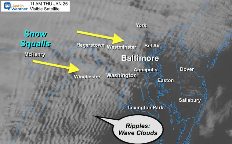
The winds flowing UP the mountains reach the continental divide, and when there is moisture, will dump snow (or rain) along the way. As the winds flow down the lower elevations, the clouds begin to break up. Often the steady snow or rain ends at the ridges, but the clouds display the influence of the sinking air.
The net result are the ripples we see on the satellite display.
When there is more energy, the clouds can blend farther east, but eventually, those ripples indicate the diminishing moisture farther east and lower in elevation.
We see this on display today. Late this morning, the cloud line reached the Fall Line around Baltimore and I-95. More breaks of sun East and south, but more clouds to overcast farther west.
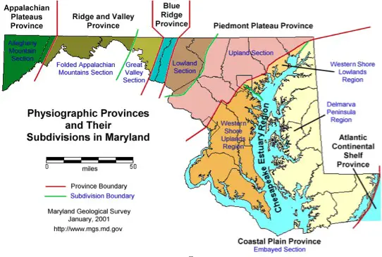
This is the map in my Maryland Winter Page.
Thursday afternoon to Friday Afternoon.
This is the upper-level support that is causing the snow squalls and may help carry some bands over the mountains into central Maryland and southern PA. The net result could be occasional snow showers or squalls through this evening.
No local stickage is expected.
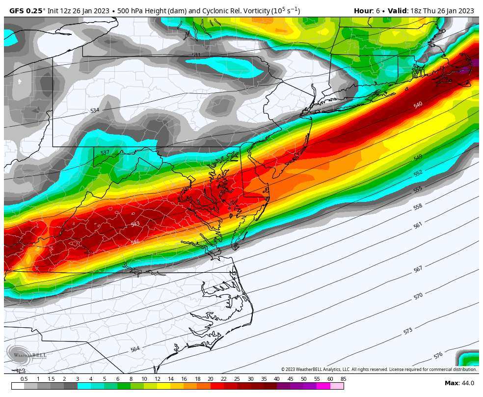
The snow squalls will be prominent in the mountains, where brief whiteouts and winds over 40 mph can create hyper-local blizzard conditions for a few minutes to half an hour or so.
Notice the attempt for the showers to carry east of the mountains.
This product is NOT Perfect and can often miss the lighter flurries.
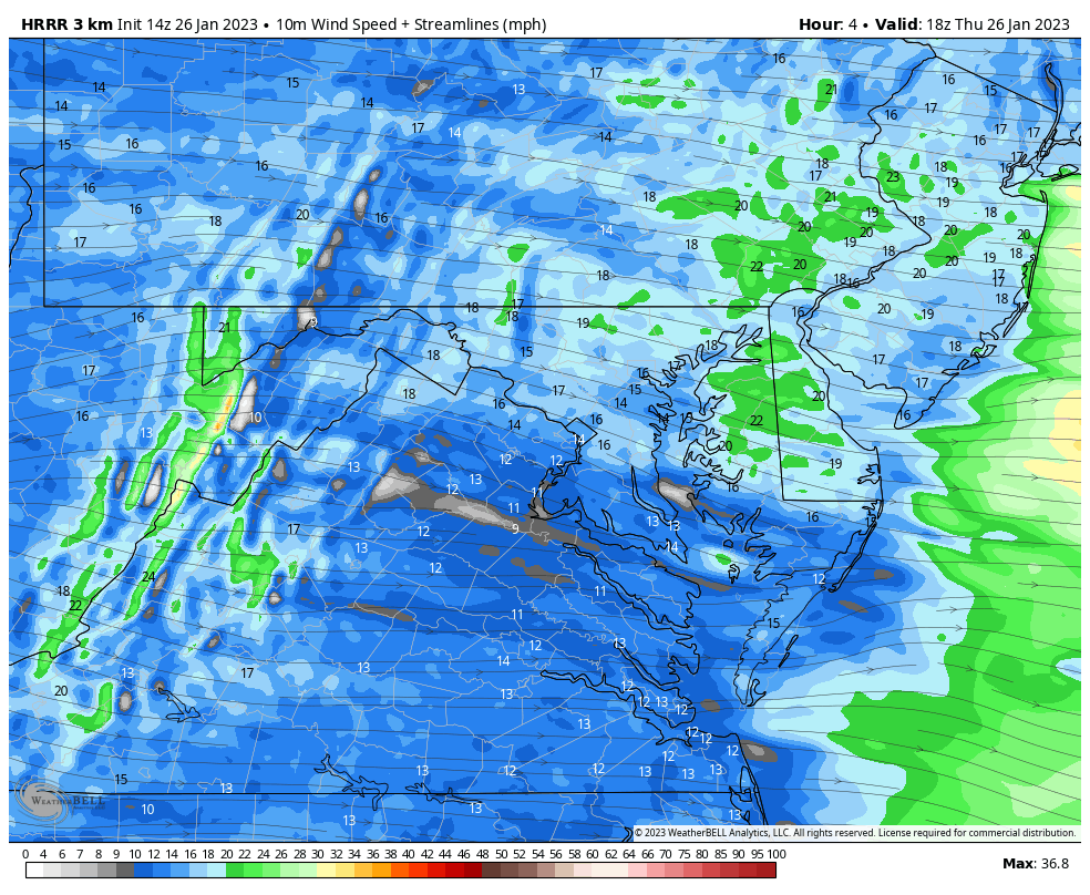
One reason this impulse will fade this evening and tonight will be the winds. While they may gust 30 to 40 mph today, they are expected to diminish this evening.
Winter History: Low Snow And Late Starts
See my research based on Baltimore data since 1883.


Click to see more and ‘Book’ a visit to your school

I see many factors to support colder influence with multiple systems. Early and later in winter. Check it out.
Winter Outlook 2023 For Snow Not Typical La Niña Plus Polar Vortex Disruption
Atmospheric Memory Suggests Active Winter Storm Pattern Outlook
Winter Outlook 2023 From NOAA Very Different Than Farmers Almanacs
Winter Outlook 2023 Early Look At Snow From Two Farmers Almanacs
If you want a snowy winter, this is what you might want to look for in the rest of the tropical season.
Record August For No Named Tropical Storms: Closer Look At Snow Following
Winter Weather Folklore Top 20 And More Outlook Signals From Nature For Cold And Snow
