New Year’s Eve Update: Dense Fog Advisory Extended And Rain Timeline
4:30 PM Saturday December 31
I wanted to share this New Year’s Eve update to help you plan or prepare for your events tonight. I will be heading to a friend’s home with a lot of other people. For what it’s worth, I will be the designated driver and plan to be dropping off at the door, then back down the street expecting to get wet!
We will have a few hours with moderate to heavy rain. In fact, some rumbles of thunder are possible, especially across Southern Maryland to the Beaches. This brings up the Winter Folklore: “If in winter there is thunder, snow may fall in one week or under”.
Let’s start with the short term:
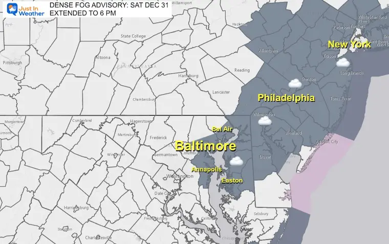
Dense Fog Advisory: EXTENDED To 6 PM
With the warm air and moisture, the fog has not lifted around Baltimore and north on I-95 to Philadelphia and New York. Please be careful with extra drivers and early partiers.
Temperatures
It is mild but not exceptional for the date. We remain in the range of the 50s for most. I do not expect much change tonight.
There are a few 60s on the map near Salisbury and also in West Virginia of all places.
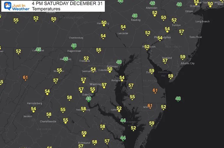
4 PM Snapshot
I am using this to compare to the HRRR Model forecast for this hour to see how it has held up.
Below are the animations and more key time frames. Then the Live Radar Widget to track all evening and see how the model is holding up.
Doppler Radar
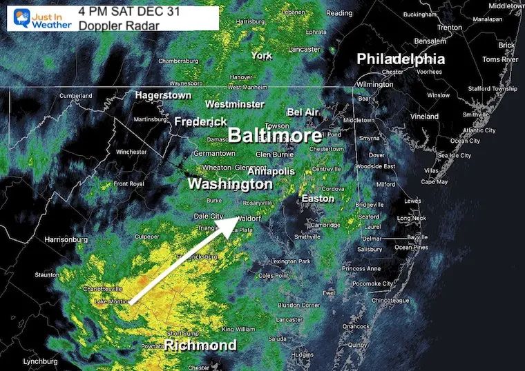
Moderate rain has spread across the region (with the fog) as expected.
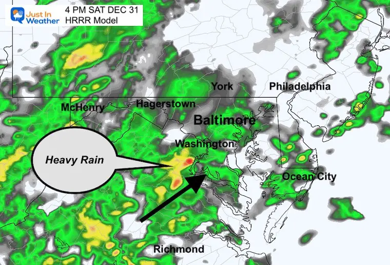
The heavy rain (yellow) between Fredericksburg and Richmond in Virginia is more impressive than the modeling suggested. This will be riding north into metro Washington and Baltimore this evening.
4 PM HRRR Model
We can compare this to the image above and see the coverage for rain was close. However, this model under estimated the heavy rain region. We may extrapolate that through the evening and that is why I think we may have some rumbles of thunder.
Radar Simulation: 5 PM to Midnight
While the heavy rain will be when many people are traveling to parties and hindering outdoor events, the storm should be gone by midnight. So the fireworks, at least over Baltimore, should be OK to go!
Key Timeframes
I added many towns to help you plot your location easier.
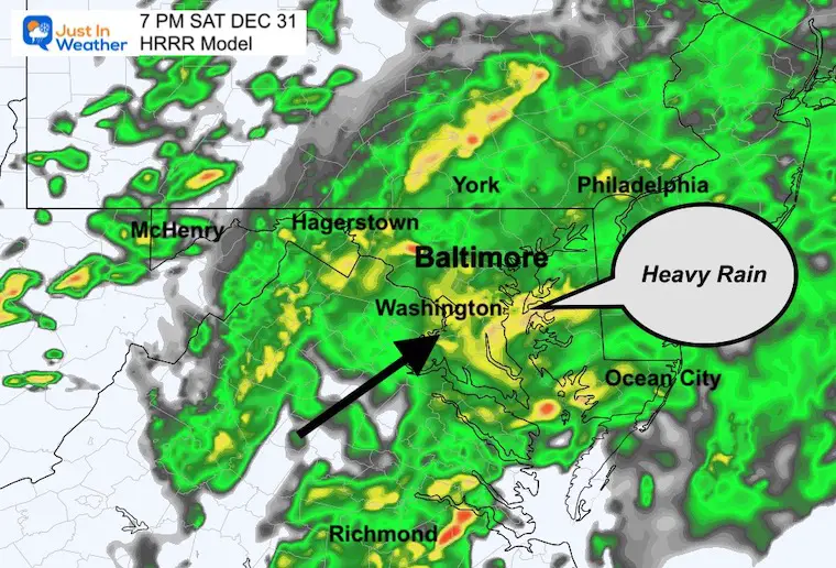
7 PM
The heaviest rain will be reaching central Maryland, including metro Washington/Baltimore between 5 and 7 PM.
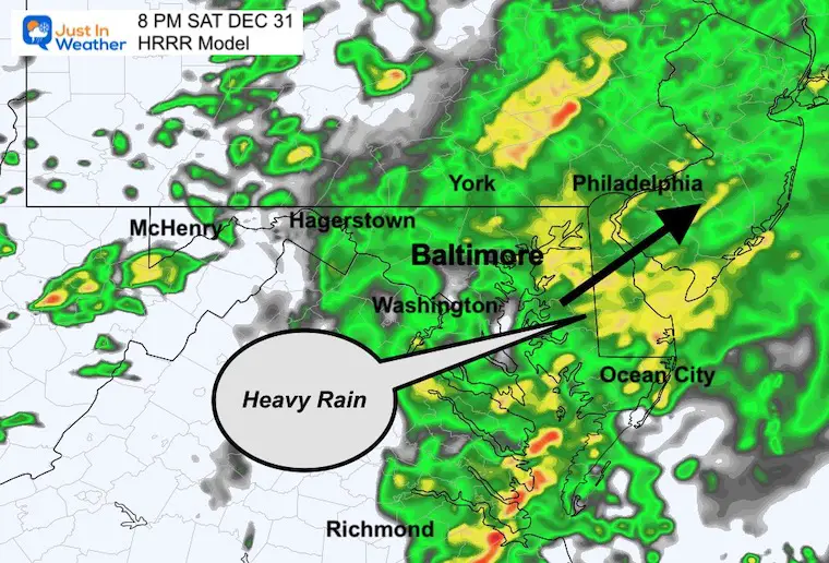
8 PM
The heaviest rain is in southern Maryland and across Delmarva.
A second heavy rain cluster near Lancaster to Allentown and Philadelphia.
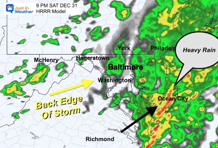
9 PM
This may be a rough time between Salisbury and Ocean City and this is where it’ll be more likely to hear some thunder.
Baltimore should be seeing the last of the showers moving through and done before 10 PM.
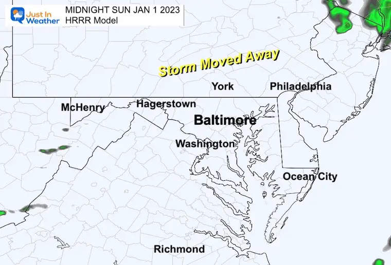
Midnight
The storm should be clear of our region by then.
LIVE RADAR WIDGET
Use the controls to pan and zoom. Compare to the relevant time Frame above to see if this is on point with the time, or faster.
New Year’s Day
There is a culture outside of the partying where people start off the new year with a sunrise or early day hike to clear the mind and start off fresh. We plan on an early day exploration and the weather will be improving. Here’s a look…
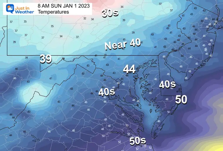
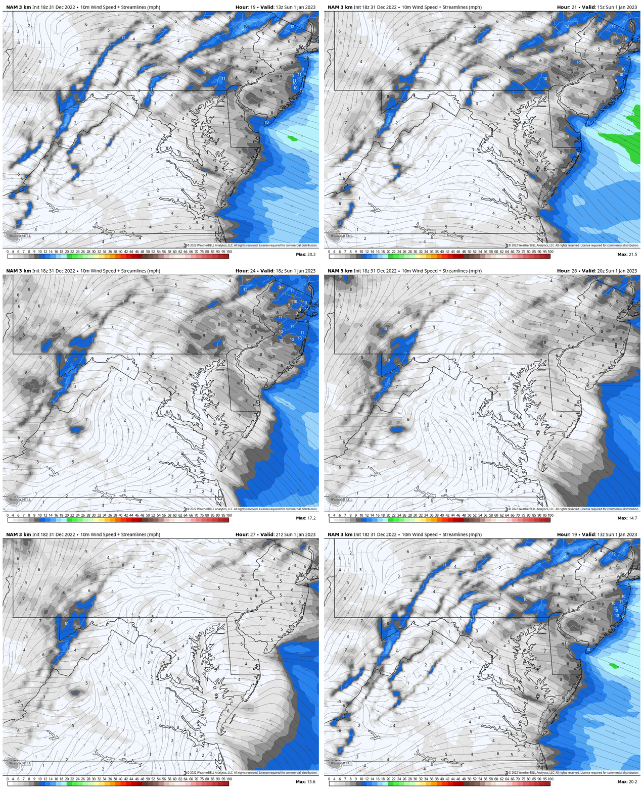
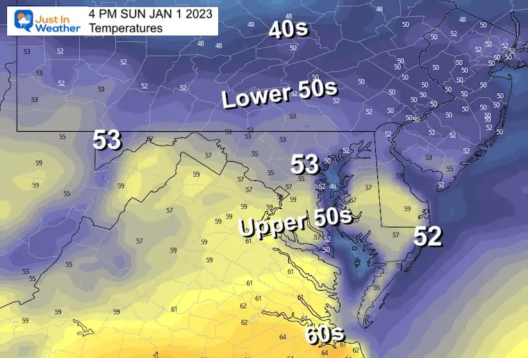
Note that the temps will be determined by the amount of sun. We may be battling with leftover clouds, but the wind should not be too gusty.
Morning Temperatures
Wind Forecast 8 AM to 5 PM
Afternoon Temperatures
Ravens Game
This was moved to Sunday night in Baltimore and the conditions should be very pleasant for early January. Nothing like the ice bowl last week.
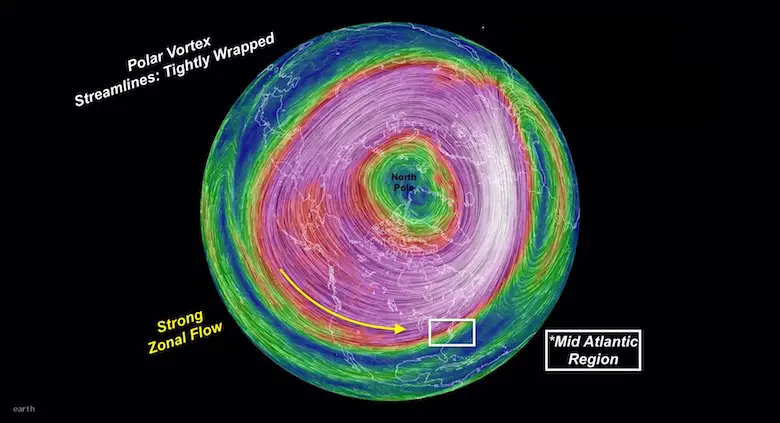
Polar Vortex Report
In case you missed this, I explain the stable circulation now and disruption forecast by mid January. Compare to 3 recent winters that were similar: Record warmth was followed by record snow.
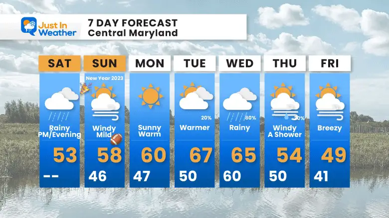
7 Day Forecast
The focus for now is on the warm up.
Faith in the Flakes Gear
What is Faith in the Flakes?
It began with my son in 2009
October 27 Nor’easter Recap Still Breezy Then Next Storm Friday
SNOWSTIX – Available Now
STEM Assemblies/In School Fields Trips Are Back
Click to see more and ‘Book’ a visit to your school
My Winter Outlook: Not A Typical La Niña!
I see many factors to support colder influence with multiple systems. Early and later in winter. Check it out.
October 27 Nor’easter Recap Still Breezy Then Next Storm Friday
Also See The Winter Outlook Series:
October 27 Nor’easter Recap Still Breezy Then Next Storm Friday
Farmer’s Almanac Comparison
September Starts Meteorological Autumn: Weather Climate Stats For Maryland at Baltimore
Triple Dip La Niña Winter
CONNECTION TO WINTER?
If you want a snowy winter, this is what you might want to look for in the rest of the tropical season. (You might be seeing a lot of commercial snow removal people out this Winter).
Rainbow Ice Cave In Mt. Rainier A Very Rare Find: Photos And Video
Wooly Bear Caterpillars
https://justinweather.com/2022/10/25/winter-weather-outlook-from-the-wooly-bear-caterpillar/
Persimmon Seeds
Click to see Top 20 and MORE
Winter Weather Folklore Top 20 And More Outlook Signals From Nature For Cold And Snow
Normals And Records: Maryland and Baltimore Climate History
Please share your thoughts, best weather pics/videos, or just keep in touch via social media
-
Facebook: Justin Berk, Meteorologist
-
Twitter: @JustinWeather
-
Instagram: justinweather


