November 29 Southern Severe Storms Today Bring Us Rain And Strong Winds Tomorrow
November 29, 2022
Tuesday Morning Update
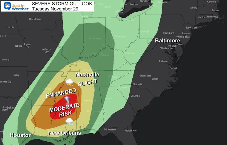
There are two severe storm seasons in the US. The first is in Spring, the second in Autumn. Today will represent that second round with a surge of warm air battling the oncoming winter air mass, and they will meet up across the lower Mississippi River Valley. The net result may be a tornado outbreak.
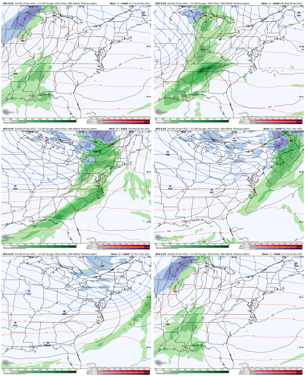
The concern is that the remaining energy, although weakening, will reach us tomorrow. We will get morning rain, then very strong winds in the afternoon. Gusts over 50 mph in parts of our region are possible.
Severe Storm Risk
Moderate Risk (Level 4 of 5) = Red
Enhanced Risk (Level 3) = Orange
Slight Risk (Level 2) = Yellow
Central Mississippi is at the highest risk for supercell thunderstorms and tornadoes.
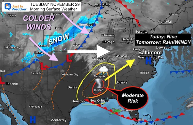
Morning Surface Weather
High is Dry! That big blue H is High Pressure and is in control of the Eastern US.
A band of snow has developed from Denver to Minneapolis on the arctic side of the pattern.
To the South: Storms are expected to erupt with afternoon heating as new Low-Pressure forms.
Storm Tracking: Tuesday Morning To Thursday Morning
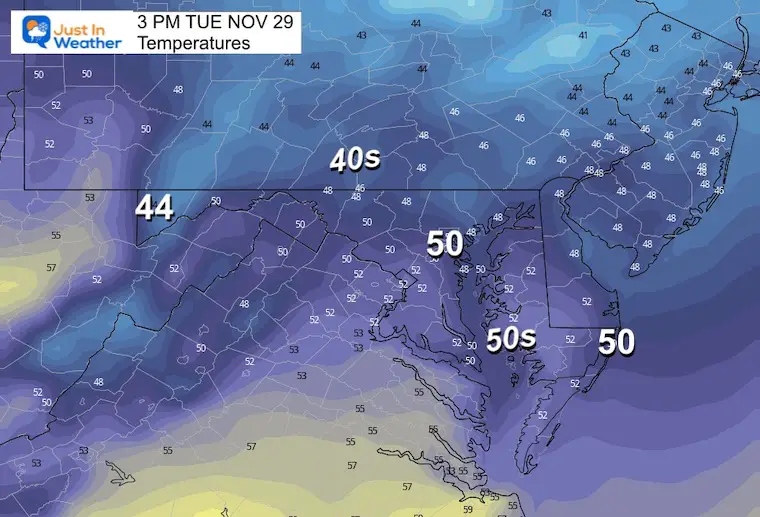
Afternoon Temperatures
Subscribe to my Newsletter
Weather posts straight to your inbox
Sign up and be the first to know!
NEW Faith In The Flakes Gear
CLIMATE DATA
TODAY November 29
Normal Low in Baltimore: 33ºF
Record 13ºF in 1955
SNOW: 1.0 inches in 1952
Normal High in Baltimore: 52ºF
Record 74ºF 1927
NEW REPORTS:
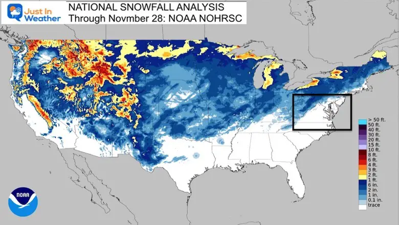
Record Snow Cover Across The Northern Hemisphere
December Pattern Change
How The Winter Weather Pattern May Develop In Early December
Wednesday
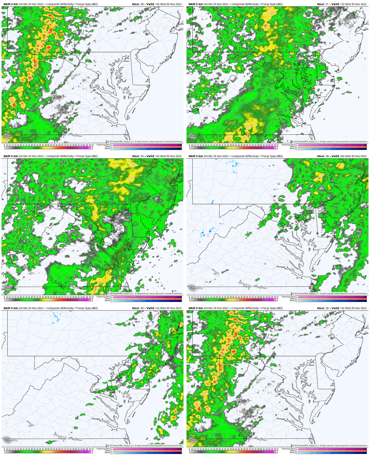
- Rain will develop in the morning during the commute. Most of the region should see it arrive between 6 AM and 8 AM.
- Rain will break up to showers in the afternoon.
- Winds: Increase in the afternoon!
Radar Simulation:
NAM 3 Km: 5 AM to 5 PM
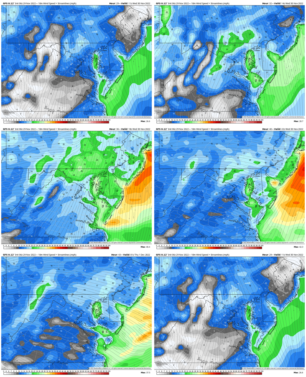
Wind Forecast
6 AM to 8 PM
- Morning: Winds from the south
- Afternoon: Winds (stronger) from the west/northwest
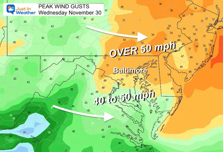
Wind Gusts
I expect Wind Advisories may be issued today (for tomorrow).
Peak gusts near and north of Baltimore may exceed 50 mph!
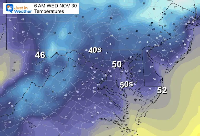
Morning Temperatures
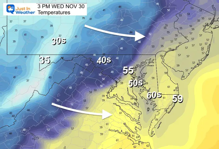
Afternoon Temperatures
Cooling down behind the rain
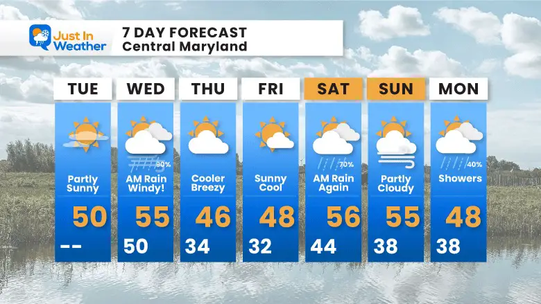
7 Day Forecast
My Winter Outlook: Not A Typical La Niña!
I see many factors to support colder influence with multiple systems. Early and later in winter. Check it out.
October 27 Nor’easter Recap Still Breezy Then Next Storm Friday
Also See The Winter Outlook Series:
October 27 Nor’easter Recap Still Breezy Then Next Storm Friday
Farmer’s Almanac Comparison
September Starts Meteorological Autumn: Weather Climate Stats For Maryland at Baltimore
Triple Dip La Niña Winter
CONNECTION TO WINTER?
If you want a snowy winter, this is what you might want to look for in the rest of the tropical season. (You might be seeing a lot of commercial snow removal people out this Winter).
Rainbow Ice Cave In Mt. Rainier A Very Rare Find: Photos And Video
Wooly Bear Caterpillars
https://justinweather.com/2022/10/25/winter-weather-outlook-from-the-wooly-bear-caterpillar/
Persimmon Seeds
Click to see Top 20 and MORE
Winter Weather Folklore Top 20 And More Outlook Signals From Nature For Cold And Snow
Faith in the Flakes Gear
SNOWSTIX – Available Now
Normals And Records: Maryland and Baltimore Climate History
STEM Assemblies/In School Fields Trips Are Back
Click to see more and ‘Book’ a visit to your school
Please share your thoughts, best weather pics/videos, or just keep in touch via social media
-
Facebook: Justin Berk, Meteorologist
-
Twitter: @JustinWeather
-
Instagram: justinweather


