November 21 Cold Morning Then Mild Travel Days: Thanksgiving Weekend Storm Update
November 21 2022
Monday Morning Update
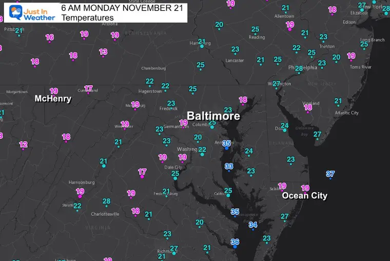
We got the record in Baltimore on Sunday. The afternoon temperature at BWI did make it back to 38ºF, which tied as the coldest max temperature for the date. Now we get the benefits of a clear sky and light wind overnight enhancing the chill. Temps have dropped into the teens for many areas, including the airport at Ocean City.
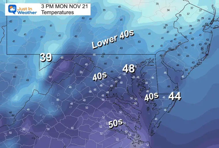
The good news is the quiet weather pattern for a few days will allow for sunshine and mild afternoons. Thanksgiving may bring more clouds, ahead of that holiday weekend storm. More on that below.
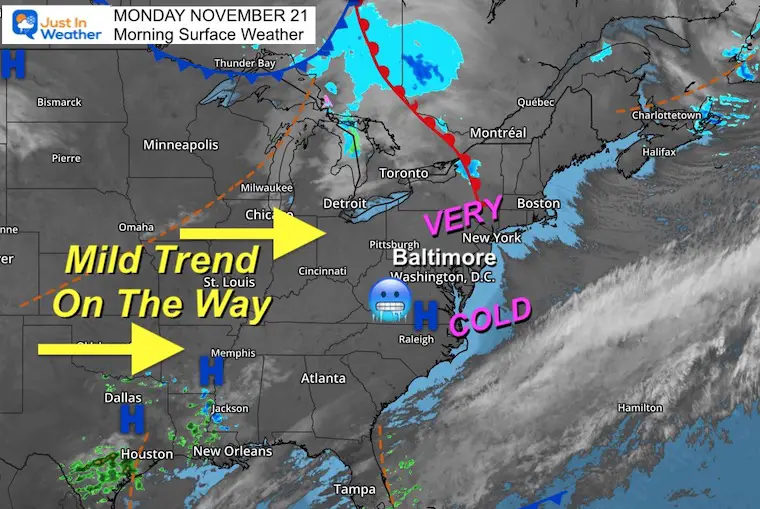
Morning Surface Weather
These winds are the final push from this cold air mass. These same winds are still producing Lake Effect Snow, however, they have shifted and the intensity is not the same as the last few days.
Morning Temps at 6 AM
Temperatures Afternoon
NEW REPORT:
Atmospheric Memory – Tracking storm patterns since the summer for hints of winter ahead. It’s been busy here in the Mid Atlantic.
Winter Weather Folklore Top 20 And More Outlook Signals From Nature For Cold And Snow
CLIMATE DATA
TODAY November 21
Normal Low in Baltimore: 35ºF
Record 16ºF in 1951
SNOW: Trace in 2008
Normal High in Baltimore: 55ºF
Record 79ºF 1900
Have you been missing some of my reports?
Two ways to get notified more often:
Sign Up For My Newsletter
Weather posts straight to your inbox
Sign up and be the first to know!
ALSO on Facebook
They keep changing the settings… Go to my page wall and click this button to mark it as *Favorites
Click this image to get to my page wall
Tuesday Morning
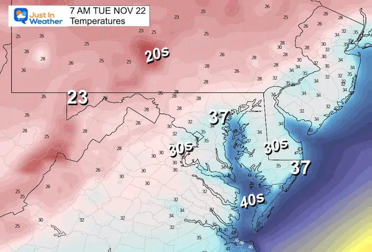
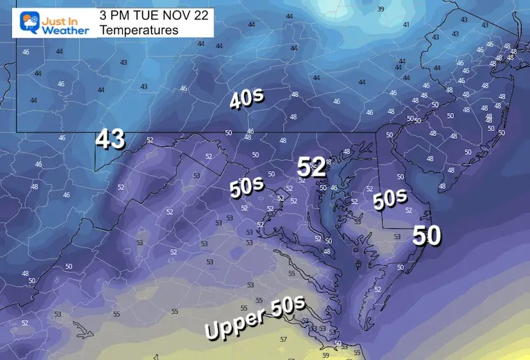
Tuesday Afternoon
Thanksgiving Storm Outlook
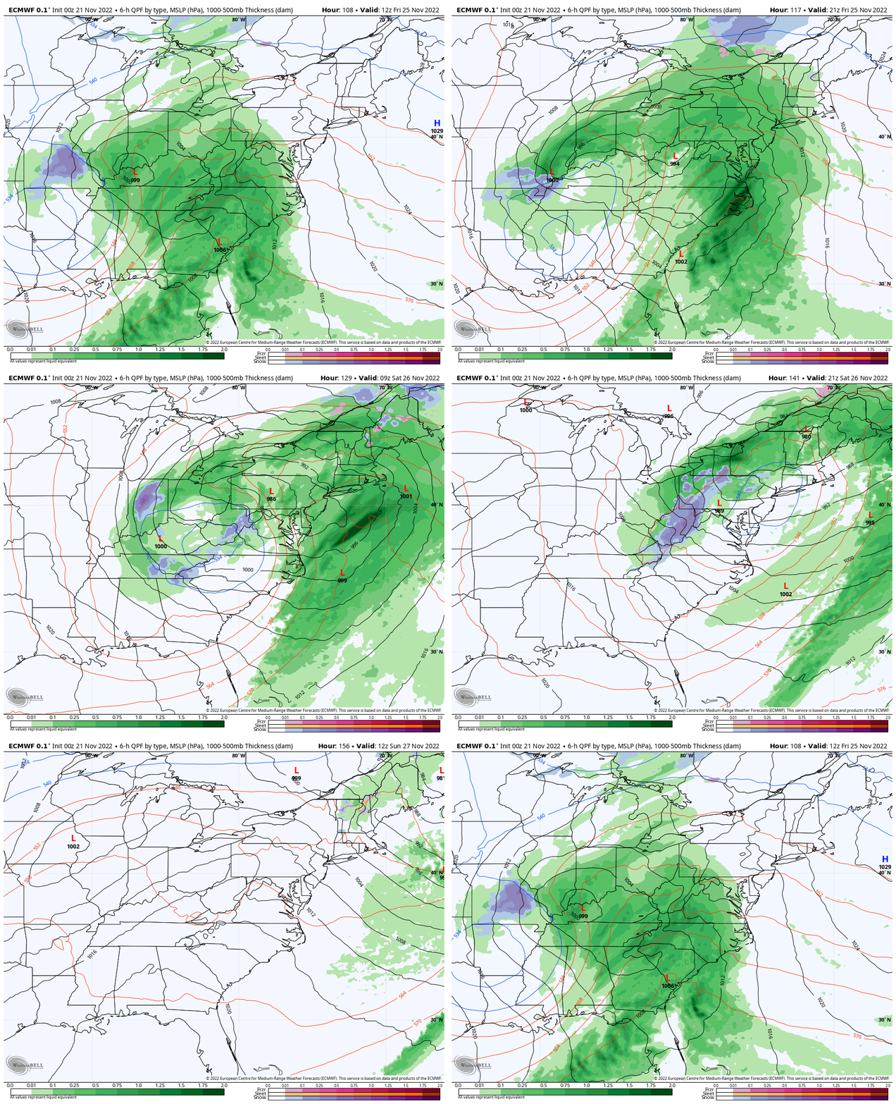
Your phone app may not show this as much with the GFS (American Model) losing sight of the storm. The European Model has been consistently showing the development. Despite my original report, this looks like mostly a rain event. There will be cold air aloft, resulting in mountain snow. I do see the cold air possibly producing producing showers with wintry mix on Saturday….
ECMWF – European Model
Friday Morning To Sunday Morning
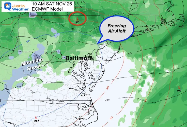
Snapshot Saturday Morning
The bulk of the storm will be north, however leftover high clouds remain. Rain is identified here, with snow in the mountains. Cloud level temps will be below freezing, so we could see a wintry mix of showers.
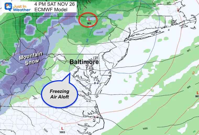
Snapshot Saturday Afternoon
Heavy snow in the mountains continues with a few more showers locally… Cloud level temps will be below freezing, so we could see a wintry mix of showers.
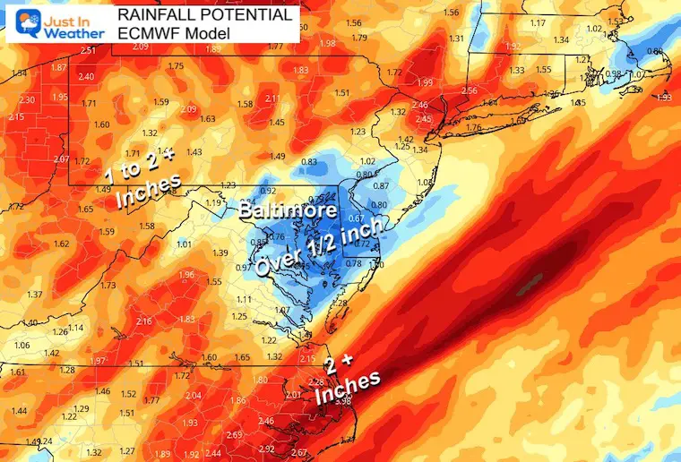
Rainfall Potential
The low rain pocket around the Bay with over 1/2 inch, however most of the region is expected over 1 inch of rain.
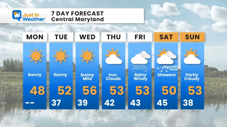
7 Day Forecast
Faith in the Flakes Gear
SNOWSTIX – Available Now
Also See: Winter Outlook Series:
ALSO, SEE THESE OTHER WINTER OUTLOOK REPORTS
Farmer’s Almanac Comparison
September Starts Meteorological Autumn: Weather Climate Stats For Maryland at Baltimore
Triple Dip La Niña Winter
CONNECTION TO WINTER?
If you want a snowy winter, this is what you might want to look for in the rest of the tropical season. (You might be seeing a lot of commercial snow removal people out this Winter).
Rainbow Ice Cave In Mt. Rainier A Very Rare Find: Photos And Video
Wooly Bear Caterpillars
https://justinweather.com/2022/10/25/winter-weather-outlook-from-the-wooly-bear-caterpillar/
Persimmon Seeds
Click to see Top 20 and MORE
Winter Weather Folklore Top 20 And More Outlook Signals From Nature For Cold And Snow
Normals And Records: Maryland and Baltimore Climate History
STEM Assemblies/In School Fields Trips Are Back
Click to see more and ‘Book’ a visit to your school
Please share your thoughts, best weather pics/videos, or just keep in touch via social media
-
Facebook: Justin Berk, Meteorologist
-
Twitter: @JustinWeather
-
Instagram: justinweather


