July 18 Flood Watch In The Mountains Then Storms Expand Back This Weekend
Friday, July 18 2025 Morning Report There is some relief in sight, but I remain cautious. For the short term, today remains muggy, while the focus of strong storms and…
Thursday November 17 2022
I want to start by saying I am going against my own policy to discuss this potential event. Under normal circumstances, I would not mention a winter storm until within a one week time frame simply because there is so much variability. The odds of a storm playing out exactly with snow and ice as we see it 8 or 9 days away is unlikely. However, something is going to try and form based on the global circulation. More on that in a moment.
For the record, I am still working to finish my winter outlook. I got sidetracked with other work and the new bottleneck with Facebook reach. Most public pages are having trouble getting to their audiences. If you want to guarantee to see my post updates, please subscribe to my email list here:
Sign up and be the first to know!
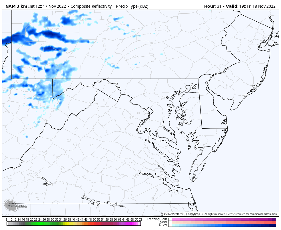
This is a minor event that may cross central Maryland to Philadelphia late afternoon and evening.
Baltimore suburbs timing: 3 PM to 6 PM.
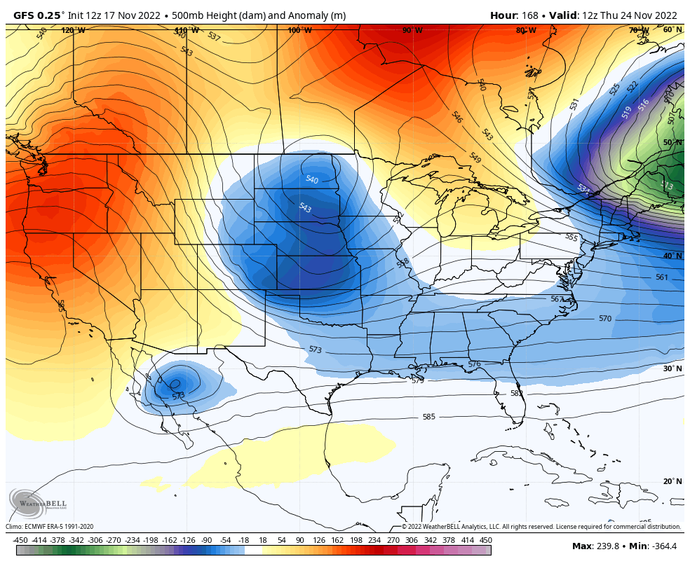
The European Model shows a closed Low in the North Atlantic, leading to a negative North Atlantic Oscillation (-NAO).
This helps feed cold air and dig a deep trough for the eastern US.
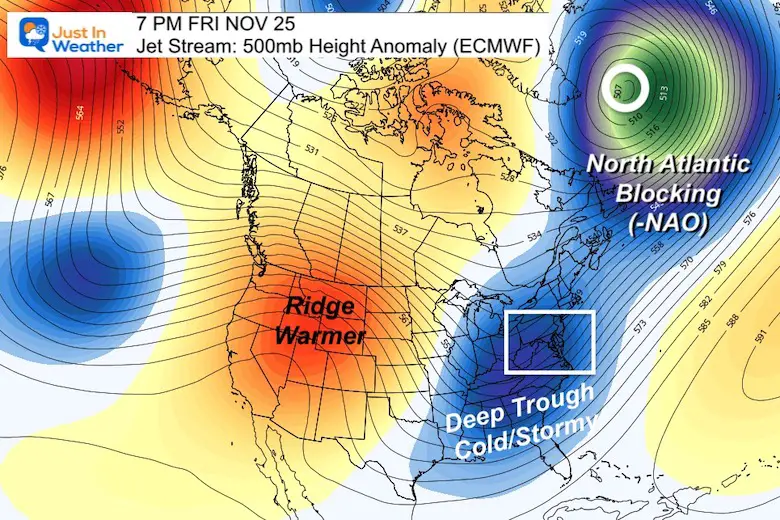
That deep trough would be responsible for colder air and a storm pattern. This does NOT promise the proper conditions, but it does support it.
We can see that trough develop Thanksgiving Day in the Southern Plains to Mid Atlantic on Friday.
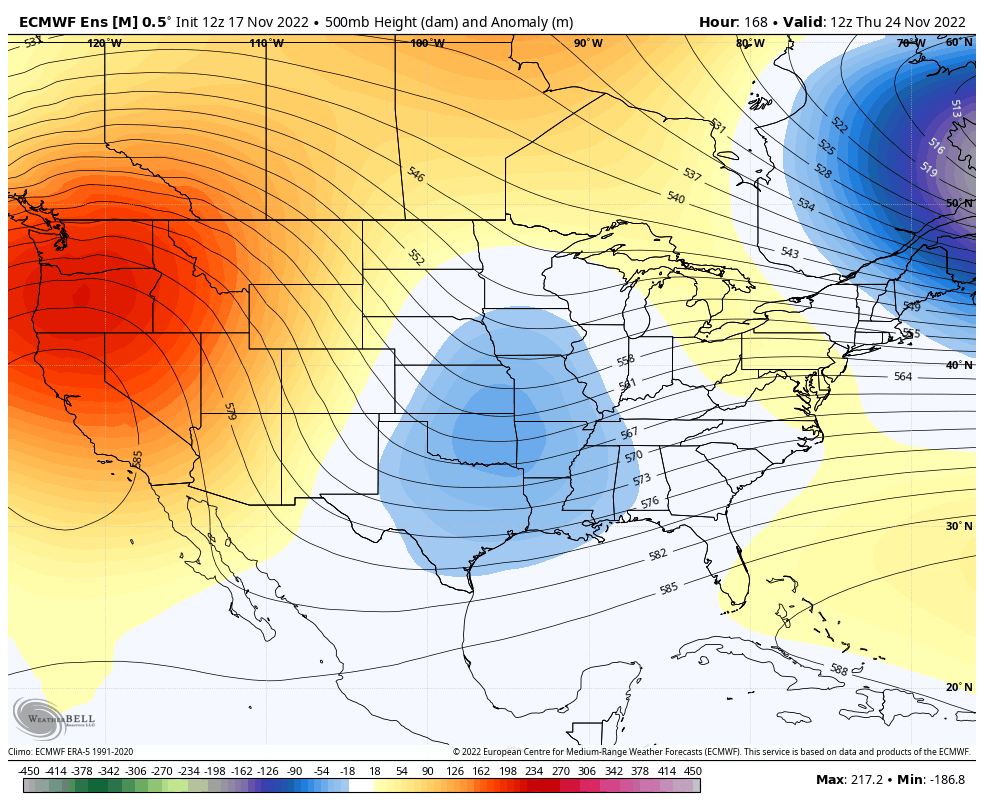
This model has a much stronger short wave and digs that trough resulting in a storm for the Mid Atlantic on Friday.
I need to mention that the European Model does not develop a surface storm (at this time). I’ve actually seen the GFS Model perform better recently, so what I show below is worth consideration.
7 AM Fri Nov 25 to 7 AM Sun Nov 27
This looks like a Miller B set up with an arctic Low in the Mid-West shifting energy to a new Coastal Low.
I am keeping the wide view to keep this vague because I do expect changes over the next few days.
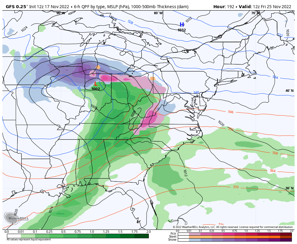
I picked the worse case scenario at this time, which would be Friday night.
This is NOT a forecast. It is a suggestion that many of us meteorologists will be watching. In fact, this was the 12Z (Thursday morning forecast). The 18 Z (afternoon) run was less impressive, but the ‘off hour’ plots often waffle. It’s too early to take seriously but fun to watch.
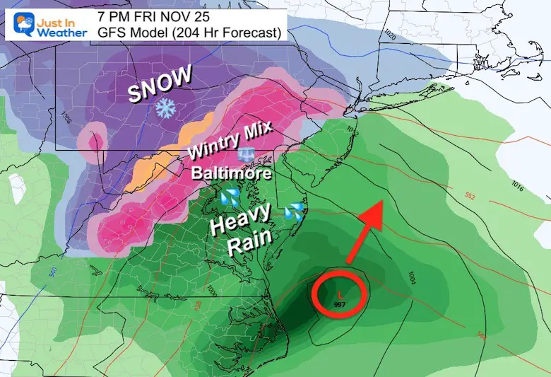
I will NOT hype this storm, and caution anyone who does. The Buffalo Lake Effect Snow will have our attention into the weekend and keep this is a side note. More than likely some form of a storm will develop Thanksgiving weekend not exactly like this. Stay tuned… Winter may try to start early.
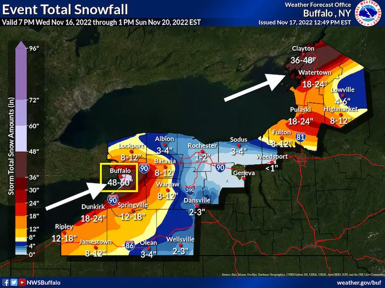
The National Weather Service UPPED the Snow Forecast.
See my Poll on Twitter below and join in to make the call.
You make the call:
❄️ What will the TOP snow total be for this #LakeEffectSnow Event?— Justin Berk (@JustinWeather) November 18, 2022


September Starts Meteorological Autumn: Weather Climate Stats For Maryland at Baltimore
If you want a snowy winter, this is what you might want to look for in the rest of the tropical season. (You might be seeing a lot of commercial snow removal people out this Winter).
Rainbow Ice Cave In Mt. Rainier A Very Rare Find: Photos And Video
https://justinweather.com/2022/10/25/winter-weather-outlook-from-the-wooly-bear-caterpillar/
Winter Weather Folklore Top 20 And More Outlook Signals From Nature For Cold And Snow

Click to see more and ‘Book’ a visit to your school

Two ways to get notified more often:
Sign Up For My Newsletter
Sign up and be the first to know!
ALSO on Facebook
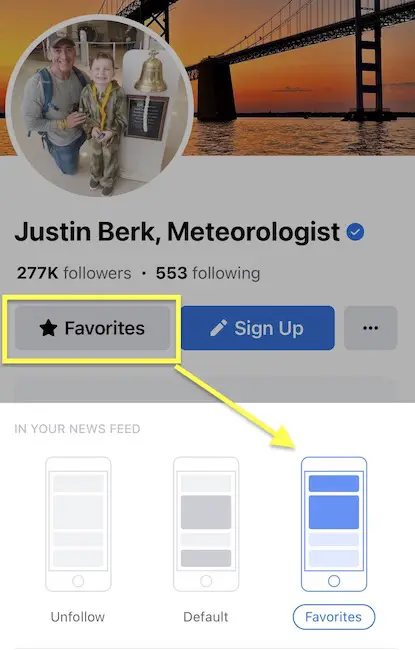
They keep changing the settings… Go to my page wall and click this button to mark it as *Favorites
Click this image to get to my page wall