


May 10 Chilly With More Rain Showers Today And Into Mothers Day Weekend
Friday May 10 Morning Report Today is the second day of the year, with sunrise before 6 AM in Baltimore, but like yesterday, we won’t see it. After a high…
November 8, 2022
Tuesday Morning Update
So much happening now and I want to make this quick and simple for my morning report. A record high temperature, lunar eclipse, election day, and Nicole transitioning to a full tropical storm then maybe a hurricane for Florida where warnings are already in place. This storm will turn north (inland) for us to get heavy rain in the Mid Atlantic on Friday.
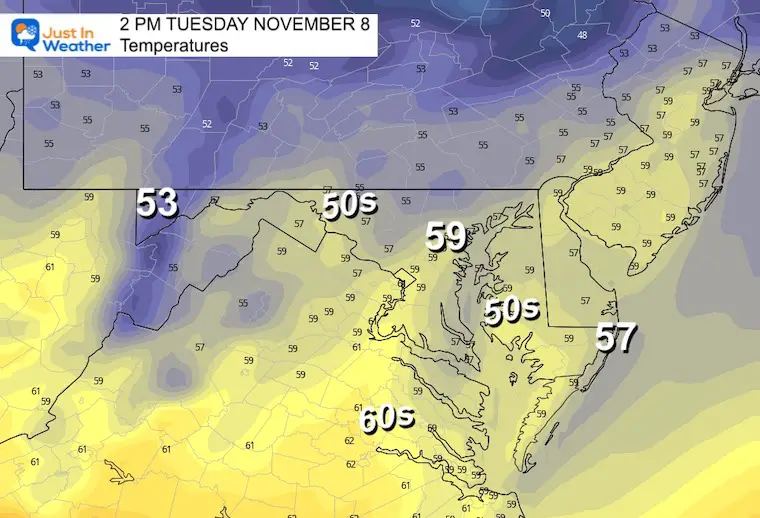
Baltimore set a new record high Monday with 81ºF at BWI. That will change today and into the week ahead for sure.
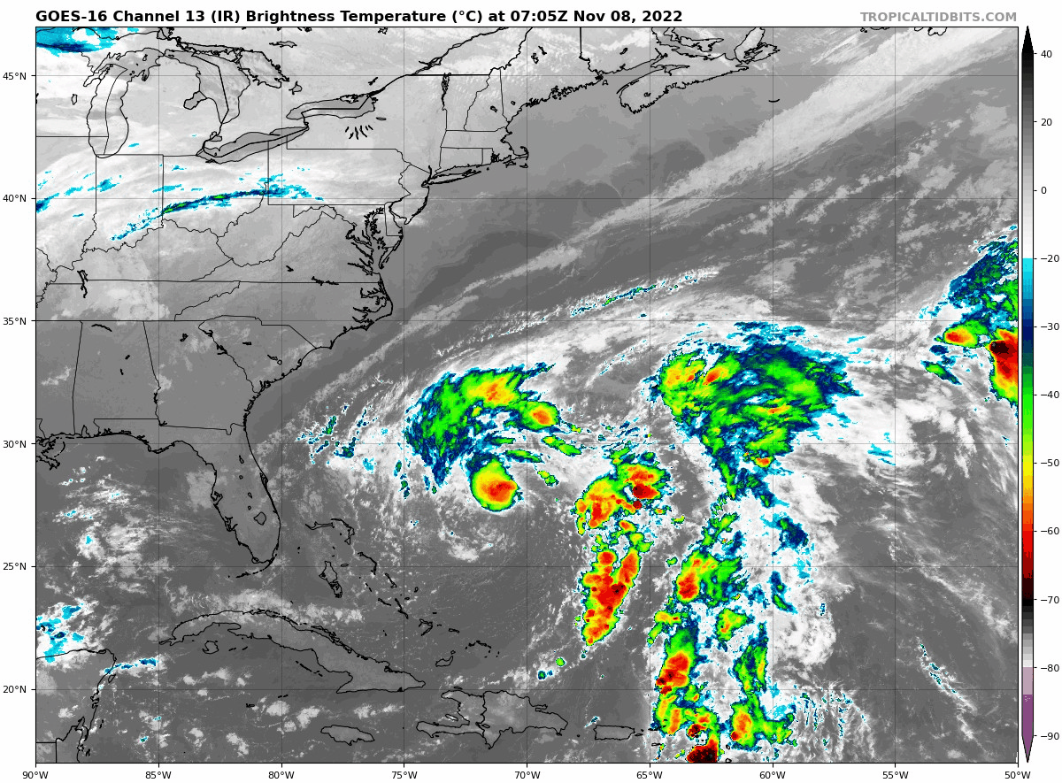
This morning, we started with a Total Lunar Eclipse, and I will be sorting through many photos to share later. Here is one of the early shows I got so far of the Blood Red Moon.
Lunar Eclipse From Central Maryland
There it is…🤩 #LunarEclipse seen in central Maryland!
🌖🌗🌘🌑 https://t.co/PANIymvVZo— Justin Berk (@JustinWeather) November 8, 2022
Meanwhile it is Election Day, so our news outlets will be dominated by that ‘stuff’.
Let’s focus here on just the weather. In this case, we need to focus on Subtropical Storm Nicole. It will transition to a full Tropical Storm today and then could become a Hurricane before reaching Florida. Warnings and watches are in place which I will highlight here.
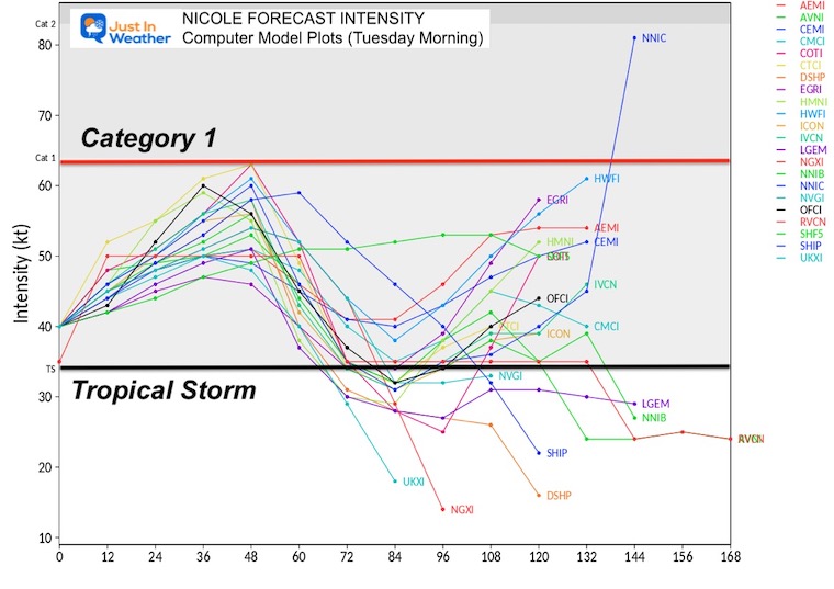
The National Hurricane Center expects a transition to a full Tropical Storm today.
LOCATION…27.6N 71.6W
ABOUT 400 MI…ENE OF THE NORTHWESTERN BAHAMAS
MAXIMUM SUSTAINED WINDS…45 MPH
PRESENT MOVEMENT…NW OR 310 DEGREES AT 8 MPH
MINIMUM CENTRAL PRESSURE…995 MB…29.39 INCHES
A Hurricane Warning is in effect for…
A Tropical Storm Warning is in effect for...
A Storm Surge Warning is in effect for…
A Hurricane Watch is in effect for…
A Storm Surge Watch is in effect for…
A Tropical Storm Watch is in effect for…
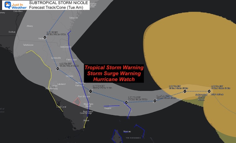
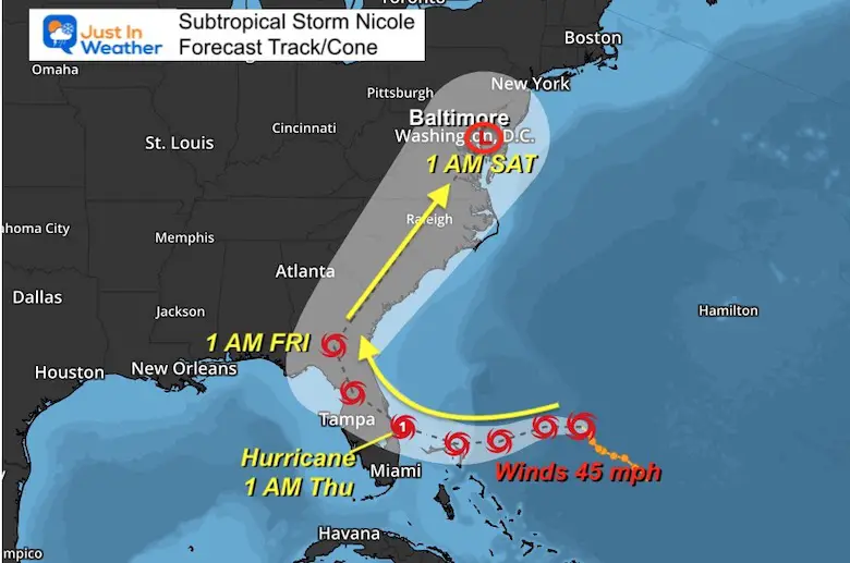
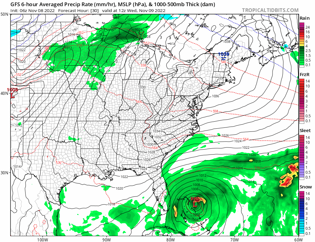
Here is the wide view, which we expect will cross Florida, and then the remnant Low may cross Central Maryland by Saturday morning. This will be INLAND so we DO NOT have a storm surge to deal with.
More on the local impact below
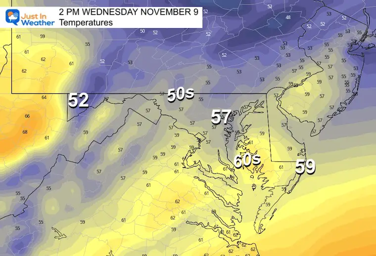
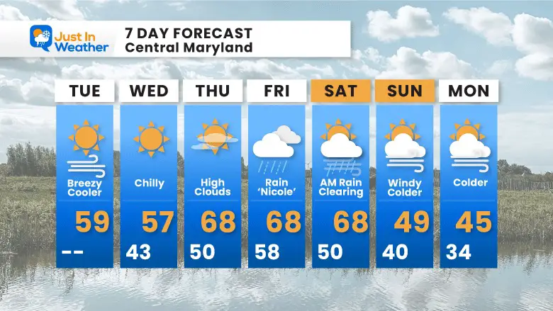
It will be much cooler than yesterday.
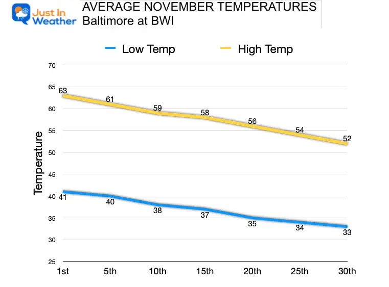
Normal Low in Baltimore: 39ºF
Record 24ºF in 1960
SNOW: Trace in 1992
Normal High in Baltimore: 60ºF
Record 80ºF 2075 *Latest date for temps this warm
Average Temperatures Trending Cooler
Freezing temps will be possible inland, while remaining mild near the water.
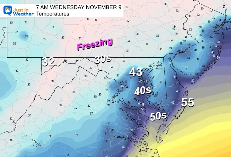
Cooler and much more in line with seasonal expectations.
This will be a quick hit for us. Rain will move in during the morning and will be heavy in the afternoon and evening. At this point, it looks like the heavy rain will shut off Saturday morning, perhaps clearing out and turning mild for the afternoon. Then colder on Sunday.
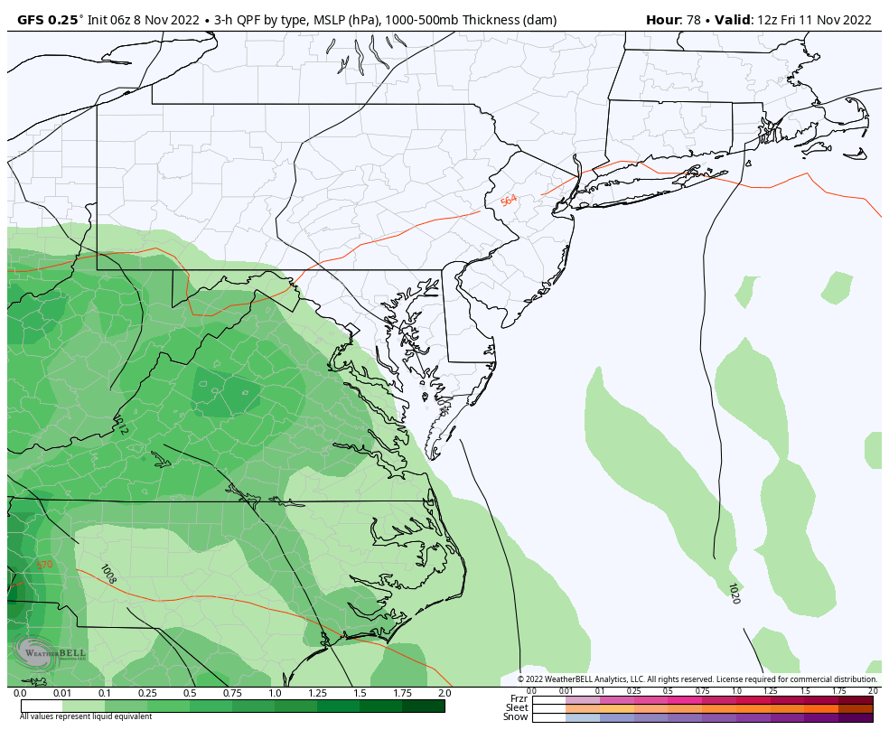
A large area OVER 2 inches may produce flooding.
I will have a comparison with other models in my next report today.
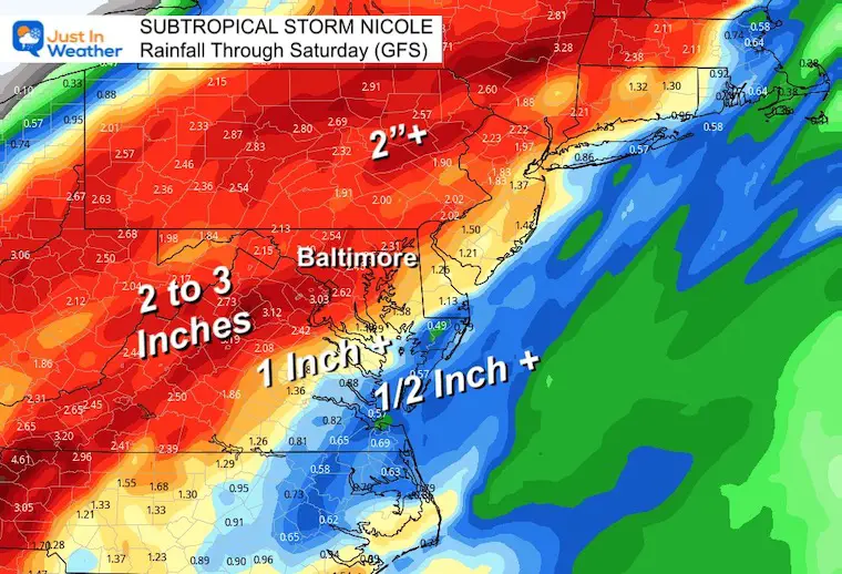
Heavy rain Friday to early Saturday, then much colder air will follow.
This pattern may bring snow to western Maryland by Sunday and Monday.
The Big Cool Down Into Mid November: NOAA Outlook Does This For First Time
Winter Outlook 2023 From NOAA Very Different Than Farmers Almanacs
Winter Outlook 2023 Early Look At Snow From Two Farmers Almanacs
If you want a snowy winter, this is what you might want to look for in the rest of the tropical season. (You might be seeing a lot of commercial snow removal people out this Winter).
Record August For No Named Tropical Storms: Closer Look At Snow Following
Winter Weather Folklore Top 20 And More Outlook Signals From Nature For Cold And Snow


