


May 3 Cooler Today Then More Rain Expected This Weekend
Friday May 3 Morning Report Another record high of 90ºF was reached yesterday at BWI. This tied the mark set in 2018. Today, a cooler wind will bring us closer…
October 18 2022
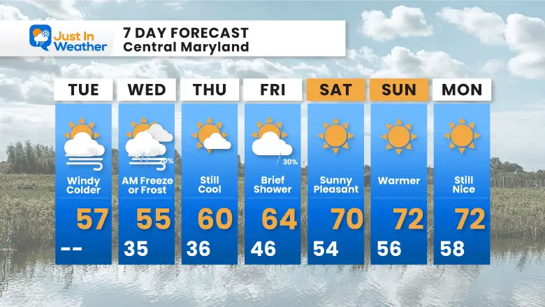
Tuesday Morning Update
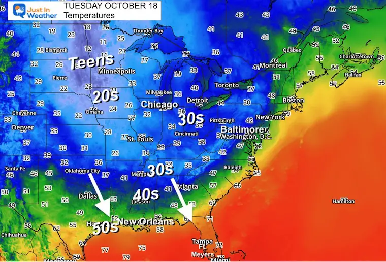
A true winter air mass is spreading across the eastern US today. Often these early outbreaks do not last AND are quickly followed by a big warm up. We have that in our forecast this week. But first, let’s check out the early winter.
The arctic air over the warmer Great Lakes has produced a lot of snow. Here is a look at where well over a Foot Of Snow has fallen in Ironwood, Michigan:
Check out the view from Ironwood, #Michigan! They woke up to so much #snow, and it looks like its still snowing! Wow! ❄️ #miwx #snowstorm pic.twitter.com/aSRxfYvTYG
— BirdingPeepWx (@BirdingPeepWx) October 17, 2022
Check out the snow coming down in Columbia City! #INwx @NWSIWX
📸: Gary Parker pic.twitter.com/iY2lo7U0HF— Liz Braden (@lizbradenwx) October 17, 2022
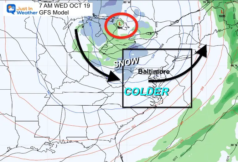
The Great Lakes Low is spinning north of Toronto and is helping to bring down more cold air… The next ‘spoke’ will pivot through Maryland today. This will kick off flurries and snow showers for Garrett County and then allow more substantial snow there through tomorrow.
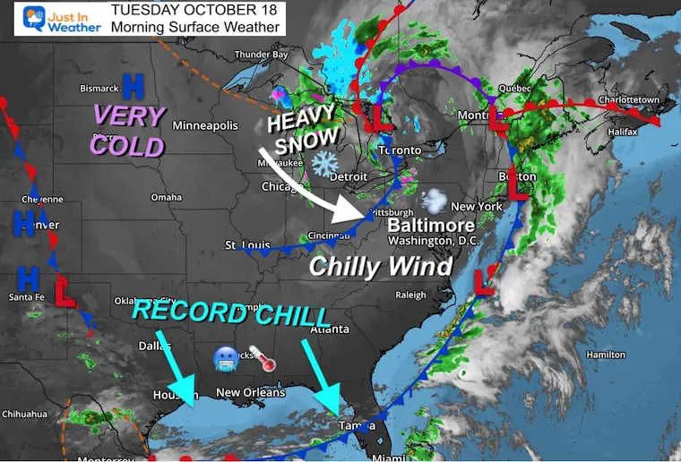
Cold Air has reached the Gulf Coast. Record Cold Afternoon Highs are expected from New Orleans to Fort Myers, FL.
As the air mass expands, here in the Mid Atlantic we will get into the core on Wednesday morning.
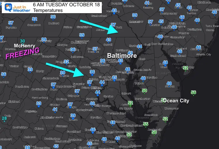
Official weather stations at area airports. It is much colder this morning, but a further drop is on the way…
Chilly AND Windy!
The first flakes will be falling in Garrett County. I will have an update and post a web cam to watch for it in my next report.
Normal Low in Baltimore: 46ºF
Record 30ºF in 1982
Normal High in Baltimore: 68ºF
Record 84ºF 2016
A Frost Advisory is in place for Delaware and parts of Maryland (upper Eastern Shore). I expect a Freeze Watch for inland suburbs based on temps in the lower 30s. Look for that to be issued today.

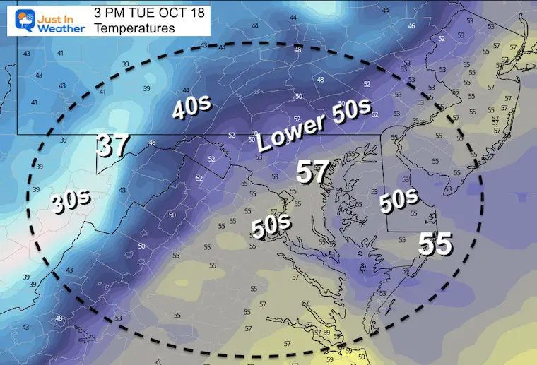
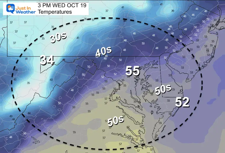
A chilly and windy day!
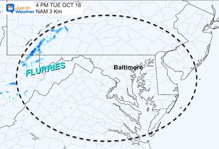
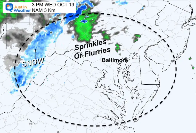
While snow will be falling in western Maryland and the surrounding mountains, a band of showers is likely to push east with the upper level energy I discussed in a prior report.
This may produce a rain OR snow shower/flurry between Fredrick, Carroll, Northern Baltimore, and Northern Harford Counties in Maryland through southern PA. NO STICKAGE but some flakes falling is possible. #FITF.
After this cold outbreak, temps bounce back BIG TIME to the 70s this weekend.
Click to see more and ‘Book’ a visit to your school


Winter Outlook 2023 Early Look At Snow From Two Farmers Almanacs
If you want a snowy winter, this is what you might want to look for in the rest of the tropical season.
Record August For No Named Tropical Storms: Closer Look At Snow Following

