Sunday Night Update October 16 2022
It is that time of year! The leaves are turning, nearing peak in suburban areas, on the horizon is a fresh Canadian Air Mass that will be labeled the proverbial ‘Coldest Of The Season’. There will be colder ones to follow.
This new air mass will arrive early in the week and bring with it cold winds off the Great Lakes that will bring the first snow of the season to the mountains in western Maryland. There is a snow accumulation forecast map below. There may be some stickage, even accumulation.
If the set up works out, there may be enough energy by Later Tuesday into Wednesday to allow some snow flurries to reach Central Maryland up to Southern Pennsylvania.
The other aspect of this will be the cold air. We could have the first Freeze of the season for inland suburbs, and even the first frost into southern Maryland and Delmarva. Check this out:
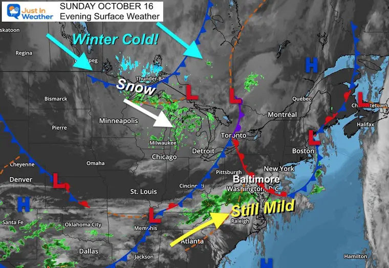
Sunday Evening Surface Weather
The leading edge of the really cold air is just starting to produce snow on the edge of Minnesota and will enter Northern Michigan on Monday.
Sunday Evening Temperatures
This is not bitter cold, but at or below freezing. That is the source of what is heading our way.

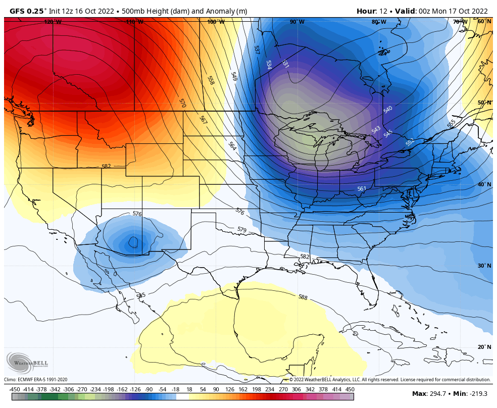
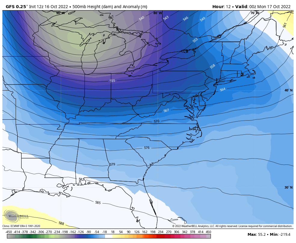
Jet Stream: 500mb Height Anomalies
Sunday Night To Wednesday Night
A Deep Trough of cold air will establish itself in the Eastern US.
Snow Forecast: NWS Cleveland
The local NWS forecast office put out this Tweet today for snow in northeastern Ohio.
Some places in Ohio may get close to their earlier snow on record.
Sunday Night To Wednesday Night
This is a closer look at the same product shown above.
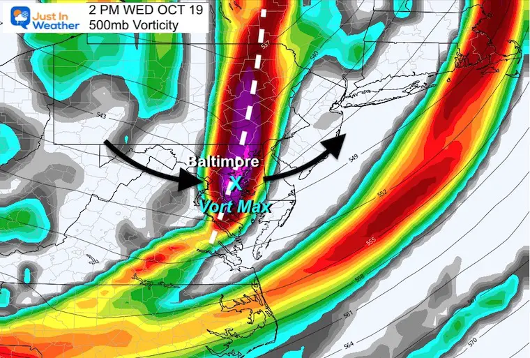
Snapshot Wednesday Afternoon
I wanted to show this view as the Trough Axis will be spinning through central Maryland.
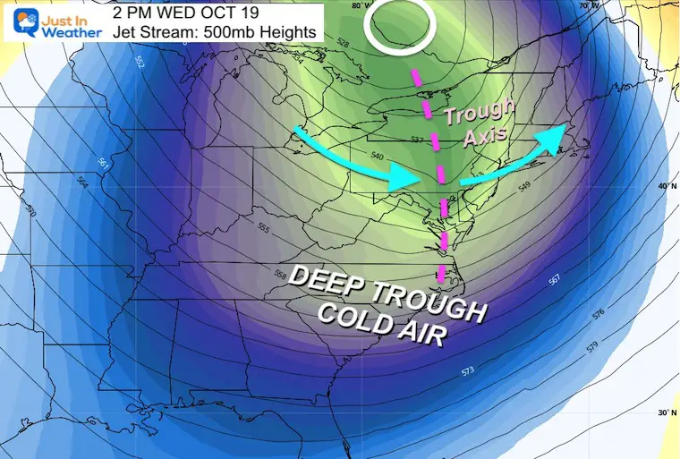
Closer Look: Vorticity = First Flurries?
This is the ‘spin’ at jet stream level. This is the ingredient that may help some additional clouds and snow flurries cross the mountains. There is NOT a lot of moisture, so the hills inland would be the best chance to see some flakes fall.
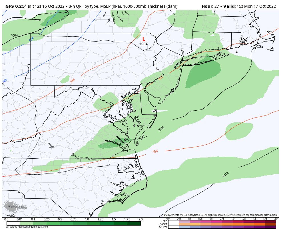
Forecast: Radar Simulation Monday Afternoon to Wednesday Afternoon
The snow is going to show up in the mountains. It is NOT showing central Maryland on this product, but that does not dismiss the chance for flurries.
#FITF
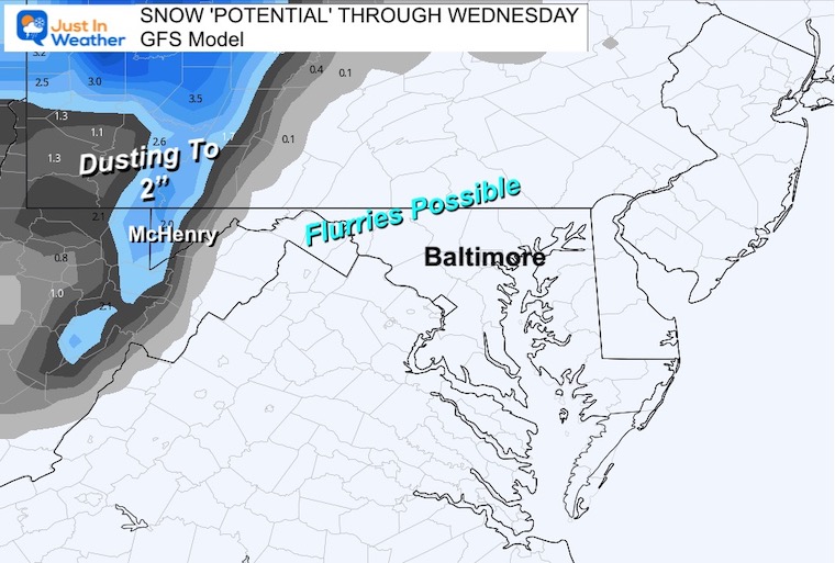
Snowfall Potential Forecast
There will be enough moisture to drop between a dusting to 2 inches of snow in the mountains of Garrett County in Western Maryland.
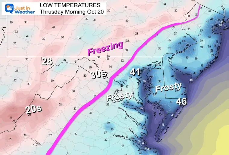
First Freeze or Frost?
Here are the morning low temperatures for midweek.
Note: To get a freeze, temps just need to be at 32ºF. However to get frost, temps can be in the mid to upper 30s with LIGHT WIND. That wind issue in the overnights will make or break the frost potential for southern Maryland and Delmarva.
Tuesday Morning Low Temperatures

Wednesday Morning Low Temperatures

Thursday Morning Low Temperatures
EXPLORE MORE: WHEN IS THE FIRST FROST?
Winter Weather Folklore Checklist
Faith in the Flakes Gear

SNOWSTIX – Available Now

ALSO SEE: Farmer’s Almanac Comparison
Winter Weather Folklore Checklist
Normals And Records: Maryland and Baltimore Climate History

Winter Weather Folklore Checklist
Also See:
Hurricane Ian Flooding May Reach Maryland This Weekend
CONNECTION TO WINTER?
If you want a snowy winter, this is what you might want to look for in the rest of the tropical season.
Rainbow Ice Cave In Mt. Rainier A Very Rare Find: Photos And Video
Hurricane Season Forecast: June 1 Through November 30
NOAA 2022 Hurricane Forecast- Above Normal Again

Related Posts
NOAA Study: Reducing Air Pollution INCREASED Tropical Storms

Atlantic Tropical History: Maps of Origin Regions Every 10 Days


