


May 19 Weather Sunday Starts Foggy The Warming With Sun And Summer Heat On The Way
Sunday May 19 Morning Report The aftermath of the rainy Saturday is plenty of leftover moisture. This has left us with a bit of humidity and areas of thick fog…
October 15 2022
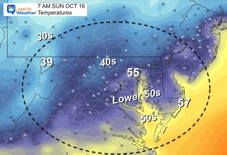
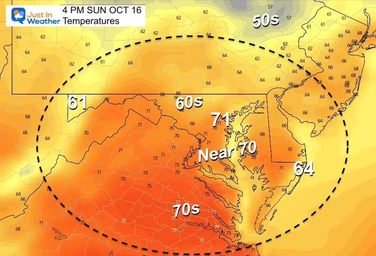
Saturday Morning Update
Let’s start with the good stuff! Today will be sunny and warm. I see this as the best weather day for a while, and couple that with it being a weekend and leaves getting close to peak color inland… We have a winner.
Fall Foliage update is available now.
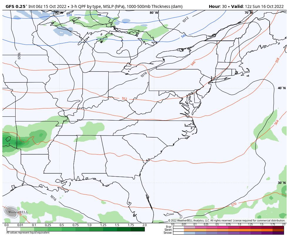
A cold front on the way will produce more clouds Sunday and may bring in some late showers to our southern half. Those showers will expand on Monday.
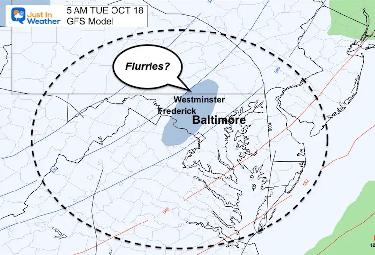
By Tuesday, there will be colder winds and the GFS Model has actually placed a band of snow flurries in the Baltimore suburbs. Check it out.
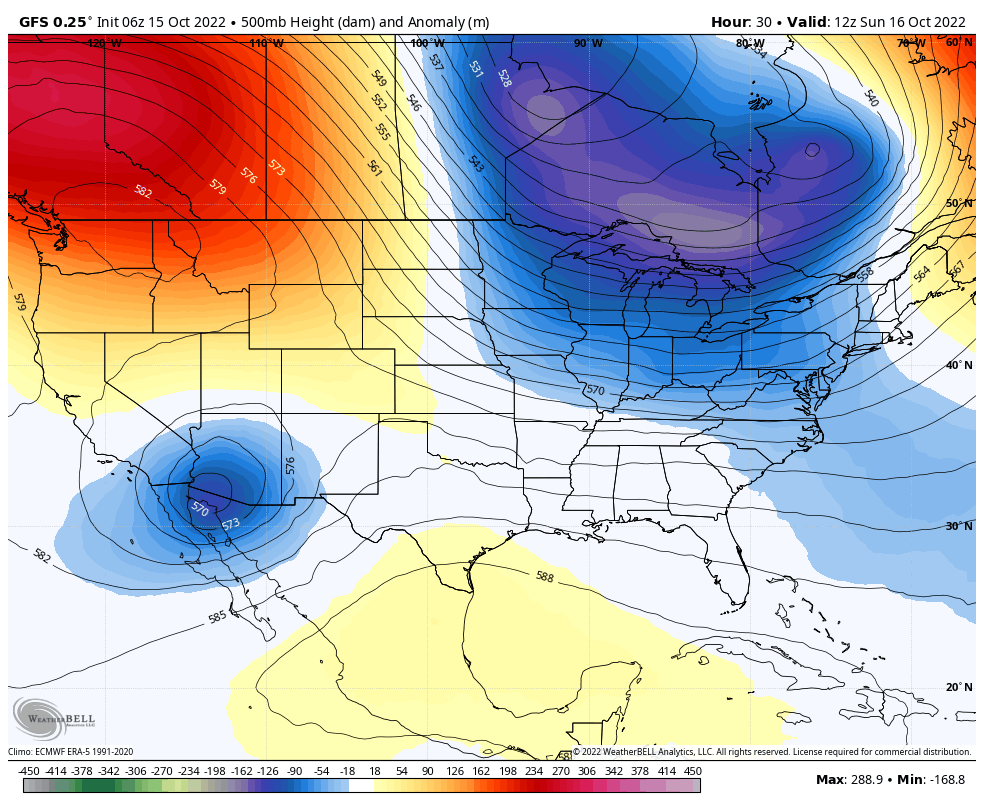
Warm air mass today, then a series of cold fronts will bring a progressively colder pattern into next week.
That is marked with snow already breaking out in northern Minnesota and Wisconsin. Snow will expand to the Great Lakes this weekend.

Official weather stations at area airports.

A little milder than this past weekend.

Normal Low in Baltimore: 47ºF
Record 32ºF in 2006
Normal High in Baltimore: 69ºF
Record 86ºF in 1989
A deep trough will dig in and establish a hold on the eastern US. This may bring frost all the way to the Gulf Coast.
The GFS Model shows the rain showers most likely Sunday night into Monday.
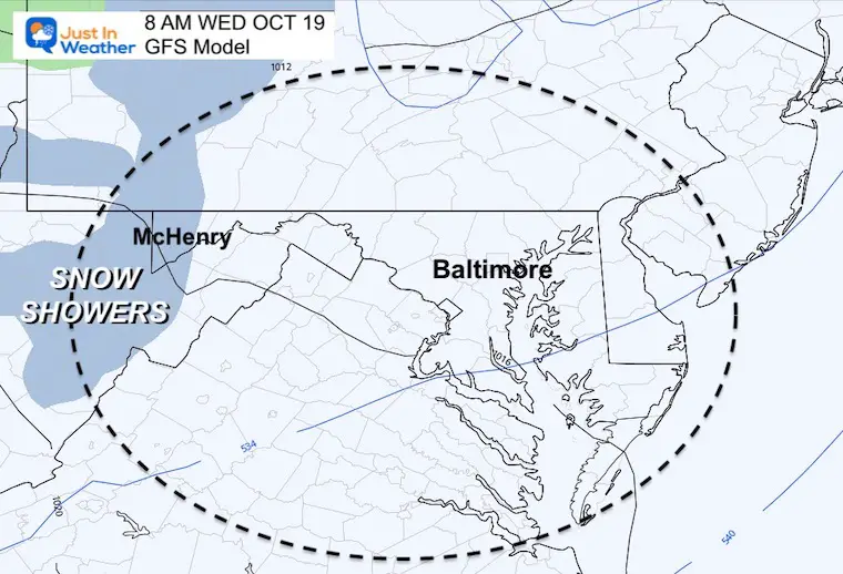
Then the flashes of ‘blue’ hint at bands of snow showers….
This is where we see possible snow flurries in the western suburbs of Baltimore
This is where Lake Effect Show Showers set up for Garrett County/Deep Creek Lake Region. This could be more pronounced with the first possible stickage. Stay tuned.

Warmer weekend then much colder next week.

Click to see more and ‘Book’ a visit to your school

Hurricane Ian May Help Cooler Pattern Change: Monitor For Atmospheric Memory This Winter
If you want a snowy winter, this is what you might want to look for in the rest of the tropical season.
Record August For No Named Tropical Storms: Closer Look At Snow Following
NOAA 2022 Hurricane Forecast- Above Normal Again

NOAA Study: Reducing Air Pollution INCREASED Tropical Storms

Atlantic Tropical History: Maps of Origin Regions Every 10 Days
