October 14 2022
Friday Morning Update
The weather system that just came through brought nearly 1 inch of rain to many areas. It has been slow to move out, and for some spots you may find patchy fog this morning. Then we will get the sun to return with a few warm afternoons only to be followed by a dramatic change to the weather pattern next week.
The gist or headline of this forecast is this:
- Clearing and mild today
- Weekend Remaining Warm/Mild
- Next Week: Much Colder with the first snow flakes falling in western Maryland.
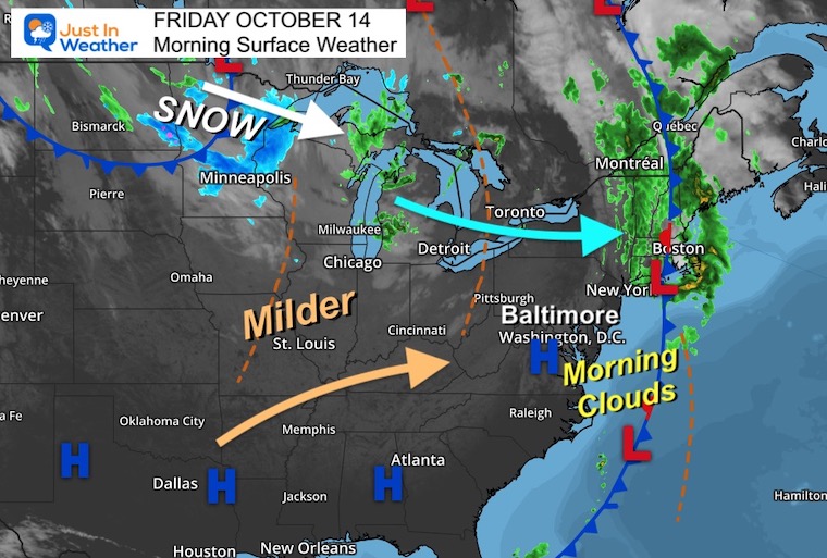
Morning Surface Weather
High Pressure will clear out the sky in the Mid Atlantic today. Warmer winds will settle in this weekend, ahead of the next front.
SNOW is falling near and north of Minneapolis, MN. The first flakes will expand through the Great Lakes this weekend.
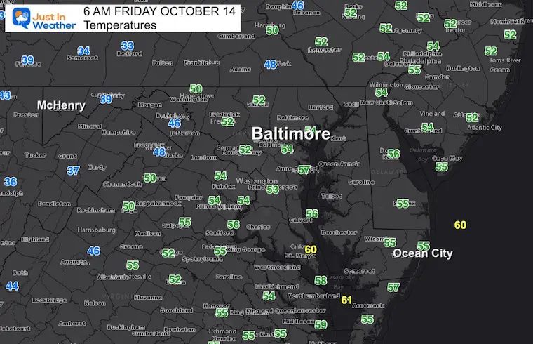
Morning Temperatures
Official weather stations at area airports.
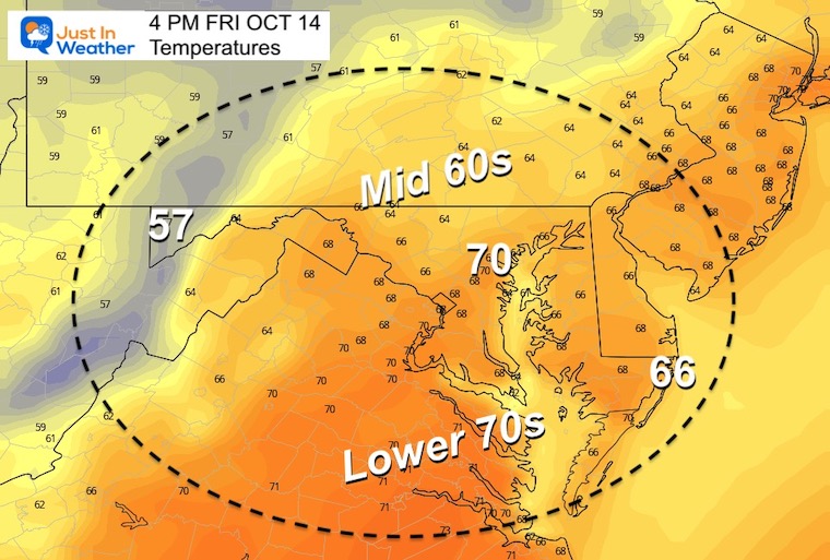
Afternoon Temperatures
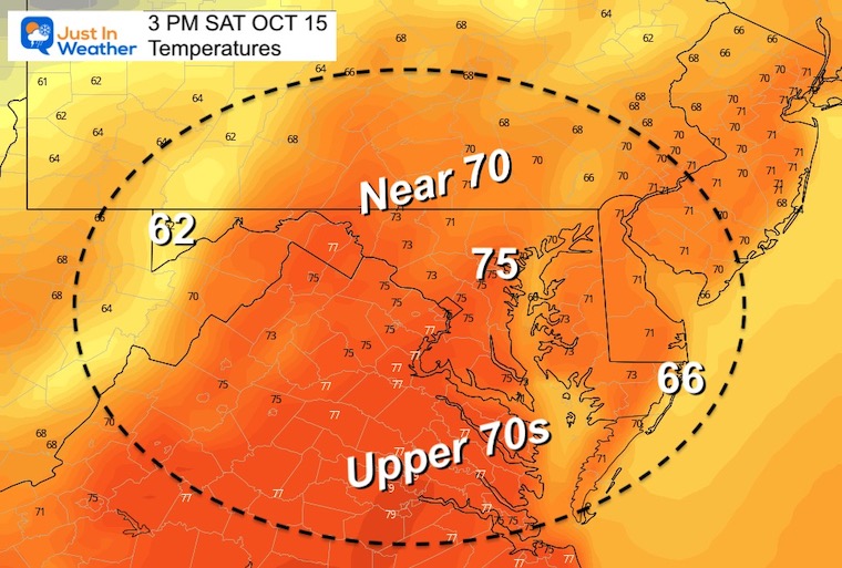
A little milder than last weekend.
CLIMATE DATA
TODAY October 14
Normal Low in Baltimore: 47ºF
Record 29ºF in 1988
Normal High in Baltimore: 69ºF
Record 86ºF 1975
EXPLORE MORE: WHEN IS THE FIRST FROST?
Winter Weather Folklore Checklist
Temperatures Saturday
Morning
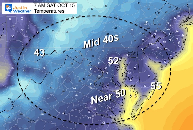
Afternoon
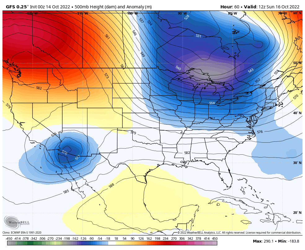
Looking Ahead: Jet Stream
Sunday Morning To Tuesday Evening
A deep trough of cold air will be building from eastern Canada to the eastern US.
Snapshot: 8 PM Tuesday

Surface Weather Animation:
Sunday Afternoon to Wednesday Morning
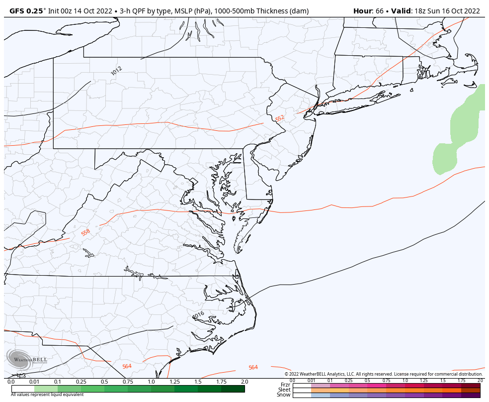
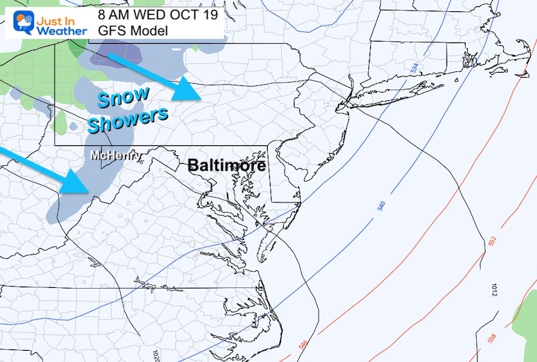
Snapshot: Wednesday Morning
Snow showers and perhaps the first ‘stickage’ of the season is possibly in the high mountains of Garrett County, Maryland and West Virginia.
Temperature Outlook: NOAA
The trend next week will be Much Colder Than Normal

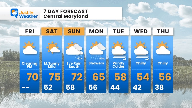
7 Day Forecast
Warmer weekend then much colder next week.
PATTERN CHANGER?
Hurricane Ian Flooding May Reach Maryland This Weekend
CONNECTION TO WINTER?
If you want a snowy winter, this is what you might want to look for in the rest of the tropical season.
Rainbow Ice Cave In Mt. Rainier A Very Rare Find: Photos And Video
Hurricane Season Forecast: June 1 Through November 30
NOAA 2022 Hurricane Forecast- Above Normal Again

Related Posts
NOAA Study: Reducing Air Pollution INCREASED Tropical Storms

Atlantic Tropical History: Maps of Origin Regions Every 10 Days


