October 6, 2022
Thursday Morning Update
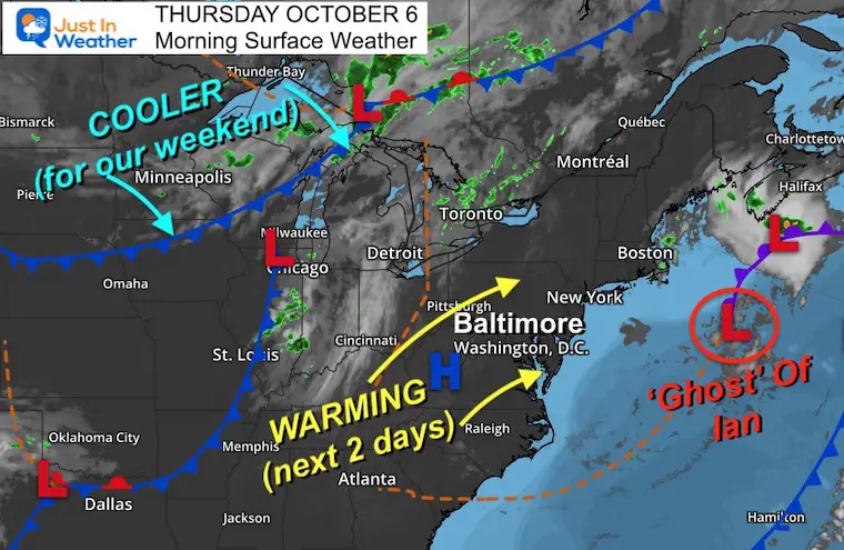
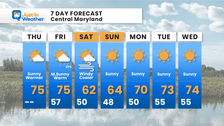
Finally we get a change after 6 days with rain. The ghost of Ian circulation is moving well off the coast and allowing a return of sunshine and warmer temperatures. A cold front will move through Friday night, setting up a cooler weekend. If you are a Fall season lover, it will be perfect for flannels and pumpkin picking with the kids. If you are riding in the Seagull Century 100 mile bike race in Salisbury, I will be with you. It will be windy and cooler, but at least dry!
Back to today, we will feel it for sure considering the unusually cool start to October. In fact Baltimore is currently 7.3ºF BELOW AVERAGE with temperatures in the first five days:
October High temps (so far) at BWI
- 1st = 62ºF
- 2nd = 61ºF
- 3rd = 55ºF
- 4th = 55ºF
- 5th = 65ºF
So how does a few days in the 70s sound? Let’s start with why the sun will be back in full force and the clearing on the satellite loop.
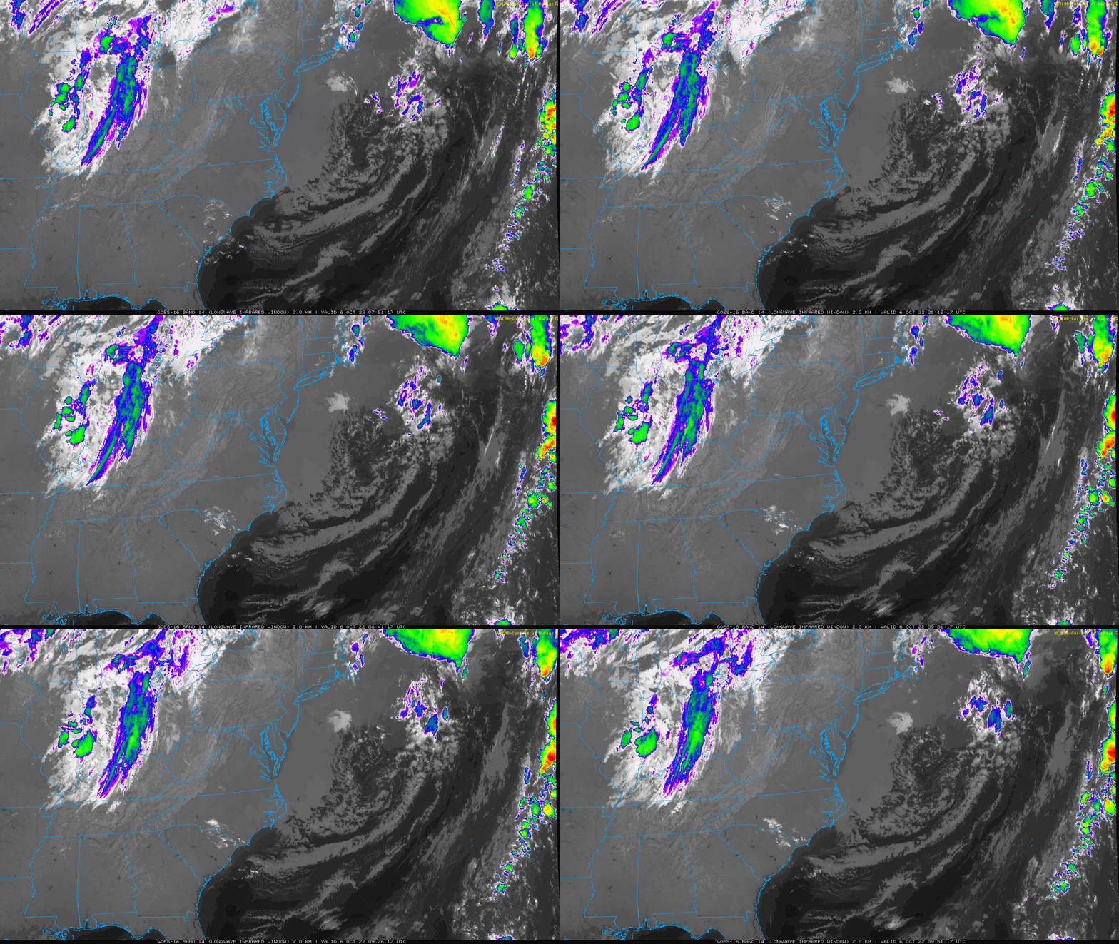
Satellite Loop
The Ghost of Ian Nor’easter circulation is pushed to the right side of this screen well off the coast. The color enhanced clouds to the west is the next cold front that will arrive later Friday.
2 hours Ending at 5:51 AM
Morning Surface Weather
That cold front will help enhance the southerly wind ahead of it. That will push warmer air back in for us today and tomorrow. The cooler air will arrive for us this weekend.
Temperatures
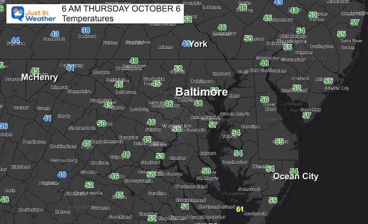
Morning Temperatures
Still cool. We did have clouds most of yesterday and a clearing tonight.
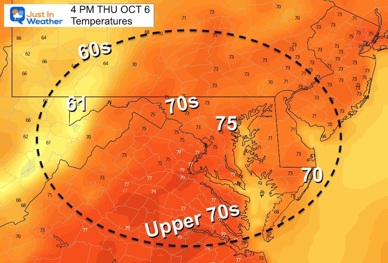
4 PM
Much warmer
CLIMATE DATA
TODAY October 6
Normal Low in Baltimore: 50ºF
Record 35ºF in 2001
Normal High in Baltimore: 72ºF
Record 96ºF 1941
Weather posts straight to your inbox
Sign up and be the first to know!
Join Us Next Monday October 10 For Our Golf Tournament
Brought In Part By JP’s Custom Home Painting
The weather WILL BE BETTER THEN!
Temperatures Friday
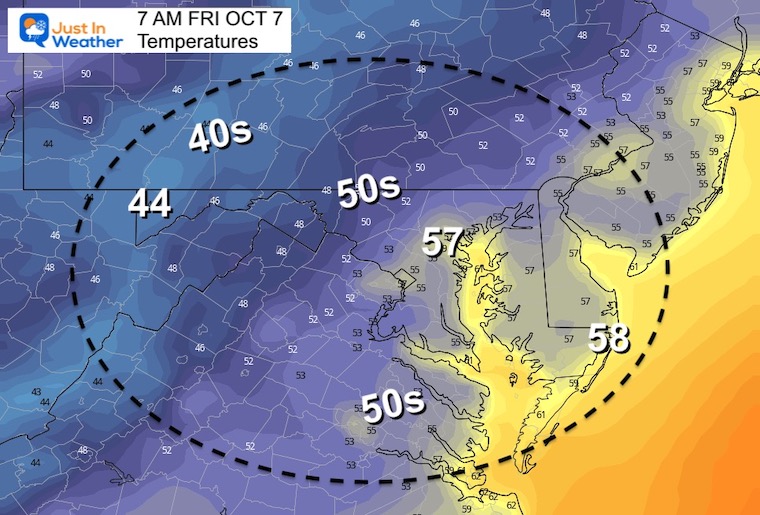
Morning
Actually a little warmer than normal.
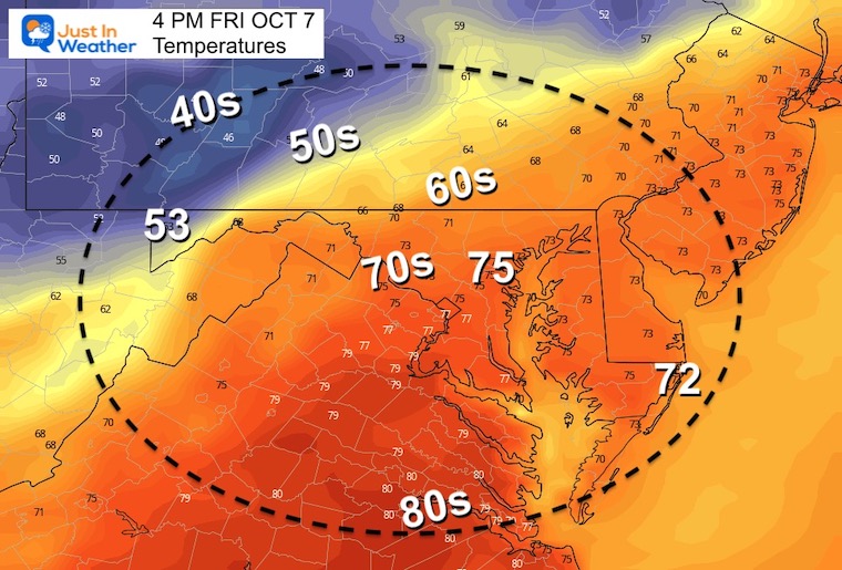
Afternoon
Another warm day, but it will become breezy and not last!
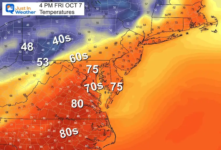
About That Cold Front
The wider view of temperatures in the afternoon helps to show that new airmass reaching western Maryland and Pennsylvania at 4 PM.
McHenry at Deep Creek Lake should drop to the lower 50s, with 40s into western PA. Meanwhile, mid 70s to near 80ºF between Baltimore, Salisbury, and Richmond VA.
Wind Snapshot:
The shift in wind, increasing FROM the Northwest shows the influence of that new airmass.
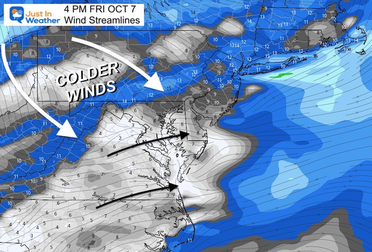
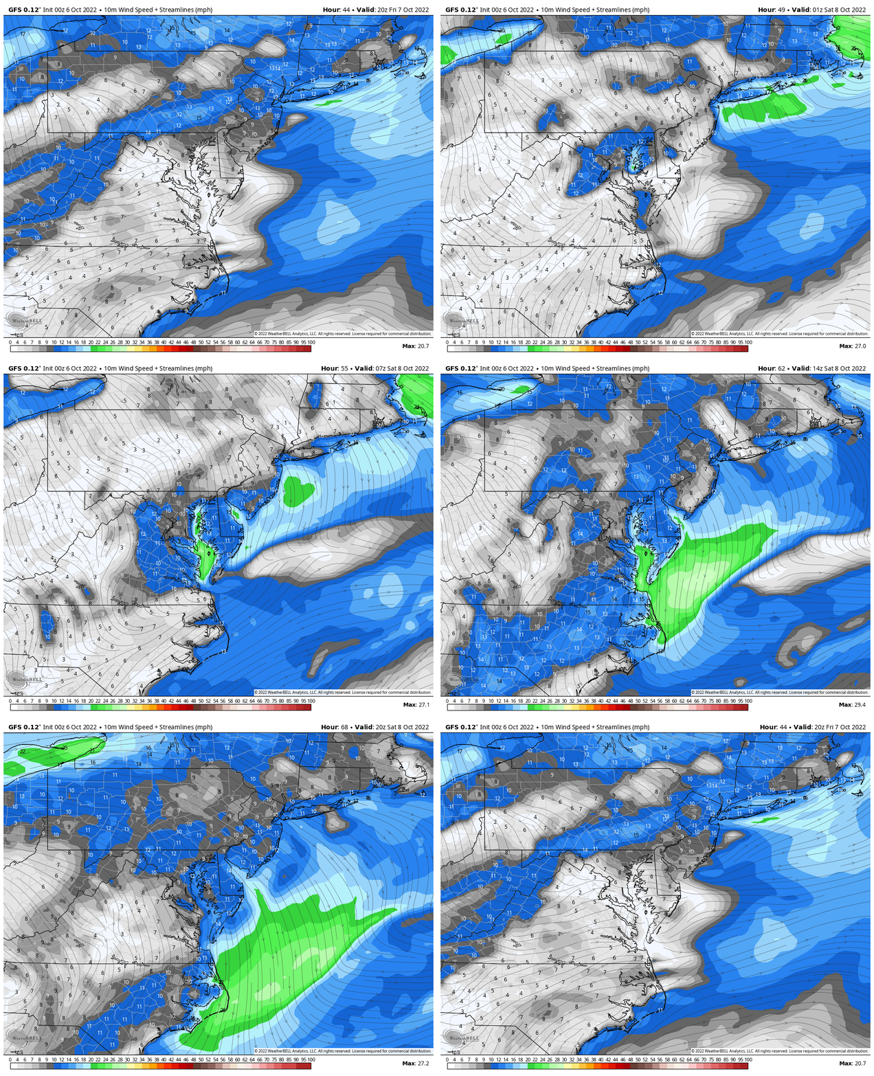
Wind Forecast 4 PM Fri to 4 PM Sat
This helps show the cold front best. While there may be some showers, our chance is about 20%, especially at night across the Bay. The wind will be felt by all. As it shifts FROM the NW, steady wind will be 10 to 20 mph, but gusting over 30 mph.
7 Day Forecast
STEM Assemblies/In School Fields Trips Are Back
Click to see more and ‘Book’ a visit to your school
Please share your thoughts, best weather pics/videos, or just keep in touch via social media
-
Facebook: Justin Berk, Meteorologist
-
Twitter: @JustinWeather
-
Instagram: justinweather
PATTERN CHANGER?
CONNECTION TO WINTER?
If you want a snowy winter, this is what you might want to look for in the rest of the tropical season.
Rainbow Ice Cave In Mt. Rainier A Very Rare Find: Photos And Video
Hurricane Season Forecast: June 1 Through November 30
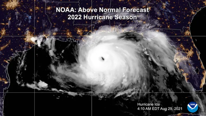
NOAA 2022 Hurricane Forecast- Above Normal Again
Related Posts
NOAA Study: Reducing Air Pollution INCREASED Tropical Storms
Atlantic Tropical History: Maps of Origin Regions Every 10 Days


