September 20 Category 3 Hurricane Fiona Update And Video Plus Local Weather
September 20, 2022
Tuesday Morning Update
The big story continues to be Hurricane Fiona. It has been upgraded to A Major Hurricane Category 3, with 115 mph winds as it crosses Grand Turk Island this morning and is getting stronger. It is expected to track east of the Bahamas and head towards Bermuda.
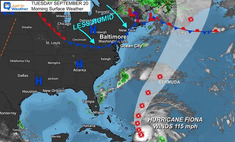
Locally we still have warm, but less humid weather today. A strong cold front will bring in a taste of Fall with the arrival of Autumn later this week. That is the system which will push Fiona away from the East Coast.
Hurricane Fiona Update
As of 5 AM EST the eye was located 20 miles from Grand Turk Island. Winds are up to 115 mph, and it is expected to continue strengthening as it travels north.
Flooding Video:
Some places have had OVER 30 inches of rain. Anna Maria here states Puerto Rico has not recovered since the 2017 hurricane.
Puerto Rico never recovered from the devastation of Hurricane Maria (2017). Now, the island is completely flooded and without electricity again.
Please DO NOT DONATE to the Red Cross or FEMA. Instead, send support to trusted local organizations [THREAD]: pic.twitter.com/jXrdXo0WKB
— anna maría (@onlyannamaria) September 19, 2022
Morning Satellite
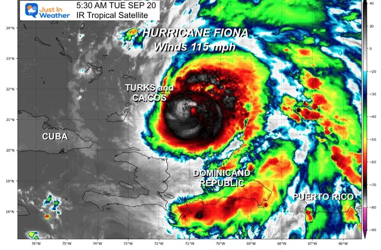
Satellite Loops
Category 3 Hurricane #Fiona has 115 mph winds this morning. It is located near Grand Turk Island pic.twitter.com/a6RqWeSBE6
— Justin Berk (@JustinWeather) September 20, 2022
Lots of Lightning Being Tracked
Hurricane Fiona putting on quite the lightning show tonight.
⚡⚡⚡⚡ pic.twitter.com/lKlfCH7JQl
— Dakota Smith (@weatherdak) September 20, 2022
Statement From The National Hurricane Center:
…CENTER OF CATEGORY THREE FIONA NEAR GRAND TURK ISLAND…
…HEAVY RAINFALL AND LIFE-THREATENING FLASH FLOODING STILL
OCCURRING IN EASTERN PORTIONS OF THE DOMINICAN REPUBLIC…
SUMMARY OF 500 AM EDT…0900 UTC…INFORMATION
———————————————-
LOCATION…21.3N 70.9W
ABOUT 20 MI…30 KM SE OF GRAND TURK ISLAND
MAXIMUM SUSTAINED WINDS…115 MPH...185 KM/H
PRESENT MOVEMENT…NNW OR 330 DEGREES AT 10 MPH…17 KM/H
MINIMUM CENTRAL PRESSURE…967 MB...28.56 INCHES
WIND WIDGET
Morning location and tracking the storm this week:
Forecast Notes:
WIND: Hurricane conditions are spreading over the Turks and Caicos at this time, and these conditions should persist through this morning.
Tropical storm conditions are expected in portions of the southeastern Bahamas starting in the next few hours.
RAINFALL: Fiona is forecast to produce the following rainfall:
British and U.S. Virgin Islands: Additional local 1 to 2 inches over the next 24 hours.
Southern Puerto Rico: Additional local 1 to 4 inches over the next 24 hours. Storm Total 12 to 20 inches with local maximum of 35 inches.
Northern Puerto Rico: Additional local 1 to 2 inches over the next 24 hours. Storm Total 4 to 12 inches with local maximum of 20 inches.
Dominican Republic: Additional 1 to 4 inches with local maximum of 6 inches over the next 24 hours. Storm Total up to 20 inches in the eastern section.
Turks and Caicos: Additional 4 to 8 inches.
Southeast Bahamas: 1 to 4 inches.
Morning Surface Weather
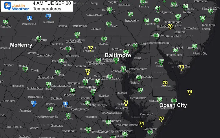
Morning Temperatures:
A mild morning and perhaps still muggy for you, but this will improve during the day.
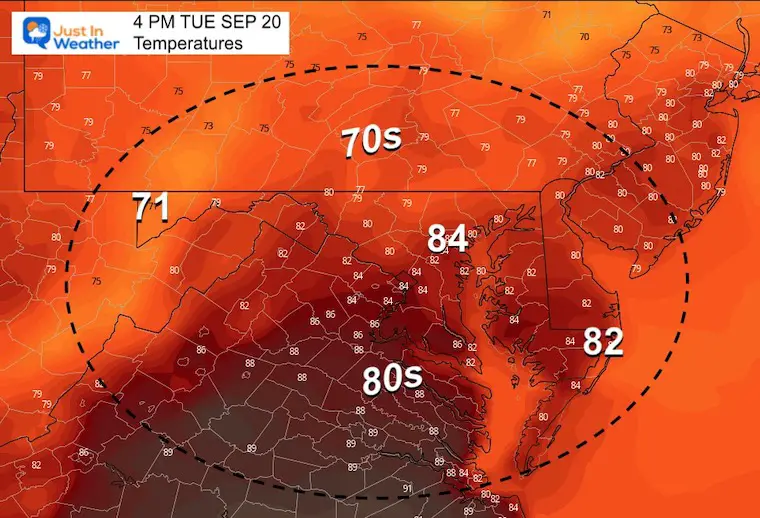
Afternoon Temperatures:
Humidity will drop throughout the day. Still warm.
CLIMATE DATA
TODAY September 20
Normal Low in Baltimore: 57ºF
Record 42ºF in 1956
Normal High in Baltimore: 79ºF
Record 94ºF 1983
Weather posts straight to your inbox
Sign up and be the first to know!
September Begins Meteorological Autumn
Climate Data/Weather Stats For The Month
Rainbow Ice Cave In Mt. Rainier A Very Rare Find: Photos And Video
STEM Assemblies/In School Fields Trips Are Back
Click to see more and ‘Book’ a visit to your school
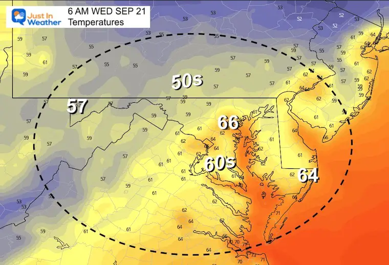
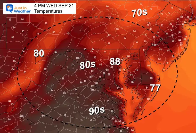
Wednesday Temperatures
Morning
Afternoon
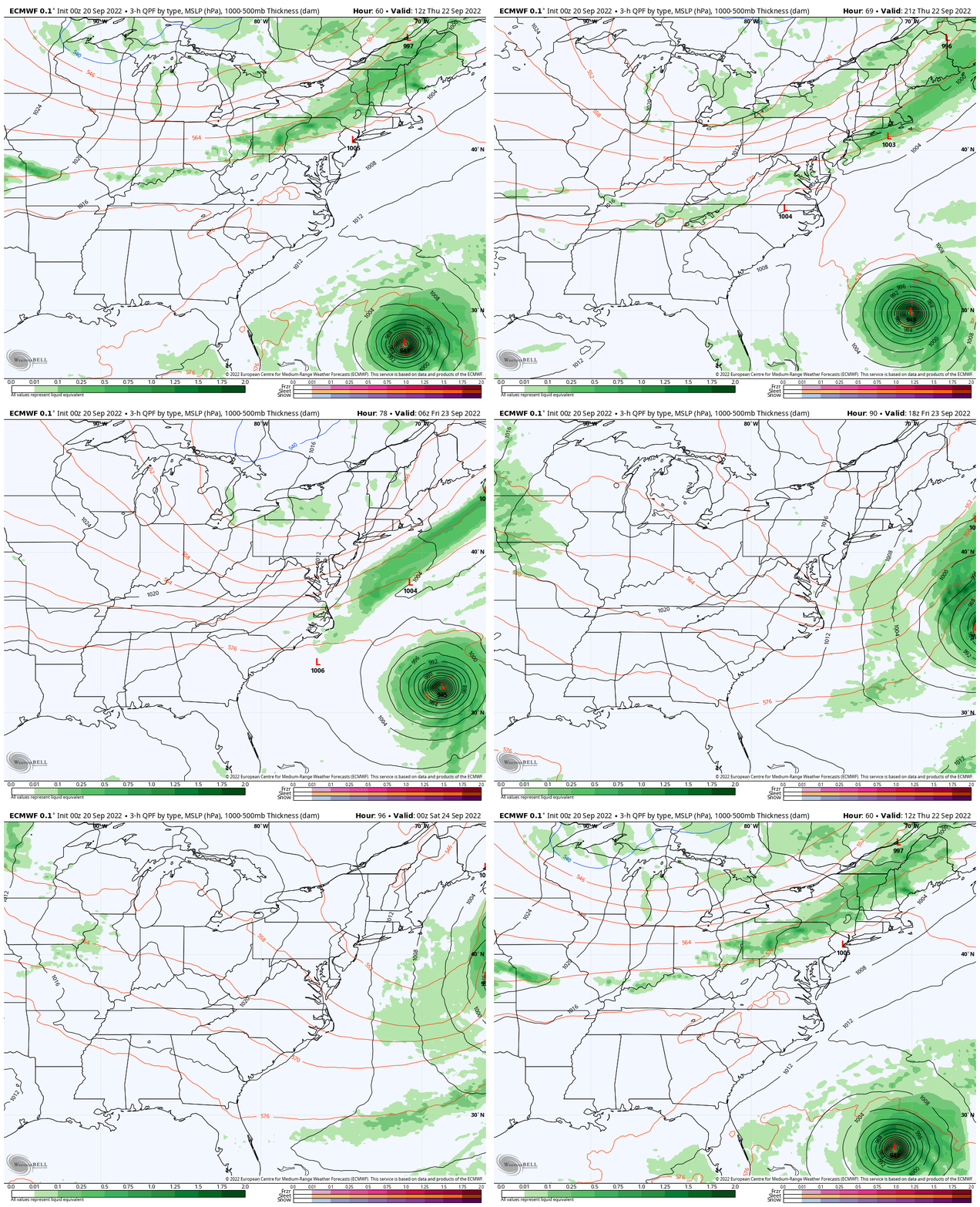
Looking Ahead: Thursday Morning To Friday Night
A Strong Cold Front will arrive between Wednesday evening and Thursday. This will bring us:
- A chance for showers
- Much cooler air into the weekend
- Push Hurricane Fiona off the coast
Hurricane Fiona Forecast
Hurricane Fiona should reach Category 4 intensity and may pass just west of Bermuda by Friday… but miss the US coast.
Strong waves will bring rip currents and erosion to our beaches.
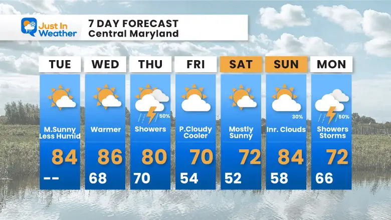
7 Day Forecast
The Fall Equinox is 9:03 PM Thursday….
Temps will be much cooler inland, with highs in the 60s and some lows in the 40s.
In Case You Missed It: Seem Early Winter Outlooks
COMPARE TO THE PAST
If you want a snowy winter, this is what you might want to look for in the rest of the tropical season.
Rainbow Ice Cave In Mt. Rainier A Very Rare Find: Photos And Video
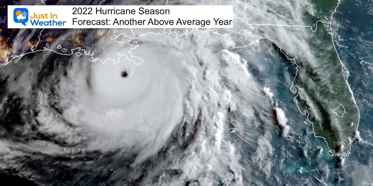
Hurricane Season Forecast: June 1 Through November 30
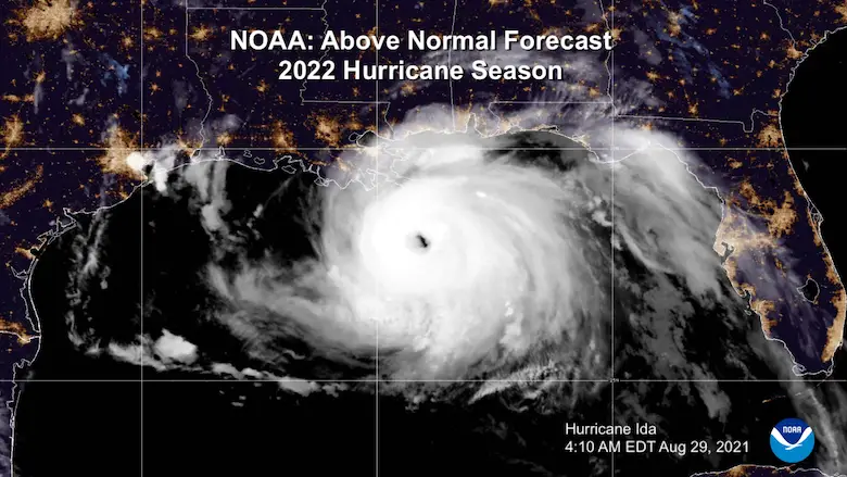
NOAA 2022 Hurricane Forecast- Above Normal Again
Forecast From Colorado State University
Related Posts
NOAA Study: Reducing Air Pollution INCREASED Tropical Storms
Atlantic Tropical History: Maps of Origin Regions Every 10 Days
Rainbow Ice Cave In Mt Rainier
Rainbow Ice Cave In Mt. Rainier A Very Rare Find: Photos And Video
Please share your thoughts, best weather pics/videos, or just keep in touch via social media
-
Facebook: Justin Berk, Meteorologist
-
Twitter: @JustinWeather
-
Instagram: justinweather


