July 26 Rain On The Way And One Of The Coolest Days This Month
July 26 2022
Tuesday Morning Update
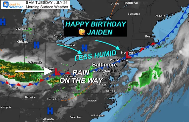
Yesterday the high temperature at Baltimore’s BWI was 92ºF. This made 8 days in a row and 15 days this month in the 90s. Today, we pause the heat! That frontal boundary we talked about has stalled, and slowly less humid air will be filtering in from the north.
A wave of Low Pressure will ride our way with a steady band of rain during the afternoon and evening. This will keep us cooler today.
Heat will return tomorrow and Thursday, but a pattern change should arrive this weekend.
Temperatures at 6 AM
Morning Surface Weather
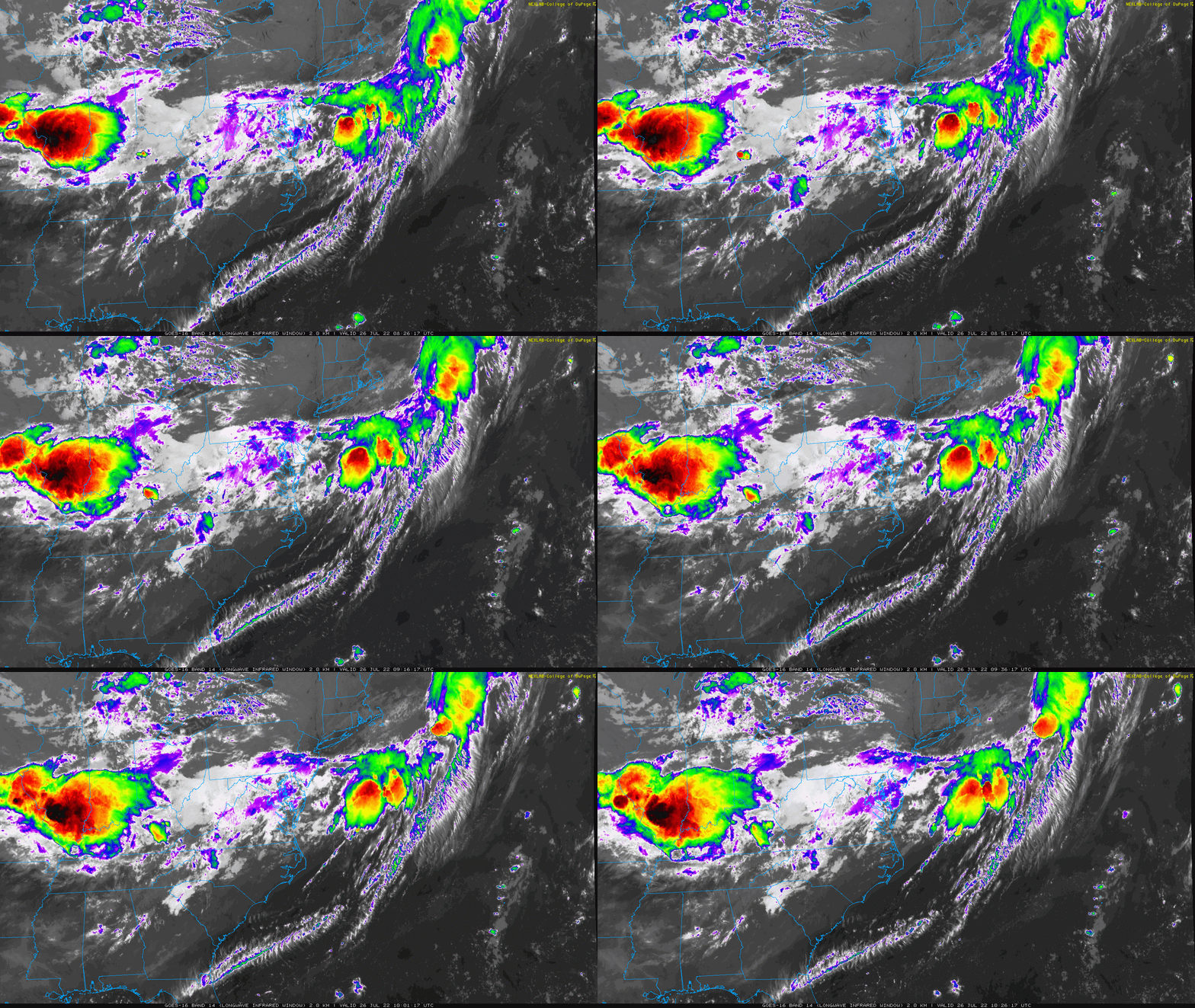
Satellite Loop 4:26 AM to 6:26 AM
The cluster of bright colored cloud tops in Illinois and Indiana is what will head our way later today.
We should remain mostly cloud to overcast with develop showers. The steady rain will arrive any time between 2 PM and 10 PM.
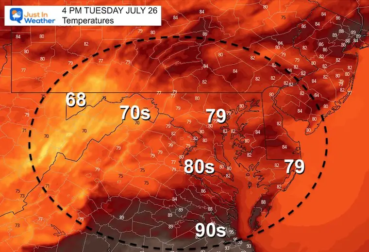
Afternoon Temperatures
In addition to being the first day in 9 days not reach 90ºF, this could be only the second day this month to stay in the 70s.
Afternoon Storms
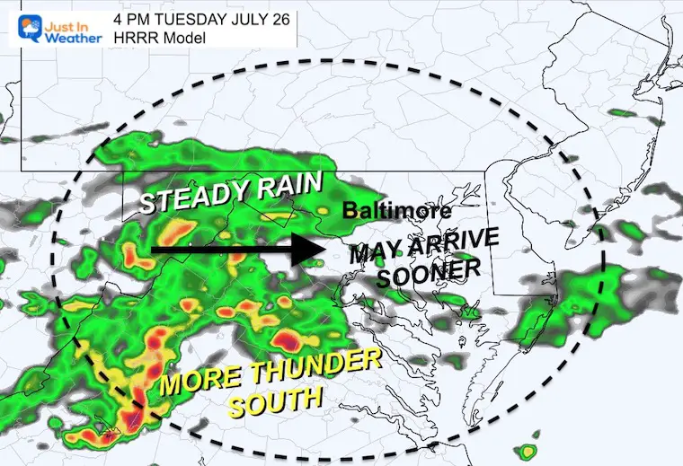
This is the HRRR Model Suggestion for rain… with the steady band just west of the cities at 4 PM. There has been a tendency for rain to arrive earlier than shown here…
Consider showers any time today, with steady rain possible any time AFTER 2 PM.
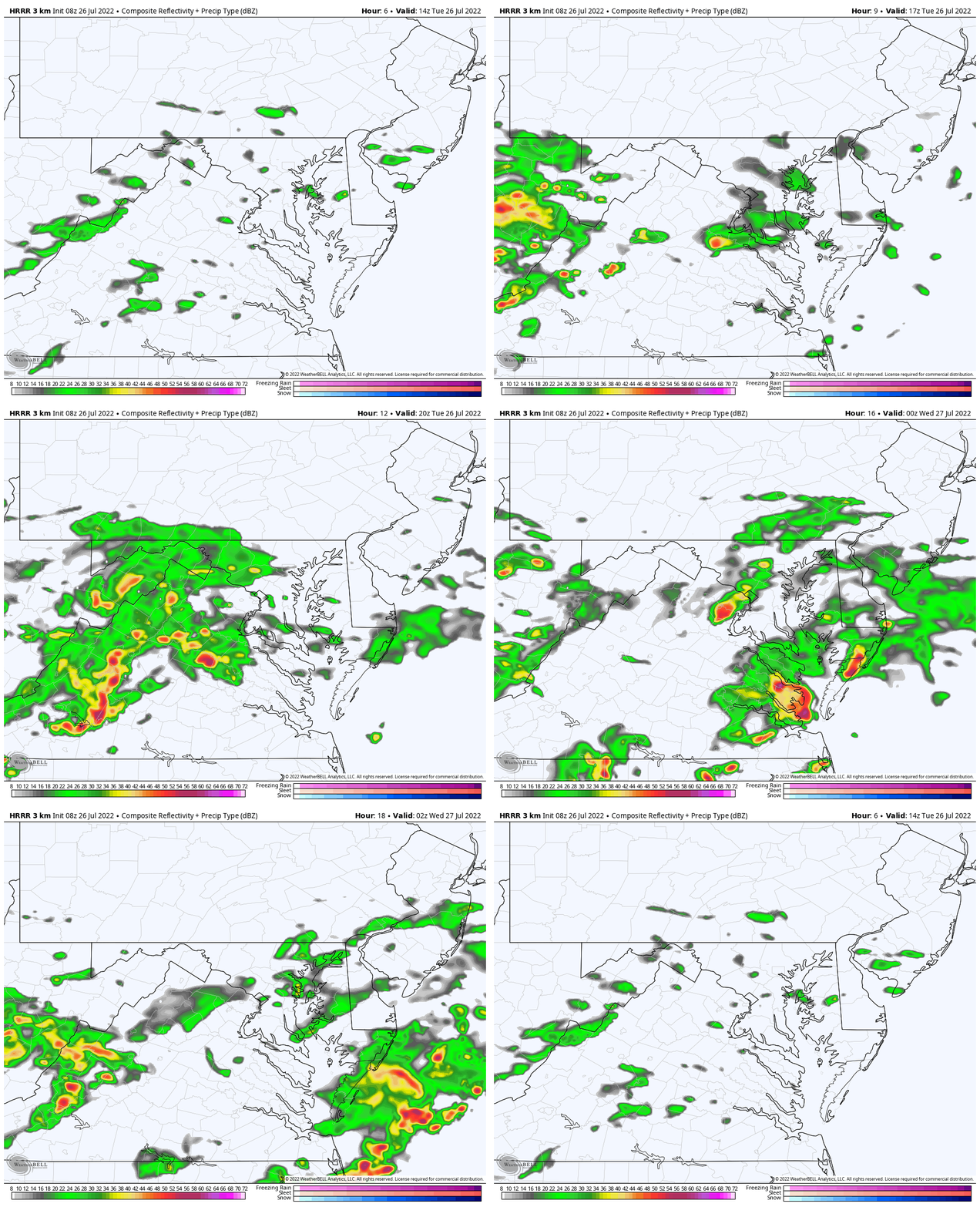
Radar Simulation 10 AM to 10 PM
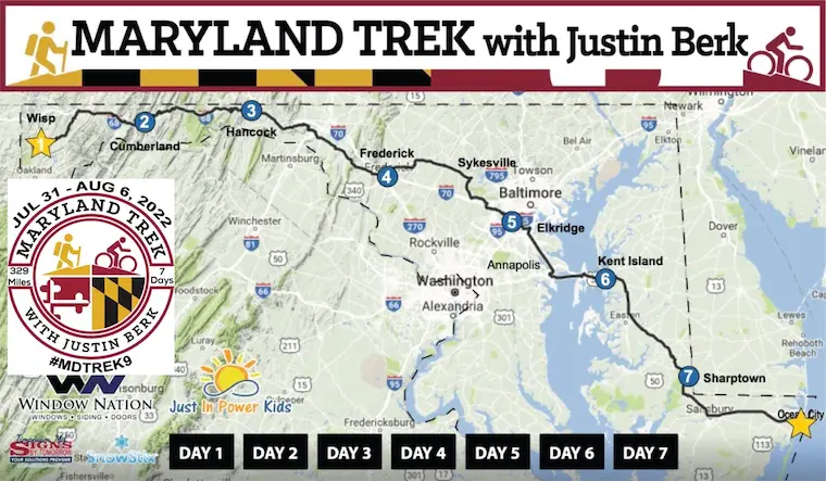
NOTICE: Maryland Trek 9 Begins 5 Days From Today!
I will continue to post weather daily, but my attention will be shifting next week:
My all volunteer team will be hiking and biking 329 from the summit of Wisp to Ocean City in 7 days. We will be sharing the stories of kids in and post cancer treatment and need your support!
This includes donation (100% goes to programs at Just In Power Kids)
Simply Follow Posts on Facebook with a Like, Comment, and or share.
(click the images for info on the event)
CLIMATE DATA
TODAY July 26th
Normal Low in Baltimore: 67ºF
Record 55ºF in 1976
Normal High in Baltimore: 88ºF
Record 101ºF 1940
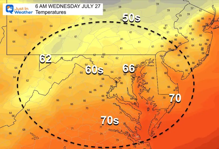
Wednesday Temperatures
Morning
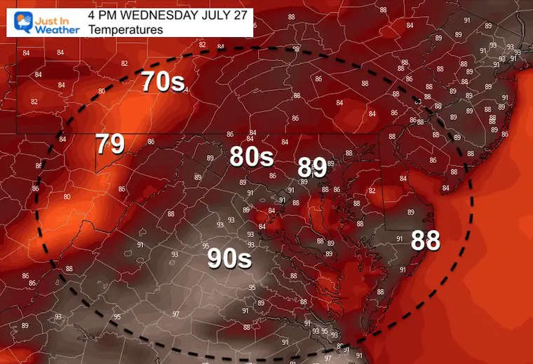
Afternoon
More sun should allow temps to recover, but may also spark scattered late day showers and storms.
Looking Ahead
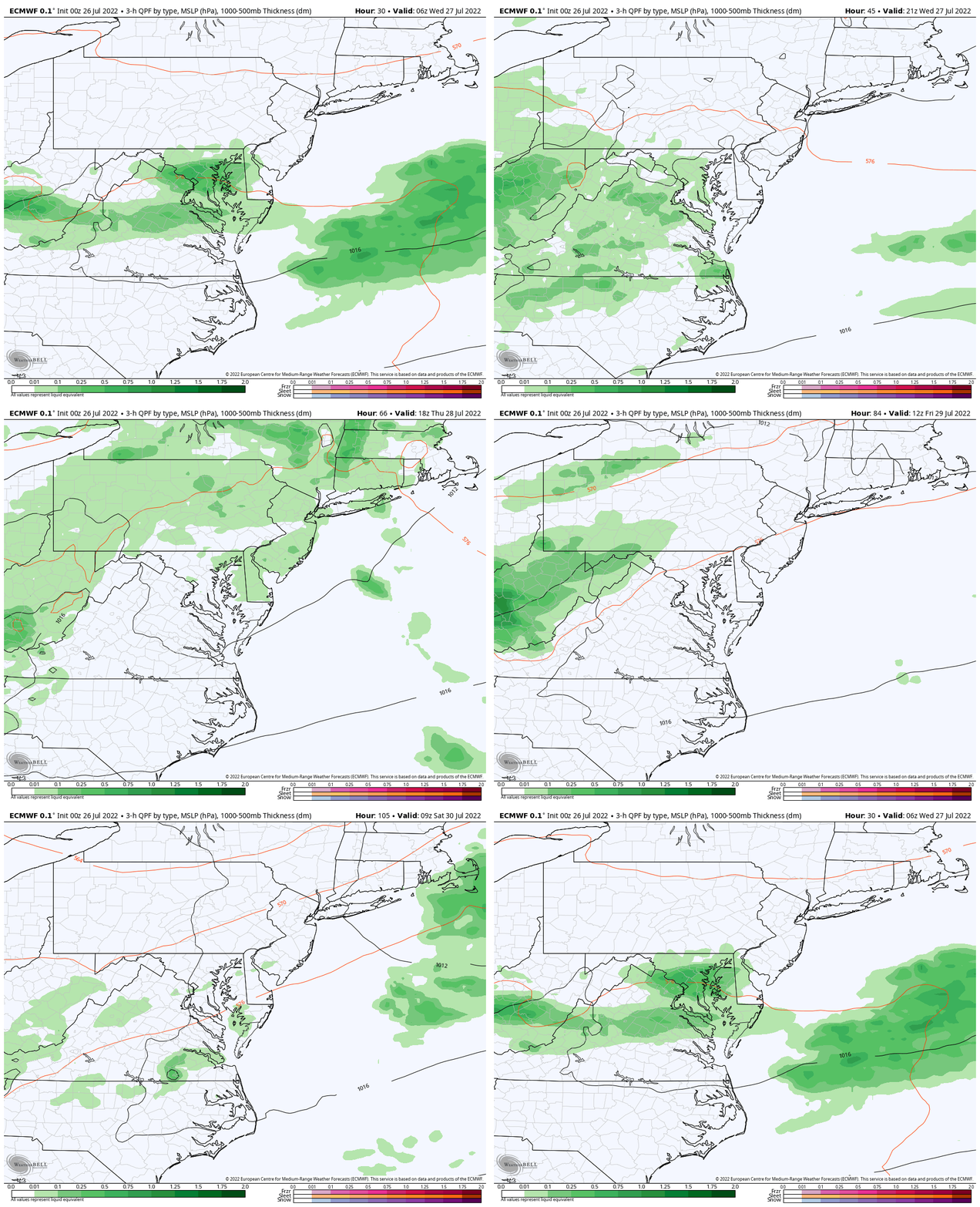
ECMWF Model Though 8 AM Saturday
While warmer air will work back in, that front stays in the vicinity keeping showers around each day.
The chance of thunderstorms will peak on Friday with possible severe cells again.
This weekend is still a wild card! The GFS Model brings back rain late Saturday into Sunday east of the mountains. However, the European Model has us dry. I am leaning more optimistic for now… but if I see any trend towards the wet stuff I will make the adjustment in my next full report.
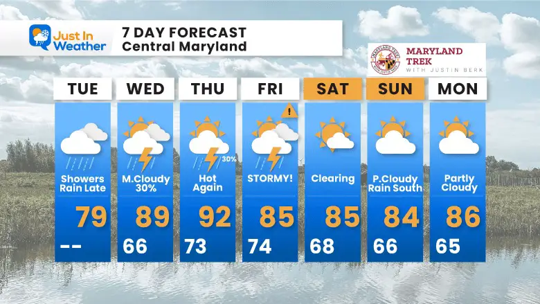
7 Day Forecast
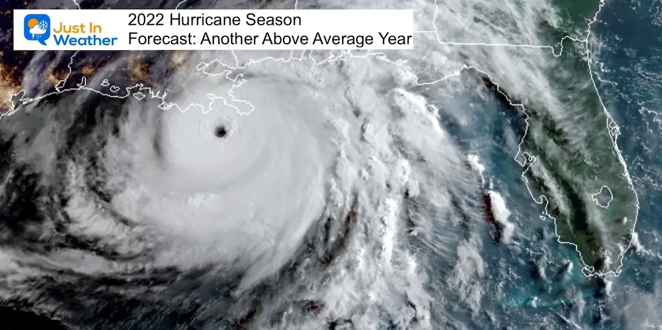
Hurricane Season Forecast: June 1 Through November 30
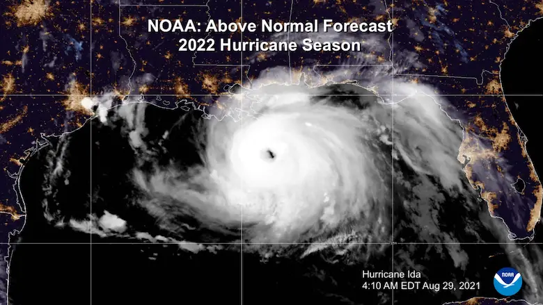
NOAA 2022 Hurricane Forecast- Above Normal Again
Forecast From Colorado State University
Related Posts
NOAA Study: Reducing Air Pollution INCREASED Tropical Storms
Atlantic Tropical History: Maps of Origin Regions Every 10 Days
Recent Storm Reports
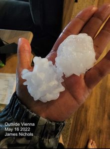
May 16 Large Hail Videos And Storm Tracking Map
Please share your thoughts, best weather pics/video, or just keep in touch via social media
Facebook: Justin Berk, Meteorologist
Twitter: @JustinWeather
Instagram: justinweather
*Disclaimer due to frequent questions:
I am aware there are some spelling and grammar typos. I have made a few public statements over the years, but if you are new here you may have missed it:
I have dyslexia, and found out at my second year at Cornell. I didn’t stop me from getting my meteorology degree, and being first to get the AMS CBM in the Baltimore/Washington region.
I do miss my mistakes in my own proofreading. The autocorrect spell check on my computer sometimes does an injustice to make it worse.
All of the maps and information are accurate. The ‘wordy’ stuff can get sticky.
There is no editor that can check my work when I need it and have it ready to send out in a newsworthy timeline.
I accept this and perhaps proves what you read is really from me…
It’s part of my charm.


