


Winter Weather Advisory Sunday As Snowfall In Two Parts Affecting Two Different Areas
Saturday Evening Update January 17 2026 One thing I carry after all of my years of forecasting: If one model does a really good job in an active pattern, then…
7 AM June 14 2022
Tuesday Morning Update
The first round of storms arrived about 2 hours earlier than expected from the simulations I showed last night. Tracking this cluster of storms have been complicated and short range models have done a poor job handling them.
Here we will recap the storms since yesterday, radar explosion this morning, and live radar/lightning to track right here.
We may have another MCC or Derecho on late Thursday night to Friday morning. Then open up a beautiful weather pattern for Farther’s Day weekend.
NOAA has issued their Severe Storm Risk for today, with the focus shifting to central and southern Maryland.
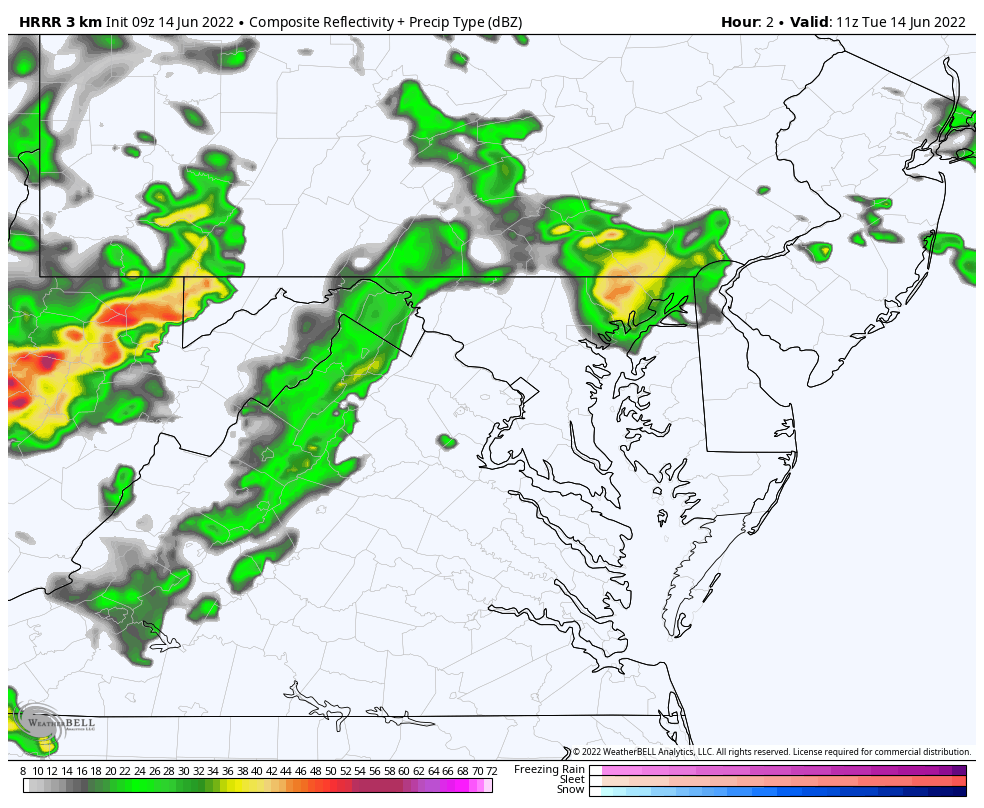
See the new Radar Simulation below. Baltimore may get another storm through noon. Eastern Shore/Delmarva through 3 PM.

I want to recap what has happened so far, and a hint at what to expect today. It is important we keep checking the radar for further development and do more nowcasting rather than trust the models.
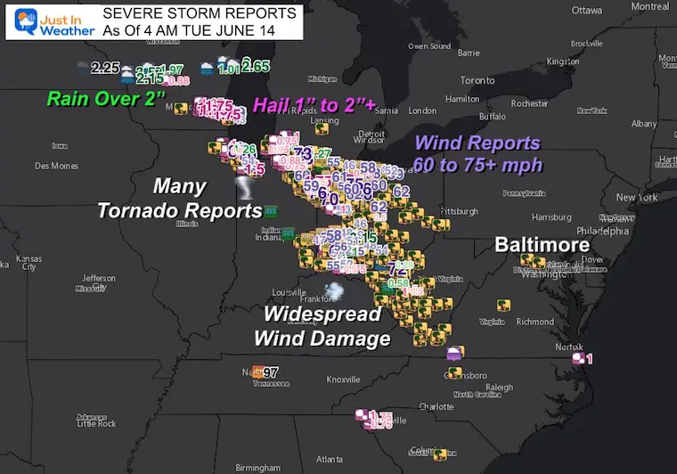
Storm Damage Reports Suggest there was a Derecho In The Great Lakes To Midwest
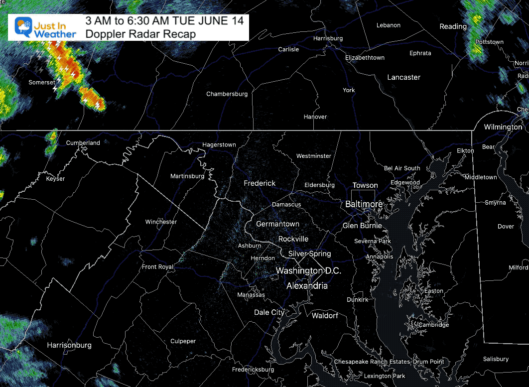
3 AM to 6:30 AM
Watch the storm development east of Cumberland, then track along the Maryland and Pennsylvania line through to Bel Air. Metro Baltimore got hit mostly on the north side. The next round will focus father south.
Live Radar and Lightning
Storms still possible to our south through early afternoon. The models have not handled this very well, so I am only showing this for the suggestion of the next flare up that could turn severe. But it may verify covering more areas than shown here.
*Baltimore could get another storm by noon.
*Eastern Shore still under the influence through 3 PM
Normal Low in Baltimore: 62ºF
Record 46ºF in 1978
Normal High in Baltimore: 83ºF
Record 98ºF 1994
GFS Model Forecast Animation: Tuesday morning to Friday Afternoon
A break tomorrow, then we may see another similar cluster of storms arrive later on Thursday, with a final line and cold front on Friday. This will be followed by a pleasant Father’s Day Weekend
Sign up and be the first to know!
Next up will be late Thursday into Friday morning for another severe complex. A final cold front is expected with scattered storms on Friday, then very nice wether for Father’s Day weekend.


NOAA 2022 Hurricane Forecast- Above Normal Again


NOAA Study: Reducing Air Pollution INCREASED Tropical Storms

Atlantic Tropical History: Maps of Origin Regions Every 10 Days


May 16 Large Hail Videos And Storm Tracking Map


*Disclaimer due to frequent questions:
I am aware there are some spelling and grammar typos. I have made a few public statements over the years, but if you are new here you may have missed it:
I have dyslexia, and found out at my second year at Cornell. I didn’t stop me from getting my meteorology degree, and being first to get the AMS CBM in the Baltimore/Washington region.
I do miss my mistakes in my own proofreading. The autocorrect spell check on my computer sometimes does an injustice to make it worse.
All of the maps and information are accurate. The ‘wordy’ stuff can get sticky.
There is no editor that can check my work when I need it and have it ready to send out in a newsworthy timeline.
I accept this and perhaps proves what you read is really from me…
It’s part of my charm.