Friday Evening Update
This is the kind of weather set up that can give us weather people a bad rap. All week I said rain was likely Saturday, and it will be. However, I have tried to elaborate over the last two days that most of it should be earlier in the day. The hope is that it moves out in time for your afternoon plans (and my son’s baseball game).
Sunday may end up going the other way. It will be warmer, with showers and thunderstorms developing through the afternoon and evening.
The north end will get hit more. Extrapolation farther south gets more complicated. So if you are going to the Paul McCartney concert at Camden Yards, there may be some showers, but could just as easily split around the city.
Let me explain…
Friday Evening Surface Weather
This is the system we were tracking all week long. Earlier on it looked like it would be a better organized Low Pressure. But as I showed last night, the short wave flattened in the jet stream.
So while there is still a disturbance, it is less organized. That is what makes plotting our rain more complicated this weekend.
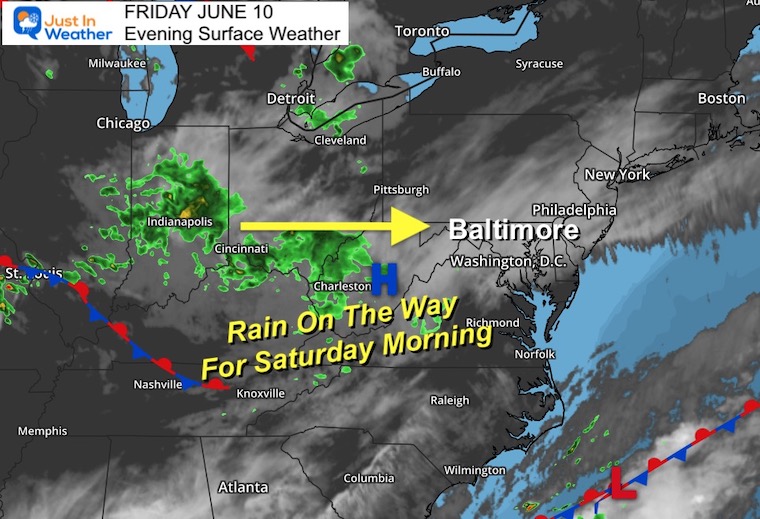
Saturday Morning Rain
It should be raining or just starting when you wake up in the morning. Then again, that does depend on your schedule. But that is the higher conference part of this forecast. Let’s go with rain around or shortly after sunrise…
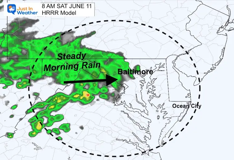
HRRR Model at 8 AM
This depiction shows a solid shelf of rain reaching metro Baltimore. This is our highest resolution product, and I trust it most in the short range.
The limitation with the version I use, it that this is the end of the projection (as of my post time).
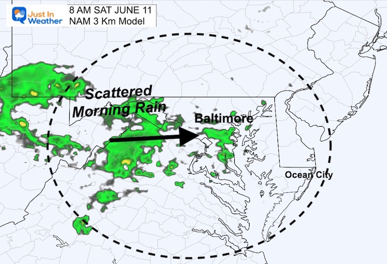
NAM 3 Km Model at 8 AM
This depiction is similar on the arrival time, but much less robust in coverage.
This is the short range model that does plot through the weekend. So I will show those animations below, but it may be under estimating the rain coverage at times.
Animation 8 AM to 8 PM
This is a guide, but I believe it may be underplaying the coverage of rain…
This shows the rain departing/ending around metro Baltimore between Noon and 2 PM.
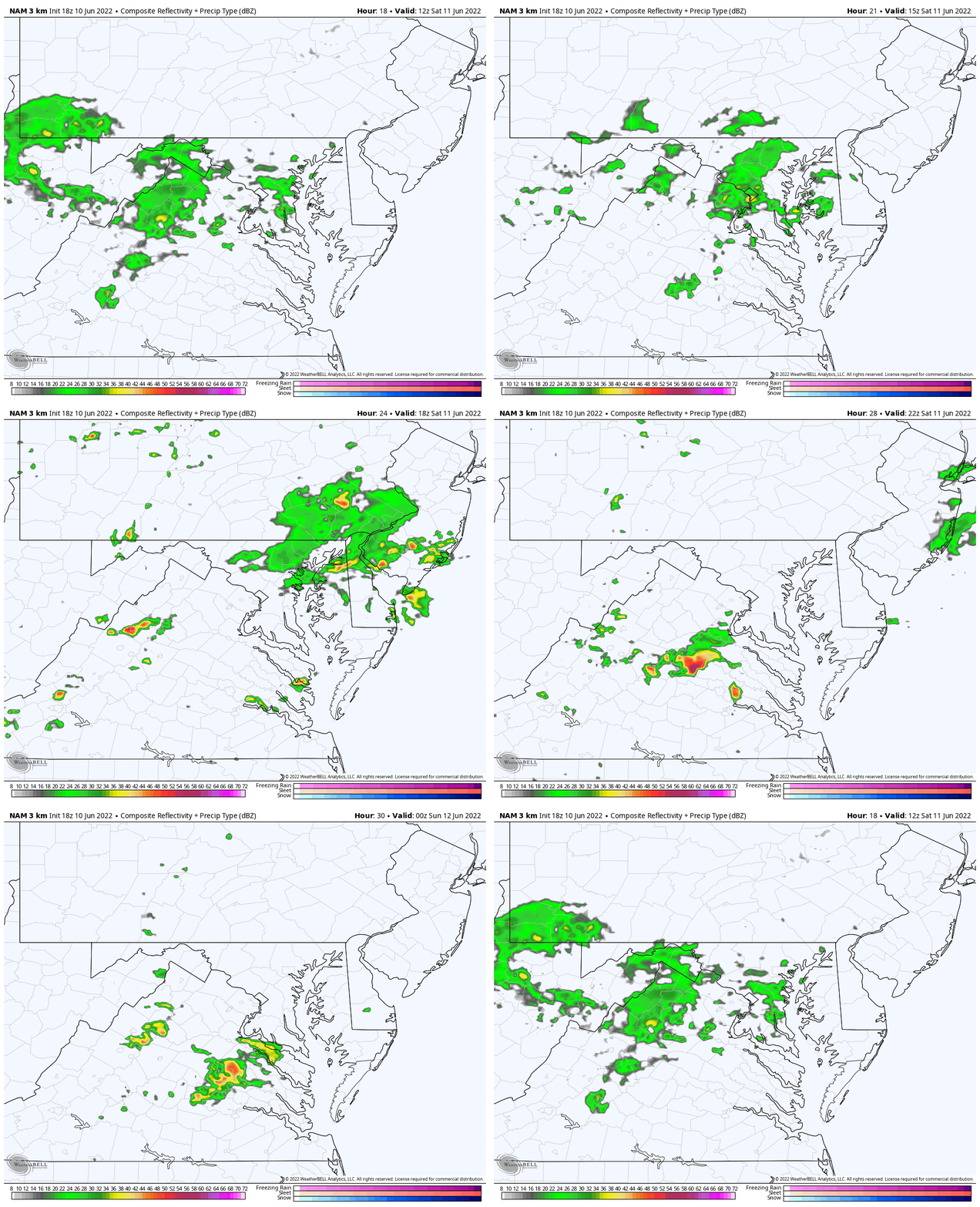
Sunday Rain Animation
8 AM to 8 PM
This shows scattered showers that become a little more widespread in the afternoon and evening.
We will focus on AFTER 2 PM for those storms to erupt.
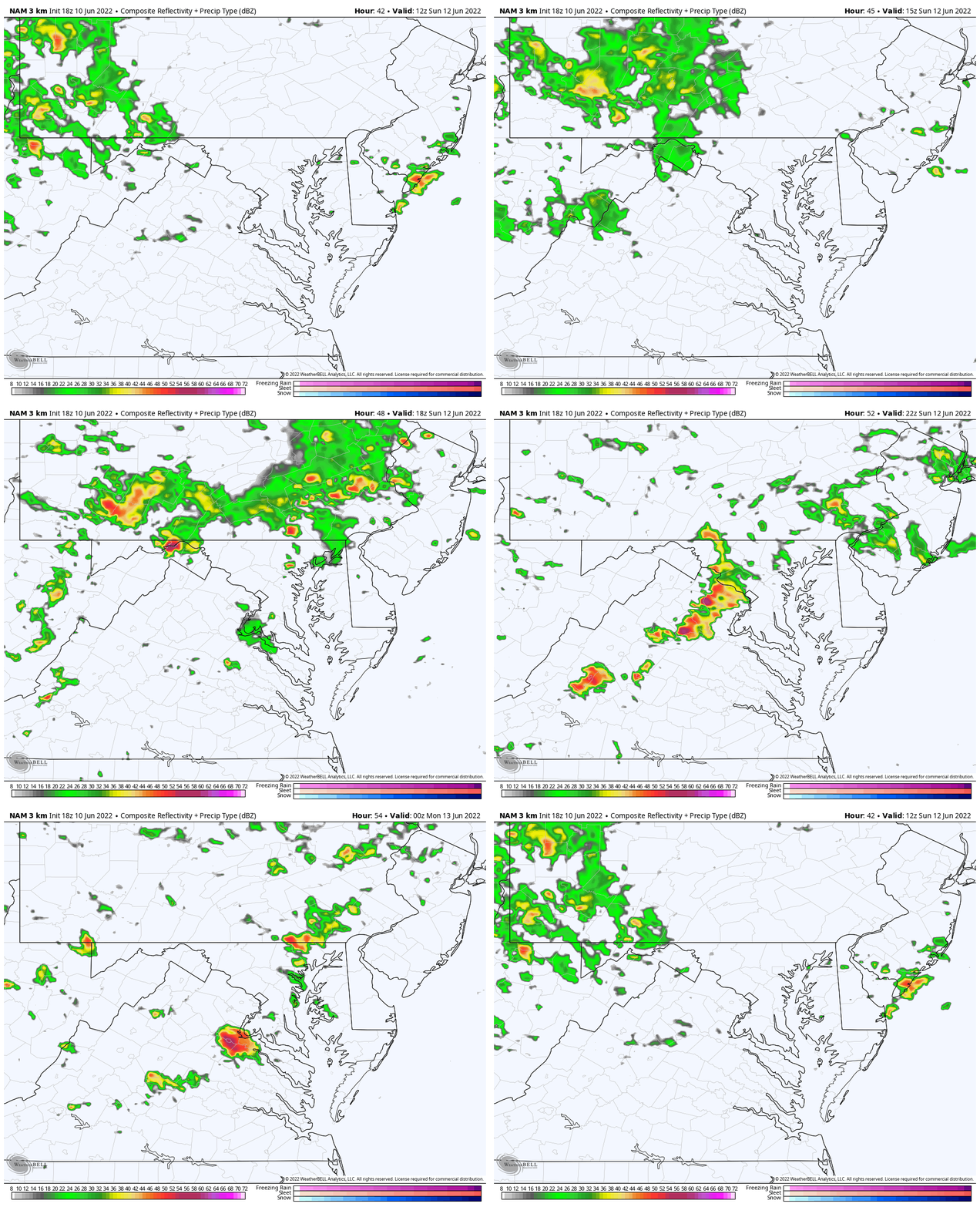
Snapshots
More along the PA line with concentrations in the mountains near Hagerstown and northern Harford to Cecil Counties after 3 PM.
Boating for our friends at Bay Venture Outfitters may be best morning to lunchtime.
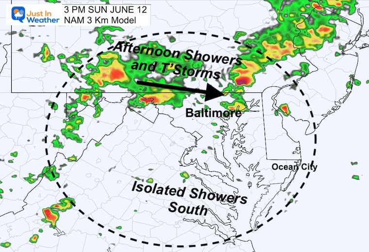
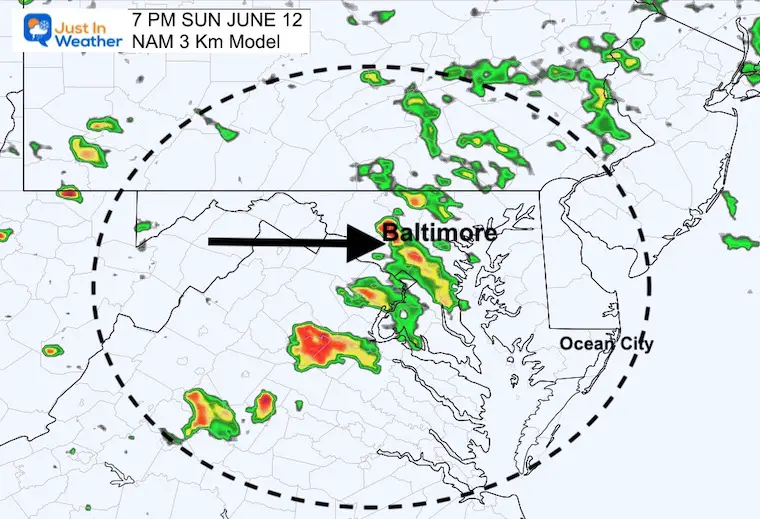
The western line of storms may reach Baltimore between 7 and 9 PM, which is when the big concert will be in Baltimore.
Often these lines can split and sometimes skirt around downtown. That depends a lot of local wind flow, which is best known the morning of the event…
That is why I suggest it is possible but not promised.
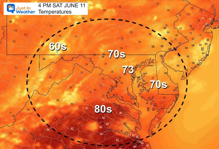
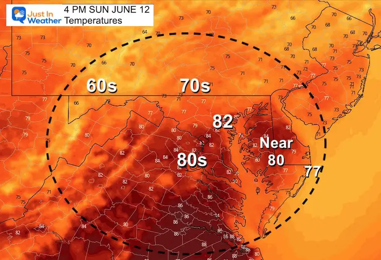
Temperatures
Cooler on Saturday, after the morning rainfall.
Warmer on Sunday to feed into the developing thunderstorms.
Full Weekend From The European Model
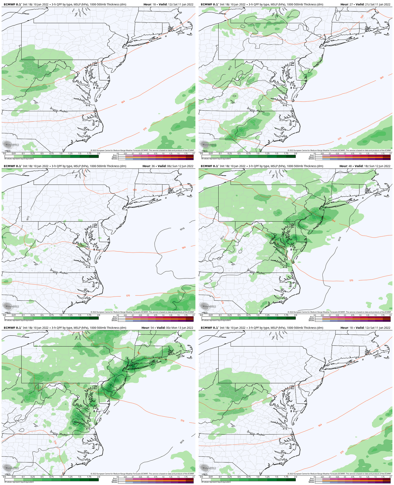
ECWMF Animation 8 AM Saturday to 8 PM Sunday
This is a lower resolution model with snapshots every 3 hours…
The main theme here is the Saturday rain mainly in the morning. Then Sunday gets more active with storms in the afternoon and evening. However, plotting specific locations and times is crude at best. I trust the HRRR Model best for that, but is limited to the day of…
I hope to have more refined details for both days in my Saturday morning full morning report.
Weather posts straight to your inbox
Sign up and be the first to know!
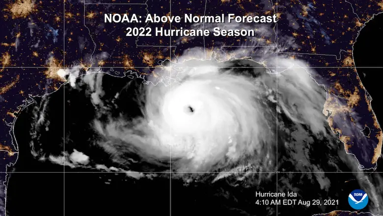
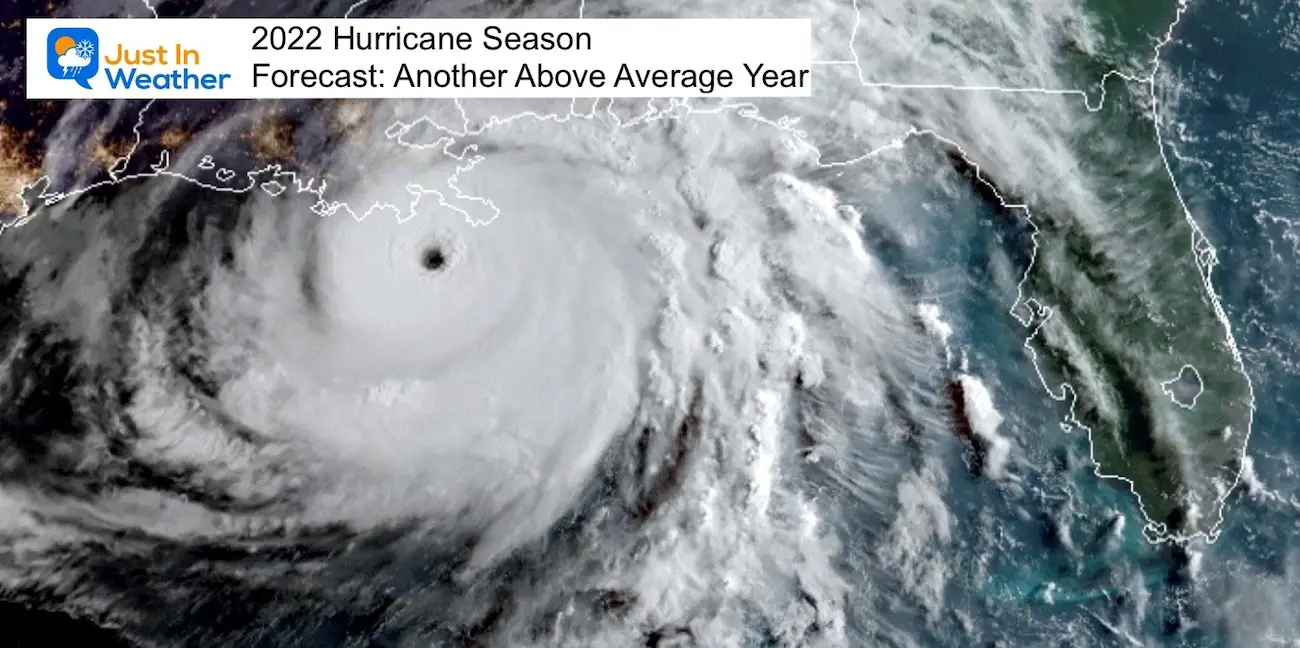
Hurricane Season Forecast: June 1 Through November 30
NOAA 2022 Hurricane Forecast- Above Normal Again
Forecast From Colorado State University
Related Posts
NOAA Study: Reducing Air Pollution INCREASED Tropical Storms
Atlantic Tropical History: Maps of Origin Regions Every 10 Days
Recent Storm Reports
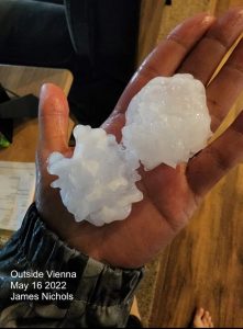
May 16 Large Hail Videos And Storm Tracking Map
Please share your thoughts, best weather pics/video, or just keep in touch via social media
Facebook: Justin Berk, Meteorologist
Twitter: @JustinWeather
Instagram: justinweather
*Disclaimer due to frequent questions:
I am aware there are some spelling and grammar typos. I have made a few public statements over the years, but if you are new here you may have missed it:
I have dyslexia, and found out at my second year at Cornell. I didn’t stop me from getting my meteorology degree, and being first to get the AMS CBM in the Baltimore/Washington region.
I do miss my mistakes in my own proofreading. The autocorrect spell check on my computer sometimes does an injustice to make it worse.
All of the maps and information are accurate. The ‘wordy’ stuff can get sticky.
There is no editor that can check my work when I need it and have it ready to send out in a newsworthy timeline.
I accept this and perhaps proves what you read is really from me…
It’s part of my charm.


