May 26 Drizzle Today Severe Storm Risk Tomorrow Then Warmer Memorial Day Weekend
Thursday May 26 2022
Morning Report
A light wind from the ocean will keep us cool and bring in a disturbance from the south today. This will primarily be drizzle or light rain, and a lot may not show up on radar. Tomorrow will be a different story with that storm in the central US that will ignite severe weather across our region in the afternoon and evening.
Following that will be a building heat wave into next week.
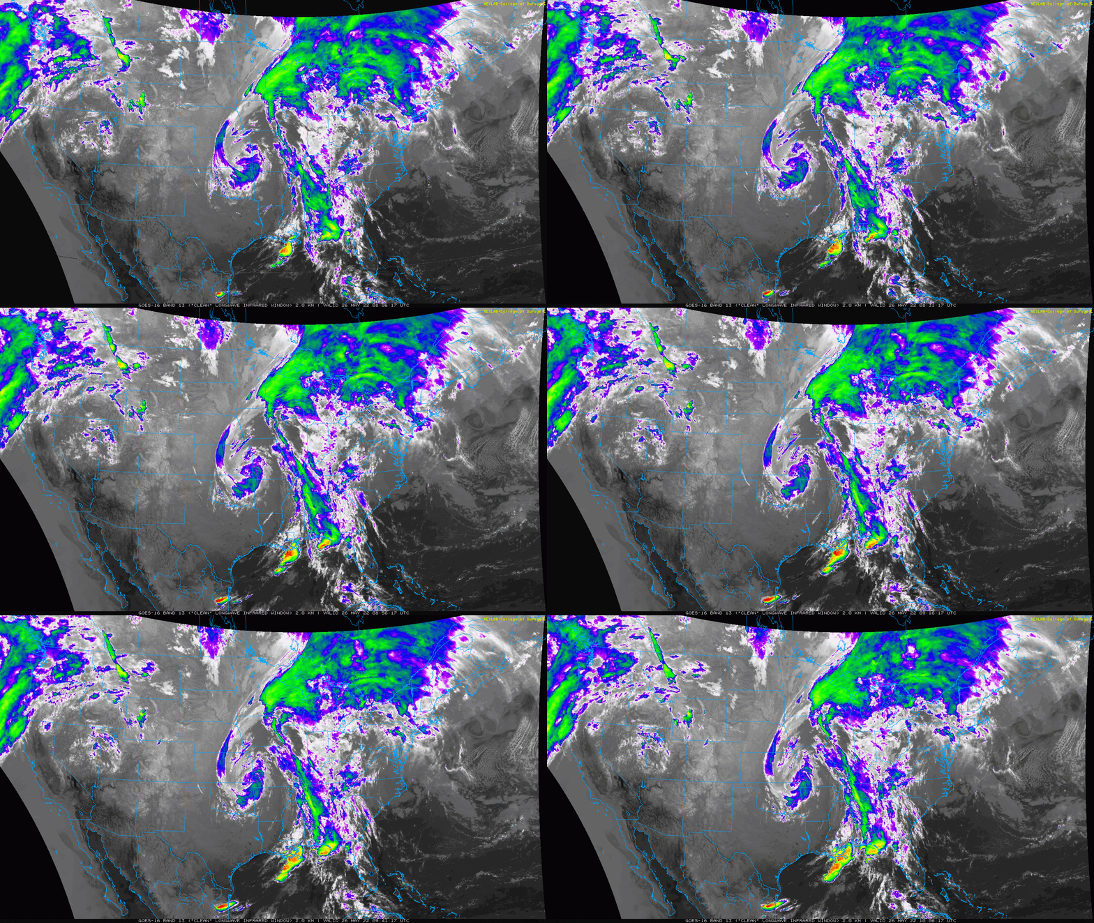
National Satellite Loop: 4 AM to 6 AM
Here we can see the color enhanced cloud tops showing a strong circulation just south of Kansas City, MO. The bulk of the storms are to the east, which will reach us on. Friday.
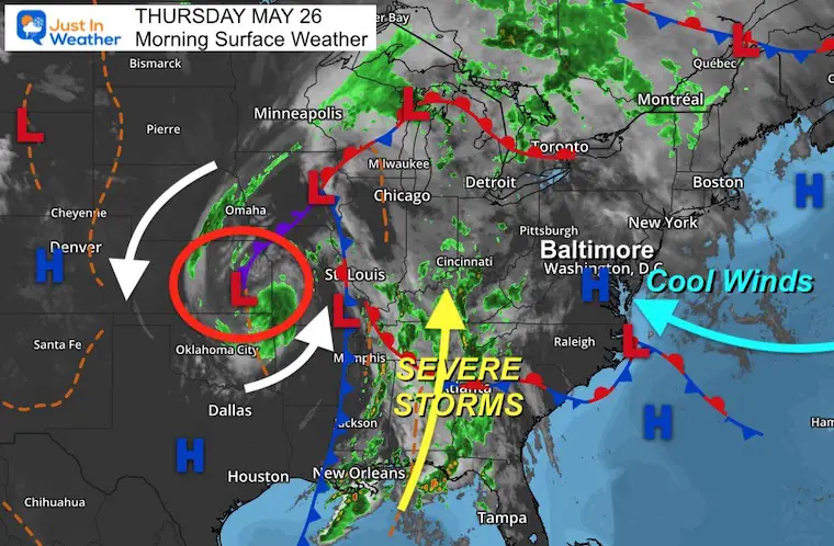
Morning Set Up
Surface Weather
While we track that larger storm across the Midwest and Deep South today, we get a damp wind from the ocean. This keeps us cool with drizzle and light rain developing.
Pollen Reports- Morning Numbers Are Ready
Keep this link handy… I’ll post the latest info as soon as I get it on this page.
The Pollen Reports Page
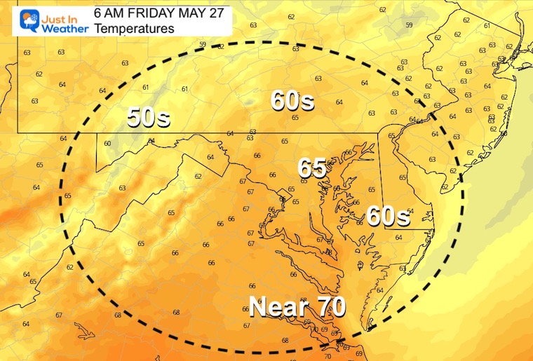
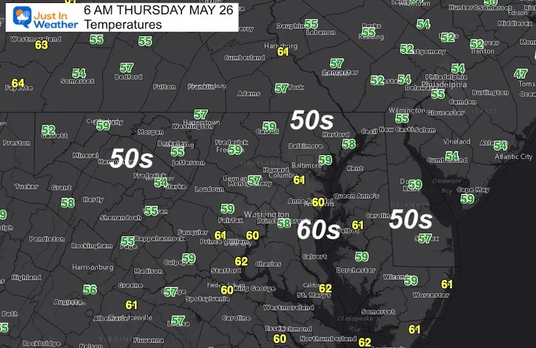
Morning Temperatures
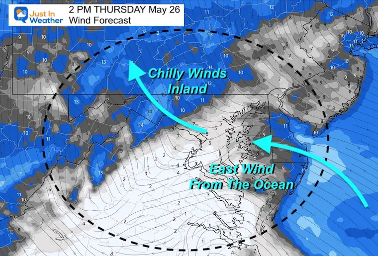
Wind Forecast
A light flow around 10 mph will persist through the afternoon.
Rain Forecast 10 AM to 8 PM
Drizzle and light rain will develop later this morning and spread north along the Bay into metro areas through the afternoon.
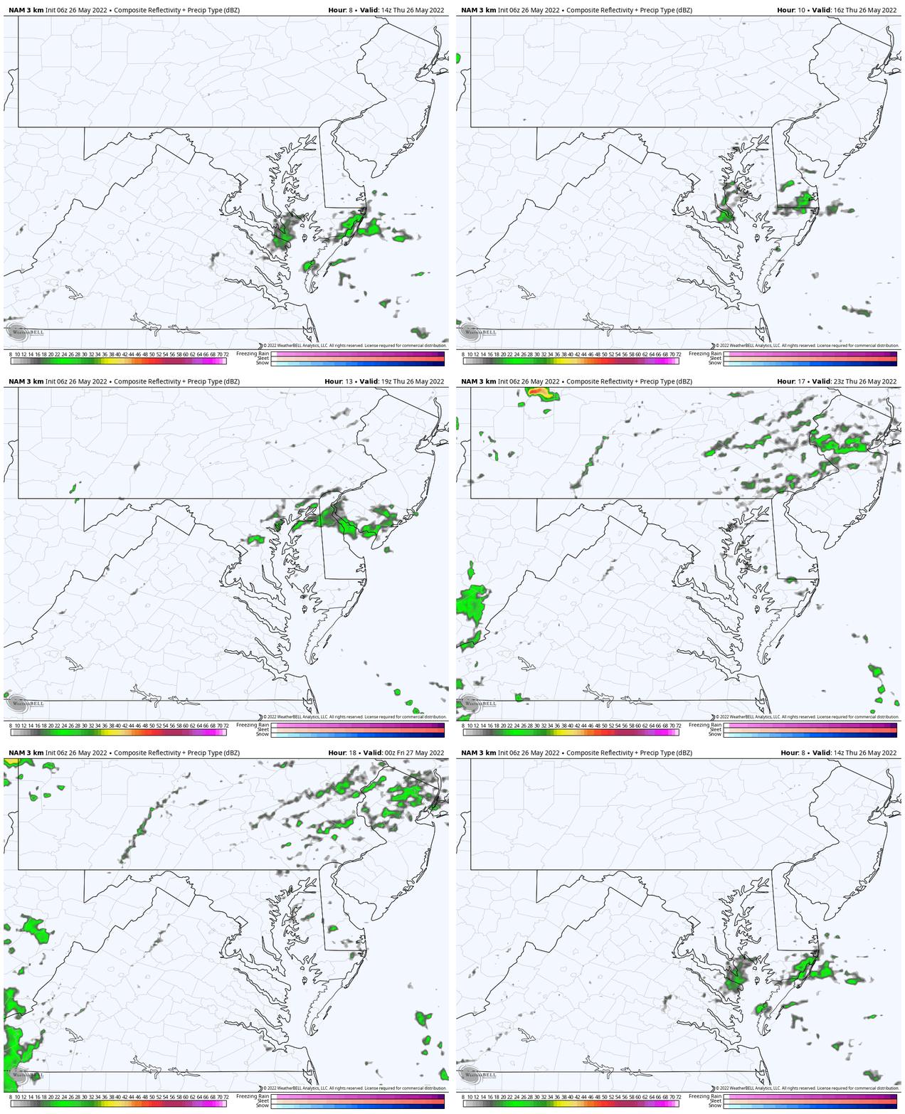
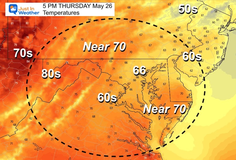
Afternoon Temperatures
CLIMATE DATA
TODAY May 26th
Normal Low in Baltimore: 55ºF
Record 41ºF in 1967
Normal High in Baltimore: 77ºF
Record 94ºF 1914
Friday
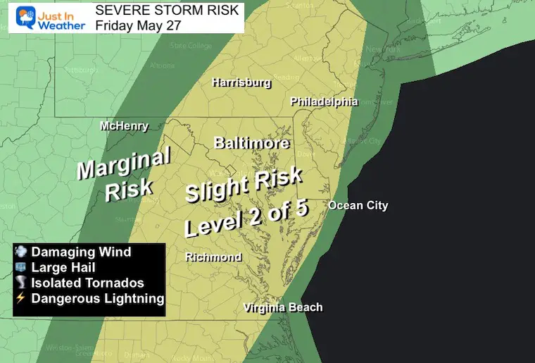
Severe Storm Risk
This will be our storm day!
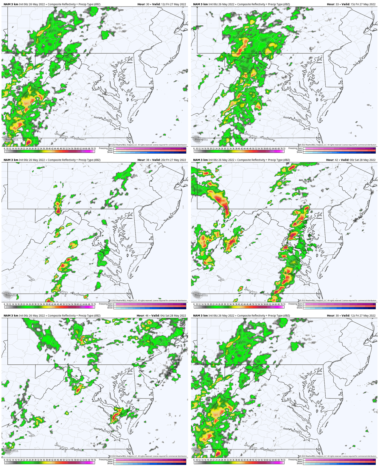
Rain Animation: 8 AM to Midnight
Multiple rounds of storms will develop in the afternoon through Friday night.
Temperatures
Morning
Afternoon

VOTE: Best ‘Meteorologist’
Of Baltimore (Reader’s Poll)
Through May 29 at 5 PM
Click here to access The Baltimore Sun
Weather posts straight to your inbox
Sign up and be the first to know!
Looking Ahead
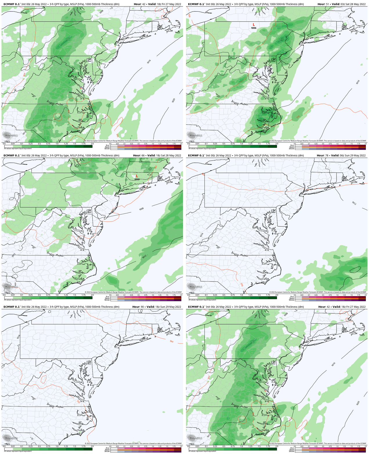
Rain Animation: Friday Afternoon To Monday Afternoon
- Friday: Stormy
- Saturday: Mostly dry with scattered storms.
- Sunday and Memorial Day: Sunny and warmer.
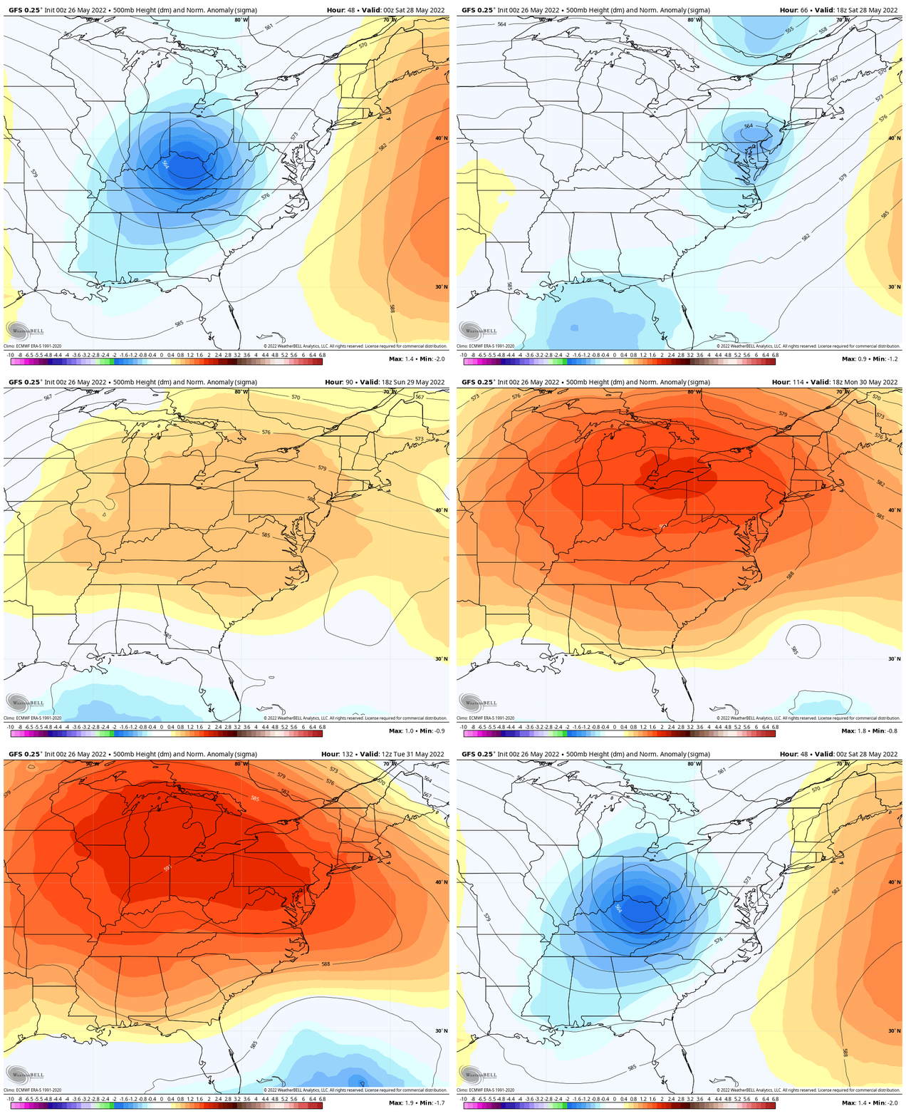
Jet Stream: Heat Wave Next Week
Friday Through Tuesday…
Notice the cool trough get replaced by a strengthening ridge of High Pressure. This will allow the 90s to return.
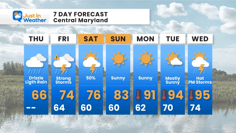
7 Day Forecast
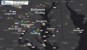
Recent Storm Reports
May 16 Large Hail Videos And Storm Tracking Map
In Case You Missed It..
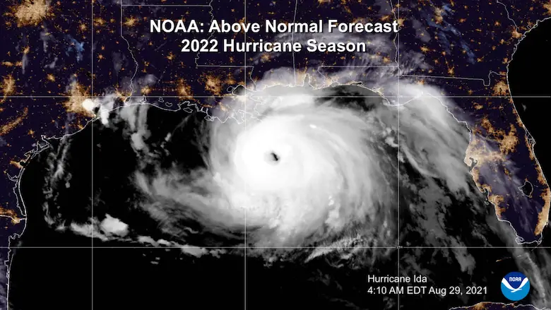
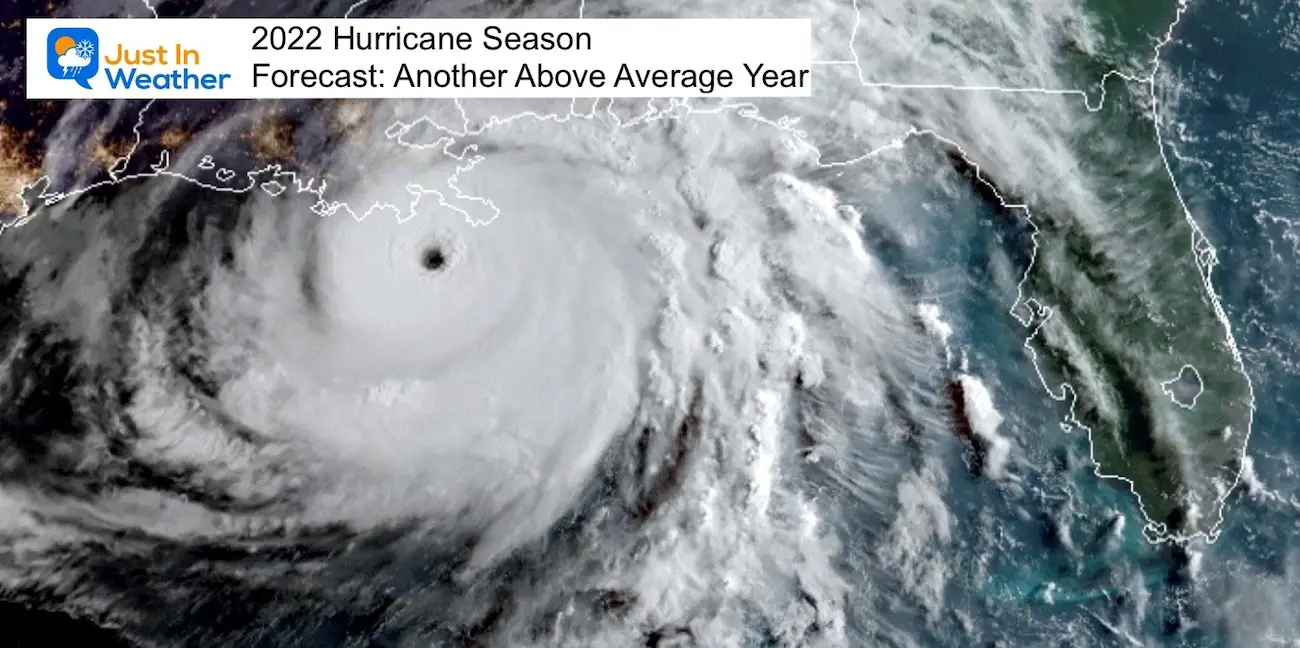
NOAA 2022 Hurricane Forecast- Above Normal Again
Tropical Season Begins June 1
Related Posts
NOAA Study: Reducing Air Pollution INCREASED Tropical Storms
Atlantic Tropical History: Maps of Origin Regions Every 10 Days
Please share your thoughts, best weather pics/video, or just keep in touch via social media
Facebook: Justin Berk, Meteorologist
Twitter: @JustinWeather
Instagram: justinweather
*Disclaimer due to frequent questions:
I am aware there are some spelling and grammar typos. I have made a few public statements over the years, but if you are new here you may have missed it:
I have dyslexia, and found out at my second year at Cornell. I didn’t stop me from getting my meteorology degree, and being first to get the AMS CBM in the Baltimore/Washington region.
I do miss my mistakes in my own proofreading. The autocorrect spell check on my computer sometimes does an injustice to make it worse.
All of the maps and information are accurate. The ‘wordy’ stuff can get sticky.
There is no editor that can check my work when I need it and have it ready to send out in a newsworthy timeline.
I accept this and perhaps proves what you read is really from me…
It’s part of my charm.


