Interesting Display On Radar Shows Wind And Return Of Chilly Rain
May 24 2022
Tuesday Afternoon Update
The storm in North Carolina is losing its punch. However, it is slowing down resulting in keeping its influence on our weather today and a few days ahead.
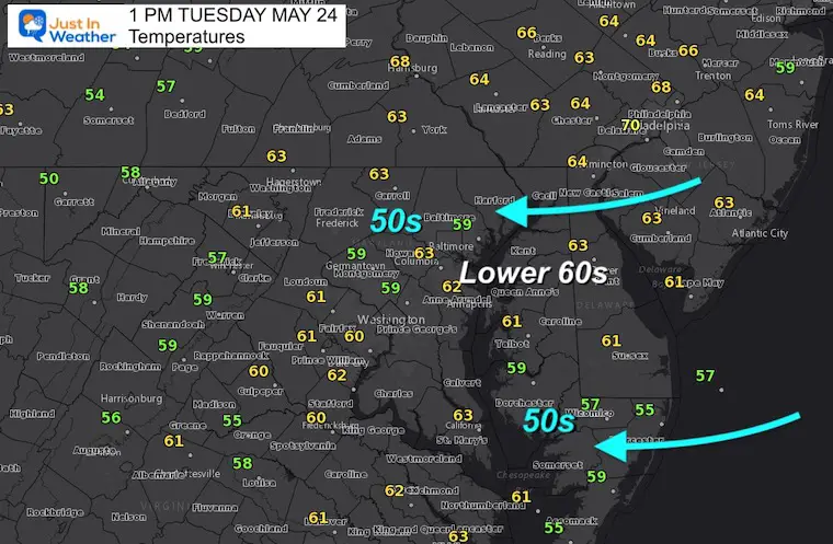
Temperatures
This includes helping the east wind from the Atlantic to hold temps down AND keep showers around. This may be a case if you have rain, temps stay in the 50s. A little drying with clouds lifting helps temps reach the lower 60s.
This is more than 30 degrees cooler than we were over the weekend.
A closer look at the radar revealed an interested reflection of those winds…
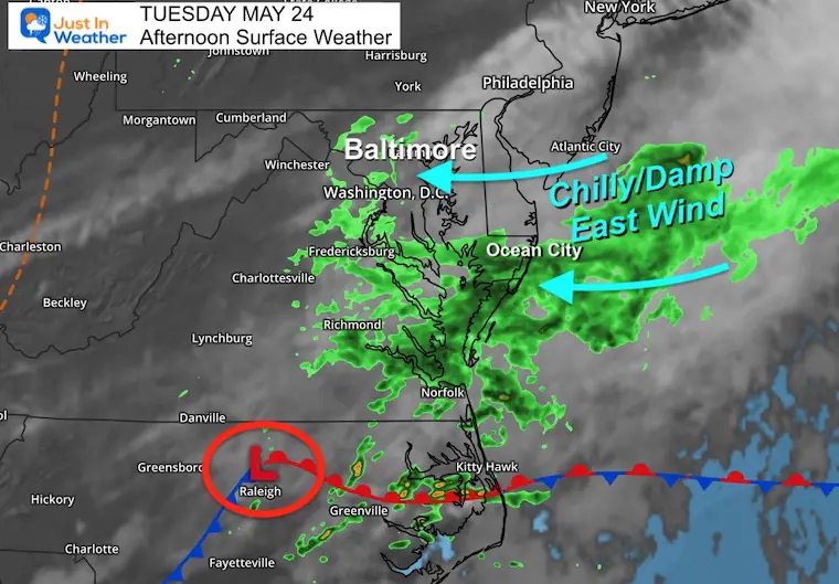
Surface Map
Low Pressure located in North Carolina is pulling in winds from the Atlantic Ocean. That is the reason for the rain showers around Baltimore.
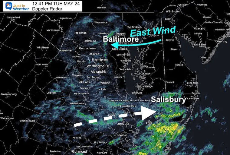
Doppler Radar Snapshot: Convergence
This line of rain I highlighted just west of Baltimore pushed in from the east/Chesapeake Bay. As this band moved westward, it got enhanced by two factors:
- Uplifting to higher terrain from sea level to over 500 Ft was just enough to enhance the rain.
- Converging with the showers in place created extra lift. That convergence led to heavier rain bands over Owings Mills, Eldersburg, and Ellicott City.
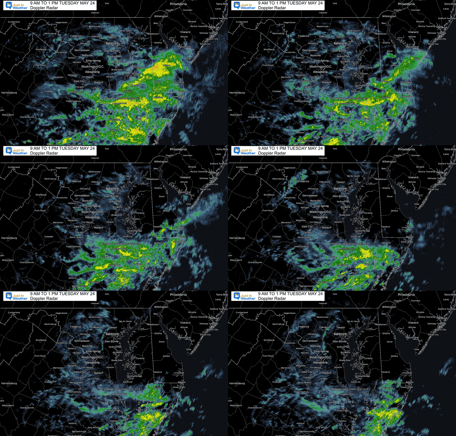
Radar Loop Between 9 AM and 1 PM
Here we can see that band shown above moving west in the later frames…
Meanwhile, the heavier rain in southern Maryland is moving with the main Low Pressure to the east…
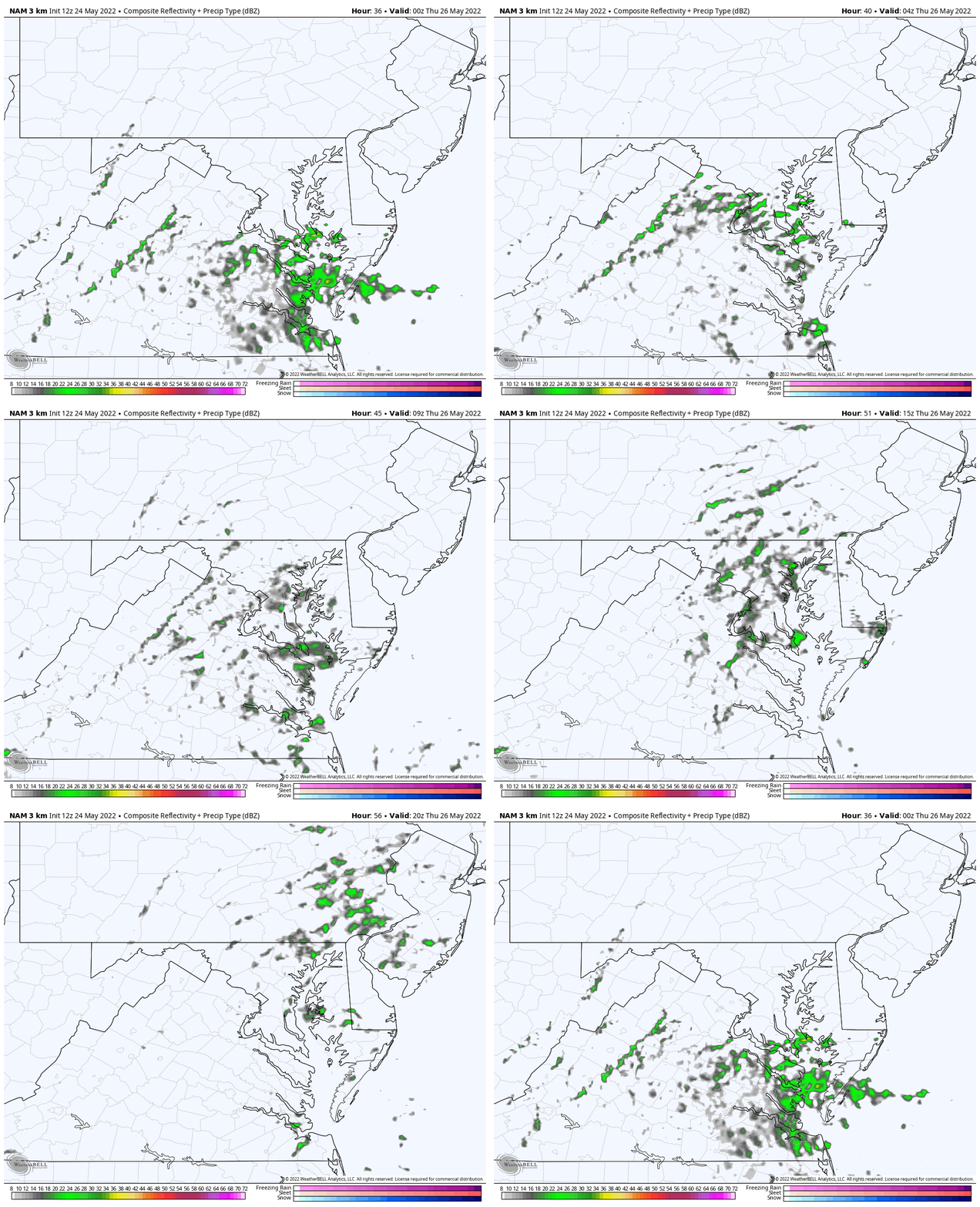
Radar Simulation
1 PM Tuesday to 8 AM Wednesday
The rain showers should diminish tonight and into tomorrow morning. We should get a break for a day…
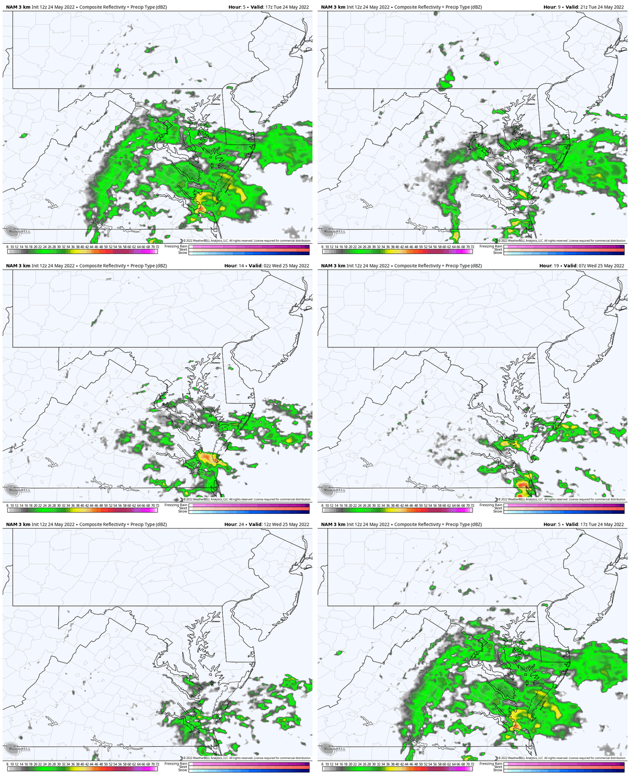
Jumping Ahead…
Radar Simulation
8 PM Wednesday to 4 PM Thursday
Watch that rain in Southern Maryland make a move back north. This is all based on the wind flow shifting the energy focus into Central Maryland. Not a deluge, but enough to be wet and impact outdoor plans Thursday.
Weather posts straight to your inbox
Sign up and be the first to know!
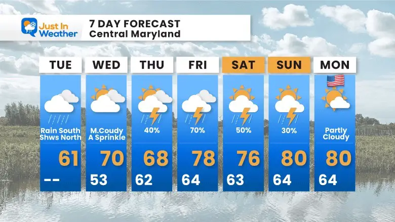
7 Day Forecast
This is how it translates for us…. The unsettled pattern remains most of the week. While we get a break on Wednesday, the risk of rain and storms increases Thursday and Friday.
It does appear that showers may linger into the start of the weekend, but aiming for an improvement by Memorial Day.
VOTE: Best ‘Meteorologist’
Of Baltimore (Reader’s Poll)
Through May 29 at 5 PM
Click here to access The Baltimore Sun
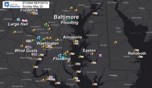
Storm Reports
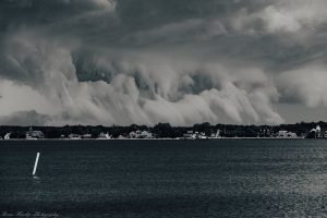
May 16 Large Hail Videos And Storm Tracking Map
Tropical Season Begins June 1
Related Posts
NOAA Study: Reducing Air Pollution INCREASED Tropical Storms
Atlantic Tropical History: Maps of Origin Regions Every 10 Days
Please share your thoughts, best weather pics/video, or just keep in touch via social media
Facebook: Justin Berk, Meteorologist
Twitter: @JustinWeather
Instagram: justinweather
*Disclaimer due to frequent questions:
I am aware there are some spelling and grammar typos. I have made a few public statements over the years, but if you are new here you may have missed it:
I have dyslexia, and found out at my second year at Cornell. I didn’t stop me from getting my meteorology degree, and being first to get the AMS CBM in the Baltimore/Washington region.
I do miss my mistakes in my own proofreading. The autocorrect spell check on my computer sometimes does an injustice to make it worse.
All of the maps and information are accurate. The ‘wordy’ stuff can get sticky.
There is no editor that can check my work when I need it and have it ready to send out in a newsworthy timeline.
I accept this and perhaps proves what you read is really from me…
It’s part of my charm.


