


May 3 Cooler Today Then More Rain Expected This Weekend
Friday May 3 Morning Report Another record high of 90ºF was reached yesterday at BWI. This tied the mark set in 2018. Today, a cooler wind will bring us closer…
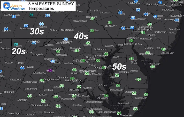
Easter Sunday Morning Report
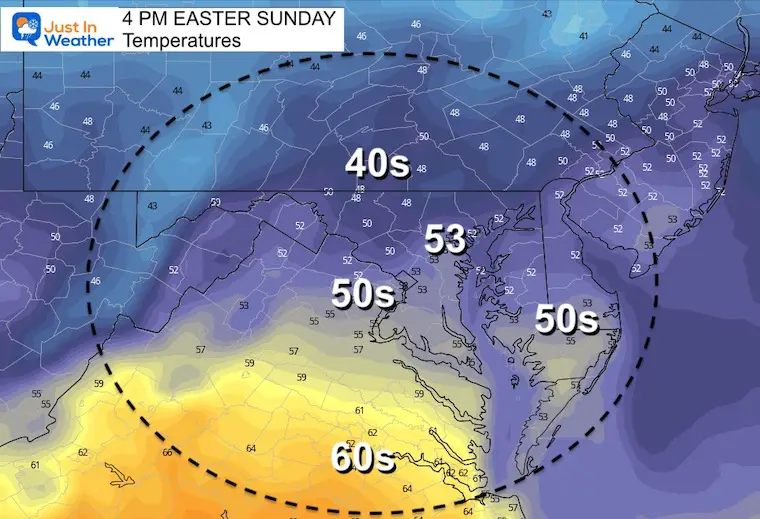
This holiday weekend is ending on a chilly and breezy note. We are underneath a large pool of chilly air in the jet stream, and the next storm system may catch up in time to keep that hint of winter around.

Top winds should be around noon, then ease a little later in the day.

TODAY April 17th
Seasonal Snow: 14.4”
Normal Low in Baltimore: 43ºF
Record 26º F in 1962
Normal High in Baltimore: 65ºF
Record 93ºF 2002
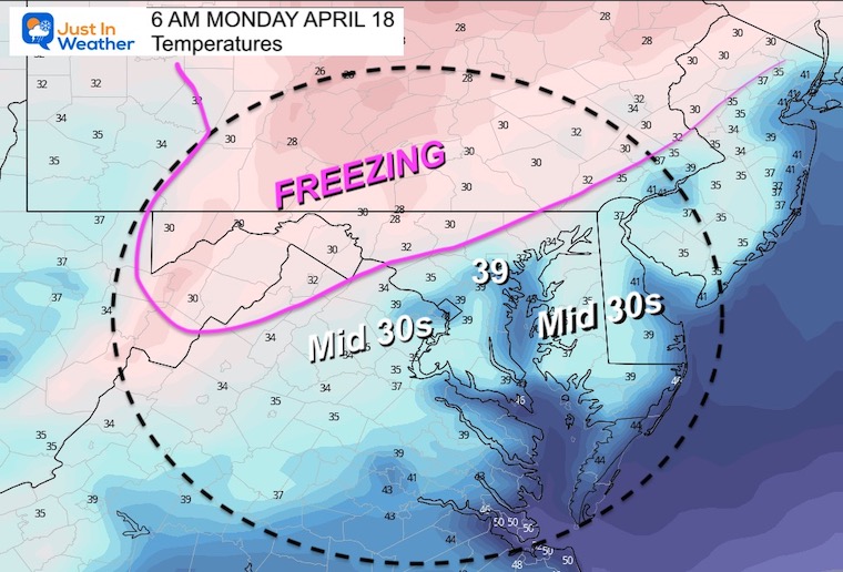
These are the most likely areas to drop BELOW 32ºF.
There will be more that will be in the 30s and high chance for frost.
UPDATE 8:20 AM – Since publishing this post, there has been an upgrade to Freeze Warning AND Frost Advisory farther south as expected. I will have a new update with that map shortly…
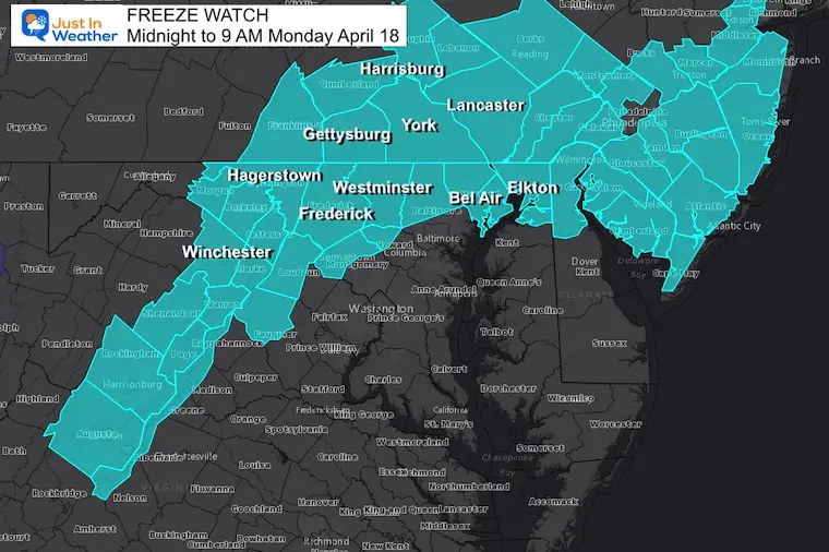
There will be plenty of areas above freezing but still down into the 30s. I expect there will be Frost Advisories issued for centrally Maryland/Virginia/Delmarva.
8 AM Monday to 4 PM Tuesday
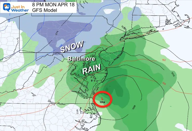
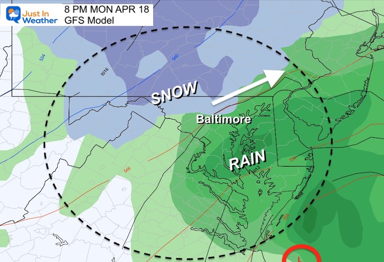
Developing rain in the afternoon will pull in enough cold air to bring that snow line very close.
This will be followed on Tuesday with afternoon rain showers that may have som snow mix in across the NorthWest Hills.
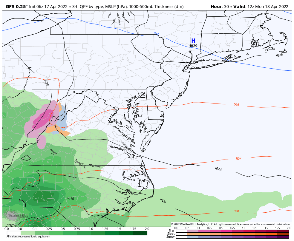
Coastal Low will pass Virginia Beach and Ocean City. The snow will be well inland, while the rest of the region gets a moderate to heave rain.
There is a chance that snow falls (likely not much stickage) northwest of the Baltimore beltway including Maryland Counties: Frederick, Carrol, Baltimore, and up through York and Lancaster in PA.
There may be two more mornings with frost and inland freeze Tuesday and Wednesday.


Atlantic Tropical History: Maps of Origin Regions Every 10 Days


*Disclaimer due to frequent questions:
I am aware there are some spelling and grammar typos. I have made a few public statements over the years, but if you are new here you may have missed it:
I have dyslexia, and found out at my second year at Cornell. I didn’t stop me from getting my meteorology degree, and being first to get the AMS CBM in the Baltimore/Washington region.
I do miss my mistakes in my own proofreading. The autocorrect spell check on my computer sometimes does an injustice to make it worse.
All of the maps and information are accurate. The ‘wordy’ stuff can get sticky.
There is no editor that can check my work when I need it and have it ready to send out in a newsworthy timeline.
I accept this and perhaps proves what you read is really from me…
It’s part of my charm.