


Soggy Saturday Update: Rain Timeline Through Preakness In Baltimore
Friday, May 17, 2024 As we approach another weekend, we have yet another weather system bringing us rain. This will make 16 of 20 weekends this year with some wet…
April 17 2022
Sunday Evening Update
Easter turned out to be chilly. After a high in Baltimore of 79ºF on Saturday, today ending up only 57ºF. With a clear sky and light wind, conditions are prefect to max out on radiational cooling overnight and drop to near freezing Monday morning.
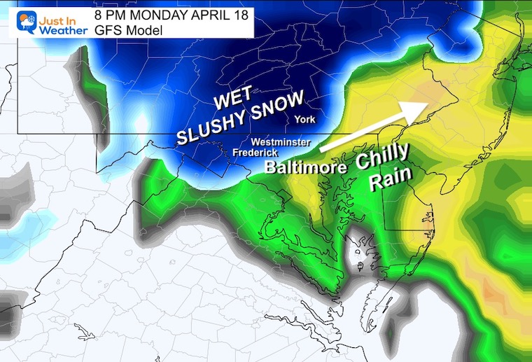
There is a storm approaching for Monday that may bring in early morning clouds. That will bring in a chilly rain, and perhaps some snow inland by evening. We will touch on that.
The timing is all that may limit how cold we can get. But it is looking probable that at least in the 30s will lead to widespread Frost, which can be enough to damage plants. There will be some northern areas below freezing, which is a certain killer for many potted plants and early plantings in the ground.
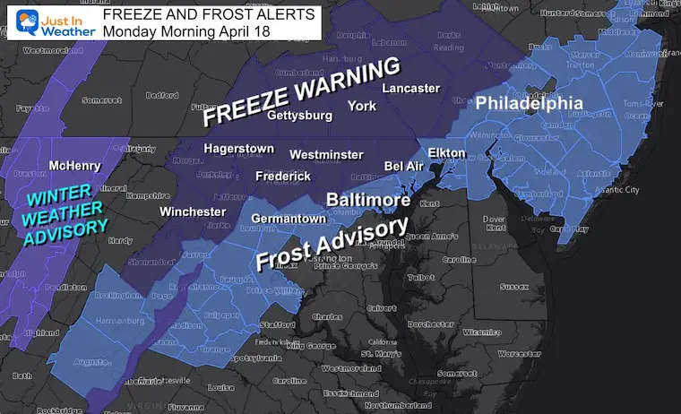
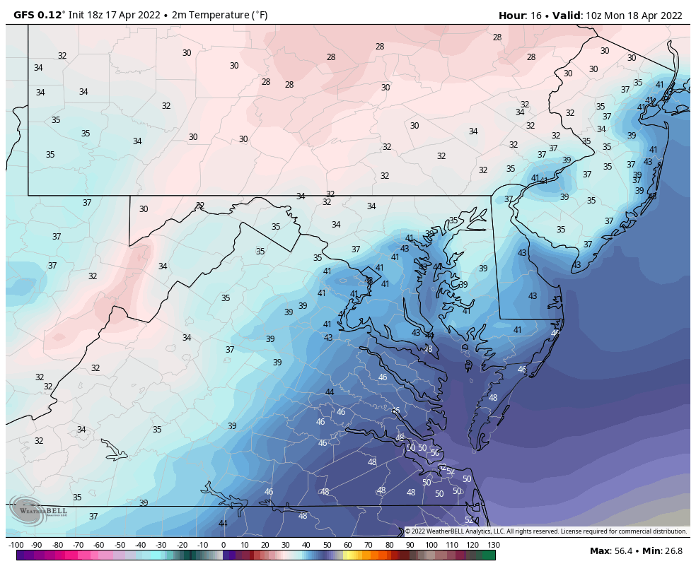
The good news is there there seems to be a lot of agreement on the freezing line and overall low temps.

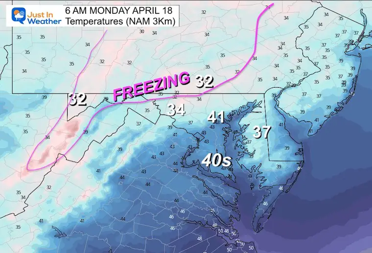
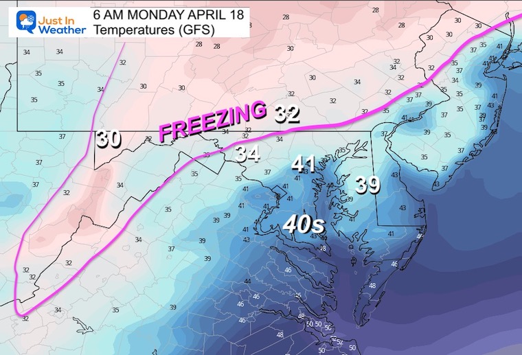
Notice the slow climb with many areas remaining in the upper 30s to lower 40s
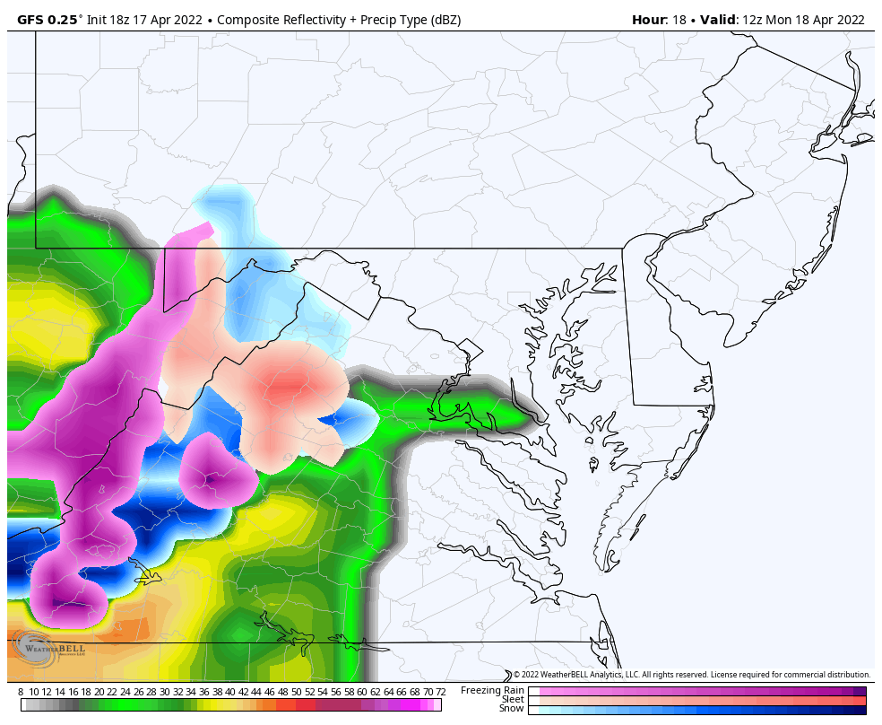
I do not want to harp too much on this BECAUSE that storm has potential for BIG snow totals to our north. Locally only wet snow but may be falling in our northwest suburbs late in the day and evening.
I need to point out that last week the model guidance suggested frozen precipitation, but still did not handle it well. SO I would still plan for even more areas to have ‘stuff’ falling in the afternoon.
Monday 8 AM to Tuesday 1 PM
After this storm passes, it will open up Lake Effect Snow in the mountains on Tuesday. This could spread additional rain or snow showers in our northwest areas Tuesday afternoon.
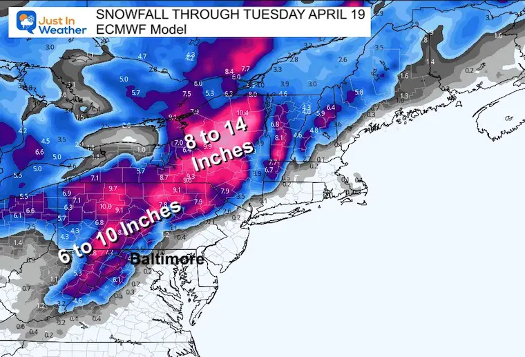
I hesitate to show snow products like this in Spring because there tends to be over estimation of what can fall, lay, and stay. But since this is mostly in the mountains and north of our region, we don’t have to shovel this.
You may hear of place getting OVER 1 foot of snow. There are models showing much higher amounts, but we need to account for compaction of heavy wet snow, and some melting on the ground. Either way, yes this is late in the season.
FITF
Looking Ahead: We will warm up by the end of the week. I played it conservative, but if the pattern speeds up we can approach 80ºF by next weekend (higher than I am showing here).


Atlantic Tropical History: Maps of Origin Regions Every 10 Days


*Disclaimer due to frequent questions:
I am aware there are some spelling and grammar typos. I have made a few public statements over the years, but if you are new here you may have missed it:
I have dyslexia, and found out at my second year at Cornell. I didn’t stop me from getting my meteorology degree, and being first to get the AMS CBM in the Baltimore/Washington region.
I do miss my mistakes in my own proofreading. The autocorrect spell check on my computer sometimes does an injustice to make it worse.
All of the maps and information are accurate. The ‘wordy’ stuff can get sticky.
There is no editor that can check my work when I need it and have it ready to send out in a newsworthy timeline.
I accept this and perhaps proves what you read is really from me…
It’s part of my charm.