


May 3 Cooler Today Then More Rain Expected This Weekend
Friday May 3 Morning Report Another record high of 90ºF was reached yesterday at BWI. This tied the mark set in 2018. Today, a cooler wind will bring us closer…
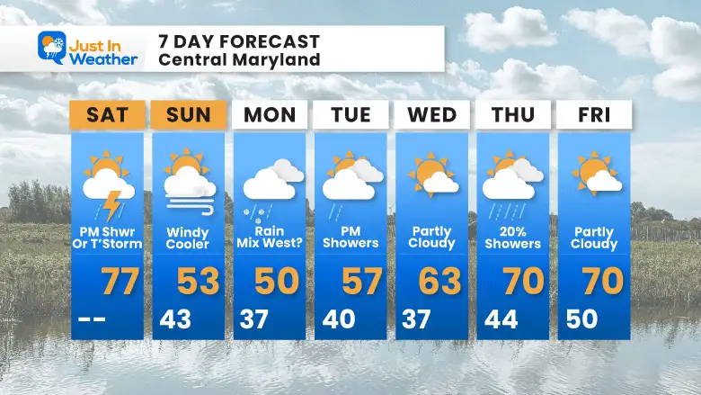
Saturday Morning Report
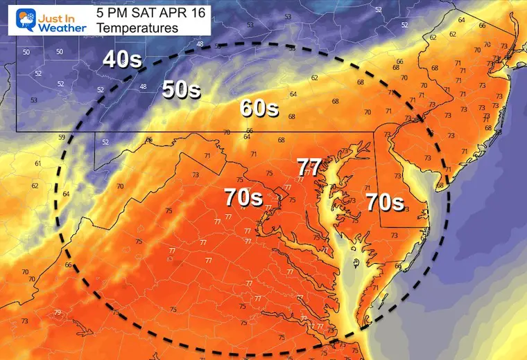
We went from two days in the 80s to a beautiful sunny, but breezy Friday in the 70s. Today will be warm again, this time with showers and evening thunder possible.
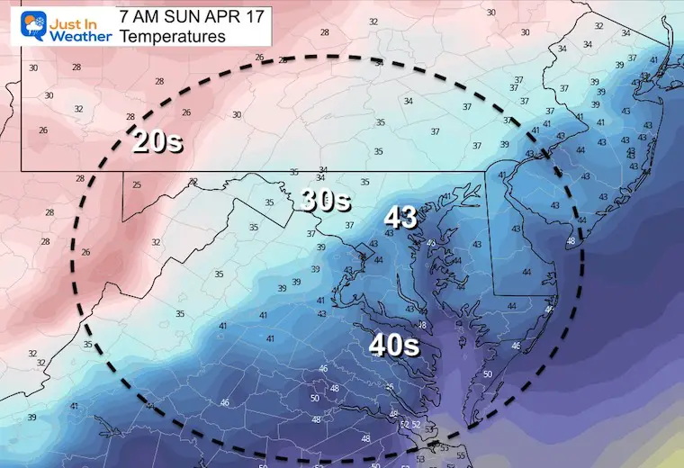
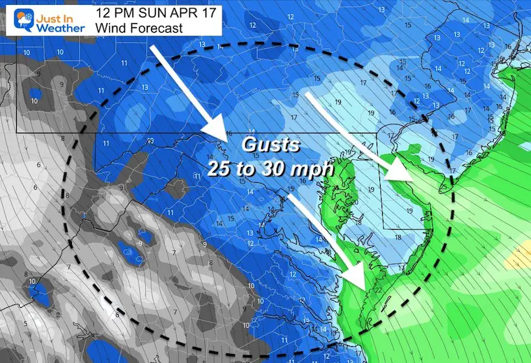
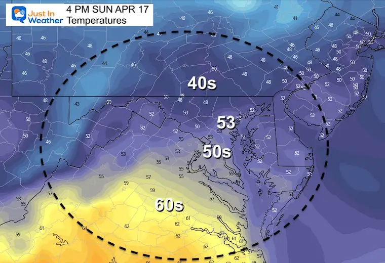
Easter Sunday will end up windy and cooler. Sorry we could not time this out better.
Come Monday, another storm has the potential to drop snow much closer than just western Maryland. Let’s take a look.

Rain is passing to our north in central PA. Storms and severe weather continue across the Deep South.
Snow showers in the Great Lakes…
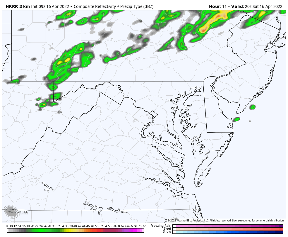
For us, Showers And Some T’Storms later this afternoon, evening, and tonight.
THEN… Windy and Colder air arrives for Easter. Will we get snow nearby????
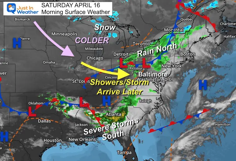
At this point it looks like the showers will be spotty later in the afternoon, with some thunderstorms developing in the evening and tonight.
TODAY April 16
Seasonal Snow: 14.4”
Normal Low in Baltimore: 43ºF
Record 30º F in 1962
Normal High in Baltimore: 65ºF
Record 90ºF 2012
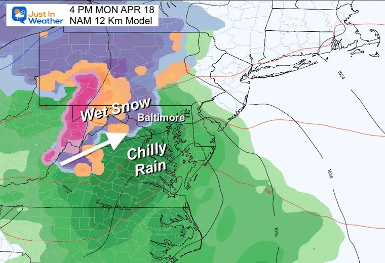
10 AM Monday To 4 PM Tuesday
This is the GFS Model showing rain, with a wet snow inland from the cities. See the snapshot comparisons below.
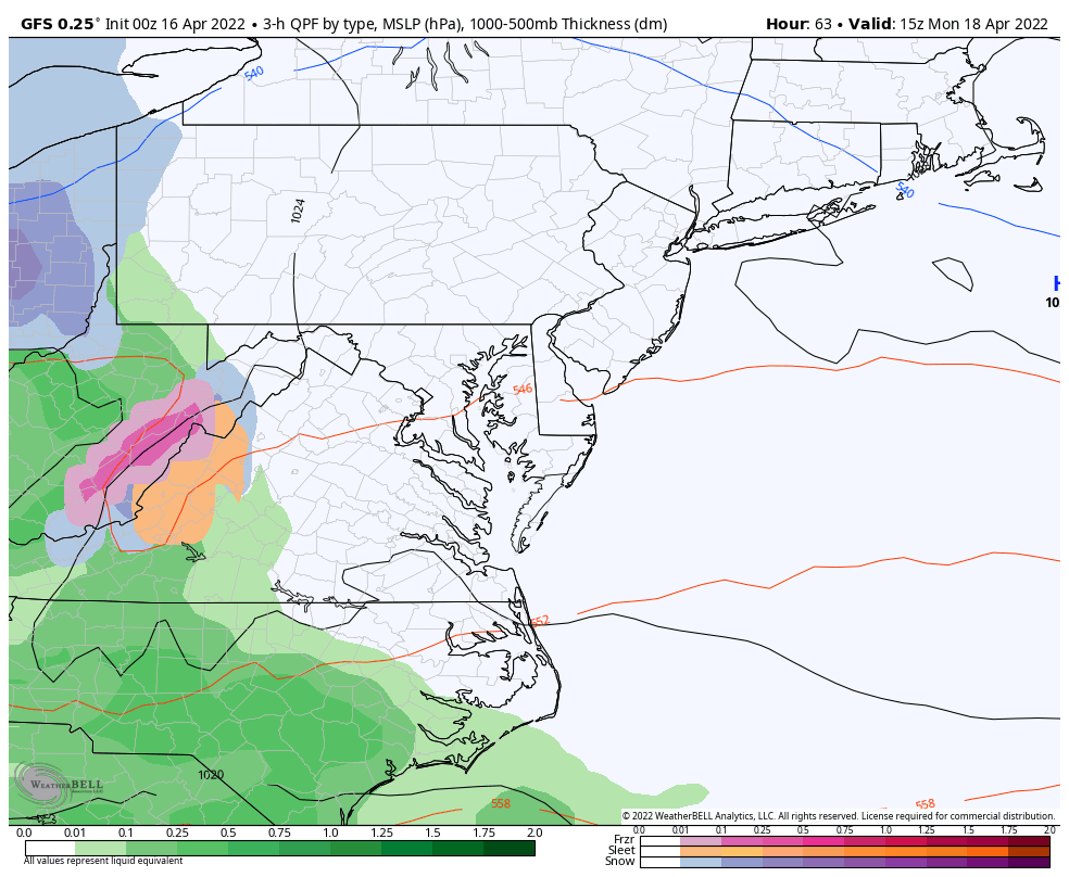
GFS– Shows wet snow as close as Frederick and Carroll Counties in Maryland.

NAM 12 Km – The MOST aggressive shows snow into western Baltimore County.
European ECMWF Model – This shows pockets of snow in The Hereford Zone and York County, also northern Frederick near Thurmont and westward.

There is a chance for Frost mid week with lows in the 30s, then back to near 70ºF by the end of the week.

Atlantic Tropical History: Maps of Origin Regions Every 10 Days


*Disclaimer due to frequent questions:
I am aware there are some spelling and grammar typos. I have made a few public statements over the years, but if you are new here you may have missed it:
I have dyslexia, and found out at my second year at Cornell. I didn’t stop me from getting my meteorology degree, and being first to get the AMS CBM in the Baltimore/Washington region.
I do miss my mistakes in my own proofreading. The autocorrect spell check on my computer sometimes does an injustice to make it worse.
All of the maps and information are accurate. The ‘wordy’ stuff can get sticky.
There is no editor that can check my work when I need it and have it ready to send out in a newsworthy timeline.
I accept this and perhaps proves what you read is really from me…
It’s part of my charm.