


Average Last Frost or Freeze Dates And Map For Maryland
There is a good reason why many gardeners suggest NOT to plan tomatoes until after Mother’s Day. Early surges of warm air in spring can be deceiving. Just because the…
Tuesday December 13 2022
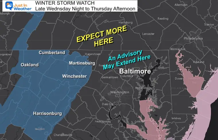
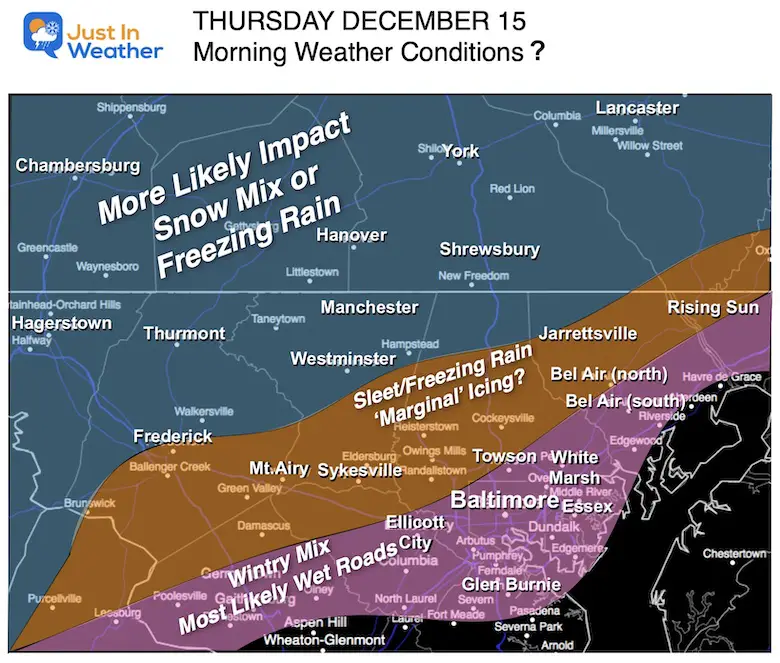
If you have been following my updates, then you may know that I am careful to NOT use the word ‘storm’ unless I believe it deserves it. For now, I expect an impact event for colder inland metro areas and A Winter Storm Watch has been issued for some mountainous regions.
The good news is that we continue to see agreement and thus high confidence in this starting icy west of I-95, and parts of Baltimore. The good news is the anticipation before sunrise will help make the call for schools, but not for travelers. However, salting should help the I-95 vicinity west.
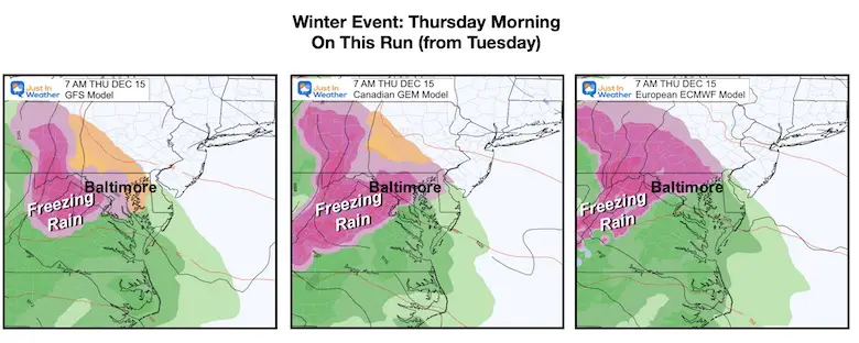
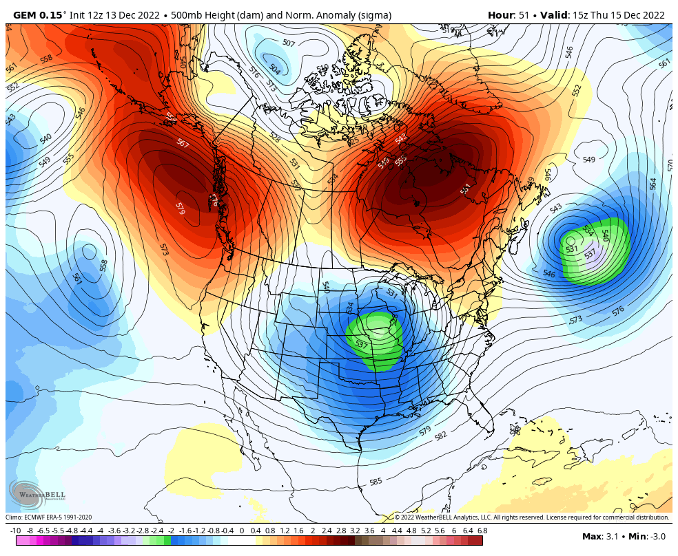
I will continue to compare the three main models, but I am leaning toward the Canadian GEM product as the baseline. This has a history of performing best in arctic air patterns. We are not there yet, but I want to give it a chance.
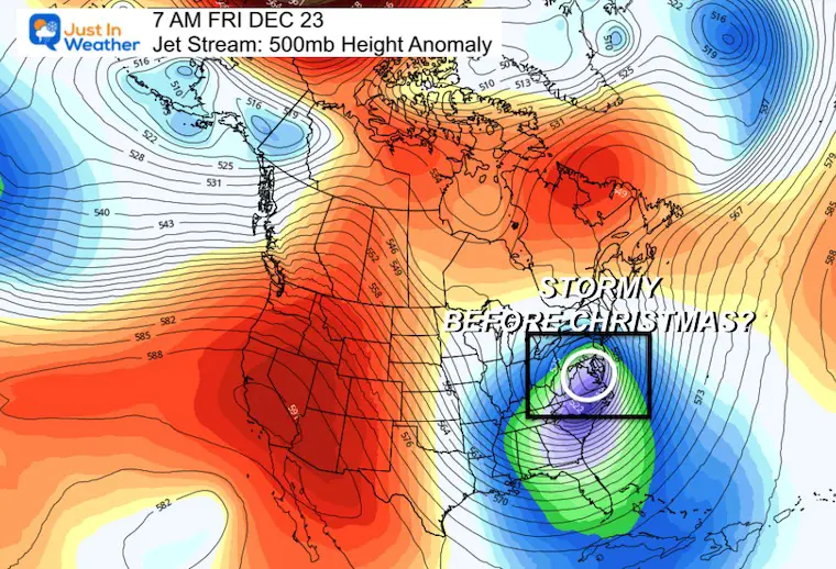
What may follow our icy Thursday morning and chilly rain will be colder air and energy in the jet stream. We could see break out flurries or snow showers this weekend. Then, NEXT WEEK there is a signal for a larger storm just before Christmas. I will show it all below.
This is all The National Weather Service has issued so far. I expect we will see ‘advisories’ into central Maryland and more alerts through much of Pennsylvania.
This includes I-81 through Virginia and westward into the mountains where ice will be a big impact.
I can’t issue weather advisories, I can just show what NWS publishes and make suggestions. The updates may happen tonight, but should almost certainly arrive Wednesday.
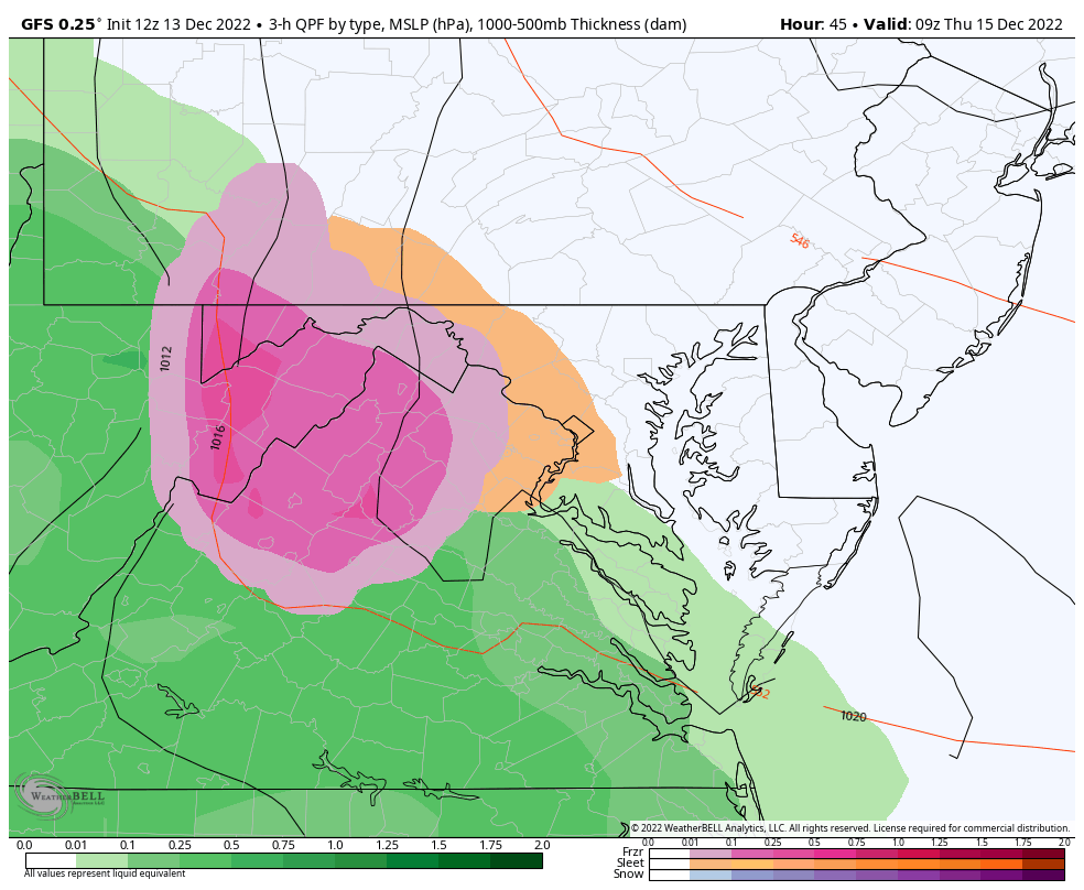
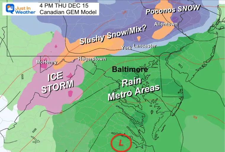
We still see mostly freezing rain, perhaps some sleet beginning across the central Maryland region between 4 AM and 6 AM on the GFS, Canadian, and European Models.
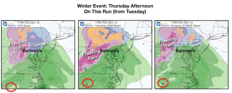
With the Low Pressure now on the local map, we can see the influence of the warming to rain, but it will be heavy!
The GFS and European do keep some hint of snow very close by the MD/PA line.
Comparing the colder GFS to the Canadian Model which is mostly freezing rain.
4 AM THU to 1 PM FRI
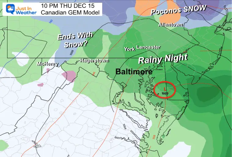
In addition to the suspicious snow midday in central Maryland, this keeps the cold air close enough to end with snow by the MD/PA line Friday. I would not expect stickage from this.
4 AM THU to 10 AM SAT
I wanted to show more of the ice, this is the model I am going with… It also is more in line with my suggestion of flurries or snow showers on Saturday. More detail on that below.
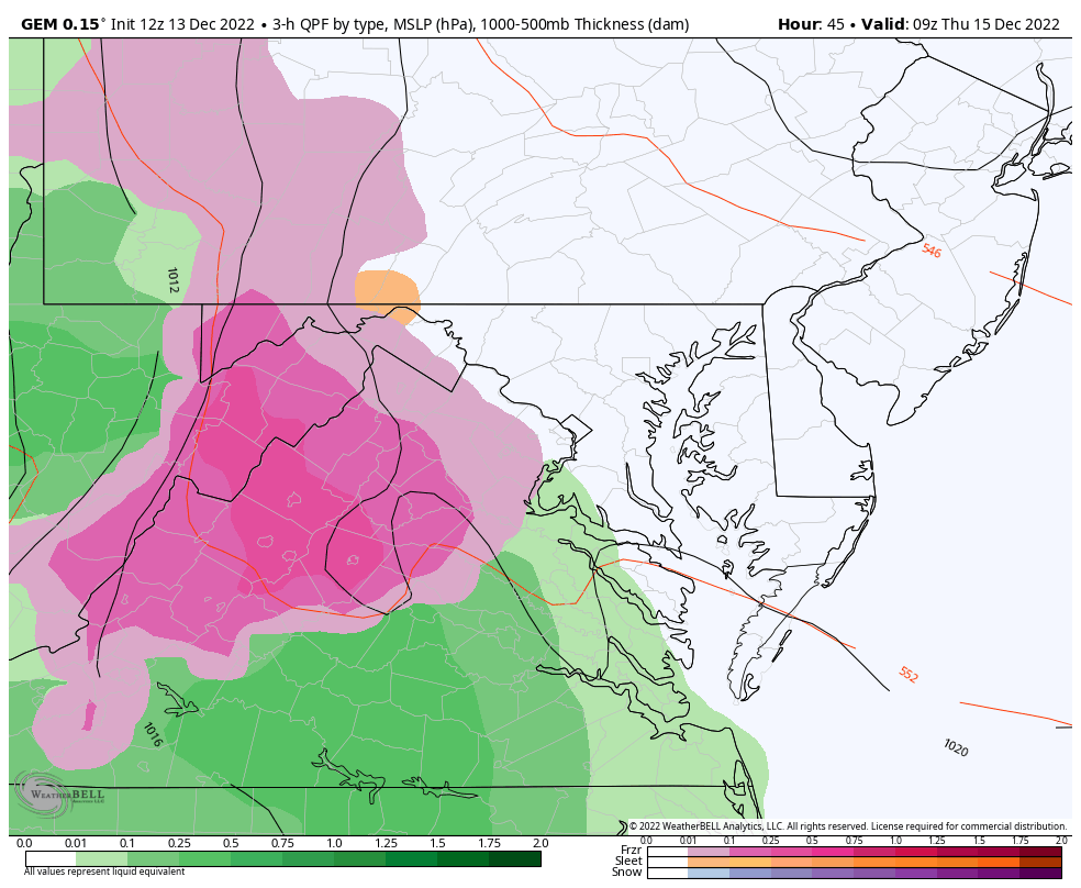
I chose this because of what we start with before sunrise, and we see a continuation here (the GFS does bring in snow).
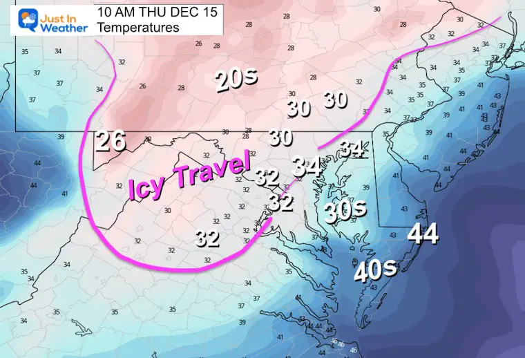
I drew the WHITE LINE to follow the freezing temperature line. This is the region I have believe will see some icing early, then a slow improvement through mid day.
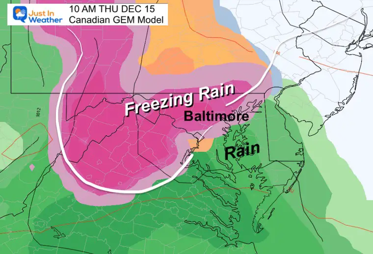
I’ve continued to see the same general FREEZING LINE similar to climatology for this time of year. Near I-95 and the Bay there is a warming influence from the water. The more likely icy zones will be farther inland.
This is what I posted last night and it still fits with this product.
Most of central Maryland should turn to steady moderate to heavy rain at this time, while the ice storm continues in the mountains.
Just north into PA there may be slushy snow. This is where the cold air will be stubborn to move out.
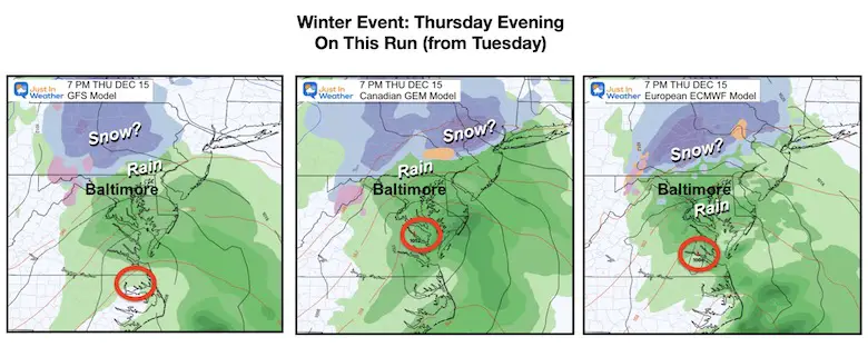
Most of our region should be over to all rain at this point, and possibly ending by midnight or at least overnight. If we get showers Friday morning, it would be from wrap around with the Low far north into New England.
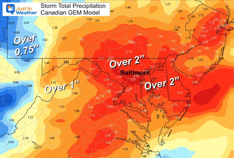
It may seem like quite a bit with the Canadian possibly over doing the Over 2 inch swath. But I would be content to say over 1 inch is still an impressive storm total for the general area. Note, southern PA is actually in a rain deficit for the year.
A large area over 1 inch, with the 2 inch bullseye over Kent Island/Chesapeake Bay.
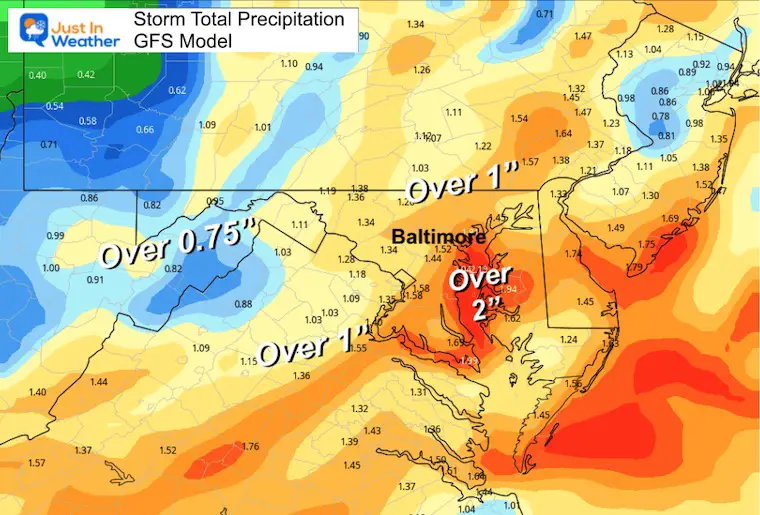
This has a much larger 2 inch total through southern Pennsylvania and much of Maryland. This may be a little on the high side.
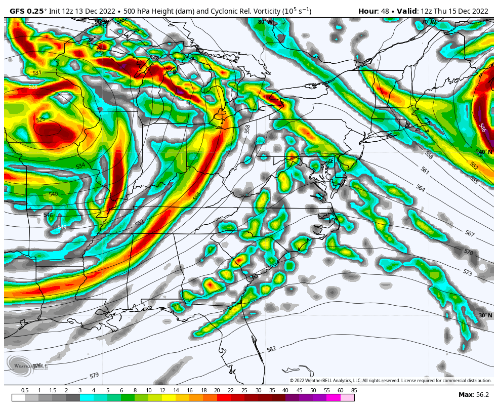
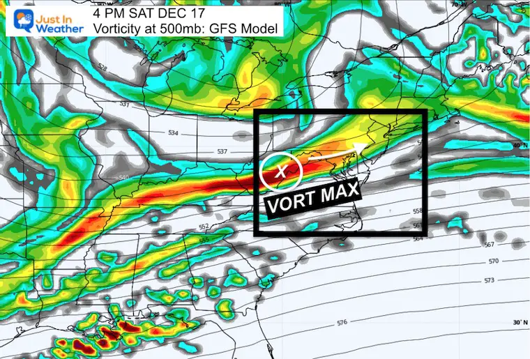
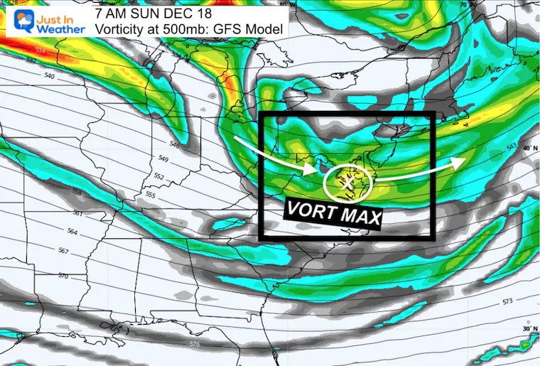
Here is the Vorticity/Spin at 500mb (around 18,000 Ft). This shows the energy aloft with two impulses over the weekend.
This is a broader base wave in a jet streak. It will keep clouds around, and may spit flurries or snow showers.
This is a weak Vort Max that may ignite some spotty showers with cold enough air to produce flakes without much substance. Just ambiance.
Check out this Jet Stream Plot from the Canadian Model for Thursday Morning. I could not resist that we have to Face the reality of the arctic air on the move…
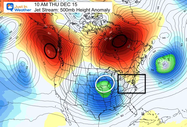
See the end frame below for my thoughts as this Deep Trough digs across the Eastern US and a Core Low is poised over central Maryland.
I do NOT make promises this far out, but it was hard to resist this view. It is subject to change, but if this verifies it would spell a major east coast winter storm. Definitely something to keep watching.
Faith in the Flakes
I will have my regular morning forecast by 6:30 AM
Snow Maps From National Weather Service Explained And Regional Links
December 5th Snow In Baltimore And The Start Of Faith In The Flakes FITF


Click to see more and ‘Book’ a visit to your school

I see many factors to support colder influence with multiple systems. Early and later in winter. Check it out.
Winter Outlook 2023 For Snow Not Typical La Niña Plus Polar Vortex Disruption
Atmospheric Memory Suggests Active Winter Storm Pattern Outlook
Winter Outlook 2023 From NOAA Very Different Than Farmers Almanacs
Winter Outlook 2023 Early Look At Snow From Two Farmers Almanacs
If you want a snowy winter, this is what you might want to look for in the rest of the tropical season. (You might be seeing a lot of commercial snow removal people out this Winter).
Record August For No Named Tropical Storms: Closer Look At Snow Following
Winter Weather Folklore Top 20 And More Outlook Signals From Nature For Cold And Snow
