October 28 Weather Last Warm Day: Tracking Rain Then Colder Air And First Mountain Snow
October 28, 2023
Saturday Morning Update
A second record high in a row was reached in Baltimore yesterday. BWI hit 82ºF at 11:18 AM matching the mark set in 1963. Temps today will be just as warm, but the record will be out of reach. It was 87ºF on this date in 1919.
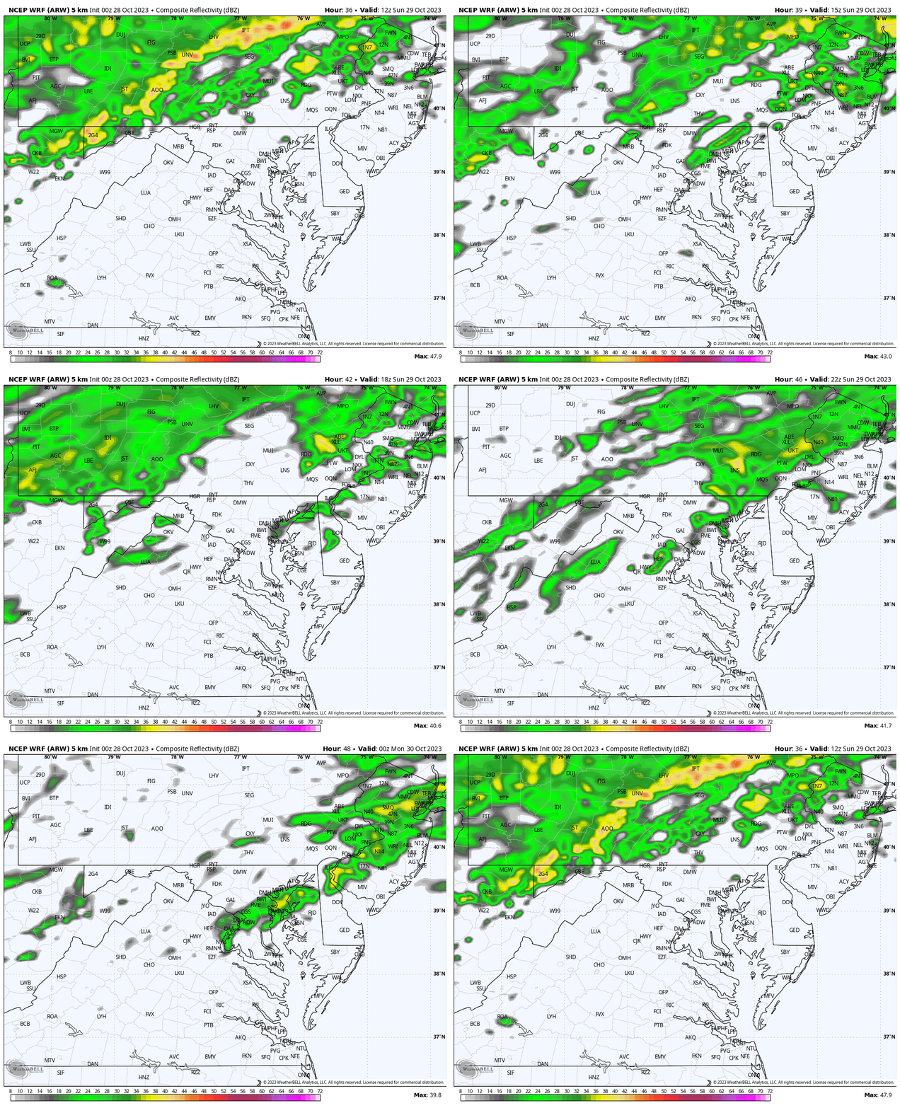
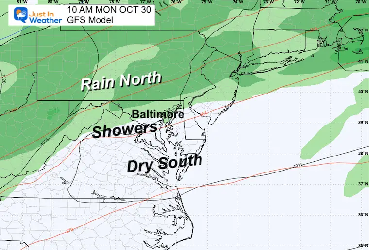
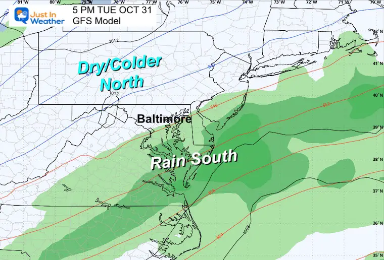
We are watching a slow-moving cold front that will gradually spread rain our way. On Sunday that rain will be north across PA with showers across the Maryland mountains and possibly into metro Baltimore. They will expand south on Monday, but southern Maryland may remain dry until Tuesday.
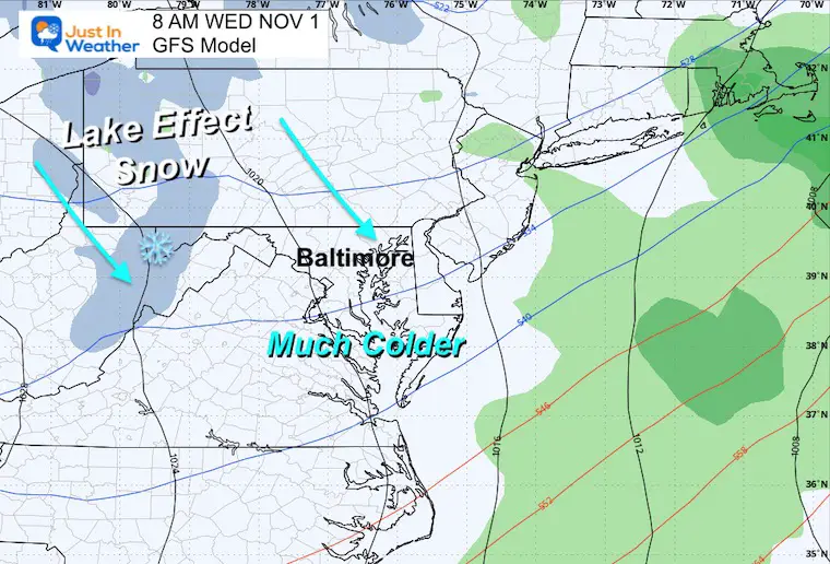
Halloween will be noticeably colder for all of us and we might have the first coating of snow of the season in the western Maryland mountains.
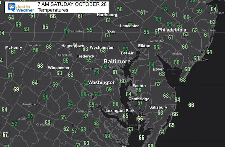
Morning Temperatures
Important to note that numbers this morning are higher than some afternoons next week.
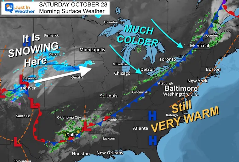
Morning Surface Weather
This weather map has almost everything on it. While the air is still warm locally and across most of the Eastern US, the cold front that will bring the change has a narrow band of rain in the Ohio Valley. Behind this, much colder air will continue to push East and South.
In that cold air, snow is falling with a new storm in Colorado and is expanding into the Central Plains.
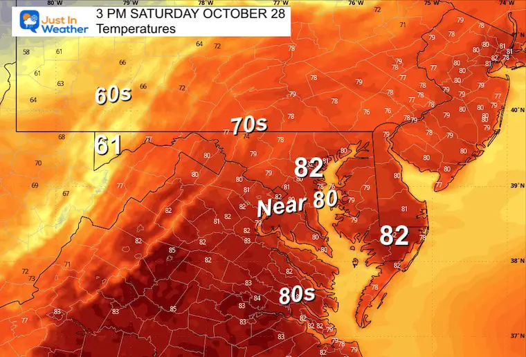
Afternoon Temperatures
This will be our last warm day for a while. No records expected locally…
Baltimore hit 87ºF on this date in 1919.
CLIMATE DATA: Baltimore
TODAY October 28
Sunrise at 7:30 AM
Sunset at 6:11 PM
Normal Low in Baltimore: 42ºF
Record 27ºF in 1976
Normal High in Baltimore: 64ºF
Record 87ºF 1919
New Reports:
NEW: NOAA’s Winter Outlook 2024
Other Reports:
Winter Weather: Can Woolly Bear Caterpillar Stripes Really Foretell Snow?
El Niño Advisory: First Look At NOAA’s Winter Outlook Expectations
Winter Outlook 2024 From Two Farmers Almanacs Return to Cold and Snow
Subscribe for eMail Alerts
Weather posts straight to your inbox
Sign up and be the first to know!
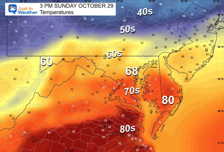
Sunday Temperatures
Morning
Still mild across Maryland with the signal of colder air in central Pennsylvania.
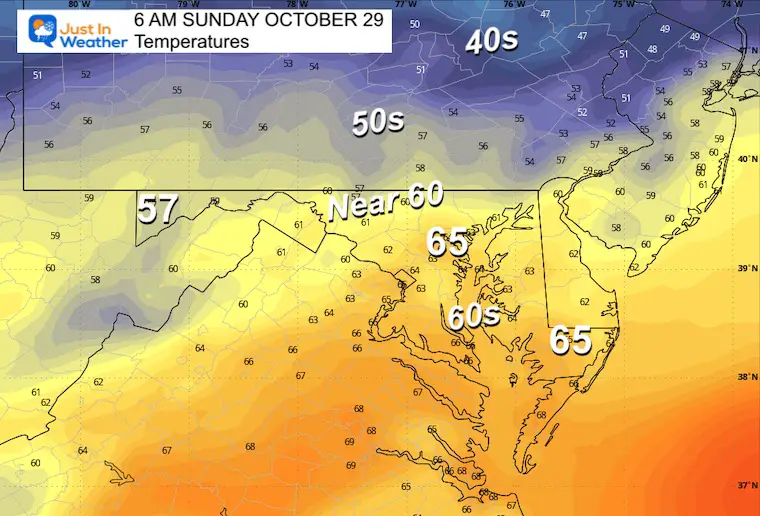
Afternoon
Cooler air will settle in with the rain to the north. This will reach near metro Baltimore while it remains dry and mild in Southern MD and Virginia.
Radar Simulation: 8 AM to 8 PM
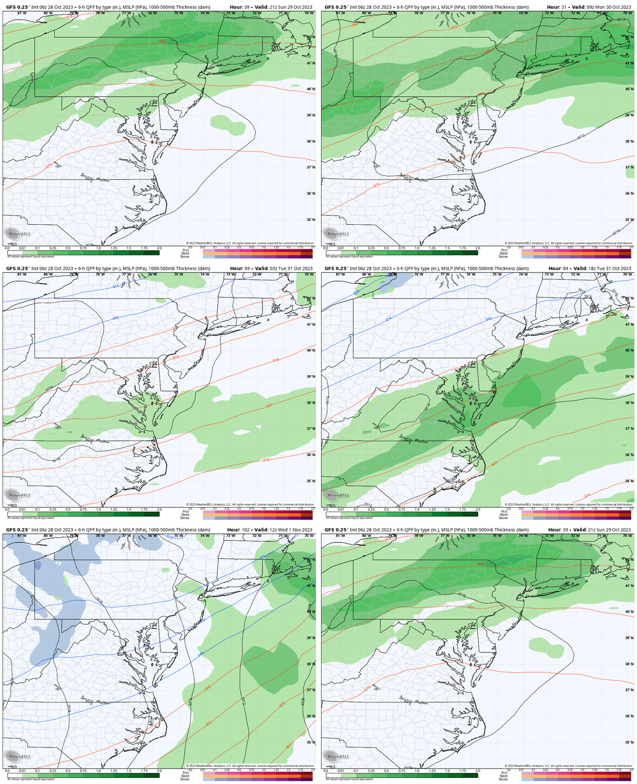
Storm Forecast
Sunday Afternoon to Wednesday Morning
The gradual shift of rain with the cold front may take a few days. Then colder air will open up the first opportunity of snowfall for the season in Western Maryland.
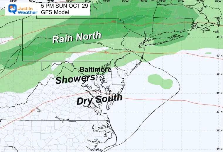
Sunday
Steady rain will be falling across central Pennsylvania with showers reaching into Central Maryland. Farther south may still remain dry.
Monday
Tuesday
Halloween will be windy and chilly. The rain will be slowly shifting south as showers may linger near Annapolis and rain will be more likely across Southern Maryland/Virginia/Delaware.
Wednesday
The coldest air in the stretch will be in place with Lake Effect Snow reaching the mountains of Western Maryland. Garrett County could have its first coating of snow.
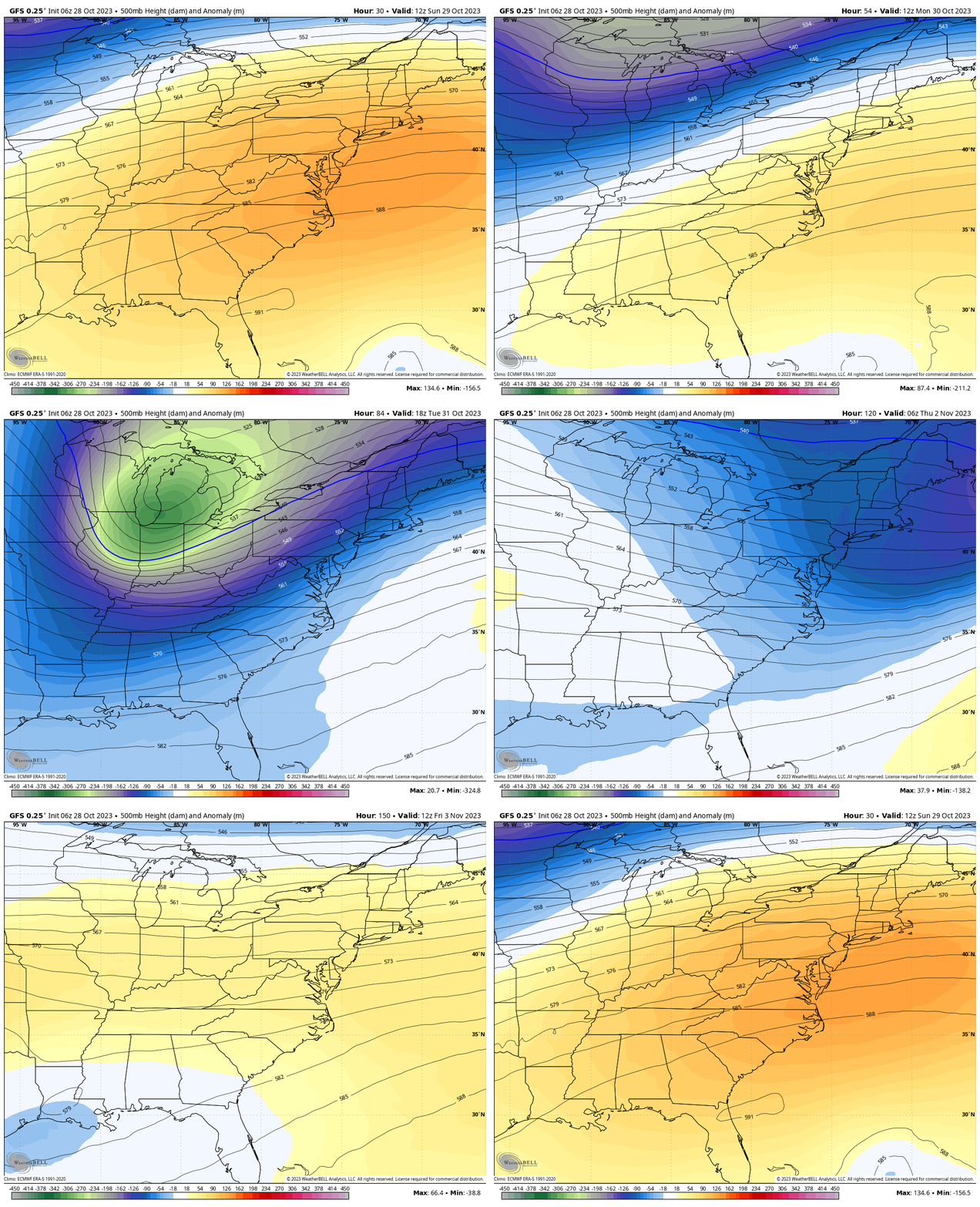
Jet Stream
Animation Sunday to Friday
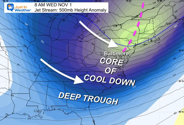
The core of this cold air will reach us mid-week, then modify heading into Next Weekend!
Wednesday
Windy and chilly. Afternoon temperatures may end up colder than the mornings this weekend.
7 Day Forecast
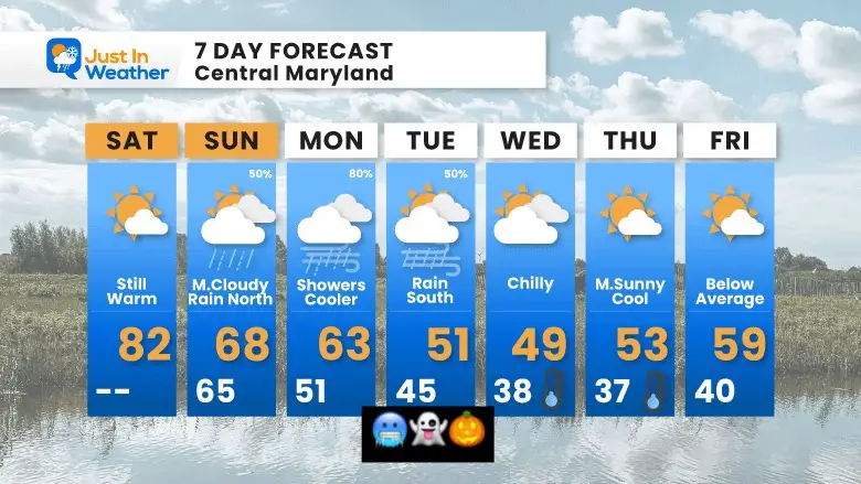
A dramatic change this week after a few days in the 80s, today will be the last one. We will watch that band of rain slowly shift south, bringing in colder air.
Halloween will be windy and cold, the coldest air settles in on Wednesday. That may be the day the first snow of the season hits the mountains of western Maryland.
Subscribe for eMail Alerts
Weather posts straight to your inbox
Sign up and be the first to know!
Faith in the Flakes Gear
STEM Assemblies/In School Fields Trips Are Back
Click to see more and ‘Book’ a visit to your school
Please share your thoughts and best weather pics/videos, or just keep in touch via social media
-
Facebook: Justin Berk, Meteorologist
-
Twitter
-
Instagram
RESTATING MY MESSAGE ABOUT DYSLEXIA
I am aware there are some spelling and grammar typos and occasional other glitches. I take responsibility for my mistakes and even the computer glitches I may miss. I have made a few public statements over the years, but if you are new here, you may have missed it: I have dyslexia and found out during my second year at Cornell University. It didn’t stop me from getting my meteorology degree and being the first to get the AMS CBM in the Baltimore/Washington region. One of my professors told me that I had made it that far without knowing and to not let it be a crutch going forward. That was Mark Wysocki, and he was absolutely correct! I do miss my mistakes in my own proofreading. The autocorrect spell check on my computer sometimes does an injustice to make it worse. I also can make mistakes in forecasting. No one is perfect at predicting the future. All of the maps and information are accurate. The ‘wordy’ stuff can get sticky. There has been no editor who can check my work when I need it and have it ready to send out in a newsworthy timeline. Barbara Werner is a member of the web team that helps me maintain this site. She has taken it upon herself to edit typos when she is available. That could be AFTER you read this. I accept this and perhaps proves what you read is really from me… It’s part of my charm.
#FITF


