Weekend Storm Update From Wednesday Afternoon: Soggy Saturday Almost Certain
September 20, 2023
Wednesday Afternoon Update
This update is to show the progress of the GFS Model. There has been some consistency for Saturday and renewed questions for Sunday. Again, I continue to be very cautious of computer model guidance. Please consider some fluctuations in timing and totals.
I still see this with some tropical characteristics, but the Coastal Storm may be best referred to now as a Nor’easter. It will move Northeast AND bring in strong Northeasterly winds. It will not reach the Northeast US, instead possibly stall over Southern Maryland.
If you have weekend plans, I would strongly consider a Plan B indoors or rescheduling. My friends at Maryland Print House had a big ribbon cutting at their new facility, which they have already postponed.
If you have plans on Sunday, including the Ravens game, this is still questionable. I was trying to be optimistic in my morning report, but the new update here shows the GFS returning to a stalling storm, which may keep the rain around longer.
Morning Recap
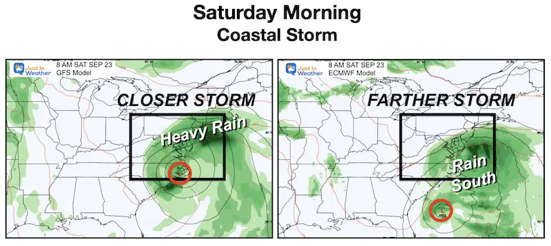
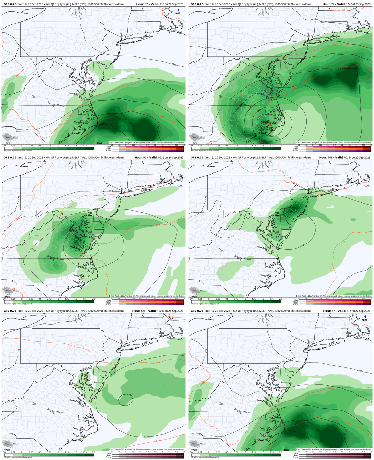
In my earlier report, I showed this comparison of the GFS (American) and ECMWF (European) Models. The story here is that the GFS has shown the storm to be closer, bringing more rain. The ECMWF has shown the storm much farther south and east.. missing our western areas and PA. This model update will arrive later today, and I will have it in my next report.
Note: The last tropical system and previous events have leaned in favor of the GFS, so I will continue to highlight it here.
COMPARING THE UPDATES
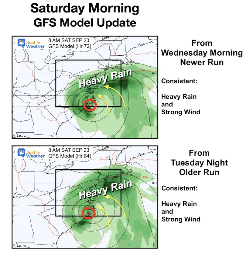
Here is the GFS Model run this morning (newer) compared to last night (older). We can see the consistency with Saturday morning, however, the bigger chance is Sunday.
Saturday Morning Model Trend
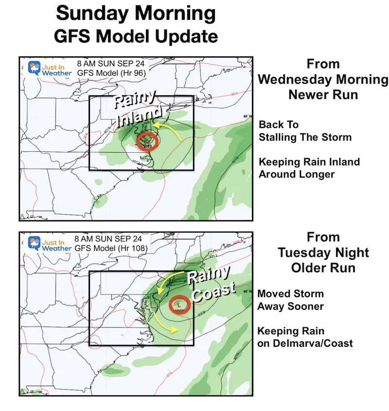
Sunday Morning Model Trend
This is back to stalling the Low Pressure and keeping the rain around an extra day. If this verifies, then showers and chilly winds may be around for the Ravens game.
Storm Animation: Thursday Morning to Sunday Morning
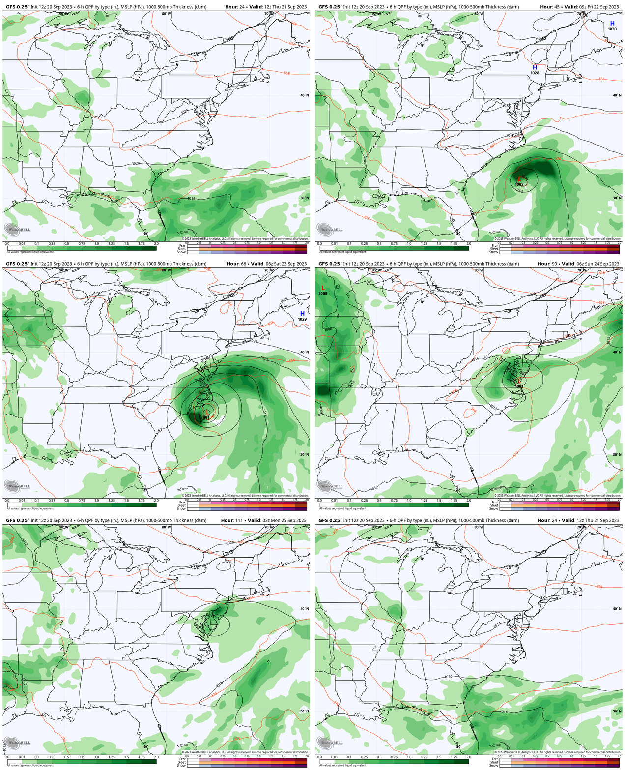
Closer Look Snapshots
The animation for this view is below.
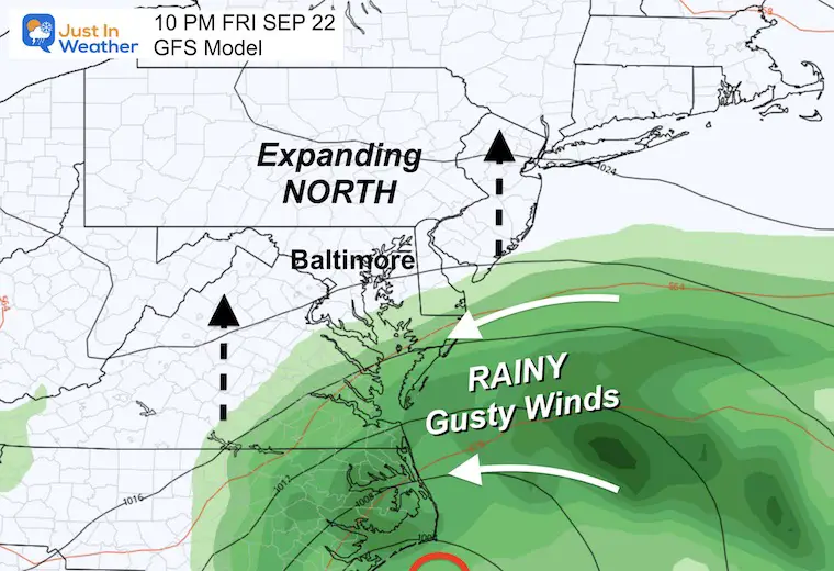
Friday Night
Rain reaches Southern Maryland by sunset and will continue to spread north overnight. The winds will be breezy all day bringing in clouds and keeping us chilly.
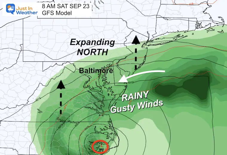
Saturday Morning
Steady rain will be falling in most of Maryland, but the northern edge may still be stuck near Hagerstown. In southern PA, there is a better chance for rain in York and the MD line less rain farther north near Harrisburg.
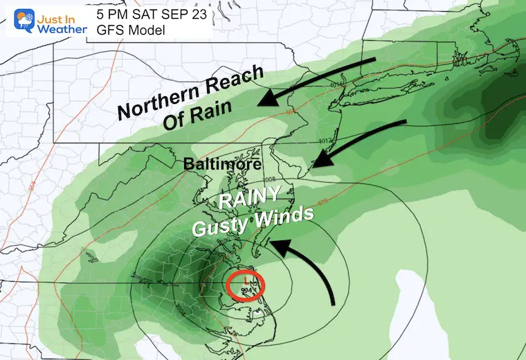
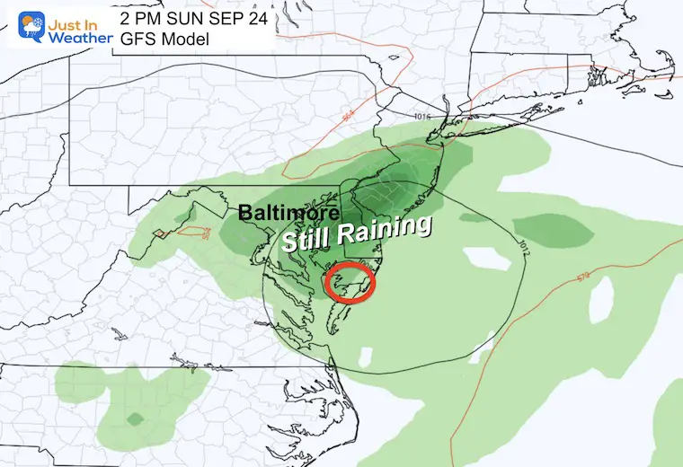
Saturday Afternoon
This may be the northernmost reach of the rain into central PA and western Maryland.
It will be a rainy, windy, blustery day in the rest of the Mid-Atlantic.
Sunday Morning
The suggestion here is that the stalling Low will confine the steady rain in Central Maryland, Delaware, and Eastern Virginia.
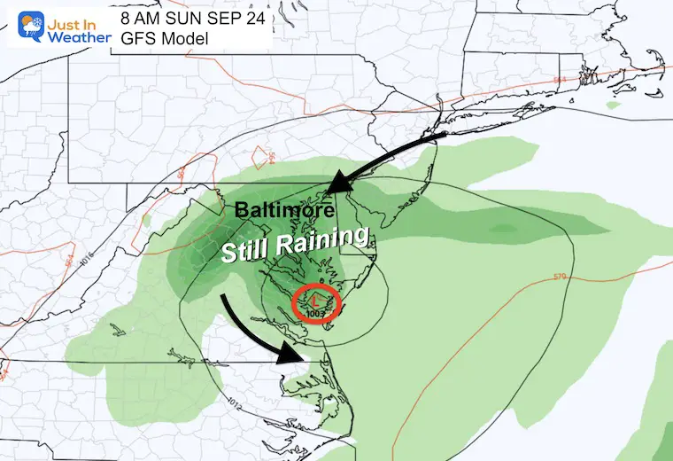
Sunday Afternoon
This is why we may need to keep the rain in the Ravens Game Day Forecast.
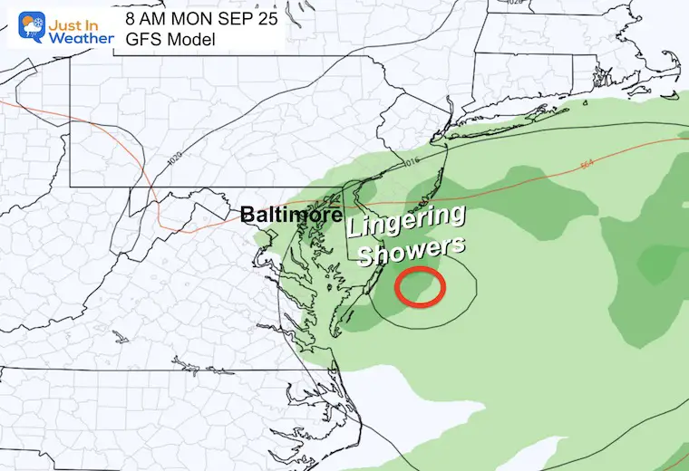
Monday Morning
This shows the storm finally fading and moving off the coast. This is a day later than the previous run I showed in my morning report.
Storm Animation: Friday Afternoon to Monday Afternoon
Surface Winds Forecast: Friday Morning To Sunday Night
This shows the core of Low Pressure in Southern Maryland.
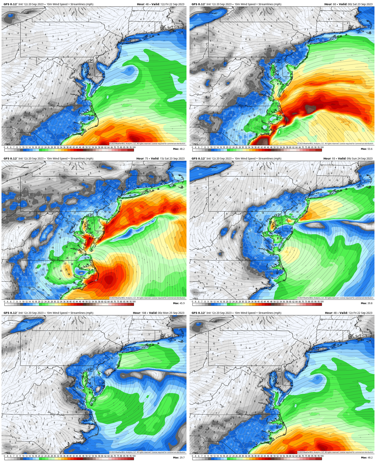
Saturday Afternoon Snapshot
Most areas in central Maryland to the coast will average 15 to 25 mph winds.
Peak GUSTS may be 35 to 45 mph… higher by the water.
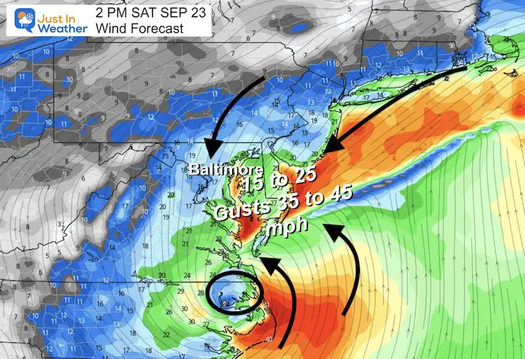
Sunday Afternoon Snapshot
Even if the rain tapers to showers or stops, the North wind will be chilly (for September), keeping us in the 60s. The winds may still gust to 35 mph.
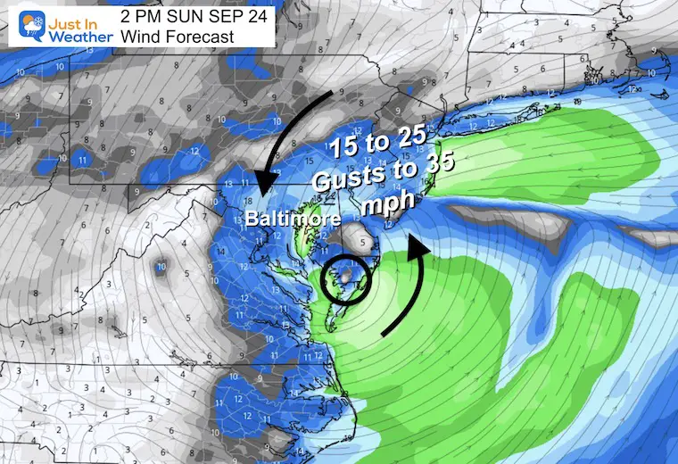
Potential Rainfall
A sharp cutoff with less rain west and north of Baltimore.
The heavier rain will be south and east, up to 5 inches or more in spots. This may lead to local flooding in Southeast VA and Southern Maryland to the Beaches.
Central areas will be in the 1 to 3-inch range. This also may produce some local flooding.
Extended Forecast
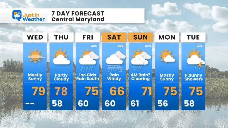
This is from my morning report. I did lower the rain chance on Sunday….
I should have added breezy for Friday and Sunday as well.
I am showing you this to highlight my thoughts to start the day, even though they conflict with the model shown here.
If I shift my Sunday forecast it will be based on more than just one model update. I will continue to look for consistency before making my adjustments. I just want to show you the main information I look at. There is a lot more that would take too long to present.
I will have my next update tonight.
New Reports:
El Niño Advisory: First Look At NOAA’s Winter Outlook Expectations
Winter Outlook 2024 From Two Farmers Almanacs
Return to Cold and Snow
Subscribe for eMail Alerts
Weather posts straight to your inbox
Sign up and be the first to know!
EARLIER IN AUGUST: Maryland Trek 10 For These Kids
I will have a follow-up and recap on our amazing week shortly.
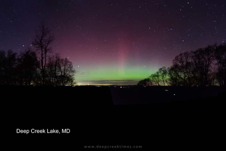
Aurora Photos From Maryland, Delaware, and Virginia
Please share your thoughts and best weather pics/videos, or just keep in touch via social media
-
Facebook: Justin Berk, Meteorologist
-
Twitter
-
Instagram
RESTATING MY MESSAGE ABOUT DYSLEXIA
I am aware there are some spelling and grammar typos and occasional other glitches. I take responsibility for my mistakes and even the computer glitches I may miss. I have made a few public statements over the years, but if you are new here, you may have missed it: I have dyslexia and found out during my second year at Cornell University. It didn’t stop me from getting my meteorology degree and being the first to get the AMS CBM in the Baltimore/Washington region. One of my professors told me that I had made it that far without knowing and to not let it be a crutch going forward. That was Mark Wysocki, and he was absolutely correct! I do miss my mistakes in my own proofreading. The autocorrect spell check on my computer sometimes does an injustice to make it worse. I also can make mistakes in forecasting. No one is perfect at predicting the future. All of the maps and information are accurate. The ‘wordy’ stuff can get sticky. There has been no editor who can check my work when I need it and have it ready to send out in a newsworthy timeline. Barbara Werner is a member of the web team that helps me maintain this site. She has taken it upon herself to edit typos when she is available. That could be AFTER you read this. I accept this and perhaps proves what you read is really from me… It’s part of my charm.
#FITF


