Severe Thunderstorm Watch Until 9 PM September 7
Thursday Afternoon Update
Shortly after my last update, The National Weather Service posted a Severe Thunderstorm Watch for much of our region. This is more validation for the potential that developing storms may be destructive. These may produce winds over 58 mph, hail over 1 inch in diameter, isolated tornados, or even flash flooding.
The area includes most of our region but does not promise we will all get something. The storm line has broken, and there are other individual cells. Basically, the storms are scattered, and not all of them will reach severe limits.
Live radar is the best tool now, as short-range models have underperformed. This high heat and humidity is fuel for very active and violent storms to pop-up.
The risk will increase and peak between 4 PM and 6 PM. Then, linger until 9 or 10 PM.
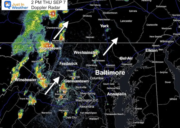
2 PM Doppler Radar
Storms were just getting active and closer to the central metro region.
Movement of the cells is to the North-Northeast. The line of activity is shifting to the East.
Live Interactive Radar and Lightning
See the set up and forecast maps below.
SEVERE WEATHER ALERTS Reminder:
A Watch may be indued for a broad area. This would be for higher POTENTIAL of severe storms. NOT A PROMISE
A Warning is issued for active storms in progress. These will be tracked for 45 minutes or so across counties and specific towns in the path.
Severe Thunderstorm Watch
Storms may produce winds over 58 mph, hail over 1 inch in diameter, isolated tornados, or even flash flooding.
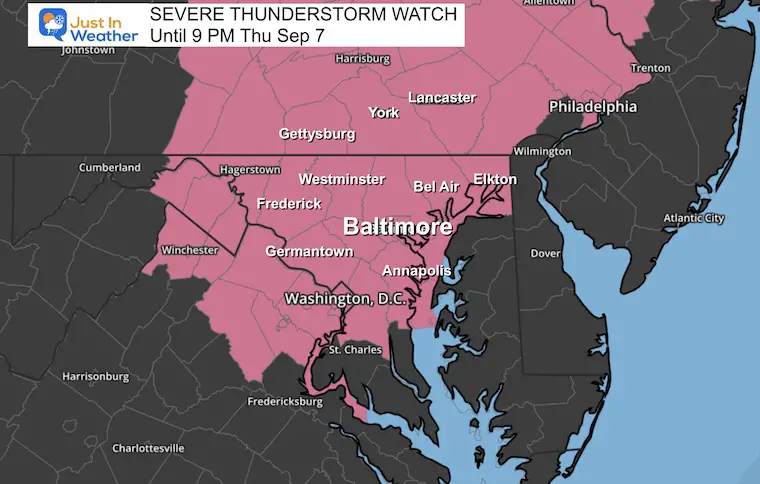
Counties Include
MARYLAND COUNTIES INCLUDED ARE
ANNE ARUNDEL BALTIMORE County and City CARROLL
CECIL FREDERICK HARFORD
HOWARD MONTGOMERY PRINCE GEORGES
WASHINGTON
PENNSYLVANIA COUNTIES INCLUDED ARE
ADAMS BERKS BRADFORD
BUCKS CARBON CENTRE
CHESTER CLINTON COLUMBIA
CUMBERLAND DAUPHIN FRANKLIN
FULTON HUNTINGDON JUNIATA
LACKAWANNA LANCASTER LEBANON
LEHIGH LUZERNE LYCOMING
MIFFLIN MONROE MONTGOMERY
MONTOUR NORTHAMPTON NORTHUMBERLAND
PERRY PHILADELPHIA PIKE
SCHUYLKILL SNYDER SULLIVAN
SUSQUEHANNA TIOGA UNION
WAYNE WYOMING YORK
VIRGINIA COUNTIES INCLUDED ARE
ARLINGTON CLARKE FAIRFAX
FAUQUIER FREDERICK LOUDOUN
PRINCE WILLIAM
VIRGINIA INDEPENDENT CITIES INCLUDED ARE
ALEXANDRIA FAIRFAX FALLS CHURCH
MANASSAS MANASSAS PARK WINCHESTER
Record Reminder: After 4 days in a row with record high temperatures, at least we will miss the mark today. That was 101ºF set in 1881 and the hottest September day on record for Baltimore. But it’s still hot and humid.
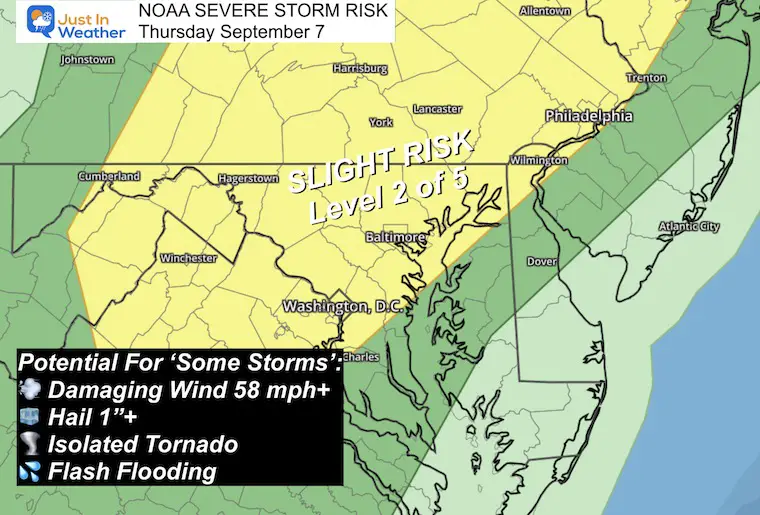
NOAA Severe Storm Risk
This Slight Risk is Level 2 of 5. It is potential and NOT a promise. There will be scattered thunderstorms, some of which may reach severe levels.
These may produce winds over 58 mph, hail over 1 inch in diameter, isolated tornados, or even flash flooding.
Model Assessments
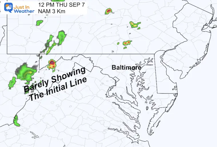
NAM 3K Model At Noon
Compared to the Doppler Snapshot Above: This was the best performer and still missed most of the initial storm line. This gives an indication that the forecasting will be underplayed.
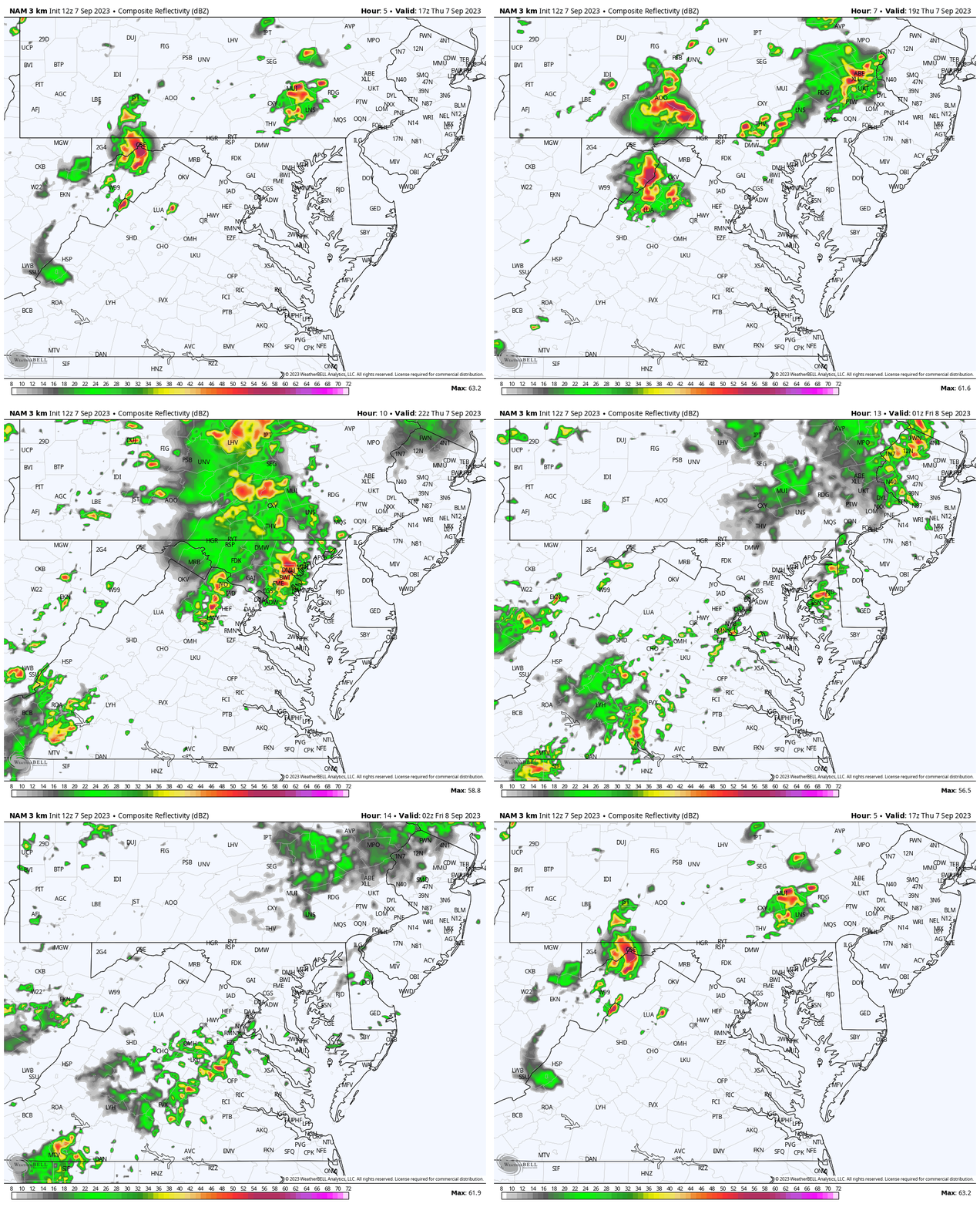
NAM Model Animation: 1 PM to 10 PM
Here we see the flare-up of activity this afternoon.
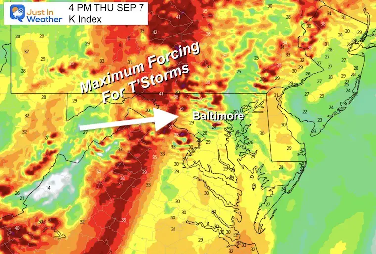
K Index at 4 PM
This shows the maximum forcing for developing storms in the mountains and pushing east, working on the maximum heating.
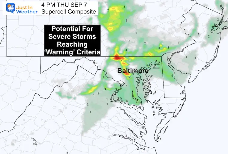
Supercell Composite at 4 PM
I find this interesting where there is a highlight just west and north of Baltimore around the Carroll County and York County PA lines.
This suggests the top potential for severe storms that could contain damaging winds, large hail, and possibly a quick spin-up tornado.
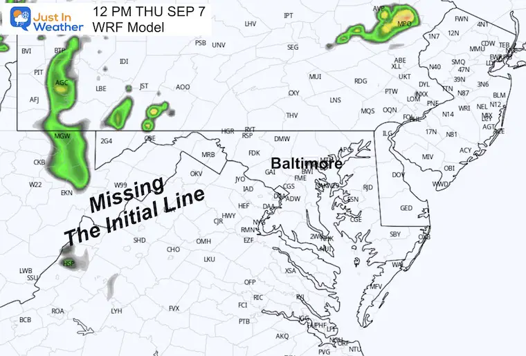
WRF Model At Noon
Compared to the Doppler Snapshot Above: This one missed even more of the initial activity.
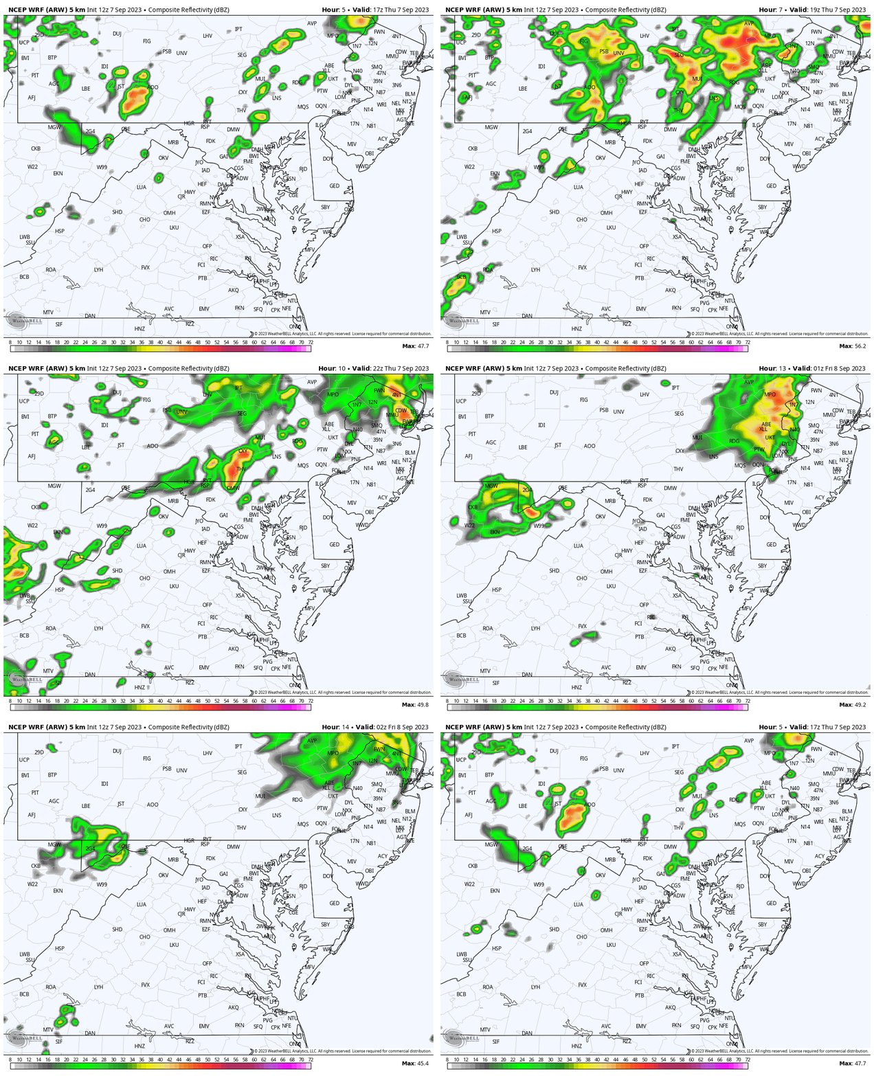
WRF Model Animation: 1 PM to 10 PM
Also underplaying, but still projects a very active afternoon, mainly west and north of Baltimore.
Looking Ahead
Storms Breaking The Heat
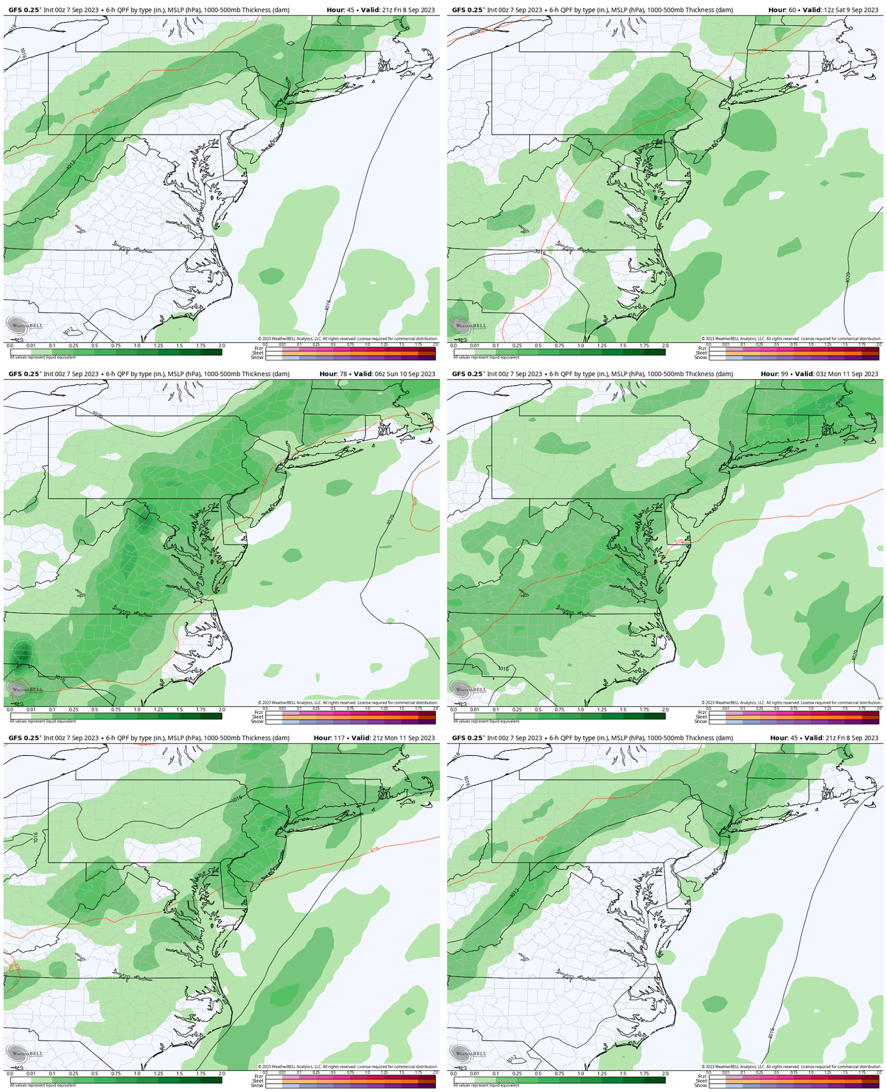
Rain Forecast Friday to Monday
Increased chance for daily storms, especially in the afternoon and evenings through Monday.
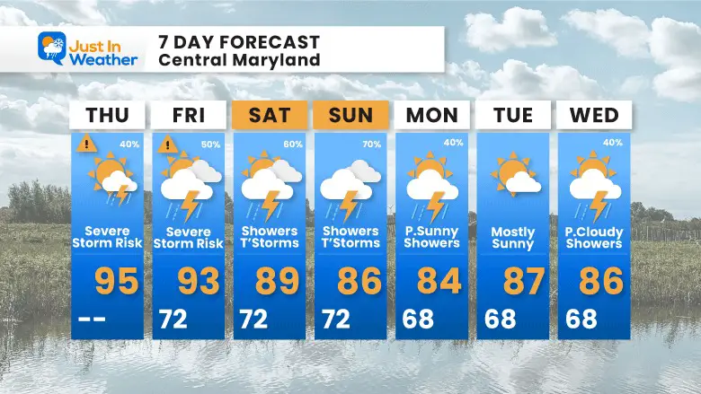
7 Day Forecast
While still hot and more humid, we will miss today’s record AND introduce some thunderstorms. The risk of rain and storms will increase through the weekend.
EXPLORE MORE
2023 Hurricane Season Forecast With An El Niño Watch
EARLIER IN AUGUST: Maryland Trek 10 For These Kids
I will have a follow-up and recap on our amazing week shortly.
Subscribe for eMail Alerts
Weather posts straight to your inbox
Sign up and be the first to know!
La Niña Has Ended. El Niño May Return By Fall
Aurora Photos From Maryland, Delaware, and Virginia
Please share your thoughts and best weather pics/videos, or just keep in touch via social media
-
Facebook: Justin Berk, Meteorologist
-
Twitter
-
Instagram
RESTATING MY MESSAGE ABOUT DYSLEXIA
I am aware there are some spelling and grammar typos and occasional other glitches. I take responsibility for my mistakes and even the computer glitches I may miss. I have made a few public statements over the years, but if you are new here, you may have missed it: I have dyslexia and found out during my second year at Cornell University. It didn’t stop me from getting my meteorology degree and being the first to get the AMS CBM in the Baltimore/Washington region. One of my professors told me that I had made it that far without knowing and to not let it be a crutch going forward. That was Mark Wysocki, and he was absolutely correct! I do miss my mistakes in my own proofreading. The autocorrect spell check on my computer sometimes does an injustice to make it worse. I also can make mistakes in forecasting. No one is perfect at predicting the future. All of the maps and information are accurate. The ‘wordy’ stuff can get sticky. There has been no editor who can check my work when I need it and have it ready to send out in a newsworthy timeline. Barbara Werner is a member of the web team that helps me maintain this site. She has taken it upon herself to edit typos when she is available. That could be AFTER you read this. I accept this and perhaps proves what you read is really from me… It’s part of my charm.
#FITF


