August 15 Weather Shifts Severe Storm Risk From NOAA To Mid Atlantic Coast
August 15, 2023
Tuesday Morning Update
We are still under the warm and humid air mass, but a larger storm system is moving east to sweep that away. While central Maryland may still get some thunderstorms today, the energy will be focused more south and east. This highlights Southern Maryland and Southern Delmarva with the risk for storms to turn severe.
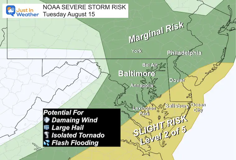
NOAA Severe Storm Risk
The outlook today has the highlight in extreme southern Maryland and the lower half of Delmarva. Level 2: Slight Risk. This means there will be widespread storms and some, NOT ALL, may turn severe. The potential is for:
- Winds to gust over 60 mph
- Hail to reach 1 inch diameter
- Tornadoes are possible
- Flash Flooding in localized storm cells.
Compare the Live Radar Widget to the simulations below.
Morning Surface Weather
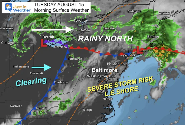
We are still watching Low Pressure from the Ohio Valley moving east. A broad area of rain extends from the Great Lakes through central New York and New England.
Here in the Mid-Atlantic, we remain in the warm and unstable air mass, with subtle boundaries that may help ignite clusters of storms later today.
The highest chance for strong winds, hail, and tornadoes will be between 3 PM and 8 PM.
Live Radar Widget
This will become more active mid-afternoon through evening… Compare to the model simulations below.
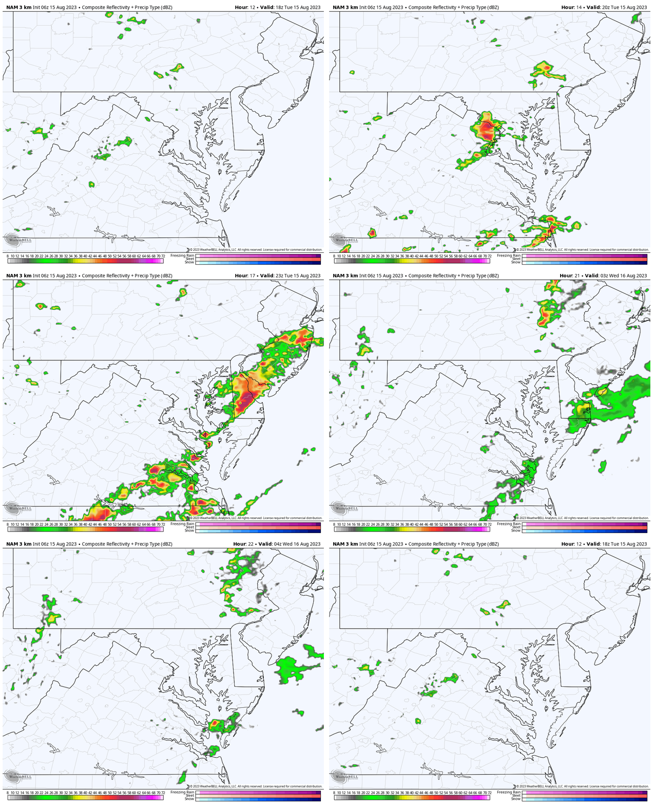
Radar Simulations
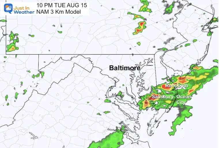
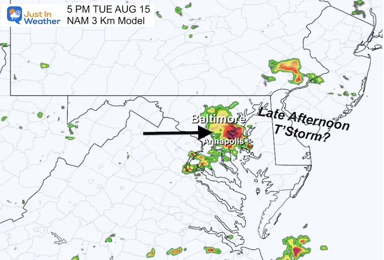
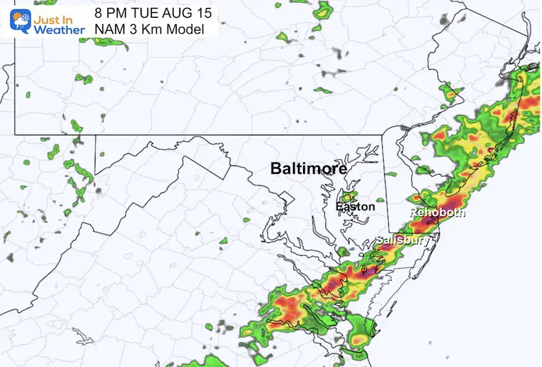
I still have low confidence in the fine-tuned accuracy of these models lately. They are a guide and simply that. We have often seen storms erupt a little earlier, track a little faster, and become more widespread than shown here.
Compare these different solutions with the LIVE Radar Widget above.
NAM 3 Km Model
12 PM to Midnight
5 PM Snapshot
8 PM Snapshot
10 PM Snapshot
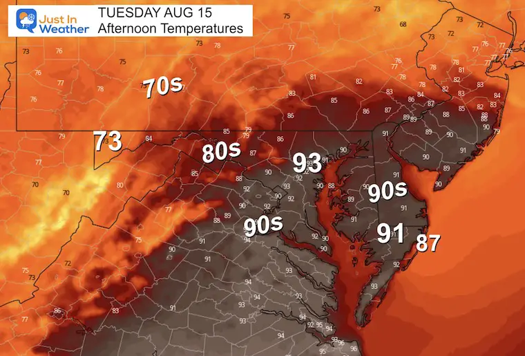
Afternoon Temperatures
Most areas will be near seasonal norms under plenty of sunshine.
Subscribe for eMail Alerts
Weather posts straight to your inbox
Sign up and be the first to know!
Weather posts straight to your inbox
Sign up and be the first to know!
EXPLORE MORE
2023 Hurricane Season Forecast With An El Niño Watch
CLIMATE DATA
TODAY August 15
Normal Low in Baltimore: 67ºF
Record 49ºF in 1964
Normal High in Baltimore: 87ºF
Record 103ºF 1988
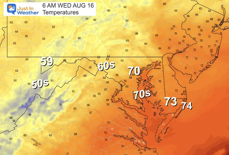
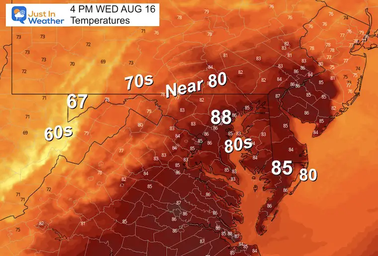
Wednesday
The new air mass will be expanding with lower humidity and more sunshine.
Morning Temperatures
Afternoon Temperatures
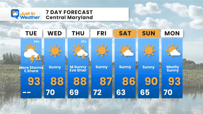
7 Day Forecast
After today’s storm system passes through, most of the rest of this week looks quiet. We may see some late day or nighttime showers on Tuesday, then a pocket of cooler weather will arrive to end the work week. The morning lows in the lower 60s seen here represent metro areas in central Maryland. Inland may easily drop into the 50s.
LAST WEEK: Maryland Trek 10 For These Kids
I will have a follow-up and recap on our amazing week shortly.
Subscribe for eMail Alerts
Weather posts straight to your inbox
Sign up and be the first to know!
EXPLORE MORE
2023 Hurricane Season Forecast With An El Niño Watch
La Niña Has Ended. El Niño May Return By Fall
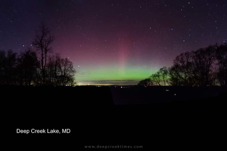
Aurora Photos From Maryland, Delaware, and Virginia
Please share your thoughts, and best weather pics/videos, or just keep in touch via social media
-
Facebook: Justin Berk, Meteorologist
-
Twitter
-
Instagram
RESTATING MY MESSAGE ABOUT DYSLEXIA
I am aware there are some spelling and grammar typos and occasional other glitches. I take responsibility for my mistakes, and even the computer glitches I may miss. I have made a few public statements over the years, but if you are new here you may have missed it: I have dyslexia, and found out during my second year at Cornell University. It didn’t stop me from getting my meteorology degree and being the first to get the AMS CBM in the Baltimore/Washington region. One of my professors told me that I had made it that far without knowing, and to not let it be a crutch going forward. That was Mark Wysocki and he was absolutely correct! I do miss my mistakes in my own proofreading. The autocorrect spell check on my computer sometimes does an injustice to make it worse. I also can make mistakes in forecasting. No one is perfect at predicting the future. All of the maps and information are accurate. The ‘wordy’ stuff can get sticky. There has been no editor that can check my work when I needed it and have it ready to send out in a newsworthy timeline. Barbara Werner is a member of the web team that helps me maintain this site. She has taken it upon herself to edit typos when she is available. That could be AFTER you read this. I accept this and perhaps proves what you read is really from me… It’s part of my charm.
#FITF


