August 1, 2023
Tuesday Morning Update
This new month almost feels like a new season. If you liked the weather yesterday, you will love today. If you were at the beaches with the eruptions of strong afternoon storms, today’s weather will be much calmer.
High Pressure is settling in and allowing the cooler/calmer air to dominate for a few days.
Temps will warm later this week with the return of afternoon or evening thunderstorms.
Yesterday Morning
If you missed this, a waterspout was spotted in Crisfield (Southern Maryland) around sunrise!
Monday Afternoon at Ocean City
A large Shelf Cloud Invaded the beaches
More Photos
This Morning’s Temperatures
The cooler air (50s) has reached into central and parts of Maryland. Farther inland there have been some 40s showing up in sheltered valleys.
The 60s and even near 70ºF has been limited to the shoreline influence from the warmer water.

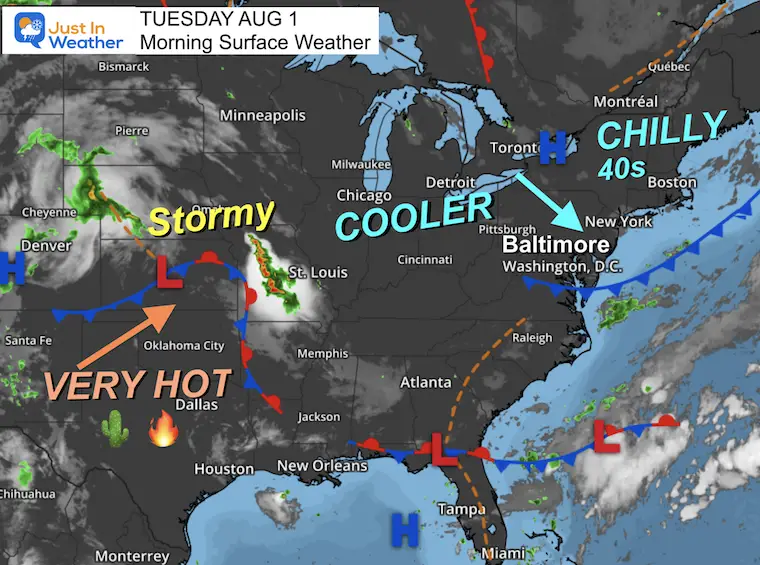
Morning Surface Weather
High Pressure and a very pleasant supply of cooler air have made the morning even chillier across parts of PA into New England.
Our region has a cool and comfortable morning… and a few pleasant days ahead.
Extreme heat remains in the south-central US where temps in much of Texas will surpass 100ºF.
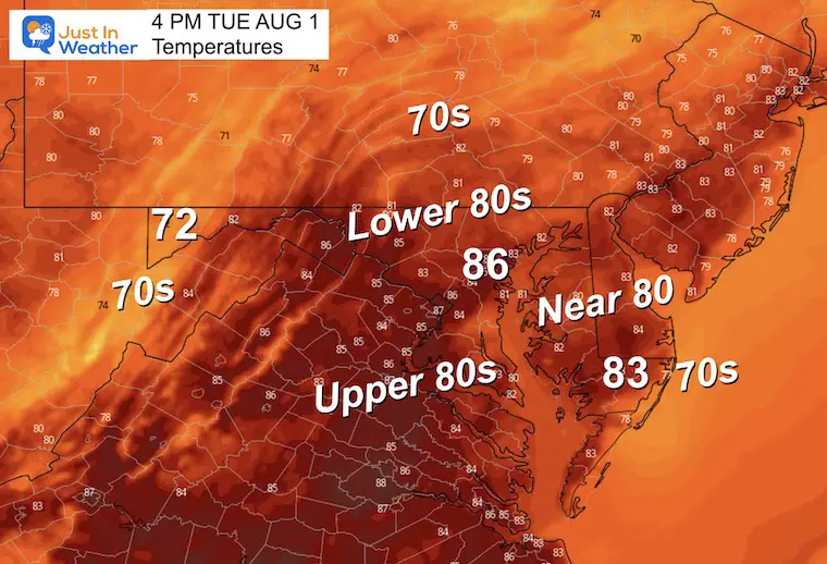
Afternoon Temperatures
Noticeably cooler and closer to average expectations.
EXPLORE MORE
Subscribe for eMail Alerts
CLIMATE DATA
TODAY August 1
Normal Low in Baltimore: 68ºF
Record 57ºF in 1885
Normal High in Baltimore: 88ºF
Record 101ºF 2006
Wednesday Weather
More like early September!
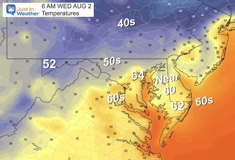
Morning Temperatures
A bit of chill in the air. The limited mild areas will be the urban heat island and bay areas.
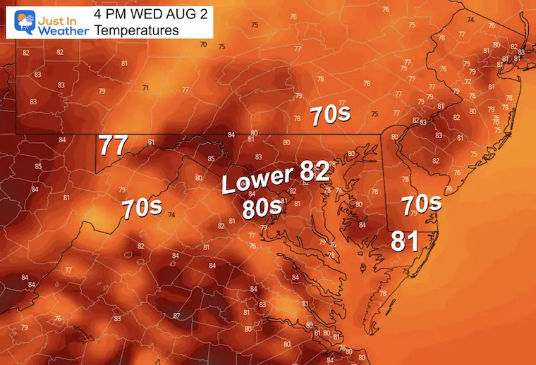
Afternoon Temperatures
Cooler than average and simply pleasant.
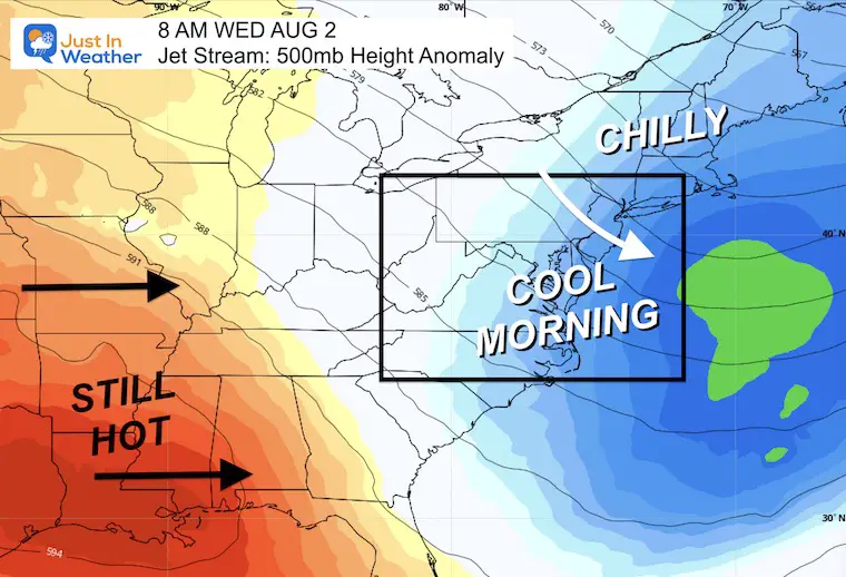
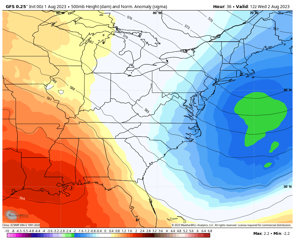
Jet Stream Snapshot Wednesday
The dominant airflow for the Eastern US will continue from the North sourced in Eastern Canada. This will keep us on the cooler trend for another few days.
Jet Stream Animation Wednesday Through Monday
Cool airflow dominates the week, then we will watch it modify along with warmer air and more showers into next weekend.
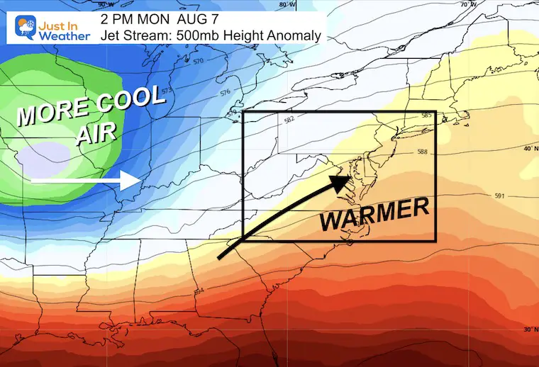
Jet Stream Snapshot Monday
The return of some summer heat will bring us close to 90ºF early next week… but nothing extreme! This will come with more humidity and expected thunderstorms.
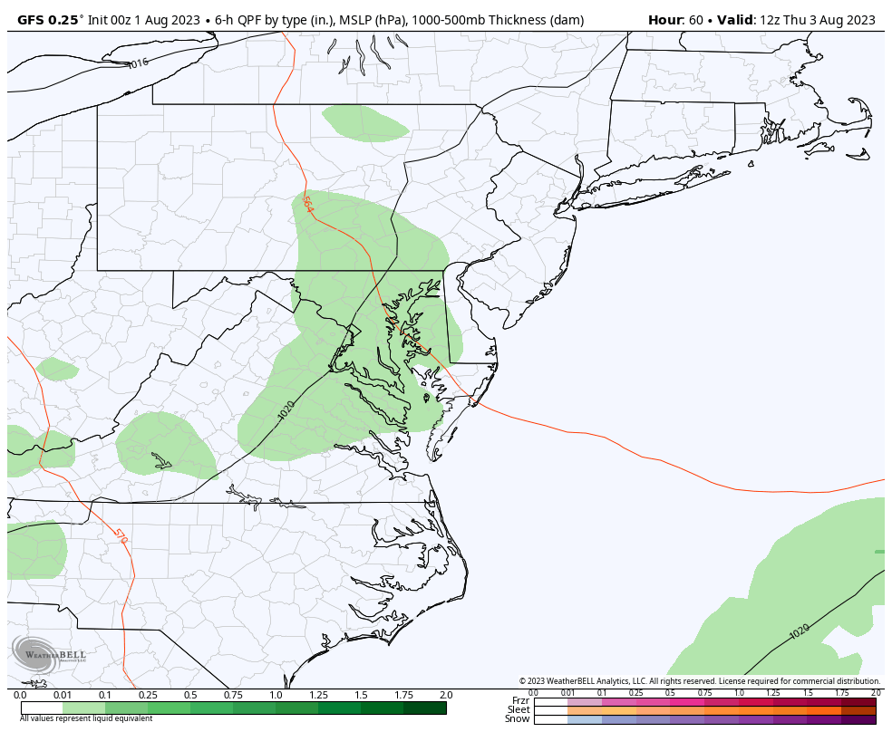
Rain Forecast Thursday to Monday
Increasing showers and thunderstorms to end the work week, and again on Monday. The weekend is not showing more dry days, an abrupt change. I did not trust the washout shown earlier, but still remain skeptical we remain this quiet as well.
5 Days From Today!
These are the kids…
The 10th Maryland Trek starts Sunday, August 6. I will be hiking and biking 329 miles with my team during a 7-day stretch to honor kids in cancer treatment. I will be forecasting daily but in a limited scope.
I hope you will consider supporting our mission and holistic programs at Just In Power Kids. Click the image to donate.

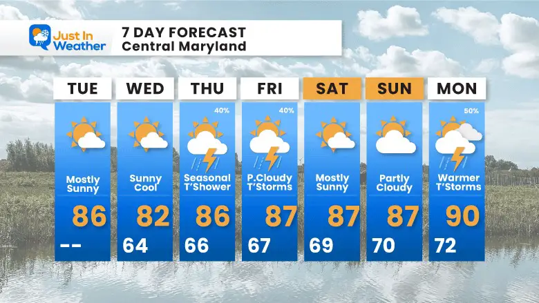
7 Day Forecast
The overall pattern looks to remain near below-average with temperatures. The warm-up will bring us some heat early next week, but it may not last long.
At this point, the best days for showers will be Thursday and Friday evenings, then again on Monday.
Subscribe for eMail Alerts
EXPLORE MORE

Please share your thoughts, and best weather pics/videos, or just keep in touch via social media
RESTATING MY MESSAGE ABOUT DYSLEXIA
I am aware there are some spelling and grammar typos and occasional other glitches. I take responsibility for my mistakes, and even the computer glitches I may miss. I have made a few public statements over the years, but if you are new here you may have missed it: I have dyslexia, and found out during my second year at Cornell University. It didn’t stop me from getting my meteorology degree, and being the first to get the AMS CBM in the Baltimore/Washington region. One of my professors told me that I had made it that far without knowing, and to not let it be a crutch going forward. That was Mark Wysocki and he was absolutely correct! I do miss my mistakes in my own proofreading. The autocorrect spell check on my computer sometimes does an injustice to make it worse. I also can make mistakes in forecasting. No one is perfect predicting the future. All of the maps and information are accurate. The ‘wordy’ stuff can get sticky. There has been no editor that can check my work when I needed it and have it ready to send out in a newsworthy timeline. Barbara Werner is a member of the web team that helps me maintain this site. She has taken it upon herself to edit typos, when she is able. That could be AFTER you read this. I accept this and perhaps proves what you read is really from me… It’s part of my charm.
#FITF


