July 28 Excessive Heat Warning Then Storms Break Pattern Tomorrow
July 28, 2023
Friday Morning Update
The temperatures have verified just a little lower than forecast. So while we are still in a heat wave and it is uncomfortable, there will be no challenge to the local record high today, but it will feel like it.
On this date in 1941, Baltimore hit 103ºF (at what was then called Friendship Airport). Today is expected to top out in the upper 90s with a heat index in the 100s.
Often these patterns get delayed, and this may last one more day. Then we will track strong to severe storms Saturday and a refreshing cooler air mass Sunday into next week.
Weather Alerts
Excessive Heat Warning
Temperatures appear to max out in the upper 90s for most of our region, with some areas near 100ºF farther inland and across northern Virginia.
However, the humidity will make it FEEL LIKE over 105ºF where the ‘warning’ is issued.
This includes much of metro Baltimore, Annapolis, Washington, and the lower Eastern Shore of Maryland.
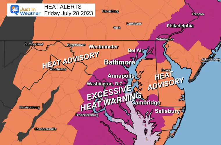
Morning Surface Weather
Today should be the peak of the heat AND humidity, with a lower risk for storms. A few may pop up, but nothing widespread. We will get the increased threat of storms tomorrow to end the heat wave.
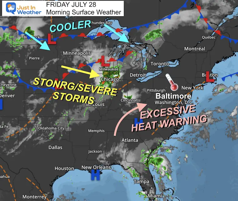
Afternoon Temperatures
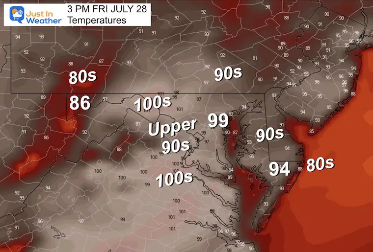
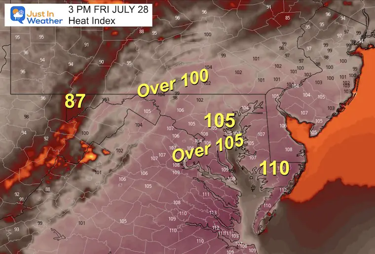
Heat Index
The combination of heat and humidity will make it feel like 105ºF or hotter in those areas under the ‘warning’.
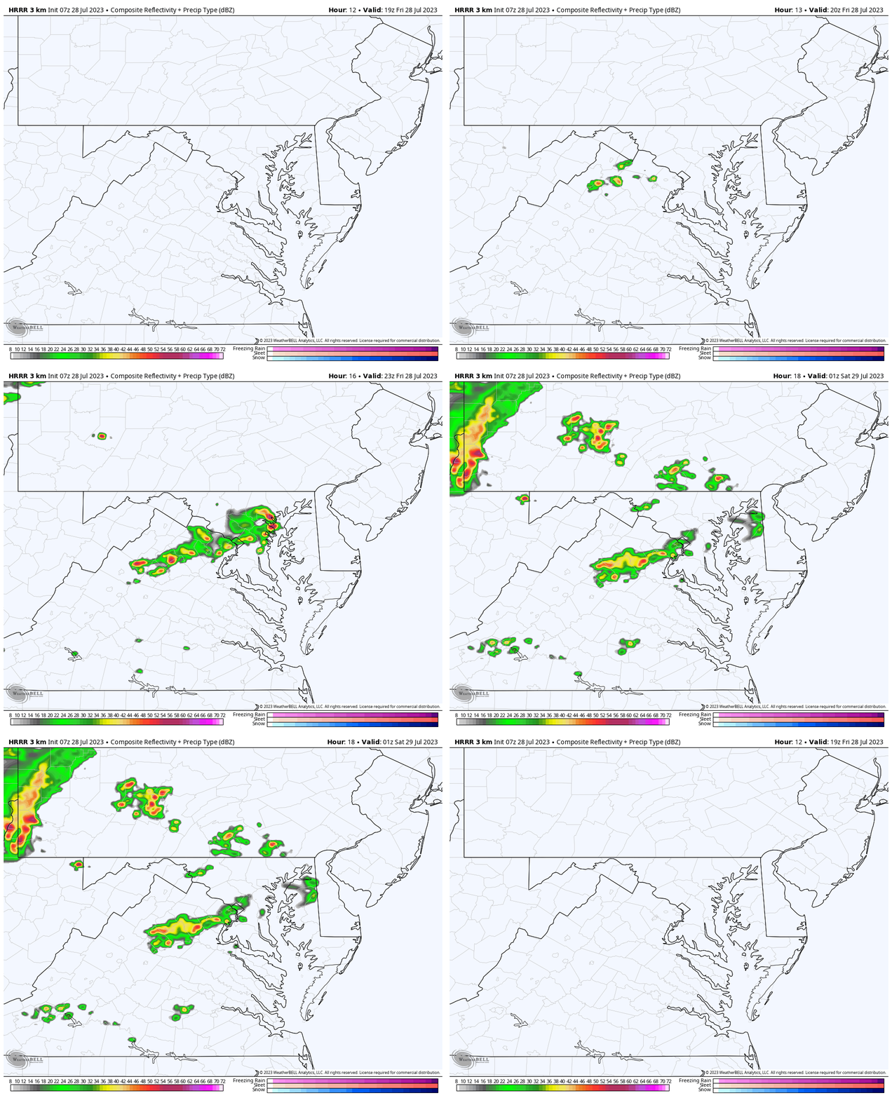
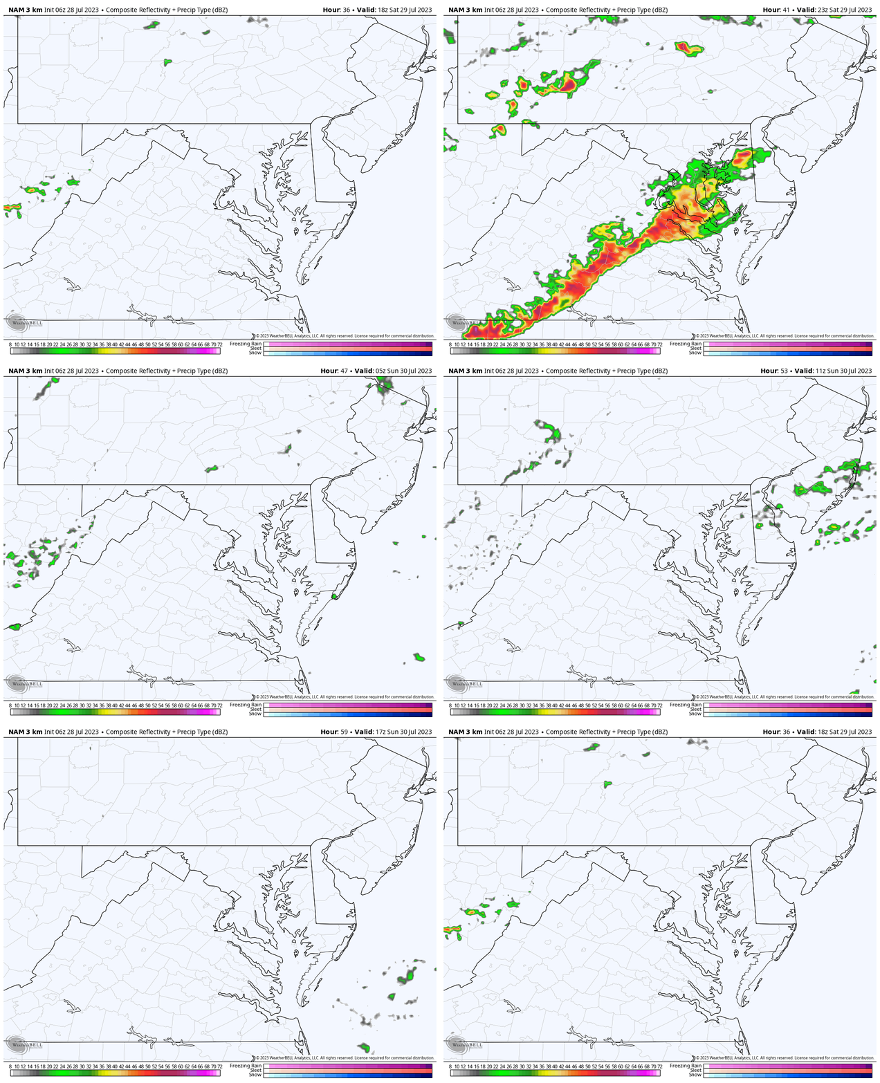
Radar Simulation
3 PM to 9 PM – There may be some spotty showers, mainly west of the Chesapeake Bay.
EXPLORE MORE
2023 Hurricane Season Forecast With An El Niño Watch
Drought Report
Subscribe for eMail Alerts
Weather posts straight to your inbox
Sign up and be the first to know!
CLIMATE DATA
TODAY July 28
Normal Low in Baltimore: 68ºF
Record 54ºF in 1962
Normal High in Baltimore: 88ºF
Record 103ºF 1941
Saturday Weather
The heat looks to last one extra day, but we did discuss this as a possibility.
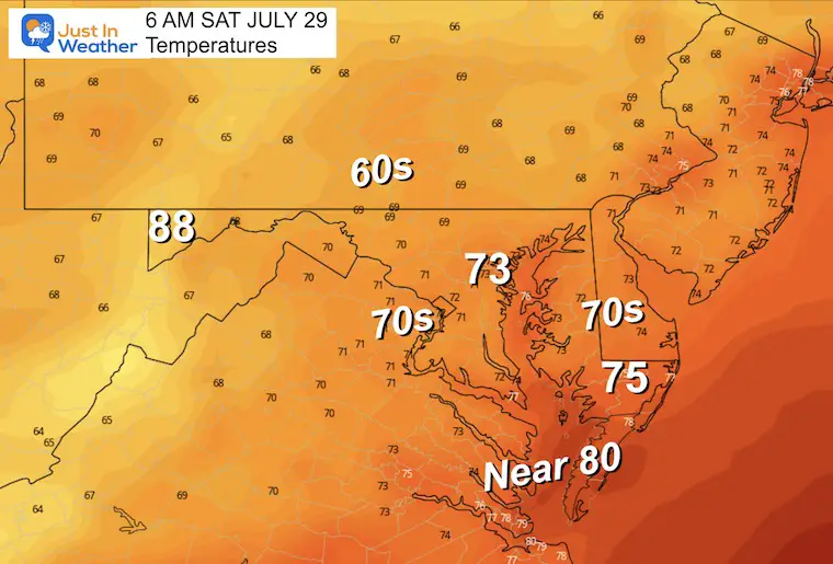
Morning Temperatures
Warm and muggy!
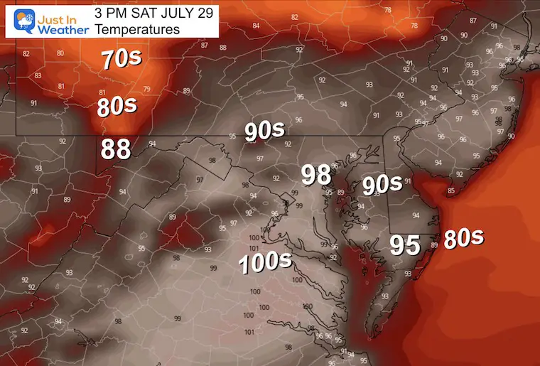
Afternoon Temperatures
Temps in the upper 90s with Heat Index over 100ºF.
Radar Simulation
Again. This product is a SUGGESTION and IS NOT PERFECT!
It looks like a line of strong to severe storms will form mid-afternoon to evening.
NOAA has our region in the Slight Risk (Level 2) for storms to turn severe.
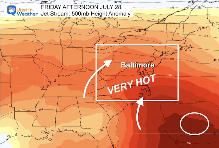
Jet Stream
Today: Heat Wave With Strong Ridge Off The Southeast US Coast
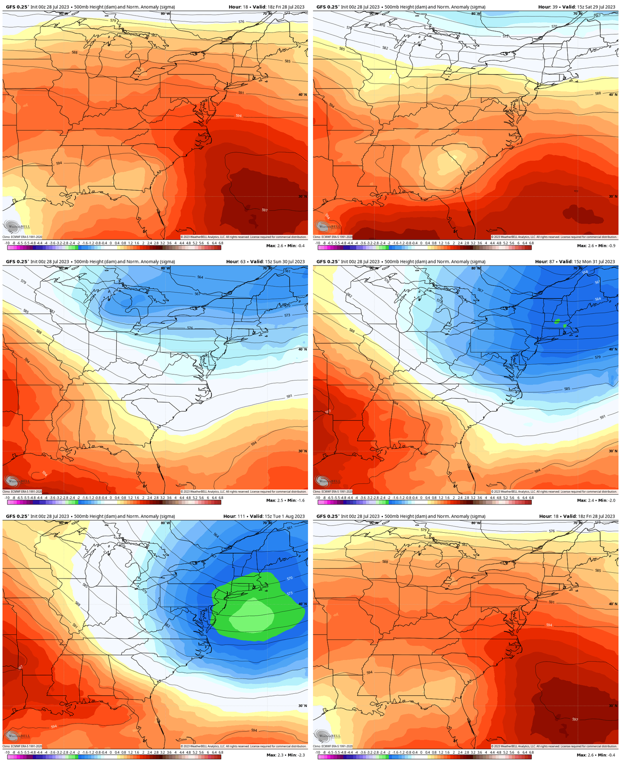
Jet Stream Animation Through Monday
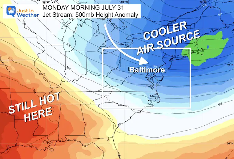
A notable shift in the upper-level winds as the heat will be replaced by cooler air from Canada early next week.
Monday: Noticeably Cooler
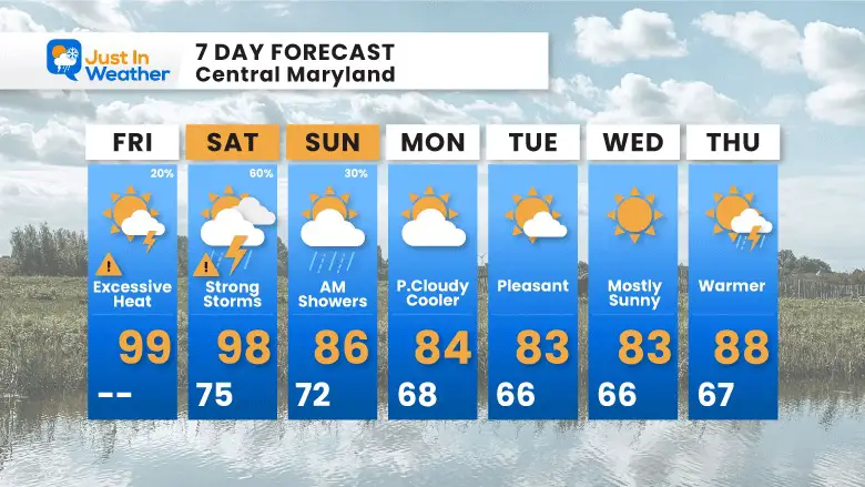
7 Day Forecast
This heat wave will last another day. The 90s last into Saturday as storms will move in later in the evening or at night. Then linger on Sunday as cooler air dominates most of next week.
Subscribe for eMail Alerts
Weather posts straight to your inbox
Sign up and be the first to know!
EXPLORE MORE
2023 Hurricane Season Forecast With An El Niño Watch
La Niña Has Ended. El Niño May Return By Fall
Aurora Photos From Maryland, Delaware, and Virginia
Please share your thoughts, and best weather pics/videos, or just keep in touch via social media
-
Facebook: Justin Berk, Meteorologist
-
Twitter
-
Instagram
RESTATING MY MESSAGE ABOUT DYSLEXIA
I am aware there are some spelling and grammar typos and occasional other glitches. I take responsibility for my mistakes, and even the computer glitches I may miss. I have made a few public statements over the years, but if you are new here you may have missed it: I have dyslexia, and found out during my second year at Cornell University. It didn’t stop me from getting my meteorology degree and being the first to get the AMS CBM in the Baltimore/Washington region. One of my professors told me that I had made it that far without knowing, and to not let it be a crutch going forward. That was Mark Wysocki and he was absolutely correct! I do miss my mistakes in my own proofreading. The autocorrect spell check on my computer sometimes does an injustice to make it worse. I also can make mistakes in forecasting. No one is perfect at predicting the future. All of the maps and information are accurate. The ‘wordy’ stuff can get sticky. There has been no editor that can check my work when I needed it and have it ready to send out in a newsworthy timeline. Barbara Werner is a member of the web team that helps me maintain this site. She has taken it upon herself to edit typos when she is able. That could be AFTER you read this. I accept this and perhaps proves what you read is really from me… It’s part of my charm.
#FITF


