July 24 Morning Storms Missed By Most Models Then Developing Our Heat Wave
July 24, 2023
Monday Morning Update
This morning brought a cluster of thunderstorms to central Maryland. This was originally expected mid day, and yet what should have been more expected was the poor performance of the short-range model forecasts.
We are expecting a true heat wave to surge this week, but before we get to that I want to identify what happened this morning.
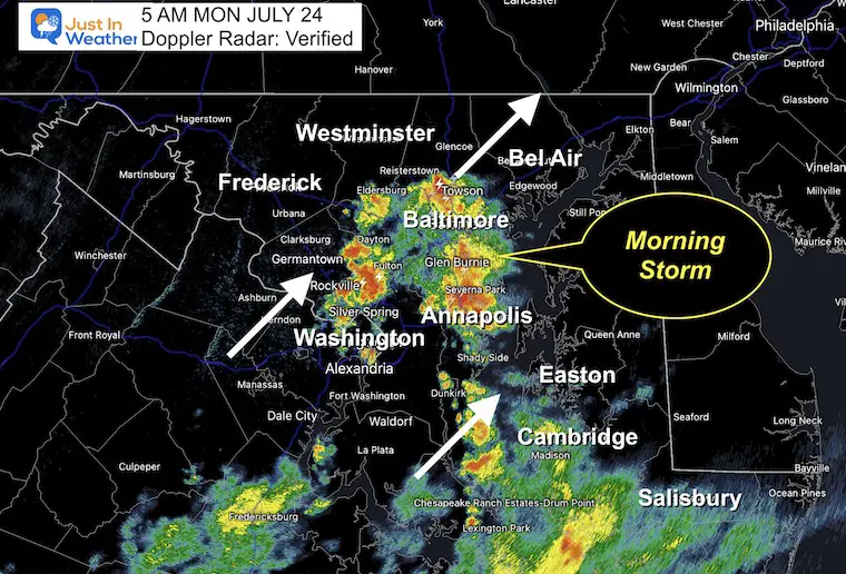
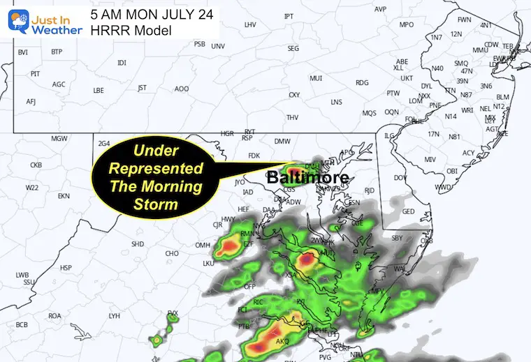
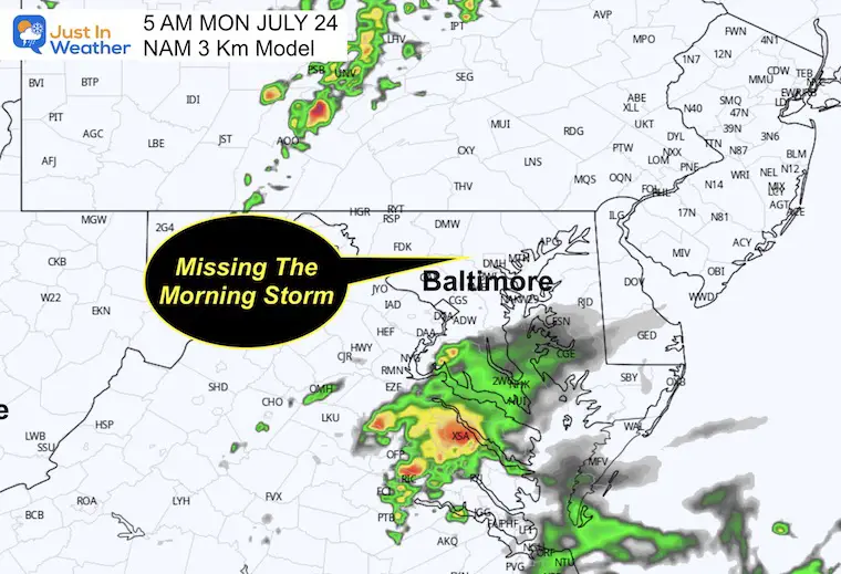
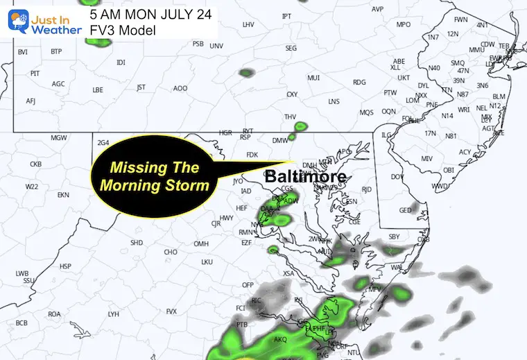
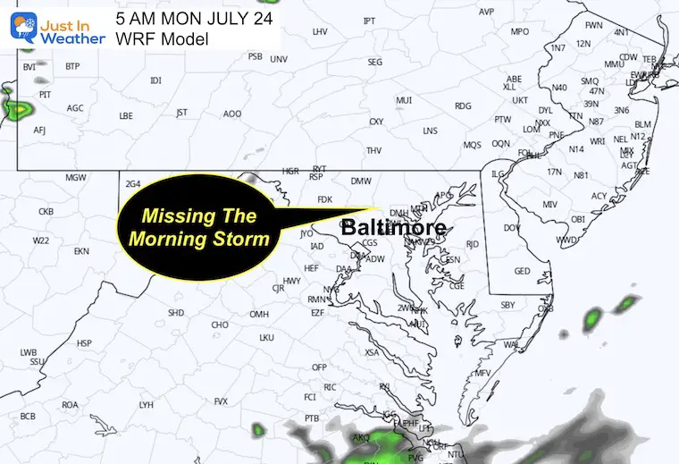
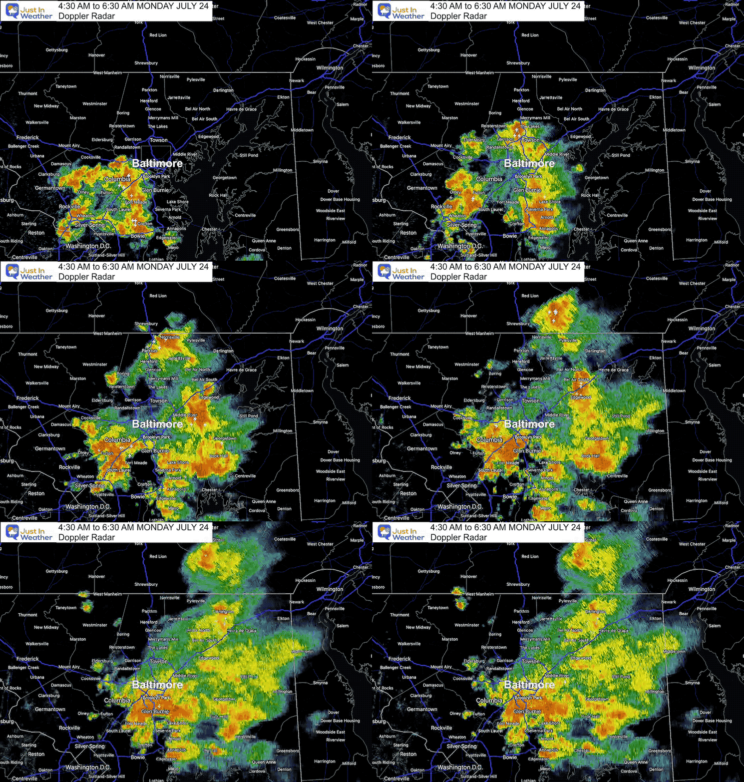
At 5 AM, Doppler Radar showed the flare-up of a cluster of thunderstorms moving to the North-Northeast. Below I want to show you the snapshot at that time and compare it to 4 short range model forecasts from just a few hours earlier. They ALL Missed this, with the only caveat of one model suggesting something was going to happen. Why mention this? Because looking ahead, I have low confidence in the precision of more showers today AND timing out more storms in a few days. The best we can do with this environment is to give a more broad suggestion for the pattern.
5 AM Doppler Radar Observation
Lightning and thunder were observed before sunrise from the Washington DC suburbs through Annapolis and metro Baltimore. Rain extended through southern Maryland and Virginia and was moving to the north.
5 AM Snapshots: Model Forecasts
HRRR
This was the closest to suggesting a storm around Baltimore, but it underplayed.
NAM 3 KM
Missing the storm cluster.
FV3
Missing the storm cluster.
WRF
Missing the storm cluster.
Radar Recap
See the storm blossom across metro Baltimore early this morning.
Live Radar and Lightning Widget
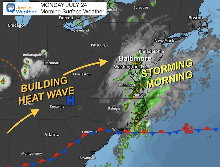
Morning Surface Weather
The cluster of storms is part of a subtle disturbance. It is not well defined, other than the flare-up of activity this morning. What it does mark is the leading edge of the next air mass and building heat wave about to move in.
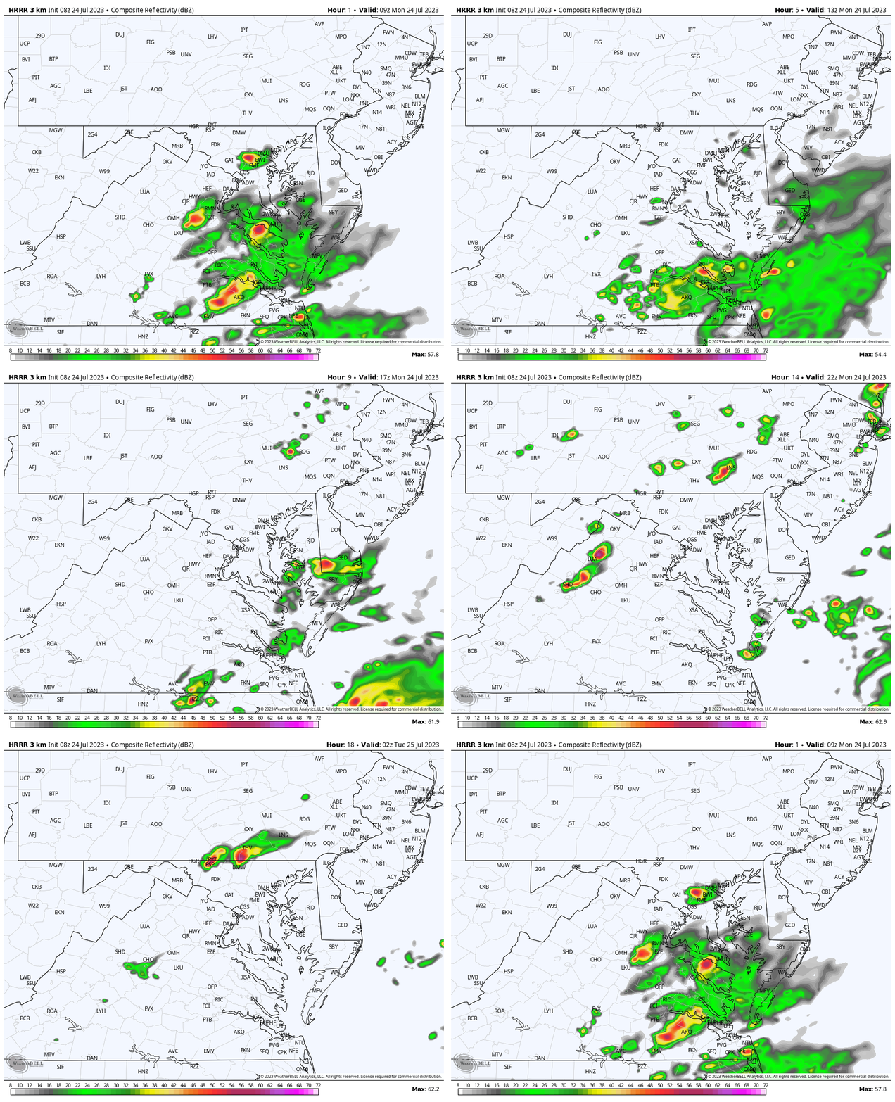
Forecast Radar to 10 PM
As I mentioned before, I do NOT trust or have high confidence in this product. So we use this as a suggestion. The best I can suggest from this is that the morning storms will move out, but we will have more pop up this afternoon and through this evening.
No promises where you live, just keep an eye out for new cells to pop up any time after 2 PM.
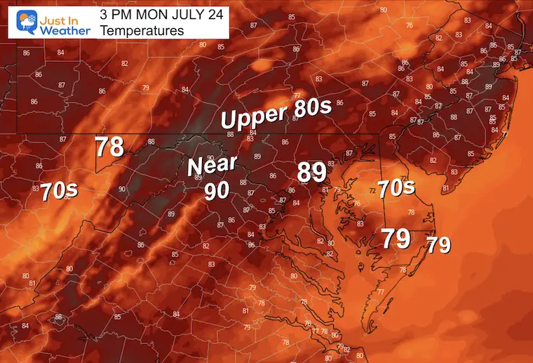
Afternoon Temperatures
EXPLORE MORE
2023 Hurricane Season Forecast With An El Niño Watch
Drought Report
https://justinweather.com/2023/07/20/severe-drought-remains-in-parts-of-maryland-july-20-2023/
Subscribe for eMail Alerts
Weather posts straight to your inbox
Sign up and be the first to know!
Weather posts straight to your inbox
Sign up and be the first to know!
CLIMATE DATA
TODAY July 24
Normal Low in Baltimore: 68ºF
Record 55ºF in 1985
Normal High in Baltimore: 89ºF
Record 101ºF 2010
Tuesday Weather
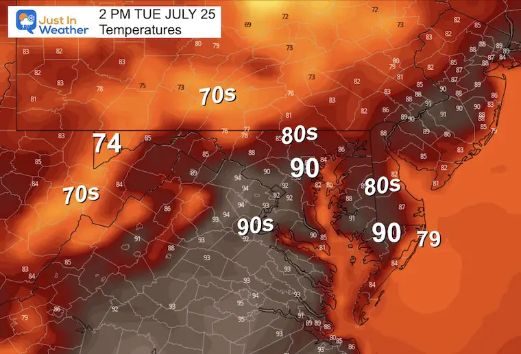
This is the transition between the recent air mass and the heat wave on the way. In between a disturbance is expected to bring a wave of showers and thunderstorms.
Morning Temperatures
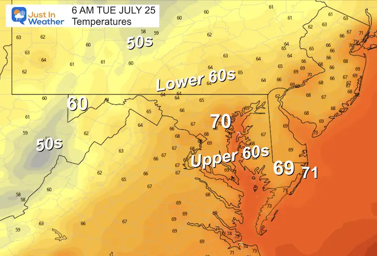
Afternoon Temperatures
These cooler numbers reflect the influence of more clouds and showers.
Radar Simulation
NAM 3 Km Model Noon to Tuesday Night
Again, no promises. However, we still may have a weakness in the atmosphere to allow more afternoon or evening showers to develop.
Looking Ahead: Building Heat Wave
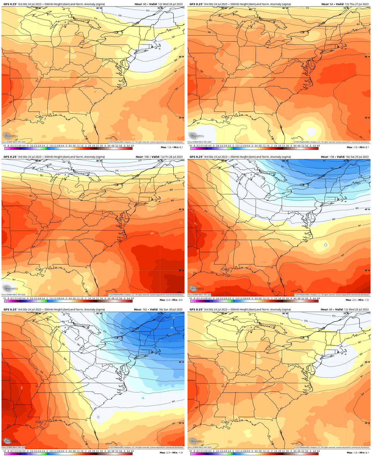
Jet Stream Wednesday to Sunday
The Ridge of High Pressure setting up off the East Coast will allow for the warmest air of the season to expand for a few days, then it will get crushed by a Canadian Trough and cool down this weekend.
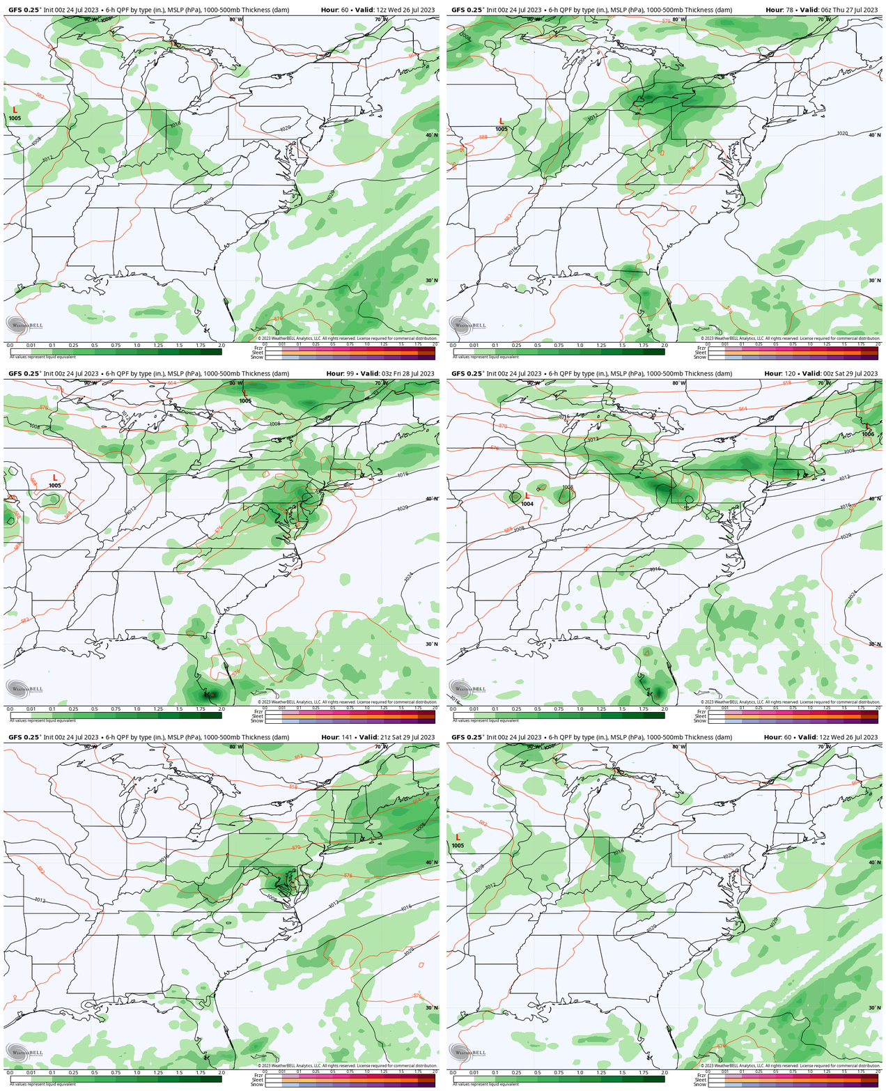
Rain Forecast:
The heat will eventually give way to the next air mass. This cold front will approach with increasing showers and storms.
- Wednesday: Mainly in the mountains at night.
- Thursday: A very hot day with strong thunderstorms (that this model is likely to not pick up on)
- Friday: Another very HOT day with more showers and possibly severe storms.
- Saturday: The cold front is forecast to slow down and take a day to cross the region, with clouds and leftover rain, then it will be much cooler.
- Sunday: Clearing.
7 Day Forecast
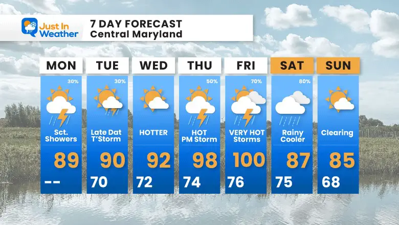
The heat will build most of the week, with the hottest days most likely Thursday and Friday. Each hot day may bring strong to severe thunderstorms that the forecast radar (and your app) could miss.
A break from the heat as of now is expected next weekend. This may come with a day with clouds and lingering rain on Saturday.
Subscribe for eMail Alerts
Weather posts straight to your inbox
Sign up and be the first to know!
EXPLORE MORE
2023 Hurricane Season Forecast With An El Niño Watch
La Niña Has Ended. El Niño May Return By Fall
Aurora Photos From Maryland, Delaware, and Virginia
Please share your thoughts, and best weather pics/videos, or just keep in touch via social media
-
Facebook: Justin Berk, Meteorologist
-
Twitter
-
Instagram
RESTATING MY MESSAGE ABOUT DYSLEXIA
I am aware there are some spelling and grammar typos and occasional other glitches. I take responsibility for my mistakes, and even the computer glitches I may miss. I have made a few public statements over the years, but if you are new here you may have missed it: I have dyslexia, and found out during my second year at Cornell University. It didn’t stop me from getting my meteorology degree, and being the first to get the AMS CBM in the Baltimore/Washington region. One of my professors told me that I had made it that far without knowing, and to not let it be a crutch going forward. That was Mark Wysocki and he was absolutely correct! I do miss my mistakes in my own proofreading. The autocorrect spell check on my computer sometimes does an injustice to make it worse. I also can make mistakes in forecasting. No one is perfect predicting the future. All of the maps and information are accurate. The ‘wordy’ stuff can get sticky. There has been no editor that can check my work when I needed it and have it ready to send out in a newsworthy timeline. Barbara Werner is a member of the web team that helps me maintain this site. She has taken it upon herself to edit typos, when she is able. That could be AFTER you read this. I accept this and perhaps proves what you read is really from me… It’s part of my charm.
#FITF


