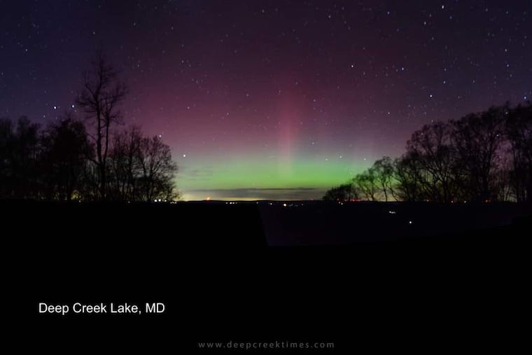
July 22, 2023
Saturday Morning Update
I support the notion to ‘enjoy what we’ve got while we got it”. This weekend will bring us warm afternoons with comfortable humidity. A fresh air mass has settled in, which still may have more clouds lingering, especially to our south.
High Pressure will dominate the week ahead. There will be more thunderstorms pulsing in the afternoons of Monday and Wednesday, but the overall pattern appears to turn very hot!
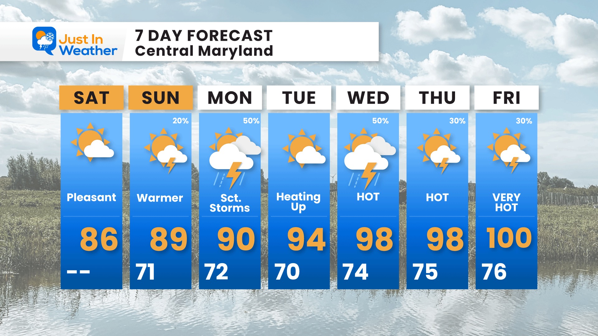
The numbers below are a scaled-back version. There is a lot of support to push us to 100ºF on a couple of days this week. I want to add that we have long-standing records for each day in the week ahead above 100ºF, so we are within the expected range of summer heat.
I scaled back the Friday temps with the expectation of some storms and higher humidity mitigating the heat surge. Also, I have lost trust in doing the range modeling as they tend to overblow longer-range weather patterns.
The century mark will be discussed and added to the media hype of the weather, AND I will continue to put the reminder in my reports that we only had 4 days in June at or above 90ºF, plus back to back months of below-average temps. So, let’s take this next week in stride as payback time.
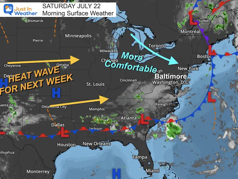
Morning Surface Weather
The old front is off the coast and a new air mass is in place, but there is leftover upper level energy that has kept clouds around… especially in the southern half of our region. This may slow any warming today… but we should remain dry. Sunday may bring pop-up T’showers, then more storms on Monday. The main focus will be the Heat EXPANDING East during the week.
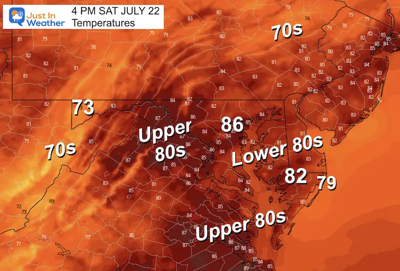
Afternoon Temperatures
Drought Report
https://justinweather.com/2023/07/20/severe-drought-remains-in-parts-of-maryland-july-20-2023/
EXPLORE MORE
2023 Hurricane Season Forecast With An El Niño Watch
Subscribe for eMail Alerts
Weather posts straight to your inbox
Sign up and be the first to know!
CLIMATE DATA
TODAY July 22
Normal Low in Baltimore: 68ºF
Record 53ºF in 1966
Normal High in Baltimore: 89ºF
Record 106ºF 2011
Sunday Weather
Morning Temperatures
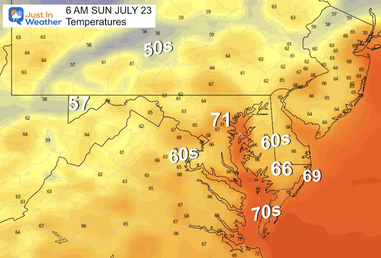
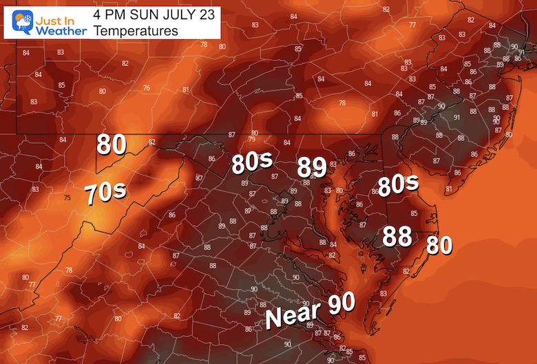
Afternoon Temperatures
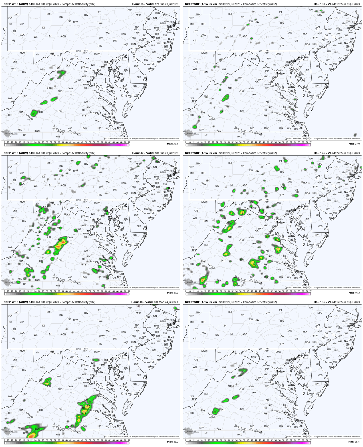
Radar Simulation 8 AM to 8 PM
If any showers develop, they will be isolated.
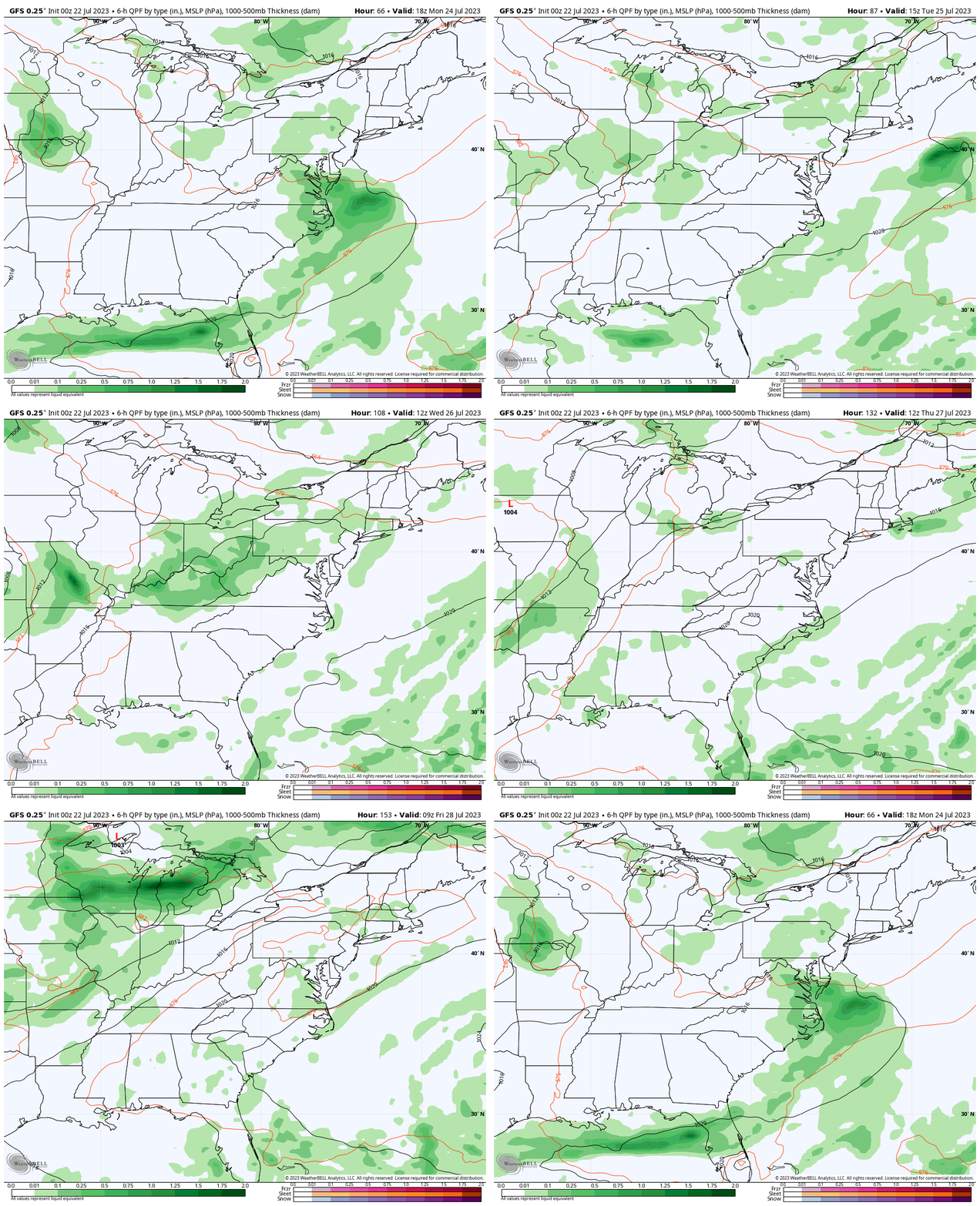
Looking Ahead
GFS Model Monday to Friday
The main storm days (at this point) appear to be Monday and Wednesday. Later in the week, the daily storm cycle may be determined by the excessive heat.
Building Heat Wave
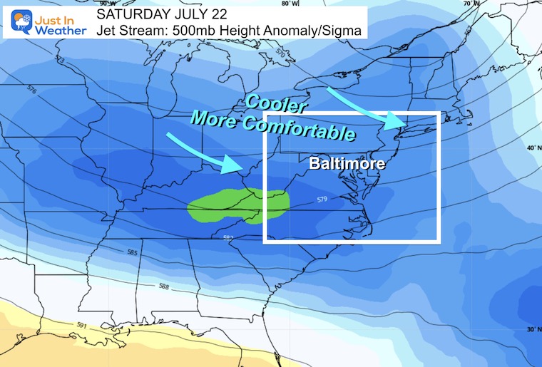
Jet Stream Snapshot Saturday
This may be deceiving. It is not showing the surface temperature, but rather the upper level of the atmosphere. We are in a cooler set up aloft… The reason for the return of more comfortable weather… and even some leftover clouds to the south.
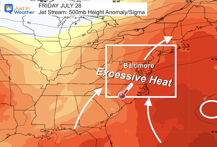
Jet Stream Snapshot Friday
A Ridge of High Pressure will set up off the coast. This ‘Bermuda High’ is a common summer source to pump in high heat and humidity up the east coast.
In this case, there is a force of extreme heat that will traverse the continent and reach the Mid-Atlantic. This is the day many areas could approach 100ºF.
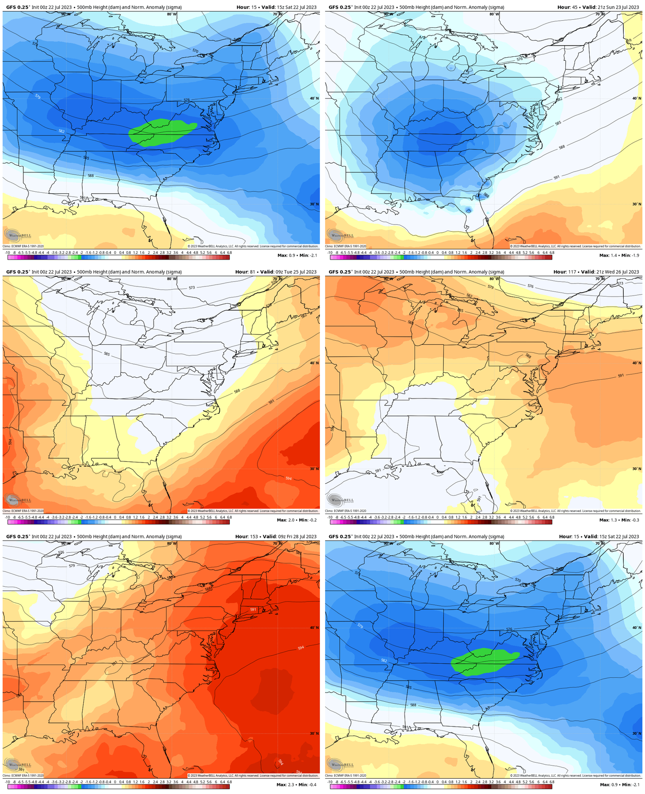
Jet Stream Animation
Watch today through next Friday to see the evolution of the warming weather pattern aloft.
7 Day Forecast
The trend will be HOTTER! I have actually scaled back on these numbers from the suggestions on model guidance. While we often see higher numbers from the BWI weather station, I have noticed prior projected heat waves scale back as we get closer.
Whatever actually transpires, we could see our first 100-degree day of the year in the week ahead.
Subscribe for eMail Alerts
Weather posts straight to your inbox
Sign up and be the first to know!
EXPLORE MORE
2023 Hurricane Season Forecast With An El Niño Watch
La Niña Has Ended. El Niño May Return By Fall
Aurora Photos From Maryland, Delaware, and Virginia
Please share your thoughts, and best weather pics/videos, or just keep in touch via social media
-
Facebook: Justin Berk, Meteorologist
-
Twitter
-
Instagram
RESTATING MY MESSAGE ABOUT DYSLEXIA
I am aware there are some spelling and grammar typos and occasional other glitches. I take responsibility for my mistakes, and even the computer glitches I may miss. I have made a few public statements over the years, but if you are new here you may have missed it: I have dyslexia, and found out during my second year at Cornell University. It didn’t stop me from getting my meteorology degree, and being the first to get the AMS CBM in the Baltimore/Washington region. One of my professors told me that I had made it that far without knowing, and to not let it be a crutch going forward. That was Mark Wysocki and he was absolutely correct! I do miss my mistakes in my own proofreading. The autocorrect spell check on my computer sometimes does an injustice to make it worse. I also can make mistakes in forecasting. No one is perfect predicting the future. All of the maps and information are accurate. The ‘wordy’ stuff can get sticky. There has been no editor that can check my work when I needed it and have it ready to send out in a newsworthy timeline. Barbara Werner is a member of the web team that helps me maintain this site. She has taken it upon herself to edit typos, when she is able. That could be AFTER you read this. I accept this and perhaps proves what you read is really from me… It’s part of my charm.
#FITF


