March 24 Rainy Friday And Turning Chilly Then Pleasant Sunday
March 24, 2023
Friday Morning
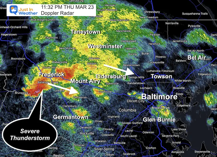
I want to start with a brief recap since yesterday is worth recalling. Temperatures surged to 80ºF at Baltimore’s BWI, while it struggled to get out of the 60s near and north of the Pennsylvania line. That is where the front lined up with more clouds and rain.
As the front slipped south, an eruption of heavier rain and some thunderstorms broke out. This ignited spots with hail and even a severe thunderstorm warning south of Frederick in the evening.
Doppler Radar Snapshot
Friday 11:32 PM
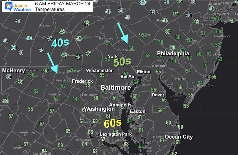
Morning Temperatures
Temperatures are cooling down, and we may have already reached our high in central Maryland. Expect a trend to the 40s by this afternoon.
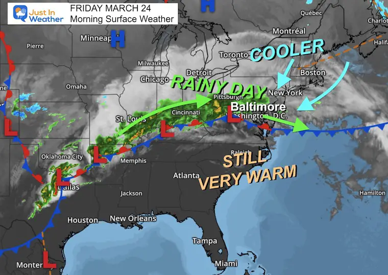
Morning Surface Weather
We are on the edge of this profound and nearly stationary frontal boundary. It is expected to drift south and send moderate rain our way most of the day… into Saturday.
As this does so, we can expect a wet day with falling temperatures.
Live Radar Widget
Radar Simulations
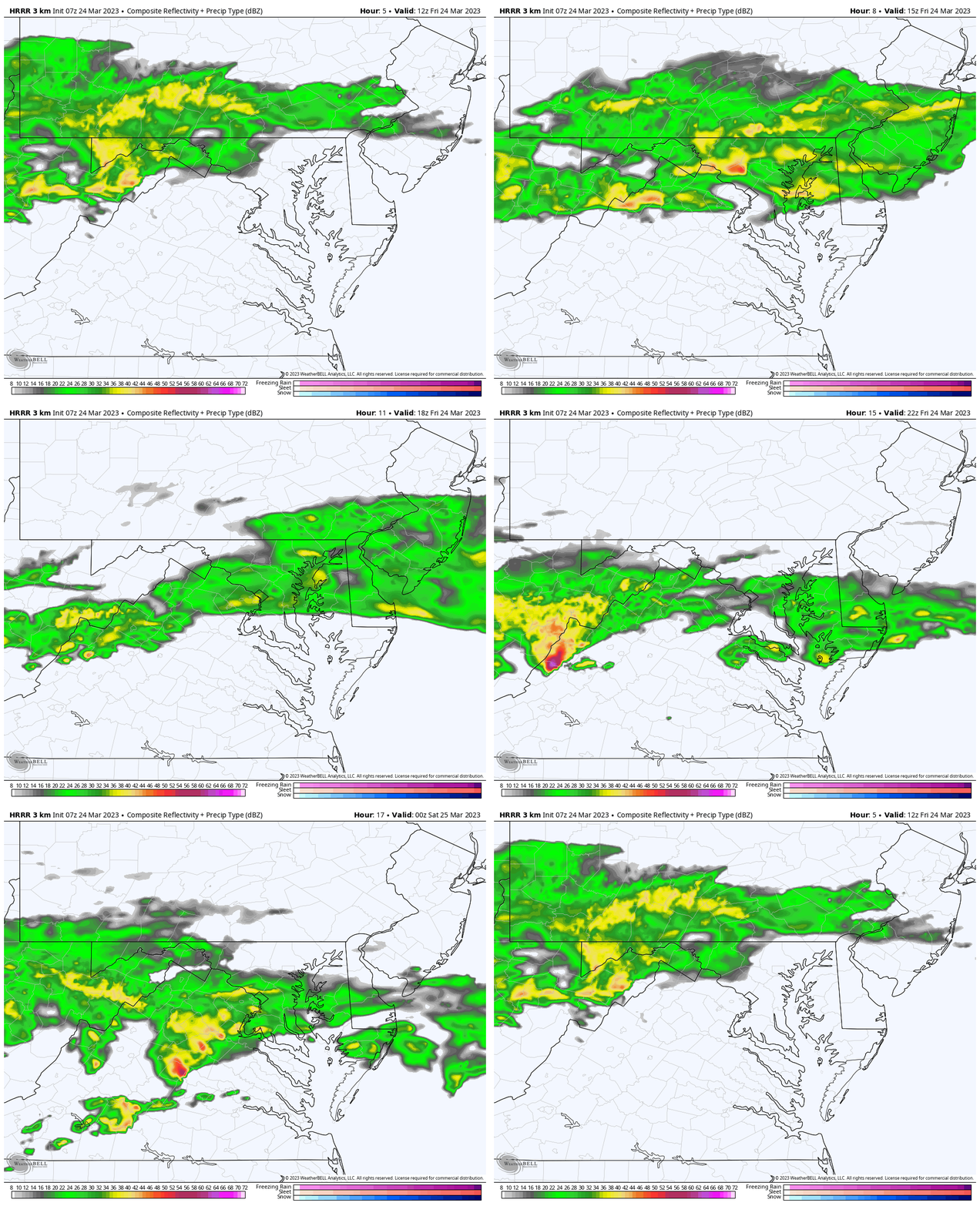
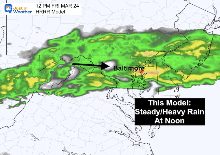
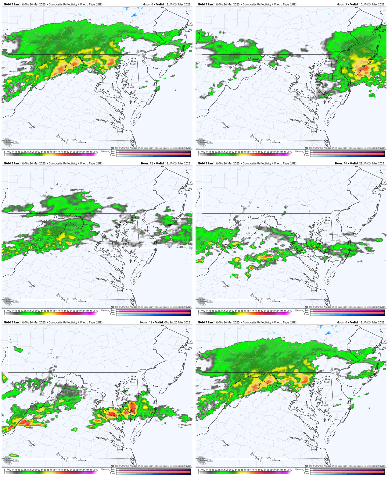
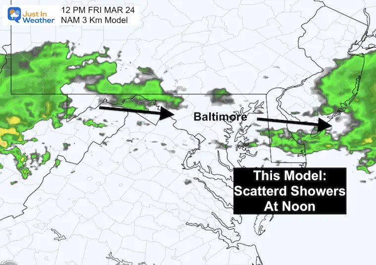
I want to show you the split between two short range models. The HRRR Model is showing a steadier rain all day, while the NAM 3 Km is breaking up the solid rain into periods of showers. I am leaning towards the HRRR solution, so plan for a wet day!
HRRR Model
8 AM to 8 PM
Snapshot at Noon
This is a rough estimate. We often allow a 1-2 hour buffer window to consider any model error with timing.
NAM 3 Km Model
8 AM to 8 PM
Snapshot at Noon
This is a rough estimate. We often allow a 1-2 hour buffer window to consider any model error with timing.
Rain Total (Just Today)
This may be a narrow band of heavy rain near 1 inch. At this point, we are running a deficit on the year, so any rain will be beneficial.
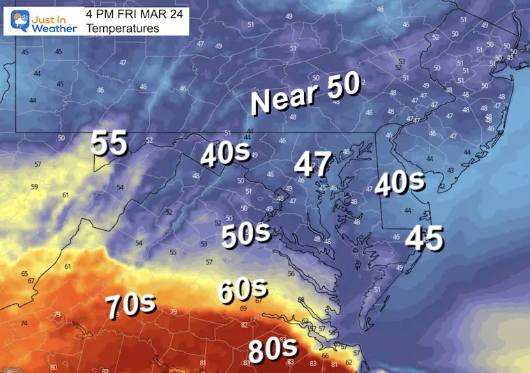
Afternoon Temperatures
This is going to be a chilly afternoon, especially with the rain and compared to yesterday.
Subscribe for eMail Alerts
Weather posts straight to your inbox
Sign up and be the first to know!
CLIMATE DATA
TODAY March 24
Normal Low in Baltimore: 36ºF
Record 18ºF in 1886
SNOW: 1.4” in 1990
Normal High in Baltimore: 58ºF
Record 83ºF in 1929
REPORTS:
Winter 2023 Recap: My BUSTED Snow Outlook
La Niña Has Ended. El Niño May Return By Fall
Cherry Blossoms Near Peak Bloom In Washington
Storm Forecast
Friday Morning to Sunday Afternoon
This band of rain will be stubborn for two days. However, Saturday will feature lighter rain and it will be more scattered. The main storm will ride to our north, then depart by Sunday morning. Sunday should get us into a clearing breeze, allowing temps to warm up again.
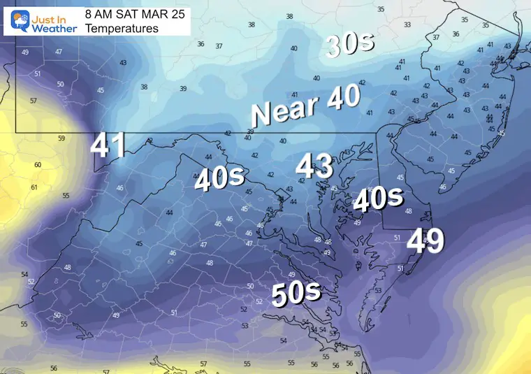
Saturday Temperatures
Morning Temperatures
Still on the chilly side….
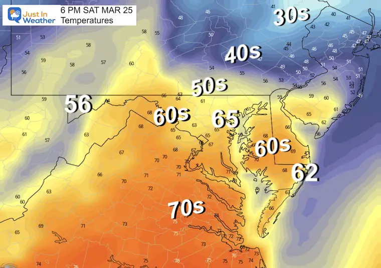
Afternoon Temperatures
If we can get this storm track to meander back, then we have a chance to push warmer air back in later in the afternoon.
These numbers are a model forecast. I may play it a little more conservative and lower the expectations just a tad.
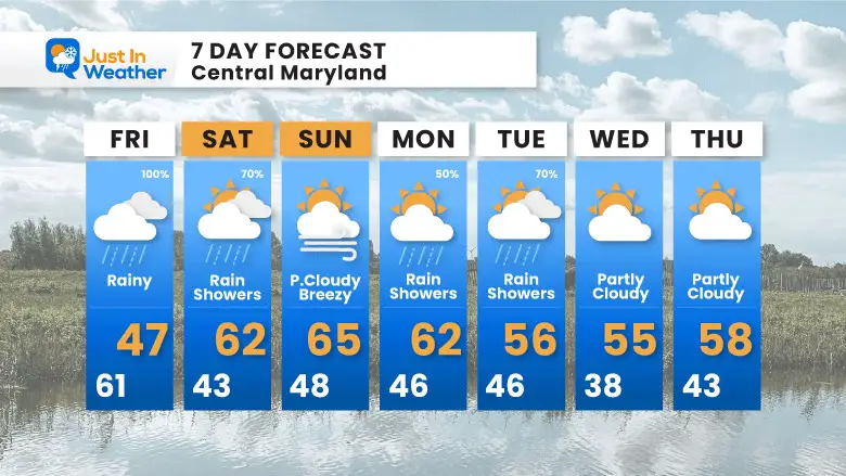
7 Day Forecast
After this bumpy weekend and warmer start to next week, we will settle back to near normal for the second half of next week.
STEM Assemblies/In School Fields Trips Are Back
Click to see more and ‘Book’ a visit to your school
RESTATING MY MESSAGE ABOUT DYSLEXIA
I am aware there are some spelling and grammar typos, and occasional other glitches. I take responsibility for my mistakes, and even the computer glitches I may miss.
I have made a few public statements over the years, but if you are new here you may have missed it:
I have dyslexia, and found out during my second year at Cornell University. It didn’t stop me from getting my meteorology degree, and being first to get the AMS CBM in the Baltimore/Washington region. One of my professors told me that I had made it that far without knowing, and to not let it be a crutch going forward. That was Mark Wysocki and he was absolutely correct!
I do miss my mistakes in my own proofreading. The autocorrect spell check on my computer sometimes does an injustice to make it worse. I also can make mistakes in forecasting. No one is perfect predicting the future.
All of the maps and information are accurate. The ‘wordy’ stuff can get sticky.
There has been no editor that can check my work when I needed it and have it ready to send out in a newsworthy timeline. Barbara Werner is a member of the web team that helps me maintain this site. She has taken it upon herself to edit typos, when she is able. That could be AFTER you read this.
I accept this and perhaps proves what you read is really from me…
It’s part of my charm.
#FITF
Please share your thoughts, best weather pics/videos, or just keep in touch via social media
-
-
Facebook: Justin Berk, Meteorologist
-
Twitter: @JustinWeather
-
Instagram: justinweather
-


