March 8 Weather Still Windy And Attention On Friday Snow
March 8, 2023
Wednesday Morning
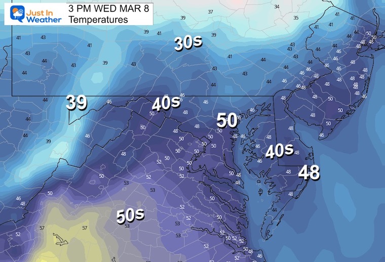
Today will be sunny and windy. Temps will be mild, just a little cooler than climate average. However, the wind will bring a bit of chill with it.
Last night I broke and decided to put more focus on the winter storm(s) on the way. After a few days of trying to downplay the event, I saw the snow in Pennsylvania verify on the higher end and the consistent plots for the storm on the way.
As I continue to show the model plots and narrow my expectations, please make sure to read the notes of my realistic approach. You may see rain or warmer temps on your phone app, but I forecast for the Mid Atlantic region and at least half of us will be affected by this. It can snow when temps are above freezing. While the ground is warm, there are conditions that may allow some impact on the ground. So while remaining skeptical, we have to be practical as well.
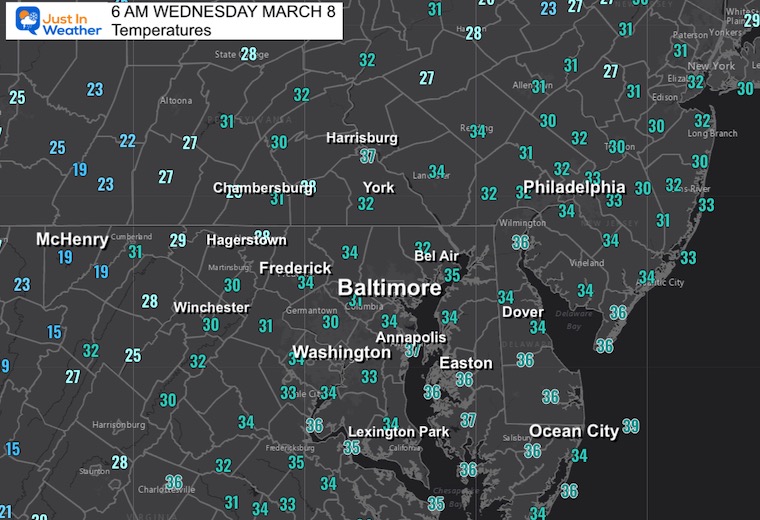
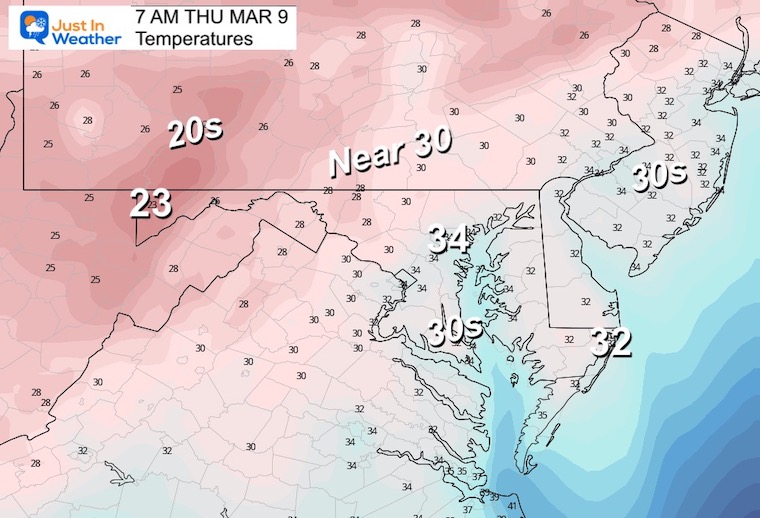
Morning Temperatures
Colder air is back in place with many near or below freezing.
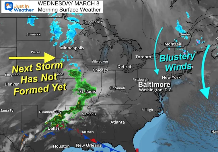
Morning Surface Weather
Watching this clipper that brought snow to Pennsylvania. Colder winds have reached Maryland. There may be some flurries this morning, but no impact expected. The winds will remain strong all day and into tomorrow.
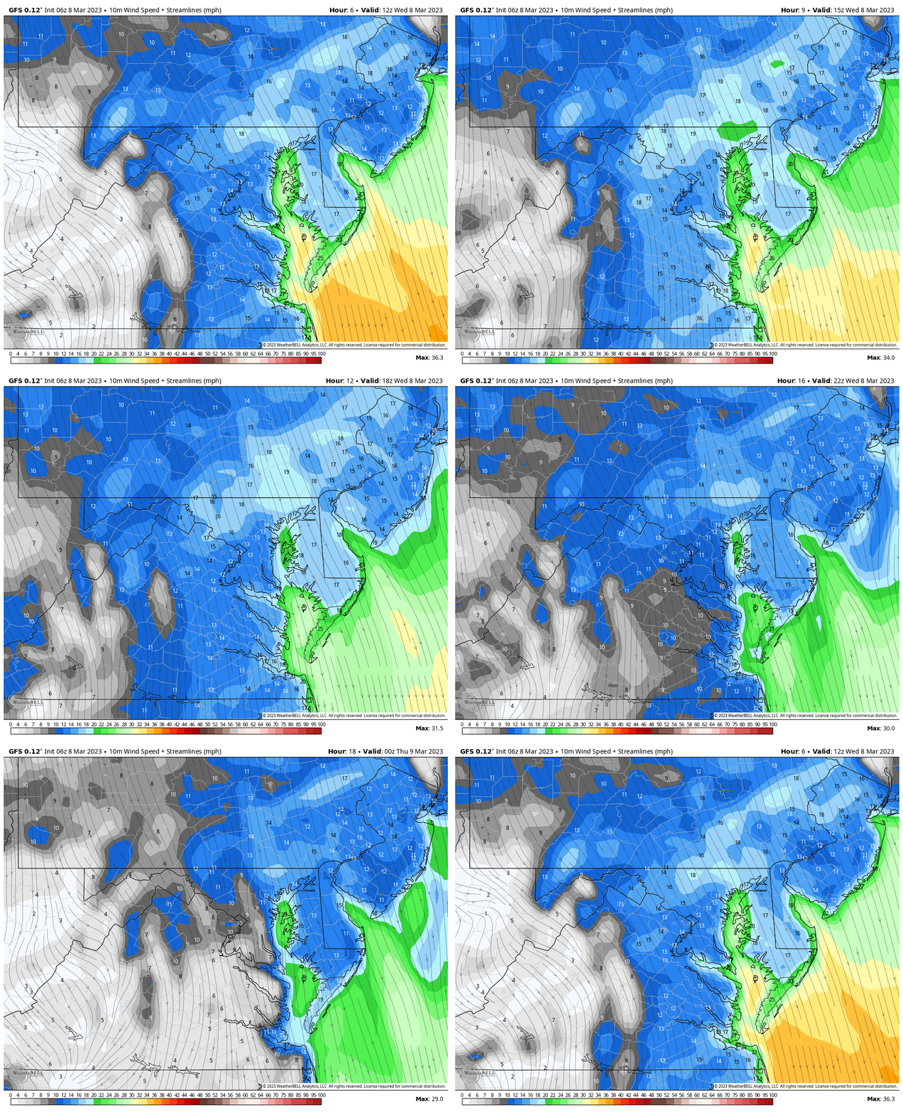
Wind Forecast
7 AM to 7 PM
The blustery flow from the North will continue at 15 to 20 mph, gusting up to 30 mph.
Afternoon Temperatures
Subscribe for eMail Alerts
Weather posts straight to your inbox
Sign up and be the first to know!
CLIMATE DATA
TODAY March 8
Normal Low in Baltimore: 32ºF
Record 10ºF in 1960
SNOW: 10” in 1934
Normal High in Baltimore: 52ºF
Record 83ºF in 2020
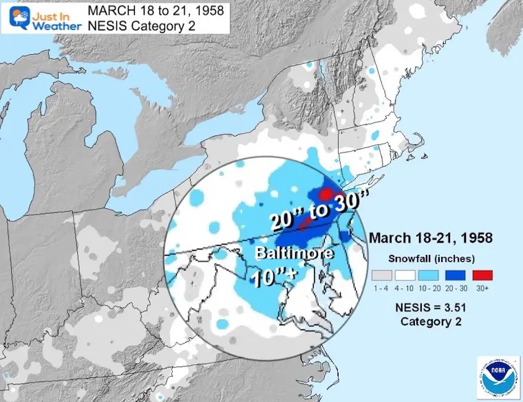
REPORT: March Snow and Extreme Weather History
March Snow and Extreme Weather History
Thursday
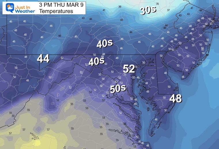
Still clear and cool. The winds will be lighter.
Morning
Afternoon
Looking Ahead
Winter Storm Development Friday
I have been downplaying this event, but last night decided it was time to take it seriously. With that in mind, I have notes I will continue to show. These include….
Realistic DOUBT About Snowfall In March
- Snow falling during the day encounters more hindrance to stick with the higher March sun angle.
- The ground will have a few nights of freezing temps to chill, but will still have plenty of latent warmth.
- The track of the Low in Pennsylvania can often result with the mountains breaking up the moisture or warming for central Maryland.
- The bias of this model (among others) all winter, has been to plot storms farther south than they verify.
If you want snow, you want the track farther south than shown here. If this ends up north, it would diminish snow chances.
Finally: This is favorable for inland areas AWAY from the Chesapeake Bay and in the higher hills. This does not favor urban, coastal, or Delmarva locations.
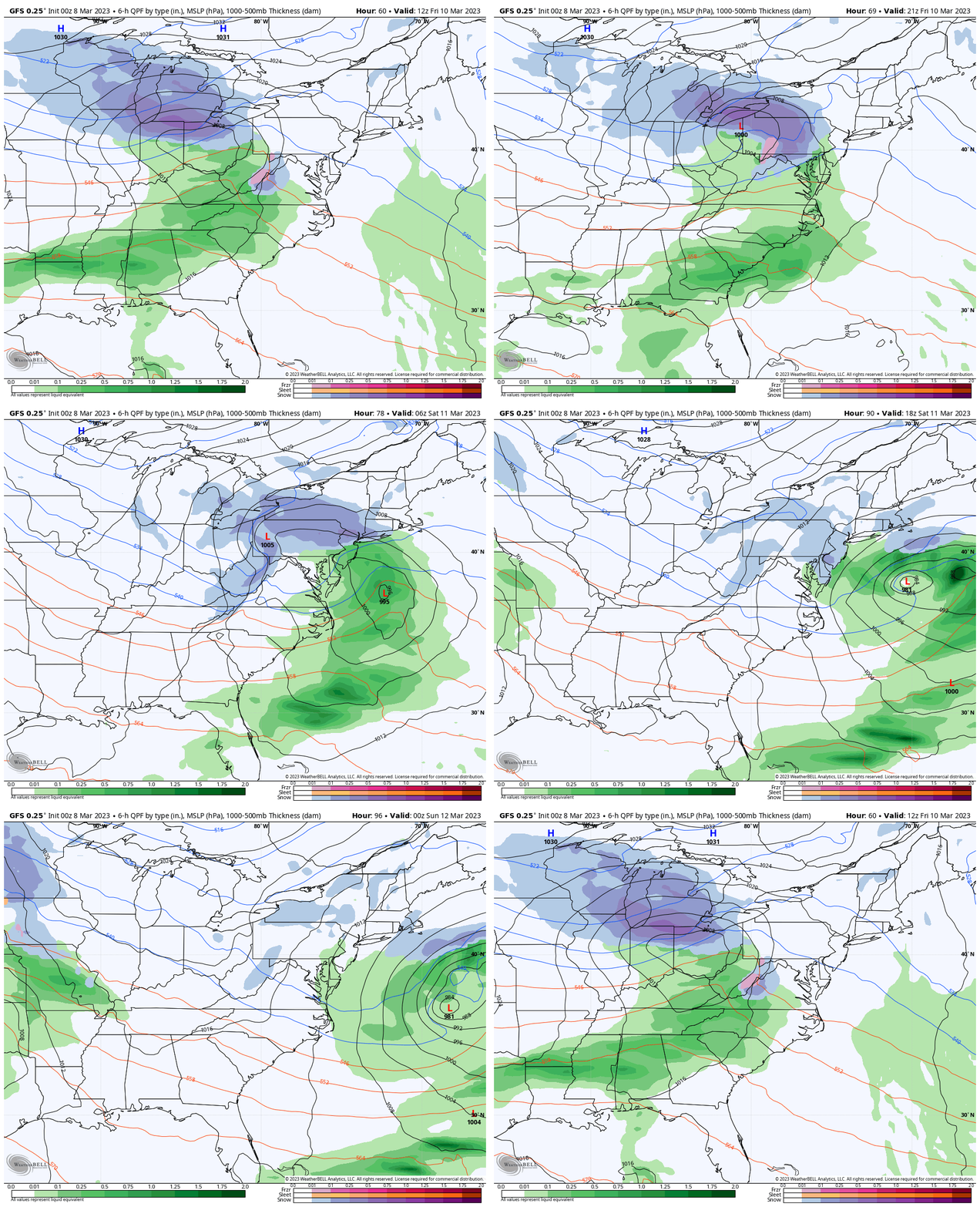
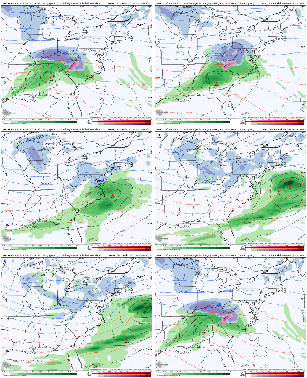
GFS Model: Friday Morning to Saturday Evening
Please note that just showing snow/blue does not automatically infer stickage or a storm. This is simply for what may fall…
Low Pressure will be moving in from the Ohio Valley into Northern Pennsylvania. This is NOT a favorable track for our region to get snow. However, we see the leading edge of snow turn to rain. Then a new Coastal Storm takes over, which would pull colder air back down to finish as snow Saturday morning.
Snapshots
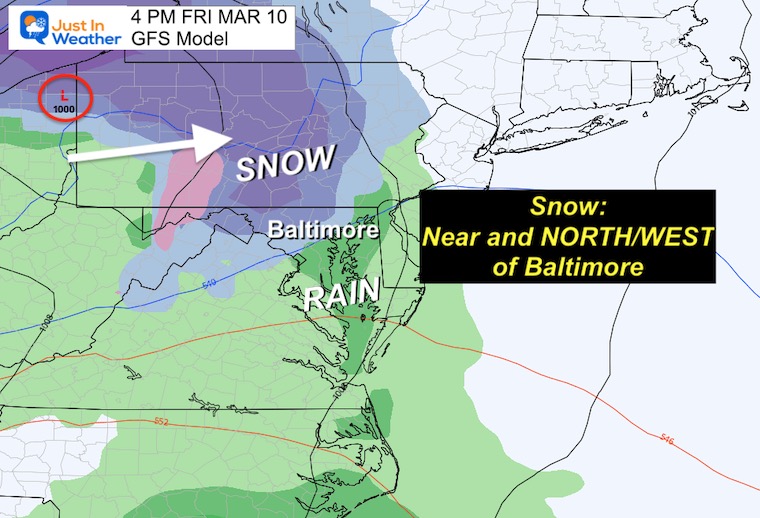
FRIDAY AFTERNOON
The GFS brings in the snow/mix late morning to early afternoon. This snapshot is a 6-hour summary at 4 PM.
It is important to watch the snow/rain line. Our region is split with the typical areas west and north of I-95 more likely to get in on this.
Central Maryland will be the transition to mix or just rain. There will need to be fine tuning for where this sets up and the more likely stickage zones. I will not even suggest this until my first call tonight.
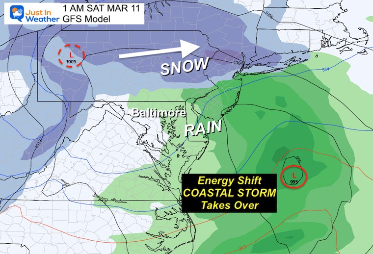
FRIDAY NIGHT
The track of the Low to our north will bring in warmer air and push the rain line into southern Pennsylvania. The new Coastal Low will be taking shape and taking over.
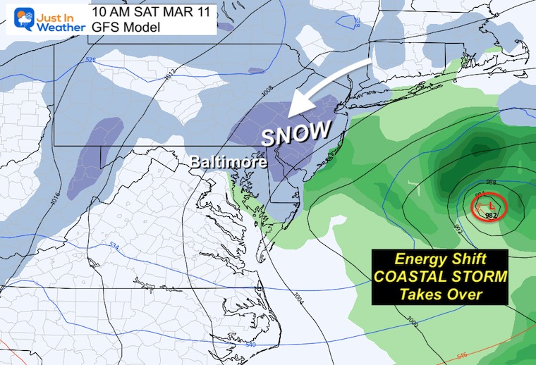
SATURDAY MORNING
If this track verifies, the Coastal Low will dominate and pull the cold air back in. Here we see snow showers accompany that. It is important to note that often this part of the storm (for us) brings light precipitation… Another factor to what may be available for this storm to produce.
Comparison
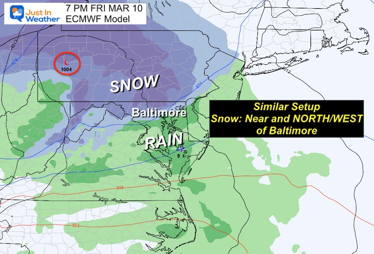
ECMWF Model
This is similar but still slower than the GFS solution. If this verifies, the snow would arrive later, which would allow the dark hours at night to support more stickage.
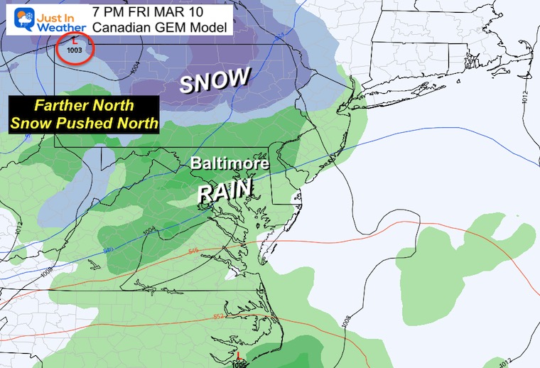
Canadian GEM
This solution is Farther North. The result would be a warmer set up and mostly rain for our region, pushing the snow to the north.
NEXT MONDAY
Both the GFS and European Models have a second event early next week. Obviously the validity of the first system will shed light on what this may be able to produce. But there has been some consistency about this notion.
Sunday 7 PM to Monday 10 PM
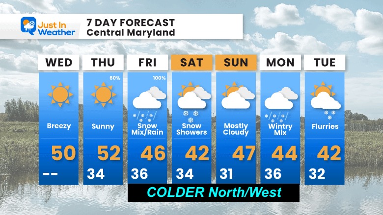
7 Day Forecast
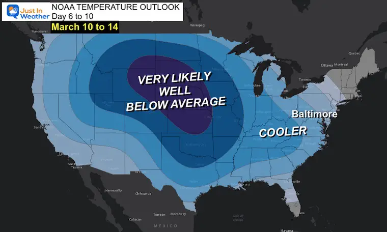
We are in our COOLER period now. Please note this is based on the official numbers that will be shown at Baltimore’s BWI.
I forecast for the region AND it will be COLDER NORTH AND WEST.
Subscribe for eMail Alerts
Weather posts straight to your inbox
Sign up and be the first to know!
IN CASE YOU MISSED IT
My REALISTIC Expectations for the COLD OUTLOOK
Also See:
Winter History: Low Snow And Late Starts
See my research based on Baltimore data since 1883.
RESTATING MY MESSAGE ABOUT DYSLEXIA
I am aware there are some spelling and grammar typos, and occasional other glitches. I take responsibility for my mistakes, and even the computer glitches I may miss.
I have made a few public statements over the years, but if you are new here you may have missed it:
I have dyslexia, and found out during my second year at Cornell University. It didn’t stop me from getting my meteorology degree, and being first to get the AMS CBM in the Baltimore/Washington region. One of my professors told me that I had made it that far without knowing, and to not let it be a crutch going forward. That was Mark Wysocki and he was absolutely correct!
I do miss my mistakes in my own proofreading. The autocorrect spell check on my computer sometimes does an injustice to make it worse. I also can make mistakes in forecasting. No one is perfect predicting the future.
All of the maps and information are accurate. The ‘wordy’ stuff can get sticky.
There has been no editor that can check my work when I needed it and have it ready to send out in a newsworthy timeline. Barbara Werner is a member of the web team that helps me maintain this site. She has taken it upon herself to edit typos, when she is able. That could be AFTER you read this.
I accept this and perhaps proves what you read is really from me…
It’s part of my charm.
#FITF
STEM Assemblies/In School Fields Trips Are Back
Click to see more and ‘Book’ a visit to your school
My Winter Outlook: Not A Typical La Niña!
I see many factors to support colder influence with multiple systems. Early and later in winter. Check it out. https://justinweather.com/2022/11/22/winter-outlook-2023-for-snow-not-typical-la-nina-plus-polar-vortex-disruption/
Also See The Winter Outlook Series:
Farmer’s Almanac Comparison
September Starts Meteorological Autumn: Weather Climate Stats For Maryland at Baltimore
Triple Dip La Niña Winter
https://justinweather.com/2022/09/09/winter-outlook-2023-la-nina-triple-dip-expectations/
CONNECTION TO WINTER?
If you want a snowy winter, this is what you might want to look for in the rest of the tropical season. https://justinweather.com/2022/08/31/record-august-for-no-named-tropical-storms-closer-look-at-snow-following/
Woolly Bear Caterpillars
https://justinweather.com/2022/10/25/winter-weather-outlook-from-the-wooly-bear-caterpillar/
Persimmon Seeds
Click to see Top 20 and MORE
Normals And Records: Maryland and Baltimore Climate History
Please share your thoughts, best weather pics/videos, or just keep in touch via social media
-
-
Facebook: Justin Berk, Meteorologist
-
Twitter: @JustinWeather
-
Instagram: justinweather
-


