Only A Little Snow Could End The Baltimore Snow Drought By Morning
January 31, 2023
Tuesday Night Update
I understand this light snow event is almost laughable to some people. To others any snow is met with excitement. For me and fellow snow lovers, we just want to end the snow drought in Baltimore. I have already seen snow and shared videos with you online. But Baltimore’s BWI has not had measurable snow yet this season. All that is needed is 0.1” or more to be considered more than a TRACE and count. That would end the pain and maybe reset winter.
This snow may lay on car tops and grassy areas. If you get more than a coating, consider that bonus.
Mark my words, if Baltimore gets that 1/10 inch of snow, there will be a lot of people celebrating. We are a special breed.
Below we will look at the snow forecast maps (laughing or crying), but first some climate trivia.
Late Dates For First Snow
This year is 3rd latest on record since 1883 in Baltimore.
The 2nd place year was 1914 (109 years ago). To give you some hope, or Faith in the Flakes, I would like to expand on that winter.
72ºF on January 30, 1914 – Record High
Imagine what those people thought that winter?
Well, they broke their snow drought on February 6th, 1914, then made up for lost time!
11.4” Snow fell in February
11.6” Snow fell in March.
That season ended with 23 inches, which was above an average winter.
It has happened before, and can happen again.
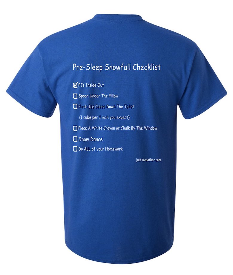
The Snowfall Checklist!
I have researched all the things kids and teachers try the night before to get a snow day. We put them on our FITF Shirts for Fundraisers. Here they are in case you want to play along.
Teachers, it is doubtful you will get out of school or a delay, but stranger things have happened.
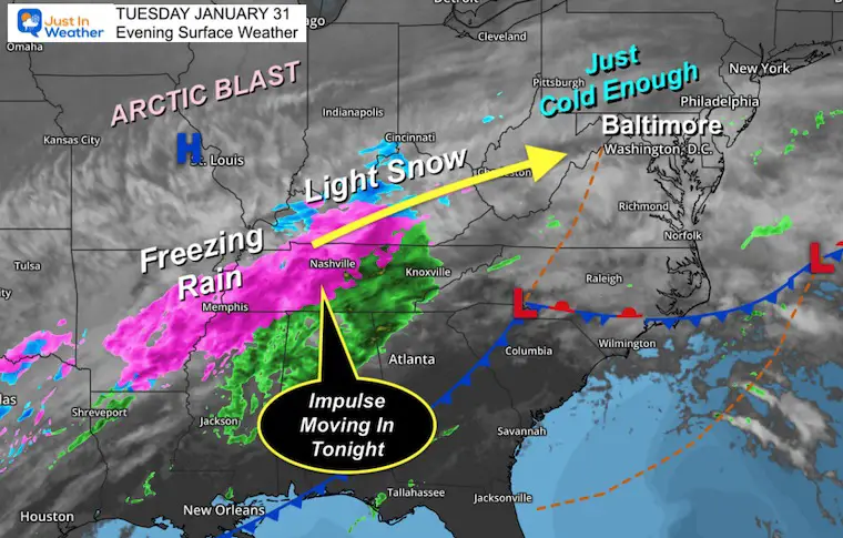
Tuesday Night Set Up
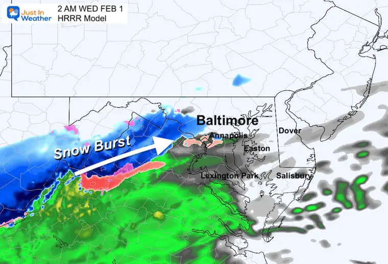
For what it’s worth, the expansion of ice and snow looks a little more impressive than the model guidance suggested. This is the impulse moving in overnight.
Final Model View
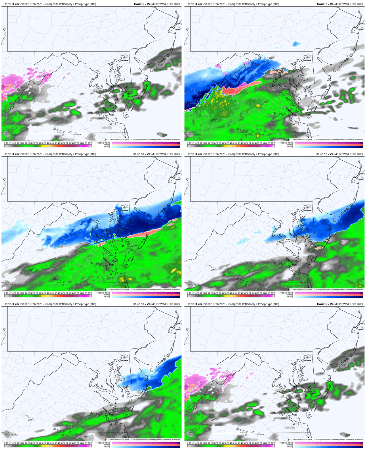
HRRR Simulation
Midnight to 8 AM Wednesday
The band of snow will develop along a Jet Streak. Fast upper level winds behind the front will produce the precipitation. The location of the front has held north, allowing central Maryland to be part of this.
Set Your Clock
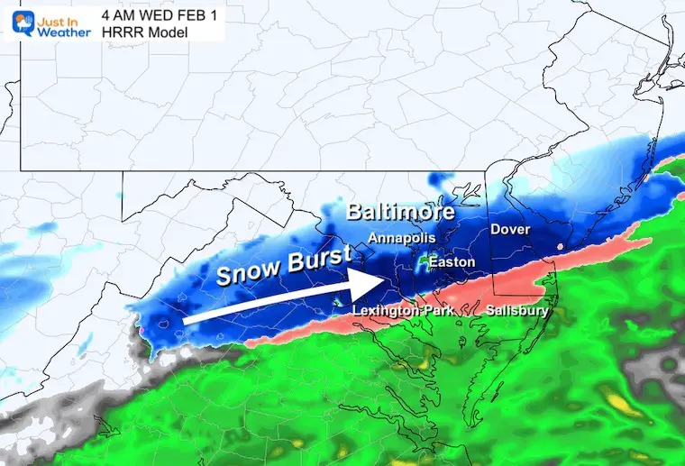
The most likely time to get this to snow to flare up across central Maryland will be between 2 AM to 4 AM. This is on target with the time frame shown over the last few days.
There still may be a 1 hour buffer to allow for error in model speed.
2 AM Snapshot
4 AM Snapshot
The snow line will move south of Annapolis and eventually change over in southern Maryland.
CONFIRMED SNOW: Click here for the Wednesday morning report.
Temperatures
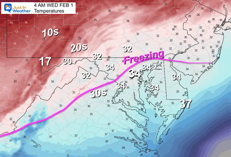
Here is the compilation. We know the ground is warm and the air is slowly dropping to near freezing. It is likely the snow will only stick on the grass and car tops. Roads will more than likely not support stickage. If it does, it will be brief, and when the snow stops it will melt.
The freezing air will slowly be moving in before sunrise. There is a small window for icing between 4 AM and 8 AM if it is going to happen.
Here is the forecasted freezing line.
4 AM
7 AM
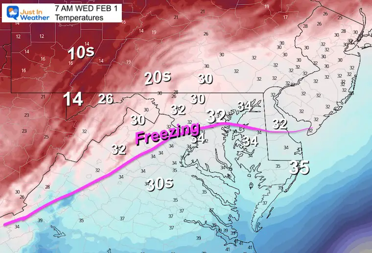
Plow Guys: Inland areas will drop to freezing. So west and north of the Baltimore and DC beltways could get the wet ground to coat a little at the end or ice up before sunrise.
How Much Snow?
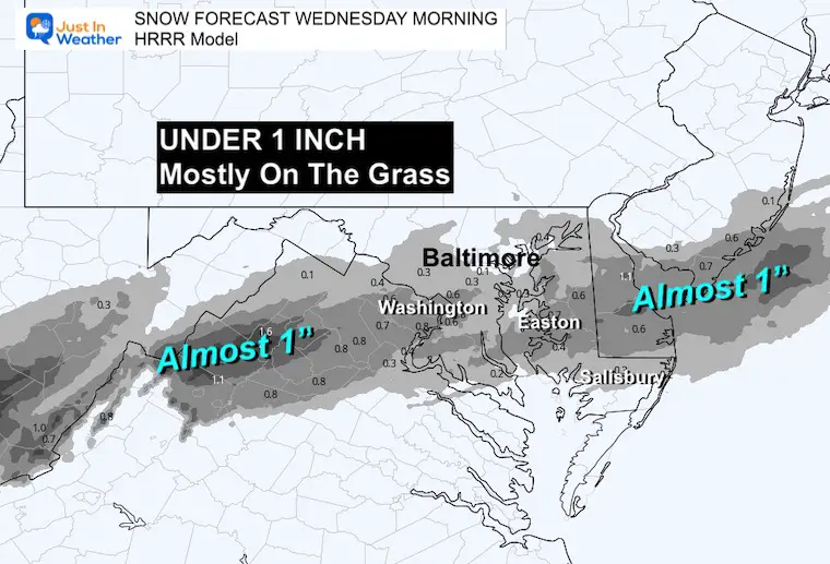
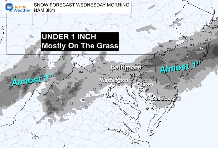
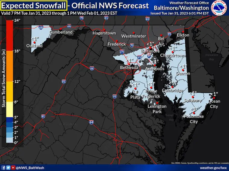
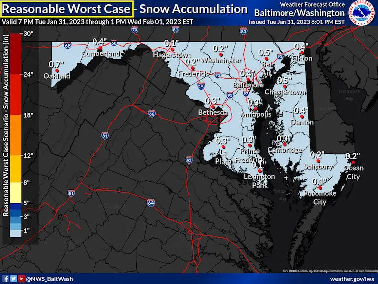
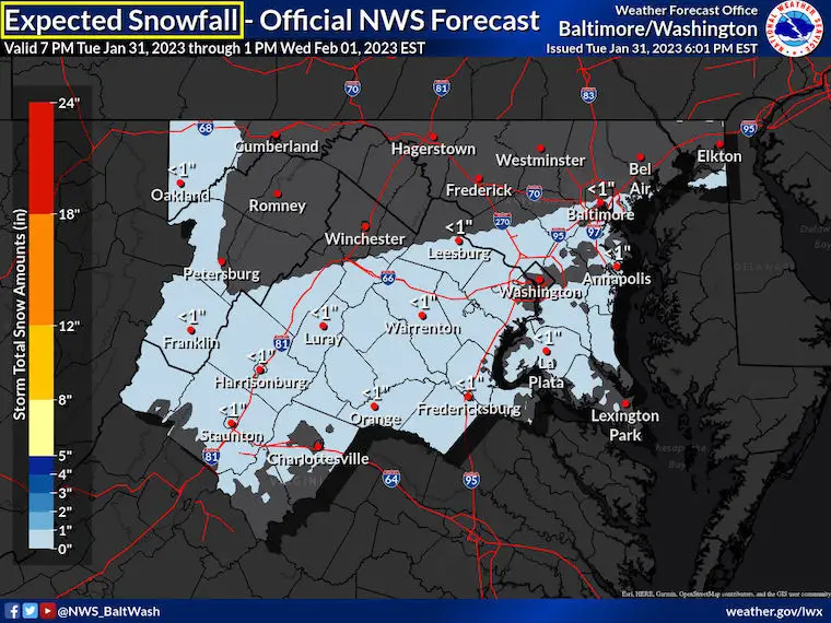
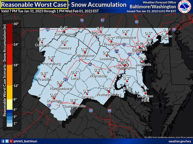
Again, you may laugh or cry at this. We are not expecting much, just looking for anything over 0.1” to qualify for Baltimore at BWI. A little more may fall to the south and on Delmarva.
HRRR Model Snow Forecast
NAM 3Km Model Snow Forecast
National Weather Service Snow Forecast Maps
For Maryland – Official
Most Snow Possible
Including Northern Virginia
Official
Most Snow Possible
SEE MORE SNOW FORECAST MAPS
Click here for the NWS Snow Map Page
Global Models
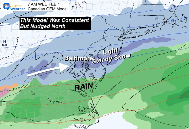
Let’s start with the Canadian GEM since it has also been showing this. Then we can see the GFS and lastly the European which all came back north.
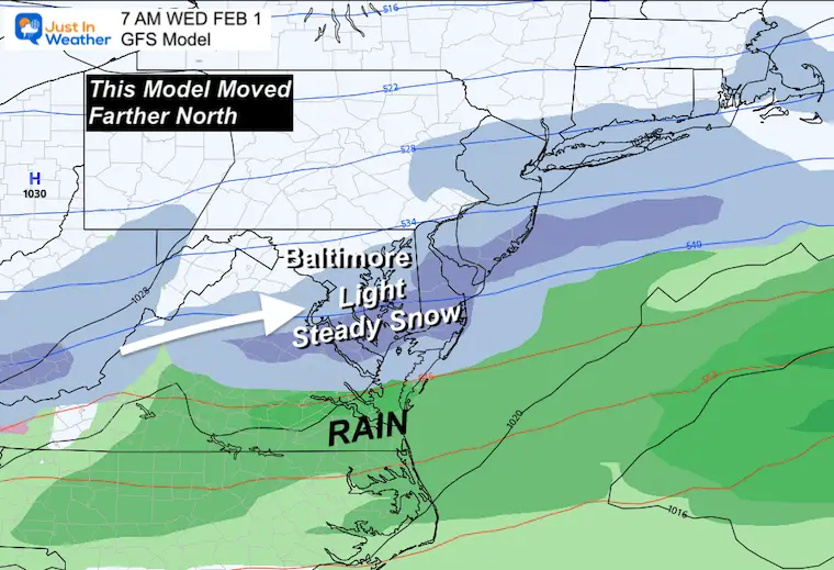
All models are plotted for 7 AM, but show precipitation for a 6 HOUR TOTAL
1 AM to 7 AM
Canadian GEM
This model has been the most consistent with the region under some snow early Wednesday morning.
GFS Model
This model started to creep a little north yesterday. Now it made the jump.
Euro Model
This was the hold out with the farthest south of the front, but has also come in line to join the rest. This adds extra comfort to boost the confidence with actual snow falling into central Maryland.
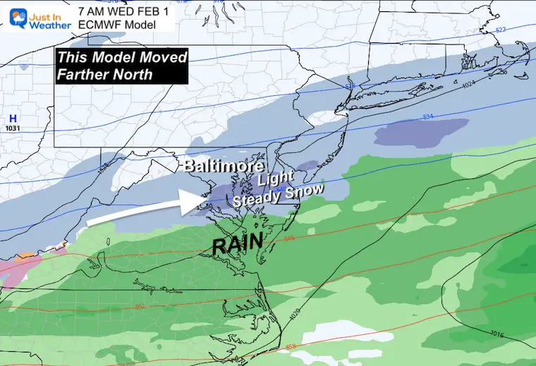
This could stick on the grass and be measured at official stations to end the drought. All that is needed is 0.1” or more to be considered more than a TRACE.
I will be up early to track along with you.
FITF – Faith in the Flakes
Latest Measurable Snow In Baltimore
Today Is 3rd Latest
- Feb 21 in 1973 (50 years ago)
- Feb 6 in 1914 (109 years ago)
- Jan 30 in 2023 (Today)
- Jan 25 in 1992 ( 31 years ago)
- Jan 25 in 1901 ( 122 years ago)
- Jan 23 in 1966 (57 years ago)
Looking Ahead:
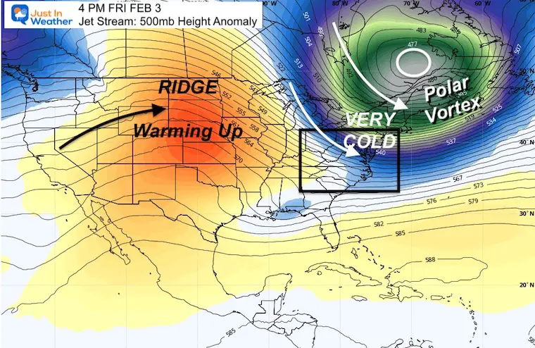
Jet Stream: Snapshot Friday
The Polar Vortex will be dislodged to Eastern Canada. That will send in our arctic blast, but like the Christmas event, it will be brief. Then we will warm up again next week.
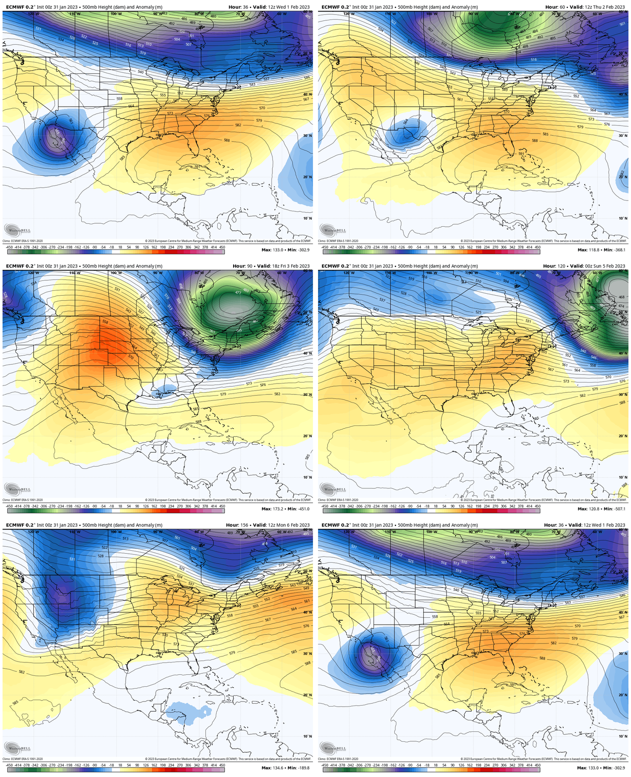
Jet Stream Animation
Wed Feb 1 to Mon Feb 6
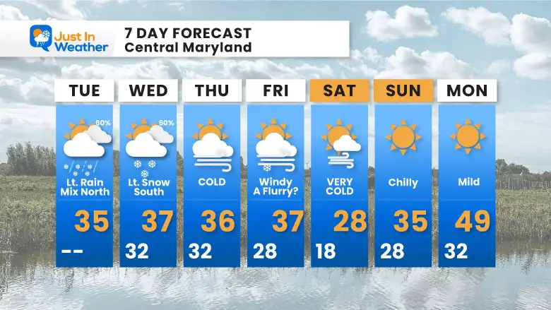
7 Day Forecast
Two impulses over the next few days, then the really cold air settles in. We could see some flurries with the cold winds, but the core arctic air will be here on Saturday. Then we start to warm up AGAIN.
Also See:
Winter History: Low Snow And Late Starts
See my research based on Baltimore data since 1883.
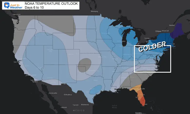
NOAA Outlook: Colder Start To February
Click here for the full report
Subscribe for eMail Alerts
Weather posts straight to your inbox
Sign up and be the first to know!
STEM Assemblies/In School Fields Trips Are Back
Click to see more and ‘Book’ a visit to your school
My Winter Outlook: Not A Typical La Niña!
I see many factors to support colder influence with multiple systems. Early and later in winter. Check it out.
Also See The Winter Outlook Series:
Winter Weather Folklore Top 20 And More Outlook Signals From Nature For Cold And Snow
Farmer’s Almanac Comparison
September Starts Meteorological Autumn: Weather Climate Stats For Maryland at Baltimore
Triple Dip La Niña Winter
https://justinweather.com/2022/09/09/winter-outlook-2023-la-nina-triple-dip-expectations/
CONNECTION TO WINTER?
If you want a snowy winter, this is what you might want to look for in the rest of the tropical season.
Rainbow Ice Cave In Mt. Rainier A Very Rare Find: Photos And Video
Wooly Bear Caterpillars
https://justinweather.com/2022/10/25/winter-weather-outlook-from-the-wooly-bear-caterpillar/
Persimmon Seeds
Click to see Top 20 and MORE
Winter Weather Folklore Top 20 And More Outlook Signals From Nature For Cold And Snow
Normals And Records: Maryland and Baltimore Climate History
Please share your thoughts, best weather pics/videos, or just keep in touch via social media
-
-
Facebook: Justin Berk, Meteorologist
-
Twitter: @JustinWeather
-
Instagram: justinweather
-


