January 31, 2023
Tuesday Afternoon Update
In recent reports, I asked you to keep an open mind for mid week. This is what I was referring to. It was not a wish-cast or a pipe dream. I am not crazy, my mother had me tested. But some of what we saw this afternoon was further support that the computer guidance was missing something. It has since caught on, and ALL the models I have been showing you have shifted north to bring light snow up to central Maryland overnight. We will explore that here.
If you saw snow, sleet, or extended rain this afternoon, that was a signal the atmosphere was not performing even up to the short-range high-resolution model expectations. It was farther north and overachieving.
Slow Motion Snow Video
In case you missed this: I recorded it around 2 PM near the Maryland and Pennsylvania border between Baltimore and York Counties. This was a few hours later and more impressive than it was expected to be.
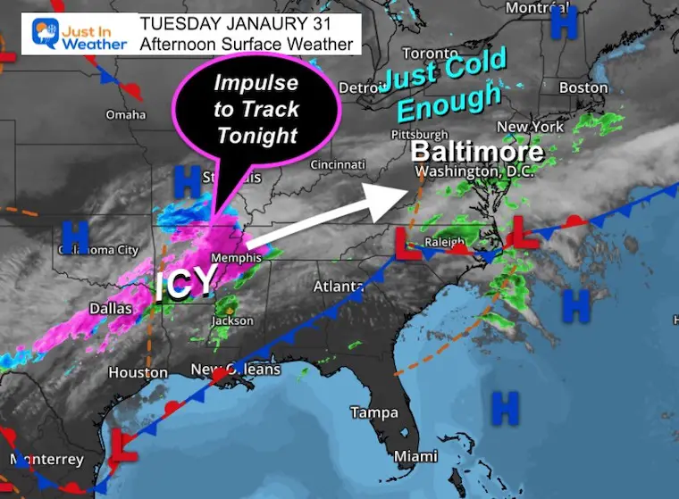
Tuesday Afternoon Surface Weather
The rain in Southern Maryland was also a little later than expected to hang around this afternoon.
Our next impulse is producing ice between Dallas and Memphis. This energy will expand north overnight. Our air will be just cold enough for snow and sleet. The ground temps may still be warm to compromise what may fall… At least to keep roads wet.
Model Update
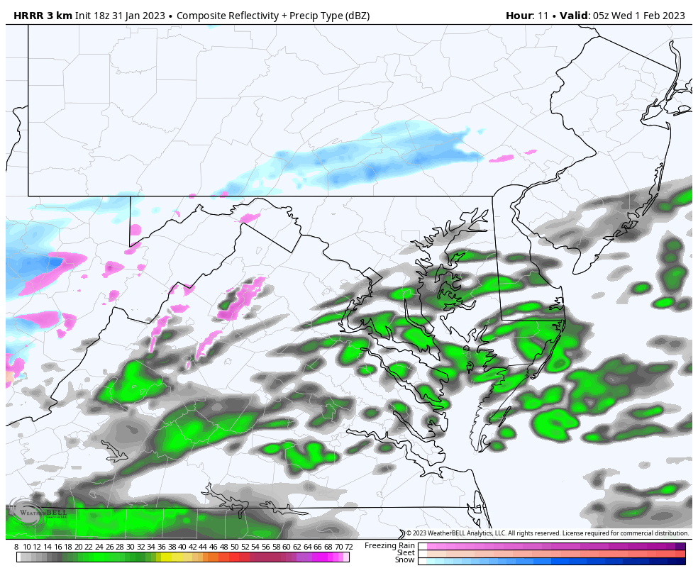
Let’s start with the HRRR Model to give you an idea of what we are talking about.
Model Simulation
HRRR 12 AM to 7 AM
This shows the impulse overnight with a brief moderate snowfall.
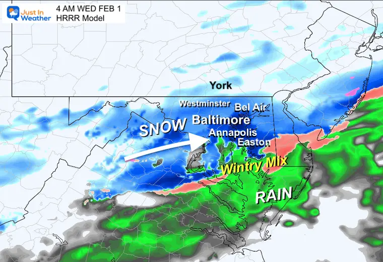
Snapshot at 4 AM
This may be the peak of the activity. Light snow up to York, PA. Metro Baltimore to Annapolis in the core with a chance to get stickage on the grass. Easton may be on the edge of frozen and wet precipitation. This may be a case where a better chance can be a few miles away from the water.
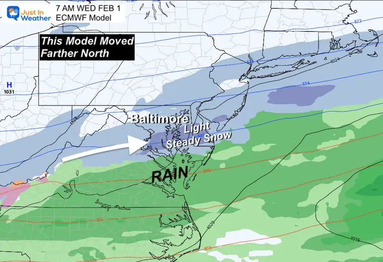
The morning model package has a little more collaboration. The short-range high-resolution models I have been showing with light snow still have it. However, they shifted a little north. The result brings metro Baltimore and Central Maryland back into play. Even up near the Pennsylvania line. That also keeps Southern Maryland warmer, with more rain, but ending with some snow Wednesday morning.
The Global Models that were missing out on this have come back north as well. The Canadian GEM was in the game, and is still there. Now both the GFS and European models have the north bump to include central Maryland.
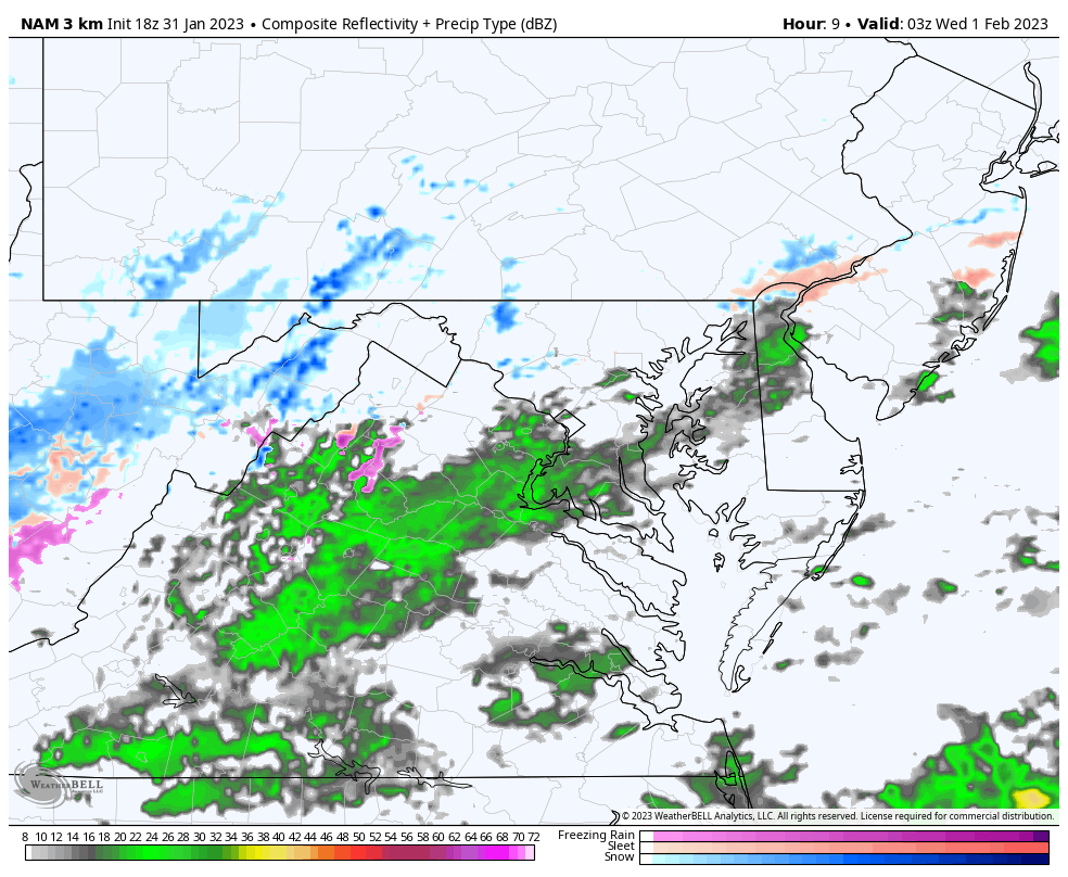
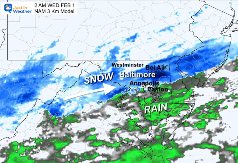
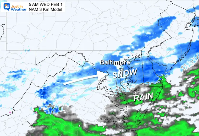
Model Simulation
NAM 3 Km 10 PM TUE to 10 AM WED
This is earlier than the HRRR Model and a little longer in duration. It also has the warmer air father north, so that rain line may be close to Rt. 50 crossing the Bay Bridge.
2 AM
5 AM
Temperatures
This is the big question. Calling snow to fall is one thing, but the ground is warm.
This is why most roads will be wet, but snow may accumulate up to 1 inch near Baltimore. That would end the snow drought.
Plow Guys: Inland areas will drop to freezing. So west and north of the Baltimore and DC beltways could get the wet ground to coat a little at the end, or ice up before sunrise.

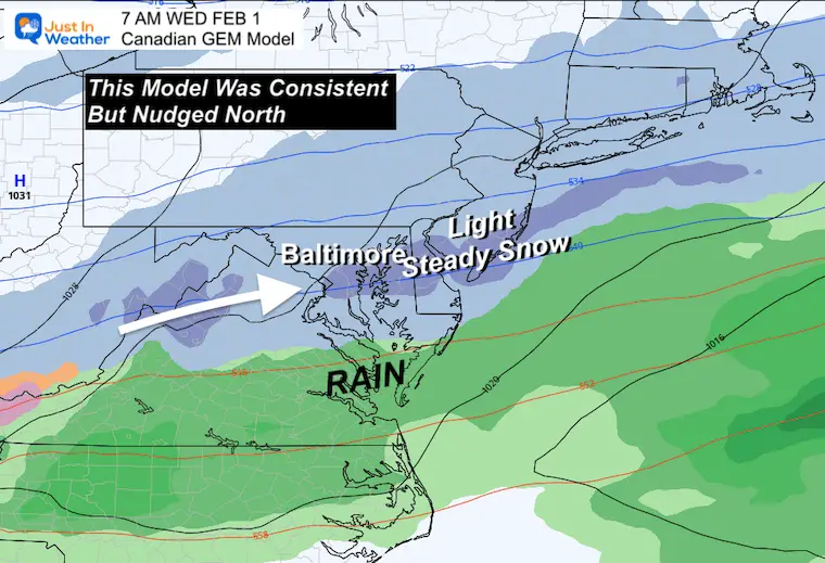
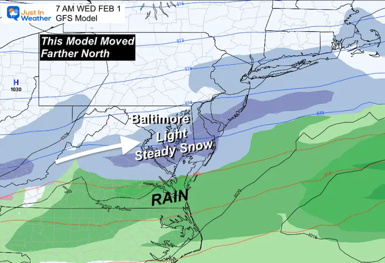
Global Models
Let’s start with the Canadian GEM since it has also been showing this. Then we can see the GFS and lastly the European which all came back north.
All models are plotted for 7 AM, but show precipitation for a 6 HOUR TOTAL
1 AM to 7 AM
Canadian GEM
This model has been the most consistent with the region under some snow early Wednesday morning.
GFS Model
This model started to creep a little north yesterday. Now it made the jump.
Euro Model
This was the hold out with the farthest south of the front, but has also come in line to join the rest. This adds extra comfort to boost the confidence with actual snow falling into central Maryland.
This could stick on the grass and be measured at official stations to end the drought. All that is needed is 0.1” or more to be considered more than a TRACE.
I will explore the snow maps and have my call in my next report tonight.
FITF – Faith in the Flakes
Latest Measurable Snow In Baltimore
Today Is 3rd Latest
- Feb 21 in 1973 (50 years ago)
- Feb 6 in 1914 (109 years ago)
- Jan 30 in 2023 (Today)
- Jan 25 in 1992 ( 31 years ago)
- Jan 25 in 1901 ( 122 years ago)
- Jan 23 in 1966 (57 years ago)
Looking Ahead:
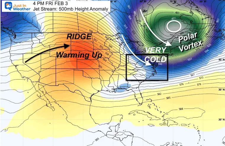
Jet Stream: Snapshot Friday
The Polar Vortex will be dislodged to Eastern Canada. That will send in our arctic blast, but like the Christmas event, it will be brief. Then we will warm up again next week.
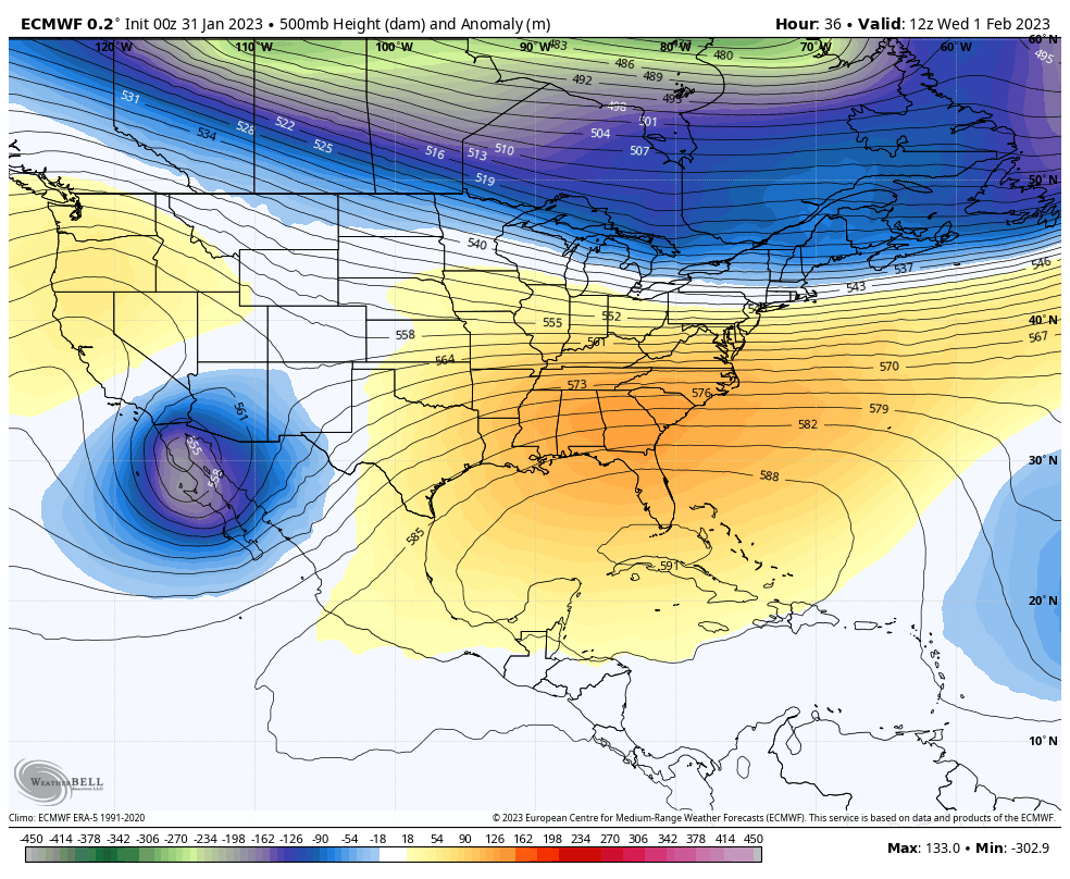
Jet Stream Animation
Wed Feb 1 to Mon Feb 6
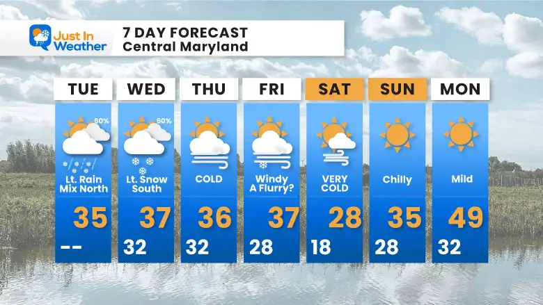
7 Day Forecast
Two impulses over the next few days, then the really cold air settles in. We could see some flurries with the cold winds, but the core arctic air will be here Saturday. Then we start to warm up AGAIN.
Also See:
Winter History: Low Snow And Late Starts
See my research based on Baltimore data since 1883.

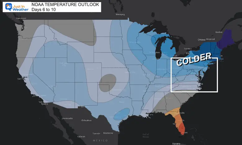
NOAA Outlook: Colder Start To February
Click here for the full report
Subscribe for eMail Alerts
STEM Assemblies/In School Fields Trips Are Back
Click to see more and ‘Book’ a visit to your school

My Winter Outlook: Not A Typical La Niña!
I see many factors to support colder influence with multiple systems. Early and later in winter. Check it out.
https://justinweather.com/2022/11/22/winter-outlook-2023-for-snow-not-typical-la-nina-plus-polar-vortex-disruption/
Also See The Winter Outlook Series:
Winter Weather Outlook: Persimmon Seeds And Snow Folklore
September Starts Meteorological Autumn: Weather Climate Stats For Maryland at Baltimore
Farmer’s Almanac Comparison
September Starts Meteorological Autumn: Weather Climate Stats For Maryland at Baltimore
Triple Dip La Niña Winter
https://justinweather.com/2022/09/09/winter-outlook-2023-la-nina-triple-dip-expectations/
CONNECTION TO WINTER?
If you want a snowy winter, this is what you might want to look for in the rest of the tropical season.
Rainbow Ice Cave In Mt. Rainier A Very Rare Find: Photos And Video
Wooly Bear Caterpillars
https://justinweather.com/2022/10/25/winter-weather-outlook-from-the-wooly-bear-caterpillar/
Persimmon Seeds
Winter Weather Outlook: Persimmon Seeds And Snow Folklore
Click to see Top 20 and MORE
Winter Weather Folklore Top 20 And More Outlook Signals From Nature For Cold And Snow
Normals And Records: Maryland and Baltimore Climate History

Please share your thoughts, best weather pics/videos, or just keep in touch via social media


