Wednesday Weather Brings Wintry Start With Timing The Key Element
January 23, 2023
Monday Evening Update
I am approaching this mid week event with mixed feelings. While we did have a bonus snow in our region this morning (inland from the city and Chesapeake Bay), it was brief and melted quickly. This day marks the 5th latest date for Baltimore proper to officially get its first snow, and the next event will be marginal. That is the best we’ve got (for now).
I have many reasons to have low confidence and hesitation calling this storm, and I DO NOT trust model snow plots. I feel better suggesting the areas that may have some impact, rather than how much. That is more realistic than showing computer model snow maps that most likely will not verify.
Also See:
Winter History: Low Snow And Late Starts
See my research based on Baltimore data since 1883.
Storm Animation
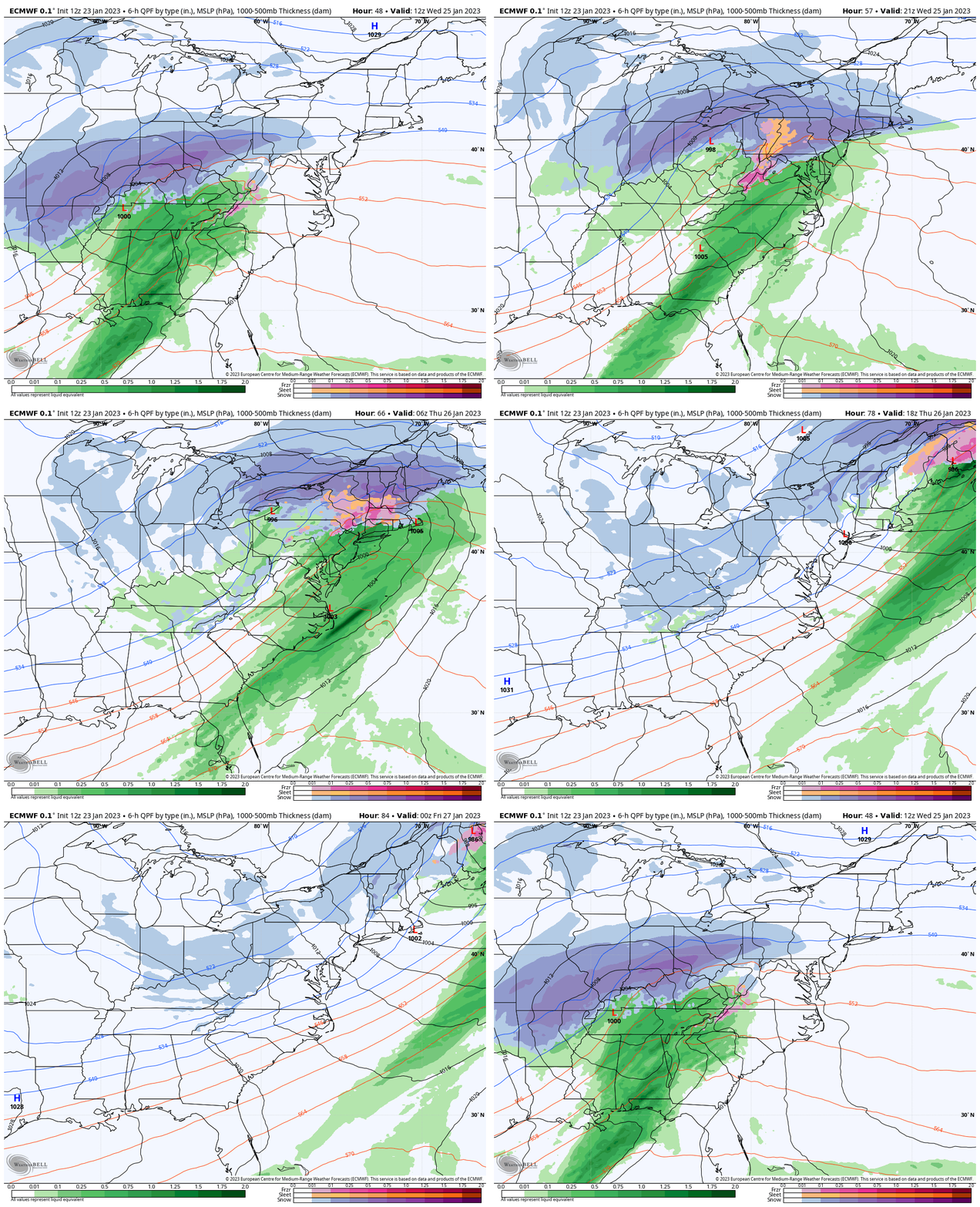
ECMWF Model: 7 AM WED to 7 PM THU
This will begin with snow, then change to rain inland. The places by I-95, the Bay, and southward are likely to once again get mostly rain.
Who Will Get Snow?
I’m showing my comfort level at this point on the map below.
Timing will be KEY! At this point, the models are trying to bring this in after sunrise to midday. Should we end up with a faster arrival closer to, or before sunrise, there will be more cold air in place to expand the snow coverage.
Impact Chances
If you saw some snow this morning (Monday), then you have a better chance to see it again Wednesday.
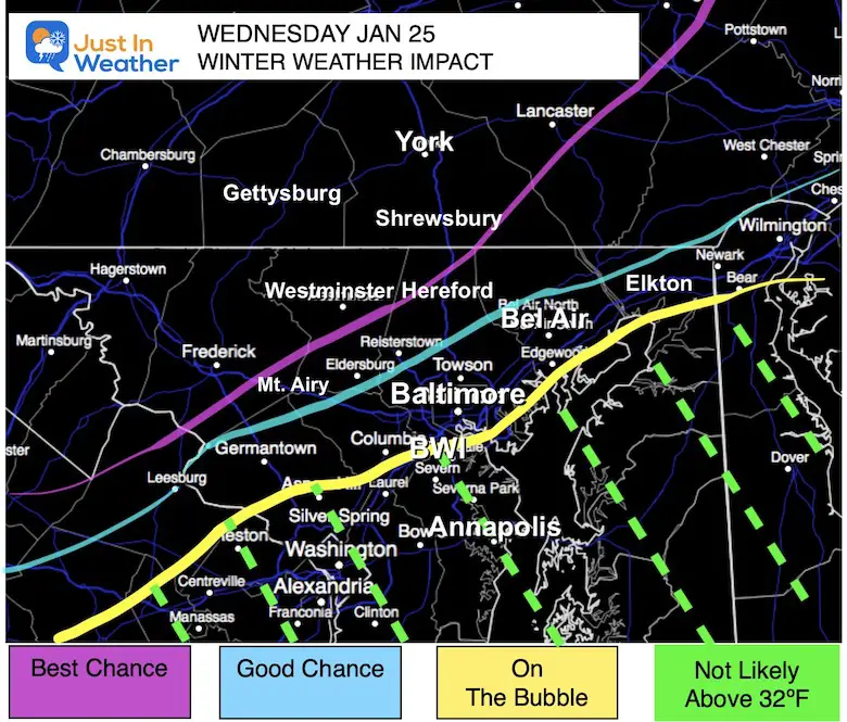
Best Chance Includes: Martinsburg, Hagerstown, Frederick, Westminster, York, and Lancaster.
Good Chance: Mt. Airy, Eldersburg, Hereford…
On The Bubble: Germantown, Columbia, Baltimore, Bel Air, Elkton, even Metro Philadelphia off the edge of the map.
Not Likely: South and East of BWI. This includes Essex, Annapolis, Washington, Southern Maryland, and most of the Eastern Shore.
Model Plots
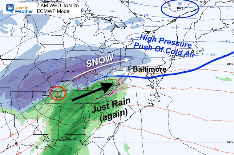
7 AM ECMWF
This is the first image in the animation above. High Pressure north of New England will be responsible for the cold air mass in place.
As the Low Pressure arrives from western Tennessee, the moisture will stream ahead of it. This is more likely to ride along the front range of the mountains. The leading edge will experience drying and result in Virga, further complicating where the initial flakes can reach the ground in the morning.
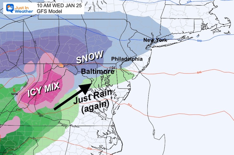
10 AM GFS Model
This is now the fastest projection, bringing in the leading edge to metro Baltimore and even Philadelphia between 7 AM and 10 AM.
Moderate snow extends to the northwest suburbs.
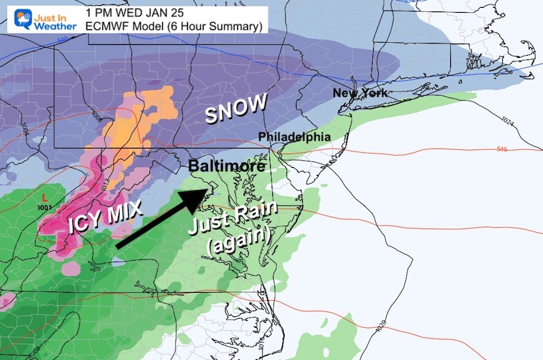
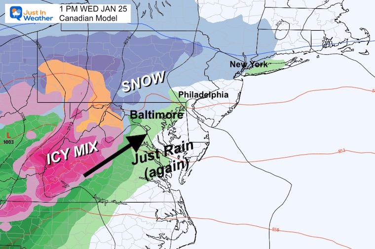
1 PM (6 Hour Summary)
ECMWF
The European Model brings in the precipitation between 7 AM and 1 PM.
The snow line slices through Baltimore.
Canadian GEM
The Canadian has a similar time frame, but is slower. The result allows for warmer air into metro Baltimore, restricting the snow farther north. But this scenario has a faster change over to rain.
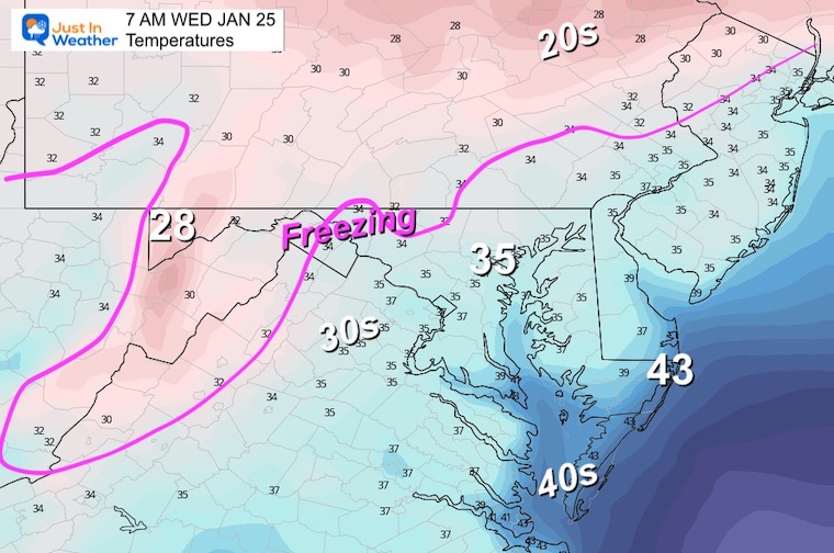
Temperatures
Early Morning
This is why the timing is important. At 7 AM, the freezing air is barely registering in the inland areas.
However, given the snow burst we saw this Monday morning with temps above freezing, it is possible to get that again with slushy stickage.
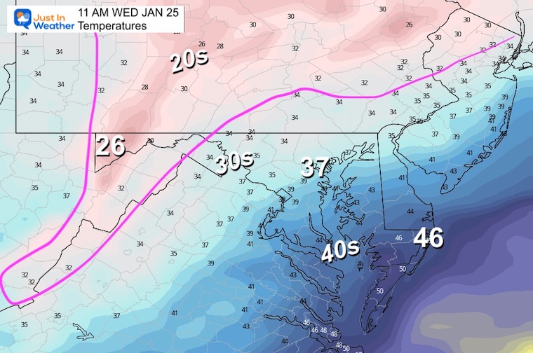
Late Morning
The cold air is prominent in the mountains west of Hagerstown and north of Harrisburg, but once again a thaw closer to metro areas. This is why if the snow arrives later in the morning, little to no stickage is expected.
Key Take Away:
TIMING! I will be watching for trends in the modeling for the arrival time. That is the make or break here. That will be my focus and I will bring more realistic expectations and snow totals if required in my Tuesday reports.
Weather posts straight to your inbox
Sign up and be the first to know!
SNOWSTIX – Available Now
STEM Assemblies/In School Fields Trips Are Back
Click to see more and ‘Book’ a visit to your school
My Winter Outlook: Not A Typical La Niña!
I see many factors to support colder influence with multiple systems. Early and later in winter. Check it out.
October 27 Nor’easter Recap Still Breezy Then Next Storm Friday
Also See The Winter Outlook Series:
October 27 Nor’easter Recap Still Breezy Then Next Storm Friday
Farmer’s Almanac Comparison
September Starts Meteorological Autumn: Weather Climate Stats For Maryland at Baltimore
Triple Dip La Niña Winter
CONNECTION TO WINTER?
If you want a snowy winter, this is what you might want to look for in the rest of the tropical season. (You might be seeing a lot of commercial snow removal people out this Winter).
Rainbow Ice Cave In Mt. Rainier A Very Rare Find: Photos And Video
Wooly Bear Caterpillars
https://justinweather.com/2022/10/25/winter-weather-outlook-from-the-wooly-bear-caterpillar/
Persimmon Seeds
Click to see Top 20 and MORE
Winter Weather Folklore Top 20 And More Outlook Signals From Nature For Cold And Snow
Normals And Records: Maryland and Baltimore Climate History
Please share your thoughts, best weather pics/videos, or just keep in touch via social media
-
Facebook: Justin Berk, Meteorologist
-
Twitter: @JustinWeather
-
Instagram: justinweather


