January 19, 2023
This is a brief update on the storm today that will still have more storms push through tonight. While one steady band of rain is moving east, there will be more showers and possible thunder mixed in as the cold front swings by overnight.
Behind this will be colder winds and snow across the mountains that will bring beneficial inches to the bigger ski resorts.
Beyond this is a colder system on Sunday that may begin with snow for parts of our region. This is trending colder, and I will explore more on the pattern change in a follow-up report.
Thursday Afternoon
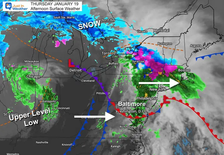
Steady rain is moving east of Baltimore but will be tracking north on I-95. We remain on the cooler side of this system, yet a cold front will pass by tonight, igniting heavier showers.
Part of this system is the Upper Level Low between Illinois and Indiana. That is the energy that will team up with colder air and bring snow to the higher mountains tomorrow.
Live Radar Widget
Radar Simulation:
HRRR Model 4 PM Thu to 1 PM Fri
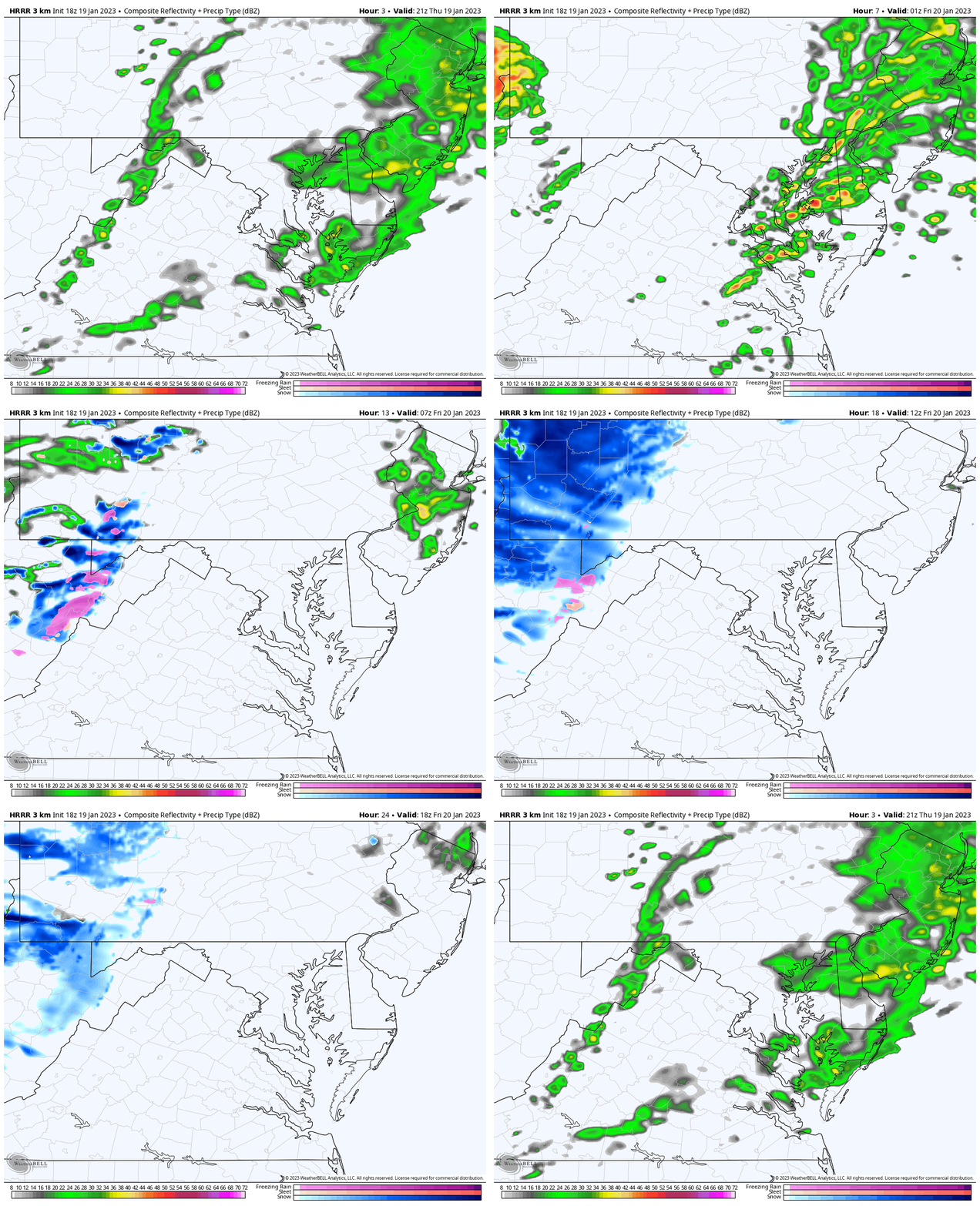
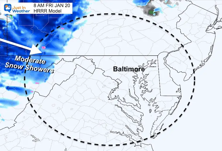
Heavier showers are possible this evening and tonight, followed by a transition to snow in the mountains through Friday.
Snapshots
8 PM
The best chance for this line to cross metro Baltimore and I-95 will be between 6 PM and 8 PM.
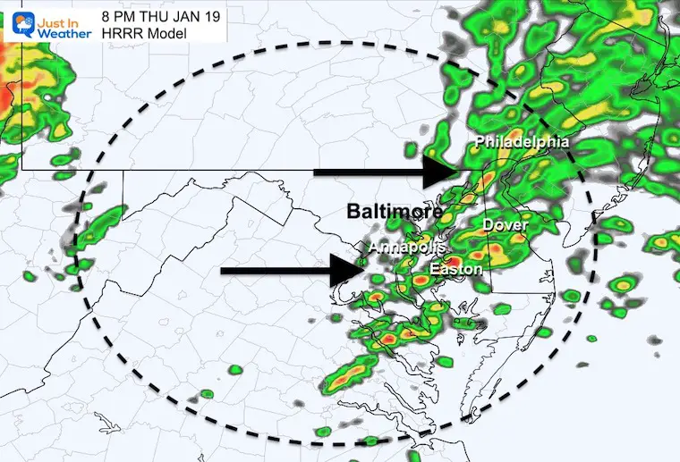
Midnight
This final band of showers along the Maryland and Pennsylvania line will be between 10 PM and midnight.
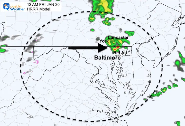
Friday Morning
If your weekend includes skiing, this is good news. Moderate snow showers will prevail on Friday.
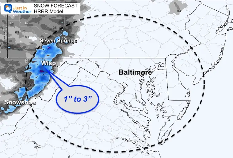
Snow Forecast
A modest fresh 1 to 3 inches of new snow is expected for Seven Springs in PA, Wisp in Maryland, and Snowshoe in WV.
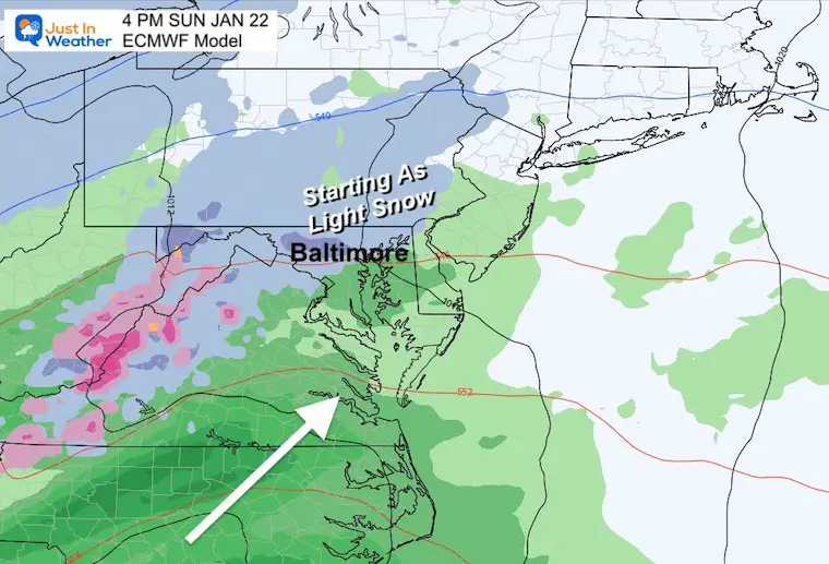
Next Up: Snow Starting Sunday?
This snapshot from the European Model shows a little more snow into central Maryland during Sunday afternoon.
This is trending to track south with colder air, and I still see marginal conditions and a trend to rain…However, this could end with snow.
I will have a deep dive into this and the pattern change in my next report this evening.
Subscribe for eMail Alerts
Weather posts straight to your inbox
Sign up and be the first to know!
SNOWSTIX – Available Now
STEM Assemblies/In School Fields Trips Are Back
Click to see more and ‘Book’ a visit to your school
My Winter Outlook: Not A Typical La Niña!
I see many factors to support colder influence with multiple systems. Early and later in winter. Check it out.
October 27 Nor’easter Recap Still Breezy Then Next Storm Friday
Also See The Winter Outlook Series:
October 27 Nor’easter Recap Still Breezy Then Next Storm Friday
Farmer’s Almanac Comparison
September Starts Meteorological Autumn: Weather Climate Stats For Maryland at Baltimore
Triple Dip La Niña Winter
CONNECTION TO WINTER?
If you want a snowy winter, this is what you might want to look for in the rest of the tropical season. (You might be seeing a lot of commercial snow removal people out this Winter).
Rainbow Ice Cave In Mt. Rainier A Very Rare Find: Photos And Video
Wooly Bear Caterpillars
https://justinweather.com/2022/10/25/winter-weather-outlook-from-the-wooly-bear-caterpillar/
Persimmon Seeds
Click to see Top 20 and MORE
Winter Weather Folklore Top 20 And More Outlook Signals From Nature For Cold And Snow
Normals And Records: Maryland and Baltimore Climate History
Please share your thoughts, best weather pics/videos, or just keep in touch via social media
-
Facebook: Justin Berk, Meteorologist
-
Twitter: @JustinWeather
-
Instagram: justinweather


