This has been one potent storm crossing the country with destruction from California to the Southeast. We had a few rounds of heavy rain with lightning and thunder in Maryland as well. Some of that rain lingers this morning, but it will be moving away.We will take a look at the live radar, simulation, and wind forecast after recapping the tornado outbreak in Alabama!
Headlines
Morning: Rain ending
Afternoon: Windy and Colder, Mountain Snow
Weekend: Seasonably Chilly
Next Week: Final Warm Push With Rain
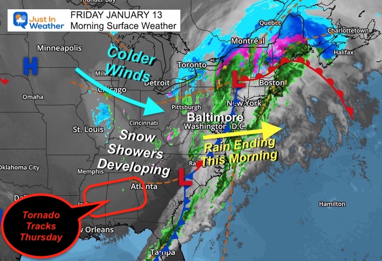
Morning Surface Weather
The storm covers the entire Eastern US, from snow in Maine to thunderstorms in Florida. We still have rain moving through, and a look at the radar below.Snow showers will develop in the mountains with the colder winds.
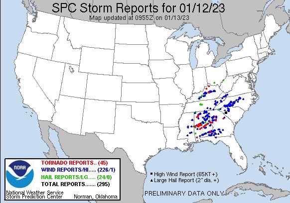
NOAA Thursday Storm Reports
It was a busy day, with 45 tornado reports! Most were in Alabama and Georgia.Hardest hit was the city of Selma.
Video: Tornado Report From CBS News
I wanted to find the shortest complete coverage of the event. Our daily weather is below.
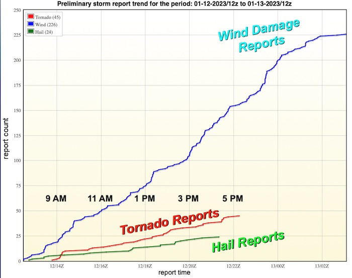
NOAA Storm Report Timing Trend
Tornadoes began in the morning and lasted through 5 PM
Local Weather
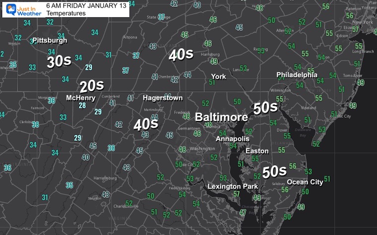
Morning Temperatures
This helps show where the front was located at 6 AM.Colder air is moving in and will be following the end of the rain.
Live Radar Widget
Radar Simulation
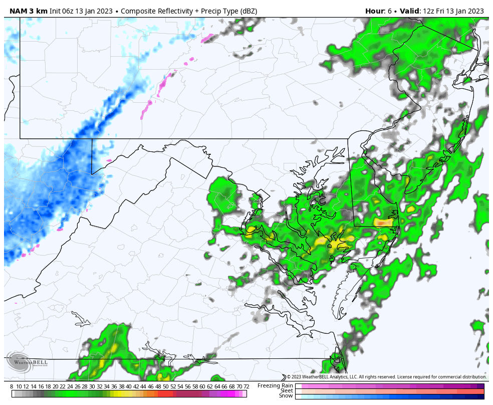
NAM 3 Km Model 7 AM to 4 PM
Rain will end after 9 AM
Snow showers will continue all day in the mountains.Between 2 and 6 inches expected from Seven Springs to Wisp, and Snowshoe.
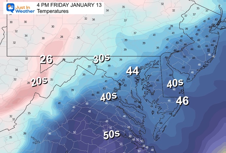
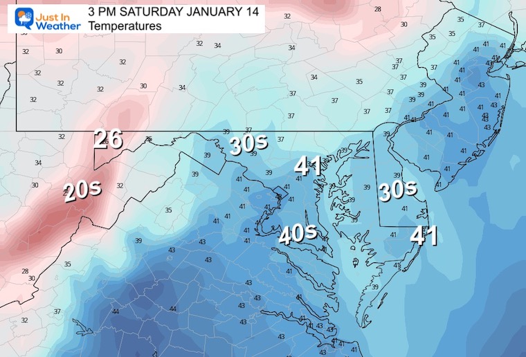
3 PM Temperatures
Colder air will arrive by noon and hold steady the rest of the day.
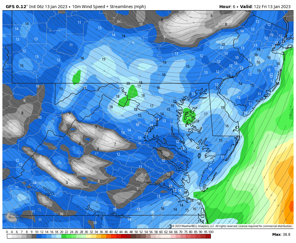
Wind Forecast: NAM 7 AM Fri to 7 AM Sat
Cold air will continue to flow through the start of the weekend.
Steady winds of 15 to 25 mph, with gusts over 30 mph will introduce a wind chill again!
Subscribe for eMail Alerts
Weather posts straight to your inbox
Sign up and be the first to know!
CLIMATE DATA
TODAY January 13
Normal Low in Baltimore:26ºF
Record 0ºF in 1981
SNOW: 7.8” 1964
Normal High in Baltimore: 43ºF
Record 76ºF 1932
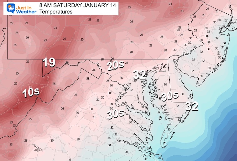
Saturday Temperatures
Morning
Afternoon
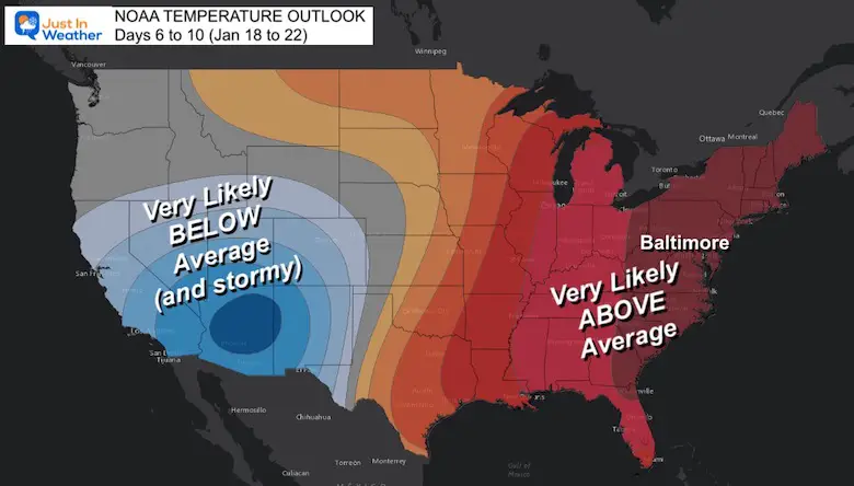
Warm Outlook Next Week, Then Winter Returns
NOAA Temperature Outlook
Yes, we will warm up again next week with a series of more rain events…
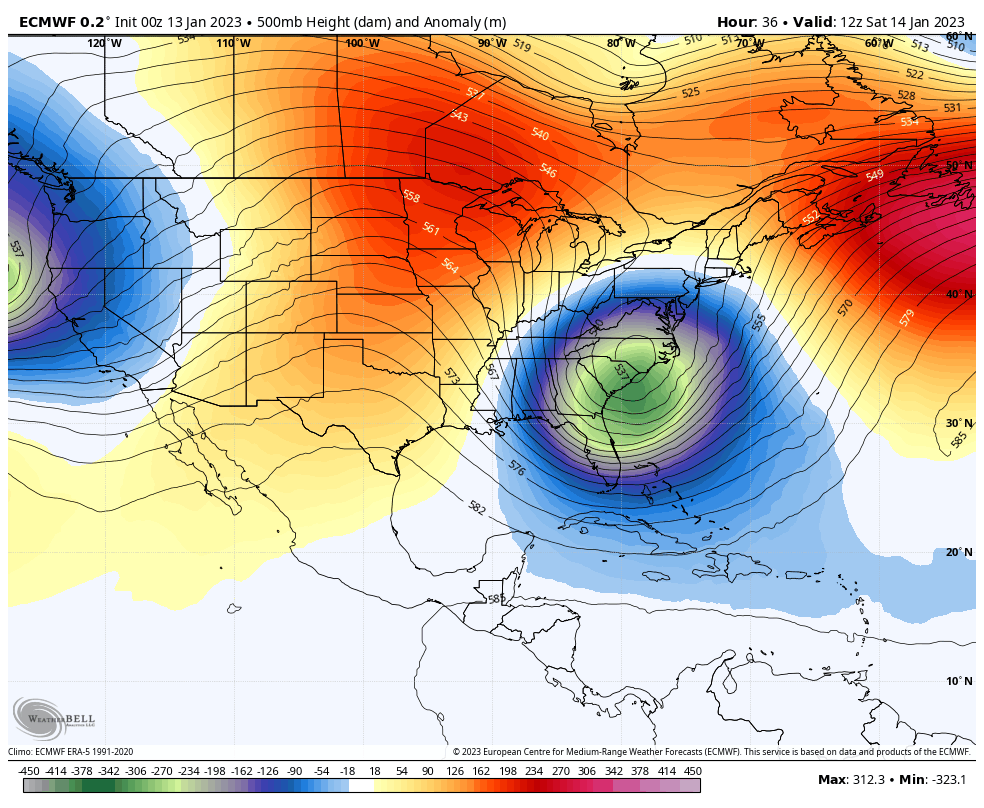
Jet Stream: Jan 14 to Jan 22
The upper air pattern is showing signs of flipping back to bring winter to the East, close to, or just after January 21.
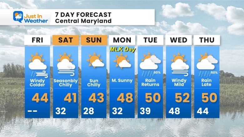
7 Day Forecast
Next week will be warmer and wet. But this should be the last of this phase, before getting back to winter for the last week to 10 days of the month.
If you want a snowy winter, this is what you might want to look for in the rest of the tropical season. (You might be seeing a lot of commercial snow removal people out this Winter).