December 17 Colder Winds Flurries And Pre Christmas Winter Storm
December 17 2022
Saturday Morning Update
The white elephant in the room is the big storm before Christmas. We are now less than one week away and it is realistic to get into more detail, which I will below. However, I want to start with our colder winds today and the flurries I have been mentioning.
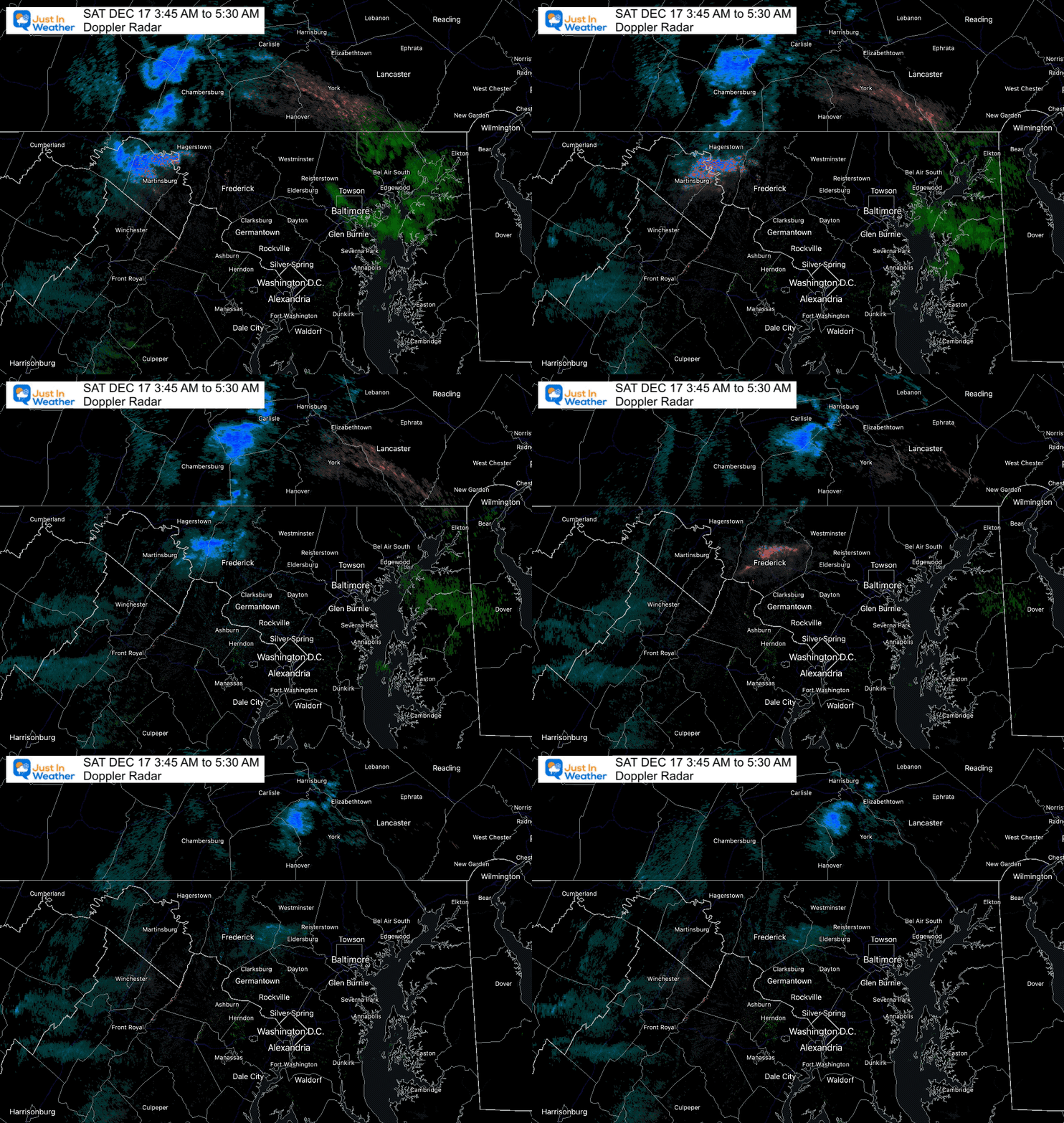
Early Morning Radar Loop
3:45 AM to 5:30 AM
Watch a few showers try to cross the mountains, but fade farther east. There is like to be more support today and tomorrow.
Morning Temperatures
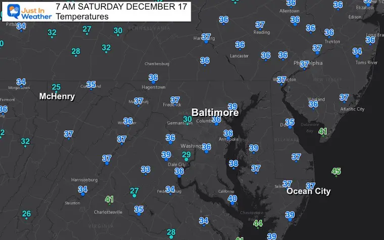
Most areas are above freezing and the ground (like) Thursday is still holding a little heat. I don’t see an ice concern locally. The mountains west of Cumberland are still a winter wonderland.
Headlines
- Weekend: Cold winds, maybe a Flurry
- Western Maryland (and nearby ski resorts): Snow Showers
- Next Week: Chilly and Dry
- Just Before Christmas: Possible Major Storm AND Arctic Outbreak
Morning Surface Weather
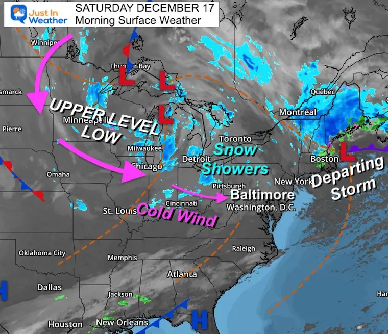
As the storm departs New England and a large Upper Level Low brings the core of the cold air over the Great Lakes, we will get colder winds. The result will be snow showers in the mountains. East of the mountains, occasional clouds and maybe a flurry.
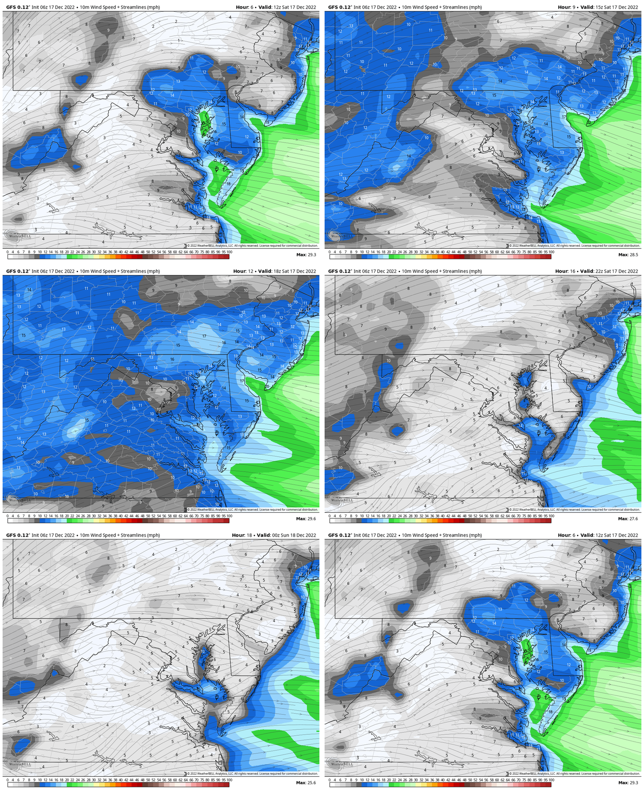
Wind Forecast
A colder push of air will increase in the afternoon.
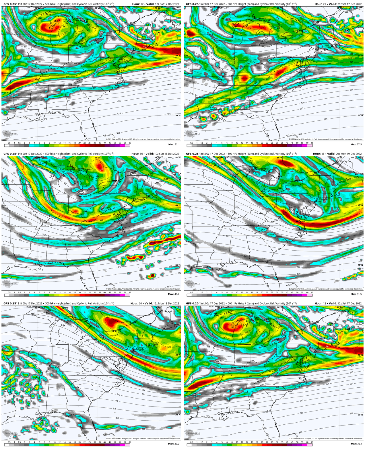
Upper Level Energy
A few Vort Maxes will rotate through around the Upper Level Low. That is why I believe occasional clouds and passing flurries are possible.
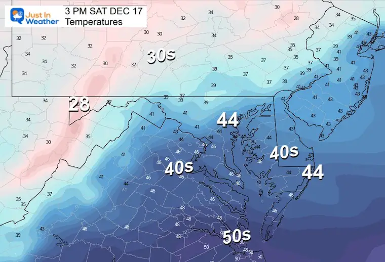
Afternoon Temperatures
Start of the colder air.
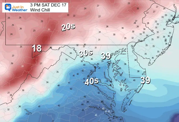
Wind Chill
It will feel up to 10 degrees colder
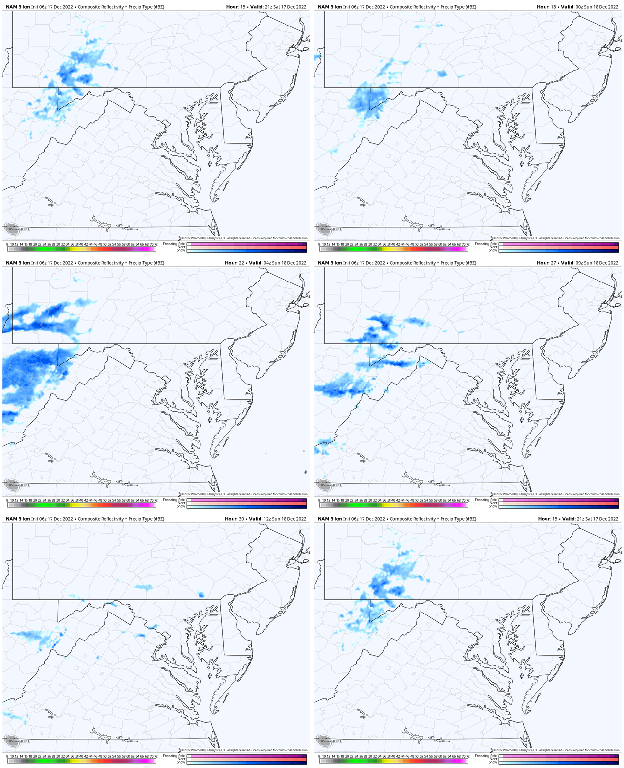
Radar Simulation
4 PM SAT to 7 AM SUN
Upslope snow will continue in Garrett County and the high mountains. This does not do a good job showing flurries, but a hint can be seen near central areas.
Subscribe for eMail Alerts
Weather posts straight to your inbox
Sign up and be the first to know!
CLIMATE DATA
TODAY December 17
Normal Low in Baltimore: 29ºF
Record 5ºF in 1951
SNOW: 11.5” 1932
Normal High in Baltimore: 47ºF
Record 68ºF 1984
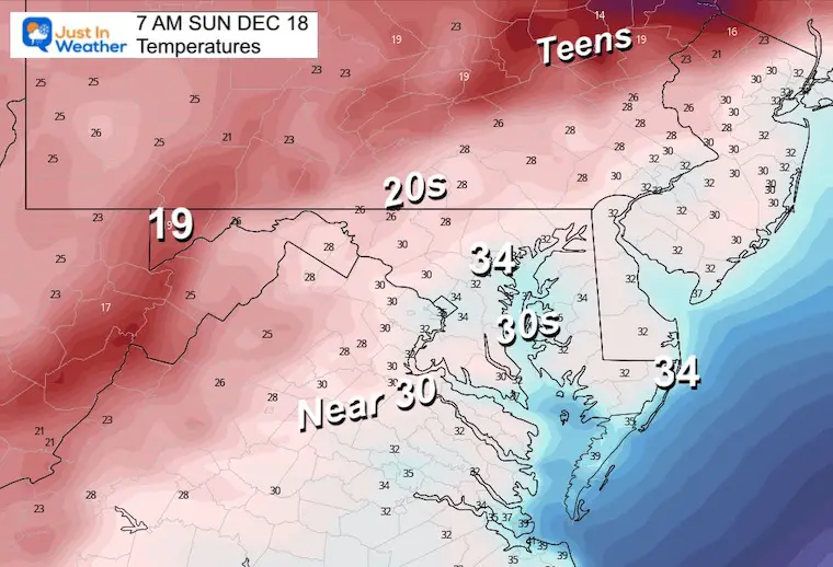
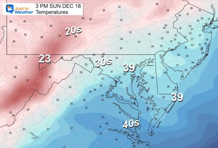
Sunday Temperatures
Morning
Colder air on the move. How cold we get will depend on the winds and cloud cover. If it clears out by you and winds settle down, then it could get colder than this.
Afternoon
A chance even Baltimore remains in the 30s.
Looking Ahead To The BIG STORM (2-Days)
THURDAY
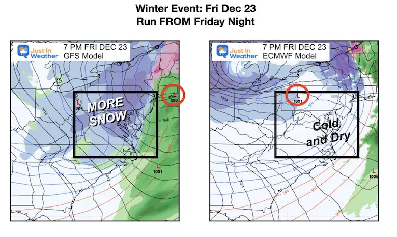
There is a BIG DIFFERENCE Between the GFS and European ECMWF Models!
The GFS (right) is colder with a coastal Low and Snow. The European (left) is warmer for us with mostly rain and snow confined to the mountains.
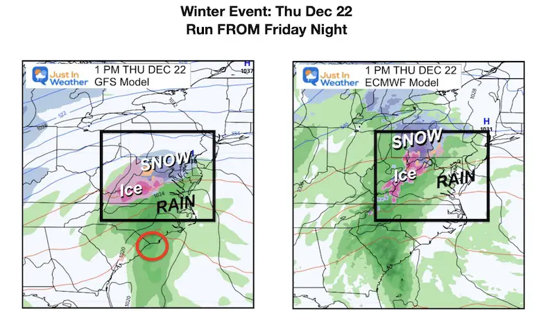
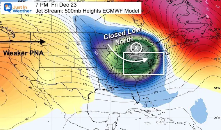
WHY SO DIFFERENT? Jet Stream!
(if you are revisiting this article I corrected the date on the storm map)
The GFS Model has a deeper Trough, pushing the energy for the Low to our south. This is in part thanks to a STRONGER PNA (energy from the Pacific).
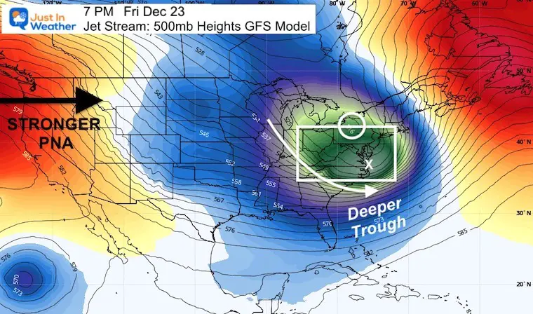
The European ECMWF has the core Low in that cold air, closed off with the energy underneath it. This is in part thanks to a weaker PNA, thus the surface energy results in a ‘cutter’ inland. That is what brings in warmer air to the big cities.
Storm Animations
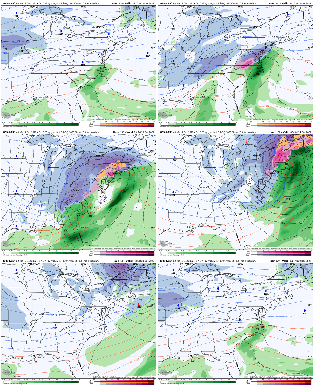
GFS Model
This is the Colder Coastal Storm Solution… Showing a snow storm and additional energy carrying Thursday into Friday.
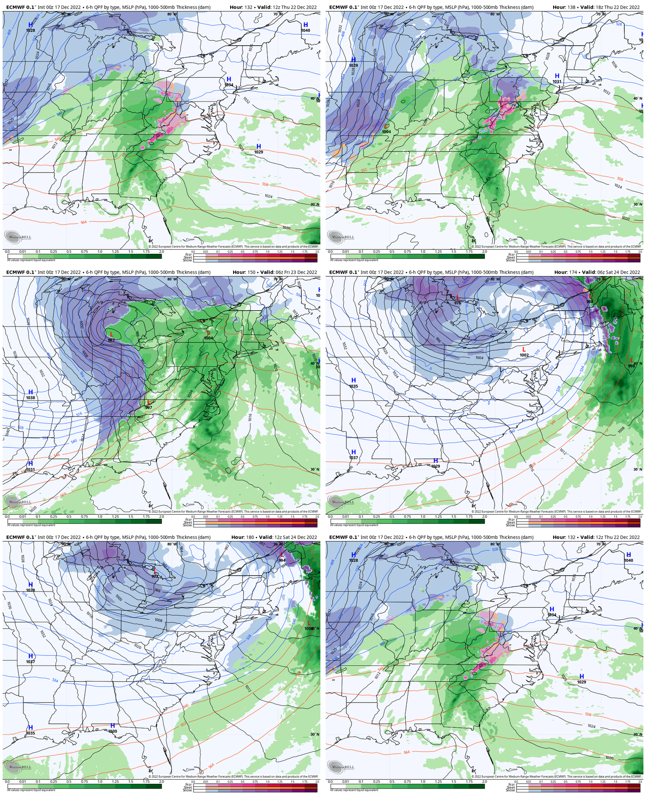
ECMWF Model
This is the Warmer solution with the Core Low Closed in the Great Lakes.
This shows Thursday with rain, ending with snow inland. With the inland orbit of the Upper Low, we get ‘dry slotted’, and a dry but colder Friday.
Friday Snapshot
We see the atmosphere likely to produce a storm, but HOW THE ENERGY COMES TOGETHER is very different. The uncertainty is because this has not even begun to form yet.
STILL TOO EARLY
I thought this Tweet was very appropriate yesterday. The storm has not even formed yet and the main energy is still very far away.
Adding a little perspective to those Southeast snowstorm posts you’re seeing on your timeline right now… pic.twitter.com/awTRiEvZqf
— Evan Fisher (@EFisherWX) December 16, 2022
I will have a more detailed look in my next report this afternoon.
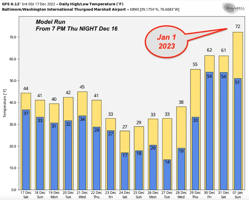
Below the 7-day forecast, I will show you how even one model can DRAMATICALLY SHIFT in a single day!
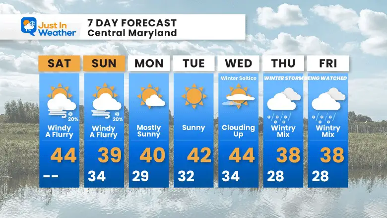
7 Day Forecast
This week is more about the cold wind, but some ambient flurries are possible. Snow will affect travel west of Cumberland.
Remaining cold next week. Winter Solstice is Wednesday!
Thursday and Friday remain a WILD CARD. I took a blend of models, but likely the High Temp would be at midnight and drop during the day.
I would not endorse anyone locking in on a promise now. Definitely do not consider a promise for totals. Just consider a possible impact on Thursday to Friday for travel.
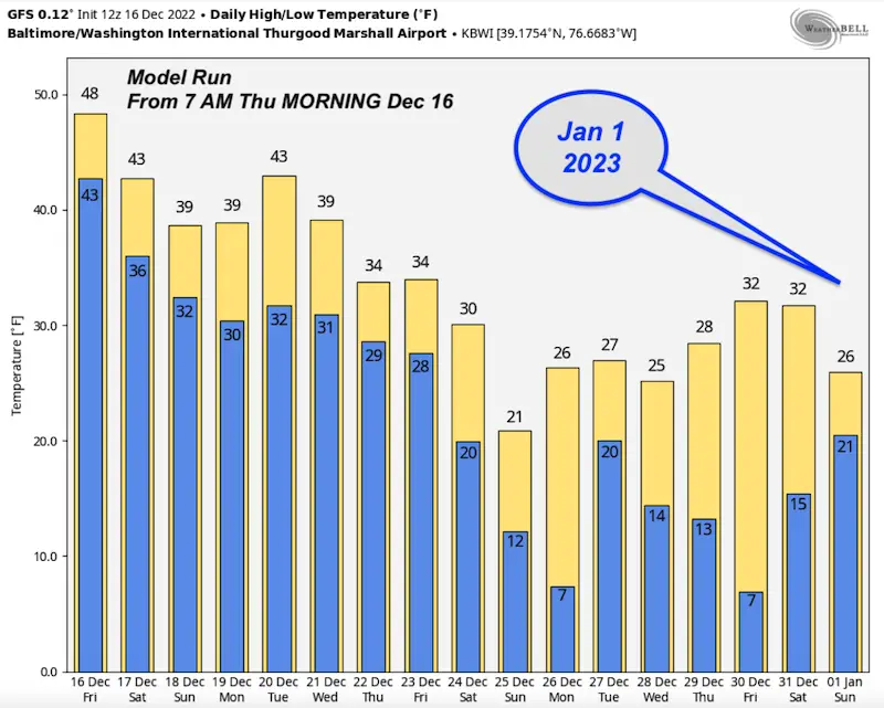
LONG RANGE MODEL UNCERTAINTY
Compare GFS Model temperatures through New Year’s Day
The big difference is based off the shift of Greenland Blocking and The Polar Vortex. The location would determine remaining cold or surging warmth. I think that ‘warmth’ is a glitch.
From Friday Morning
From Friday Evening
I will have a more detailed look at the storm in my afternoon report.
Faith in the Flakes Gear
What is Faith in the Flakes?
It began with my son in 2009
October 27 Nor’easter Recap Still Breezy Then Next Storm Friday
SNOWSTIX – Available Now
STEM Assemblies/In School Fields Trips Are Back
Click to see more and ‘Book’ a visit to your school
My Winter Outlook: Not A Typical La Niña!
I see many factors to support colder influence with multiple systems. Early and later in winter. Check it out.
October 27 Nor’easter Recap Still Breezy Then Next Storm Friday
Also See The Winter Outlook Series:
October 27 Nor’easter Recap Still Breezy Then Next Storm Friday
Farmer’s Almanac Comparison
September Starts Meteorological Autumn: Weather Climate Stats For Maryland at Baltimore
Triple Dip La Niña Winter
CONNECTION TO WINTER?
If you want a snowy winter, this is what you might want to look for in the rest of the tropical season. (You might be seeing a lot of commercial snow removal people out this Winter).
Rainbow Ice Cave In Mt. Rainier A Very Rare Find: Photos And Video
Wooly Bear Caterpillars
https://justinweather.com/2022/10/25/winter-weather-outlook-from-the-wooly-bear-caterpillar/
Persimmon Seeds
Click to see Top 20 and MORE
Winter Weather Folklore Top 20 And More Outlook Signals From Nature For Cold And Snow
Normals And Records: Maryland and Baltimore Climate History
Please share your thoughts, best weather pics/videos, or just keep in touch via social media
-
Facebook: Justin Berk, Meteorologist
-
Twitter: @JustinWeather
-
Instagram: justinweather


