October 17 Strong Front May Start A Storm Then Bring Freeze And Mountain Snow
October 17 2022
Monday Morning Update
A series of cold fronts will be surging in true FALL temperatures over the next two days. It may not seem like it this morning with a mild start. This is ahead of the first front, which has brought a band of rain overnight and this morning across southern Maryland and the beaches.
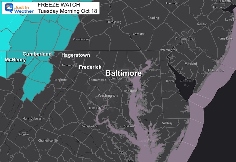
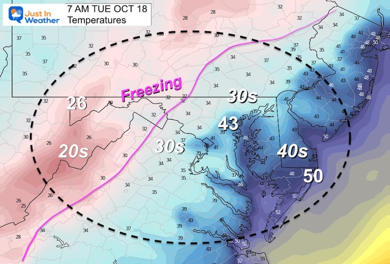
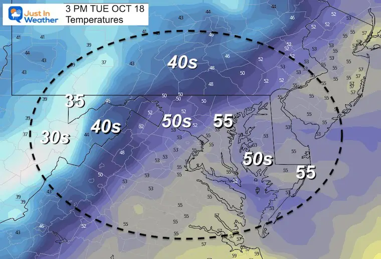
The next push will be noticeable by Tuesday morning. Colder winds will keep most of us in the 50s during the days, with 30s overnight. A Freeze Watch has been issued for Western Maryland, but I expect it to expand.
Lake Effect Snow will reach western Maryland with some stickage in the mountains, and a few flurries may pass metro areas mid week.
Morning Surface Weather

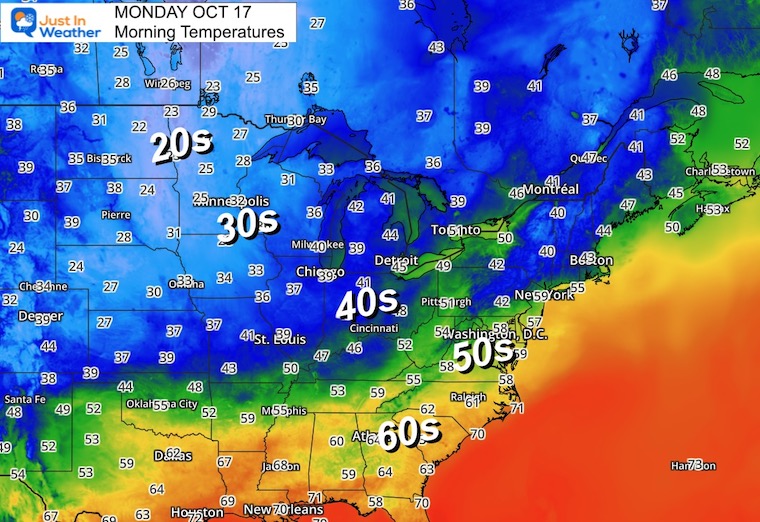
Morning Temperatures
Widespread 30s and 20s are being reported cross the Northern Plains into Central Canada. That is the source for our next air mass.
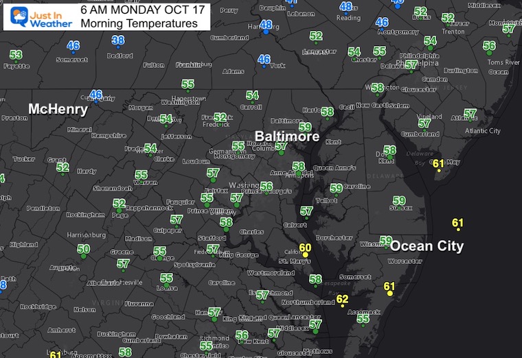
Closer Look
Official weather stations at area airports.
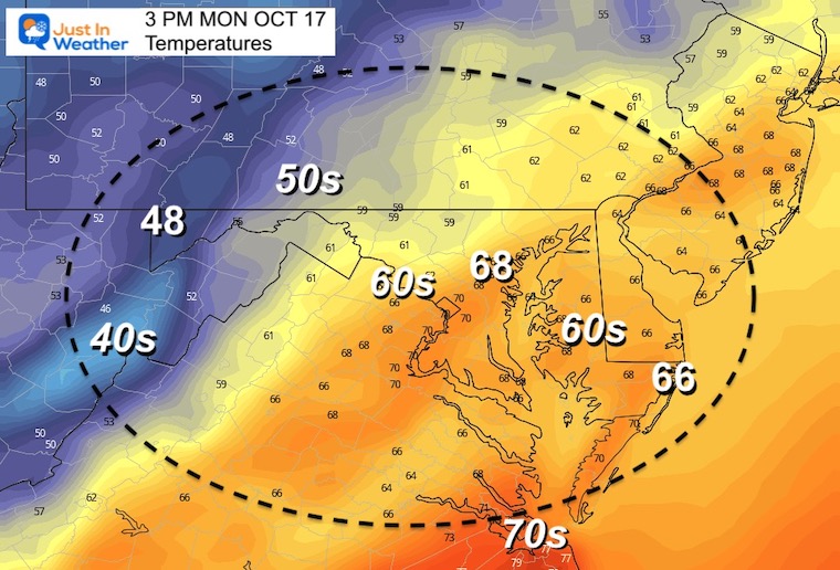
Afternoon Temperatures
Still mild, but the cold air is on the way.
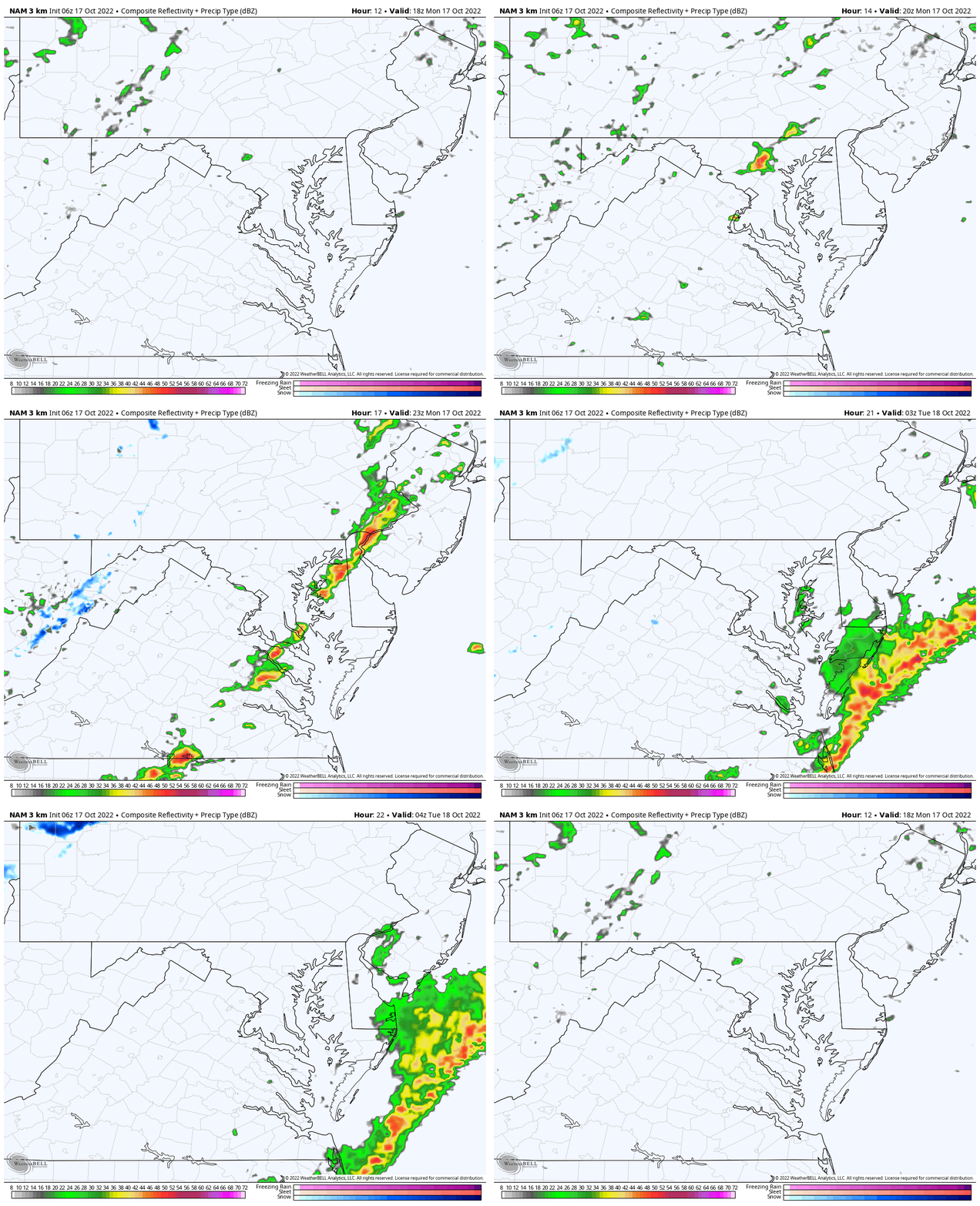
Radar Simulation:
Showers and maybe a line of thunderstorms will try to develop AFTER 2 PM.
CLIMATE DATA
TODAY October 17
Normal Low in Baltimore: 46ºF
Record 33ºF in 1982
Normal High in Baltimore: 68ºF
Record 90ºF 1938
Weather posts straight to your inbox
Sign up and be the first to know!
Tuesday
Freeze Watch: Far Western Maryland (for now).
This may expand east AND expect more counties by Wednesday Morning
Temperatures
Morning
EXPLORE MORE: WHEN IS THE FIRST FROST?
Weather posts straight to your inbox
Sign up and be the first to know!
Tuesday Afternoon
Weather Set Up
A closed-off Upper Level Low will be spinning around Lake Erie. This will keep bringing colder winds across all the Great Lakes to produce clouds and snow showers. Snow will reach and may stick in the mountains of Western Maryland on Tuesday and Wednesday.
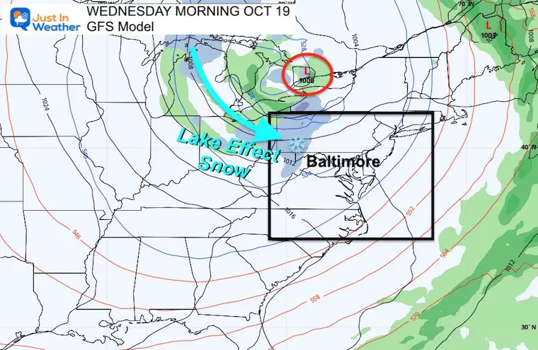
Tuesday Morning To Wednesday Afternoon
Lake Effect Snow reaches the Western Maryland Mountains. Snow is NOT showing up farther east, but there is a hint that upper level energy will allow some flurries to reach the inland suburbs west and north of Baltimore.
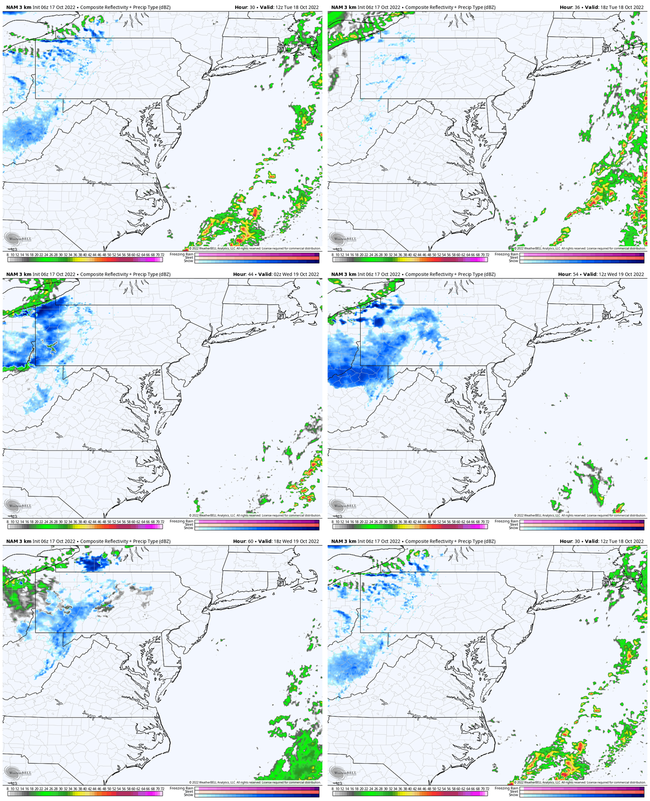
Snow Forecast (suggestion)
These first events very early in the season we need to consider:
- Timing of Snow Falling
- Melting Vs. Stickage
7 Day Forecast
Warmer weekend then much colder next week.

Faith in the Flakes Gear
SNOWSTIX – Available Now
ALSO SEE: Farmer’s Almanac Comparison
CONNECTION TO WINTER?
If you want a snowy winter, this is what you might want to look for in the rest of the tropical season.
Rainbow Ice Cave In Mt. Rainier A Very Rare Find: Photos And Video
Normals And Records: Maryland and Baltimore Climate History
STEM Assemblies/In School Fields Trips Are Back
Click to see more and ‘Book’ a visit to your school
Please share your thoughts, best weather pics/videos, or just keep in touch via social media
-
Facebook: Justin Berk, Meteorologist
-
Twitter: @JustinWeather
-
Instagram: justinweather


