September 5 Labor Day Flood Watch Inland Should Expand East
September 5 2022
Monday Morning Update
The Labor Day holiday may be ending early for some as rain has already moved into the mountains. A Flood Watch includes many campgrounds across western Maryland, West Virginia, and Pennsylvania as heavy rain is expected to slowly push east.
In this post you can compare the live radar widget and forecast simulations. We have seen all summer the tendency has been for rain to arrive earlier than the computer model guidance has shown.
Thunderstorms will develop ahead of the main rain line in metro areas around Baltimore to southern PA this afternoon. But if you are at the beaches or southern Maryland, you should get through more of today dry, however the rain will reach you tonight and tomorrow.
Morning Surface Weather
The slow moving system has already reached our nearby mountains. This will be steady rain, with locally heavy downpours that will slowly spread east. It will be with us through tomorrow, then lingering showers on Wednesday.

Morning Temperatures
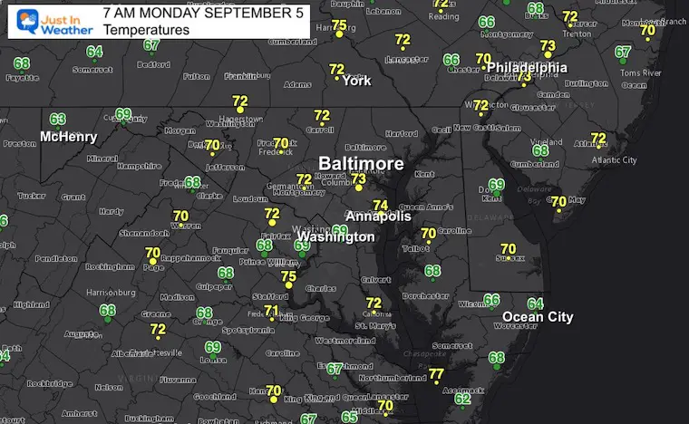
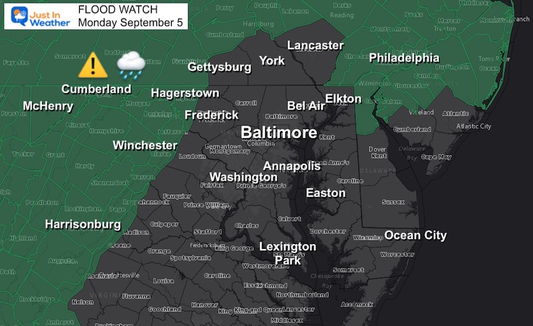
Flood Watch Labor Day Monday
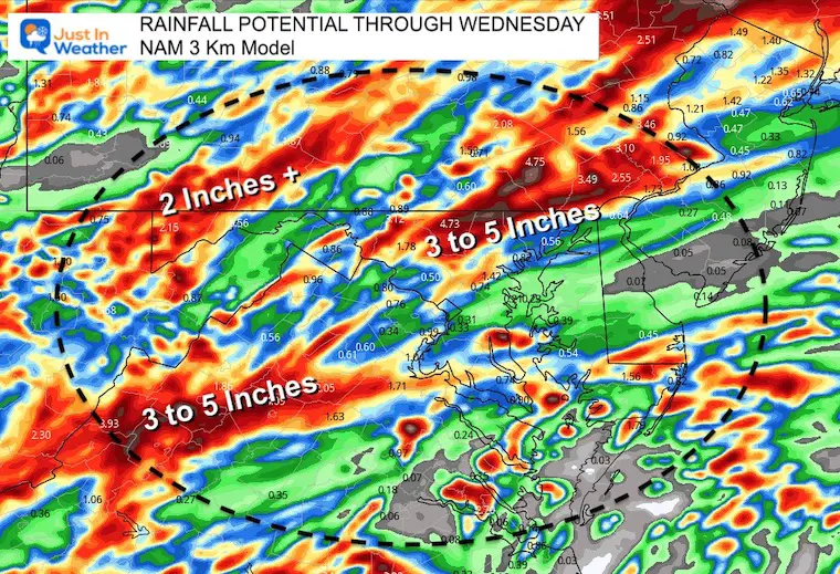
A large portion of the mountains into metro Philadelphia have been included in the advisory today. While there is a GAP between Frederick, Baltimore, and York, I expect these counties will be added by tonight into Tuesday. This is where rainfall may exceed 3 inches with some slow moving thunderstorms.
Rainfall Forecast ‘Potential’ Through Wednesday
LIVE RADAR WIDGET
*Rain this morning has reached Hagerstown… The green shading is where rain is identified by radar at cloud level and most likely reaching the ground.
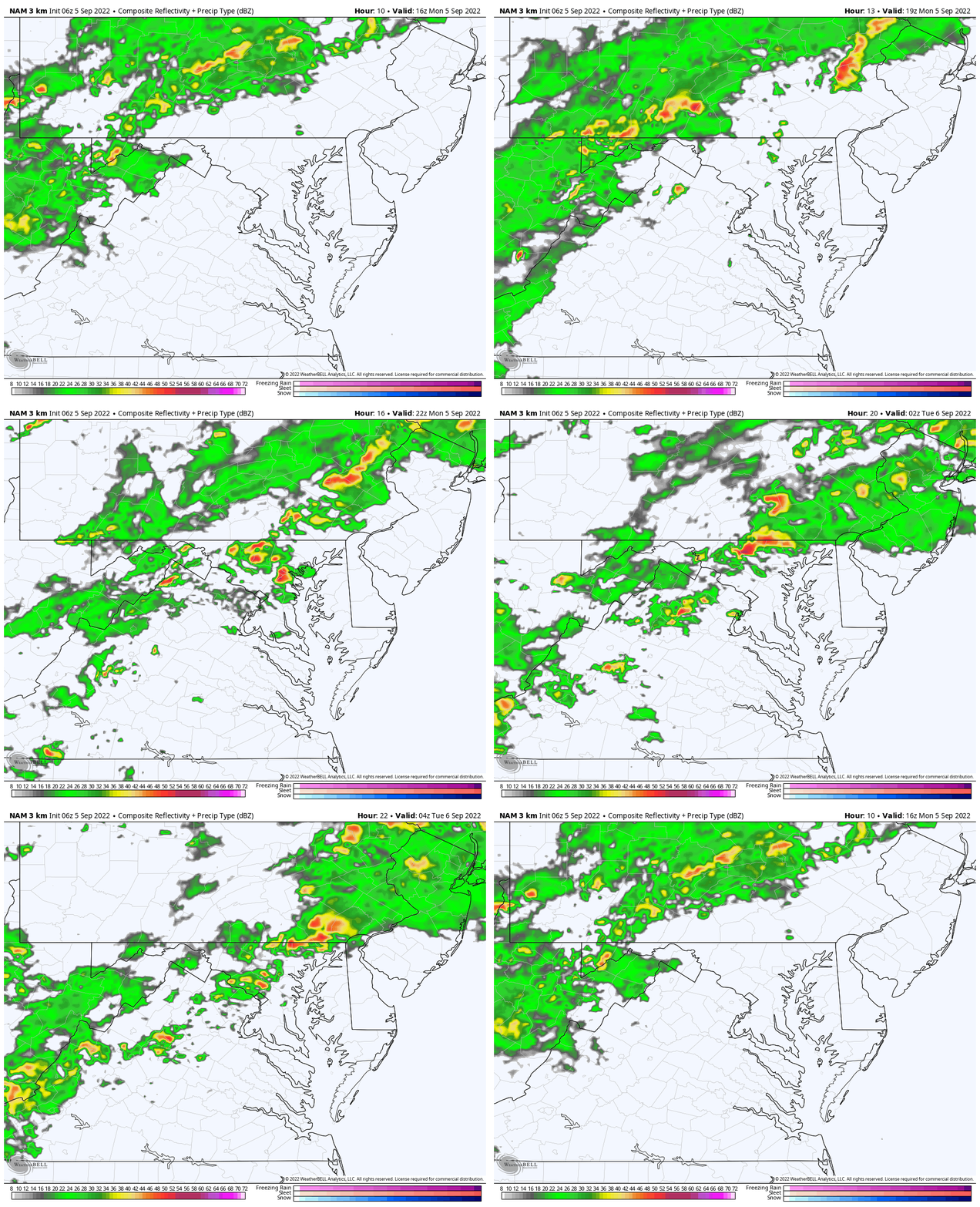
Radar Simulations NAM 3 Km Model
Hourly Slider —> 2 PM to 11 PM
Reminder: This product has been running slow. Rain may arrive an hour earlier than shown here.
Animation Noon to Midnight
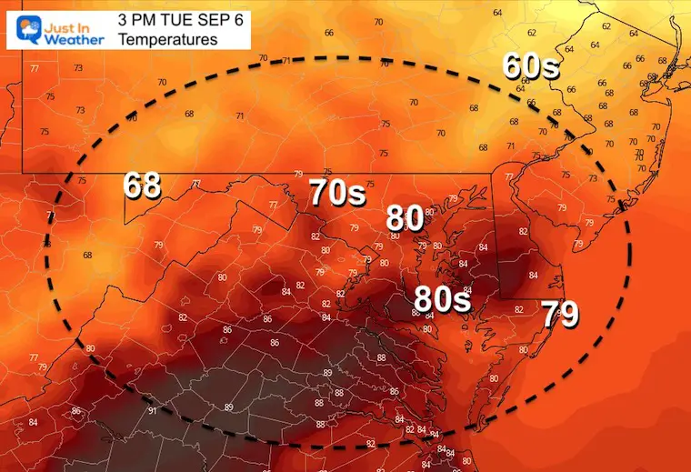
Afternoon Temperatures:
Temps will be dropping into the 70s when rain arrives.

CLIMATE DATA
TODAY September 5
Normal Low in Baltimore: 62ºF
Record 47ºF in 1997
Normal High in Baltimore: 83ºF
Record 96ºF 1954
September Begins Meteorological Autumn
Climate Data/Weather Stats For The Month
Rainbow Ice Cave In Mt. Rainier A Very Rare Find: Photos And Video
Weather posts straight to your inbox
Sign up and be the first to know!
Tuesday Temperatures
Morning

Afternoon
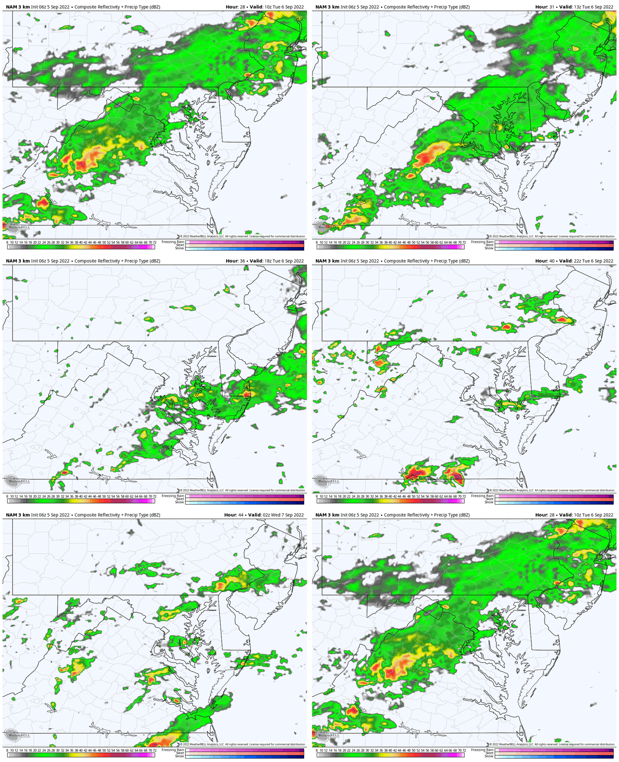
Radar Simulation: 6 AM to 10 PM
Tropical Tracks
There are still two systems in the Atlantic, but no immediate risk to land.
Tropical Storm Earl is moving north of Puerto Rico. This is expected to curve east of Bermuda.

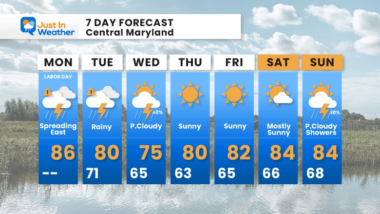
7 Day Forecast
STEM Assemblies/In School Fields Trips Are Back
Click to see more and ‘Book’ a visit to your school
COMPARE TO THE PAST
If you want a snowy winter, this is why you might want to look for in the rest of the tropical season.
Rainbow Ice Cave In Mt. Rainier A Very Rare Find: Photos And Video
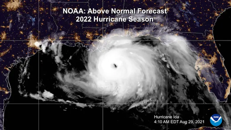
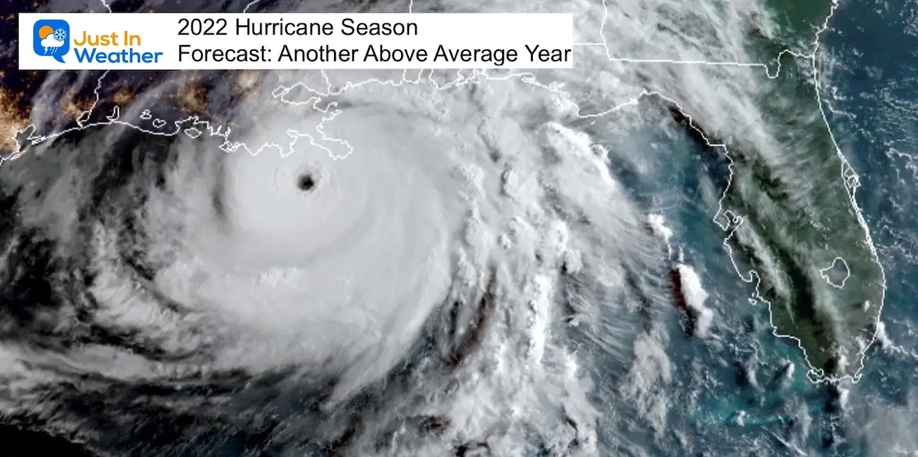
Hurricane Season Forecast: June 1 Through November 30
NOAA 2022 Hurricane Forecast- Above Normal Again
Forecast From Colorado State University
Related Posts
NOAA Study: Reducing Air Pollution INCREASED Tropical Storms
Atlantic Tropical History: Maps of Origin Regions Every 10 Days
Rainbow Ice Cave In Mt Rainier
Rainbow Ice Cave In Mt. Rainier A Very Rare Find: Photos And Video
Please share your thoughts, best weather pics/videos, or just keep in touch via social media
-
Facebook: Justin Berk, Meteorologist
-
Twitter: @JustinWeather
-
Instagram: justinweather


