This may be named the Post Easter Nor’Easter.A late season storm is working with the chilly air in place and will produce wintry weather nearby.For the most part the snow will be in the mountains through central PA, but snow will mix in our nearby hilly suburbs tonight, and possibly tomorrow with showers.
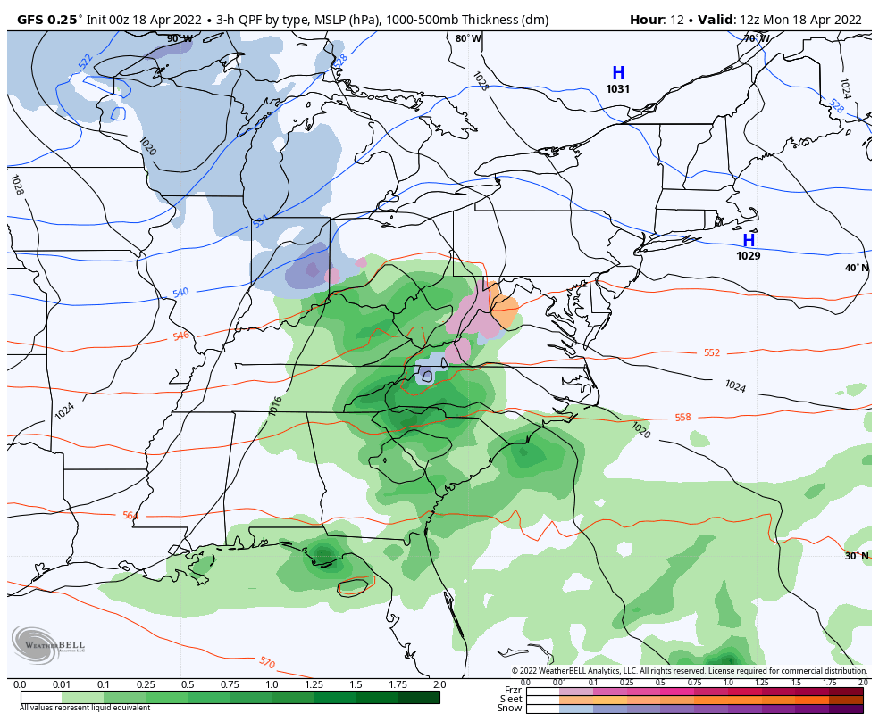
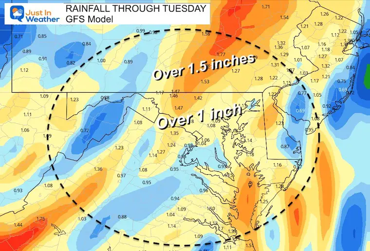
Most of our area will get a heavy rain as Low Pressure crosses Delmarva.See the forecast totals below.
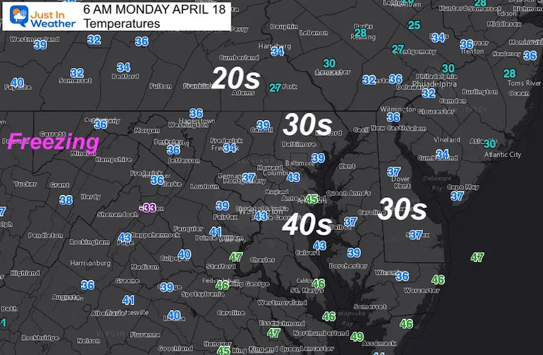
Monday Morning
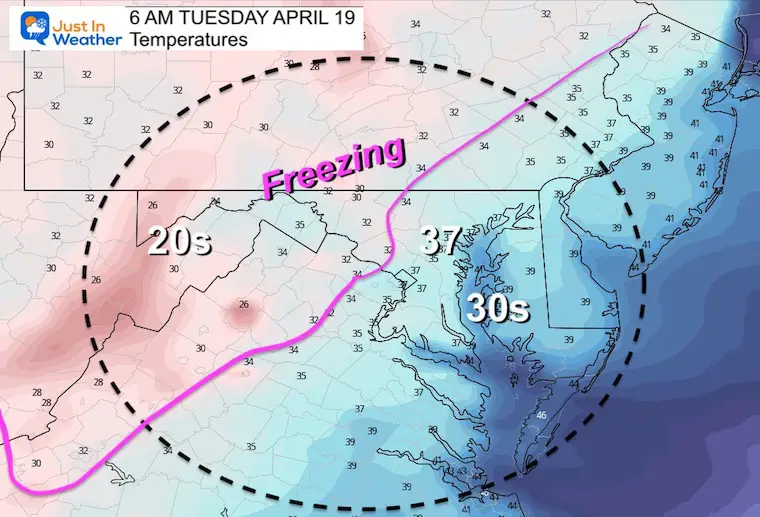
Morning Temperatures
The 30s have reached Delmarva and why I though the Frost Advisory should have been extended there…
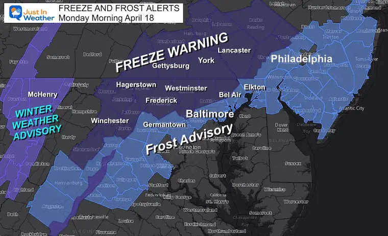
We are still in a Frost Advisory and Freeze Warning until 9 AM
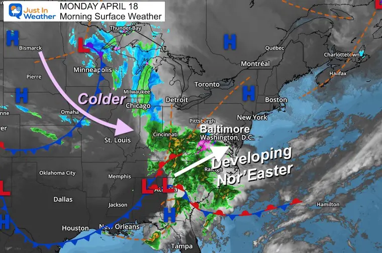
Surface Weather
A strong storm is forming and will be spreading heavy rain today. The air is cold enough to be snow or a mix in the mountains, then turn colder… So more snow will expand during the afternoon and tonight.
Storm Forecast: Monday Morning To Tuesday Afternoon
Low Pressure will develop and expand the heavy rain and snow… with the hardest hit for us being later today and tonight.
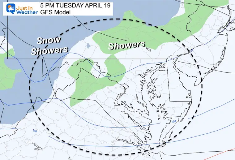
Unsettled air will follow bringing in showers Tuesday afternoon that could mix with snow for us.
Radar Simulation –> slider
GFS Model
april-18-weather-snow-rain-storm-monday-am-10
april-18-weather-snow-rain-storm-monday-pm-2
april-18-weather-snow-rain-storm-monday-pm-5
april-18-weather-snow-rain-storm-monday-pm-8
april-18-weather-snow-rain-storm-monday-pm-11
april-18-weather-snow-rain-storm-tuesday-am-2
Snapshot Model Comparisons
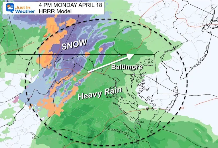
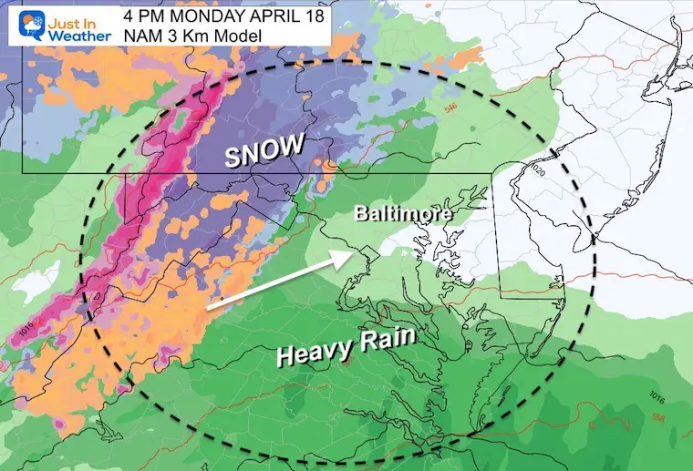
Here we see snow in the mountains of Frederick County during the afternoon… They could expand to the northern Baltimore Suburbs overnight….
In addition to snow across southern PA.
HRRR Model
NAM 3 Km Model
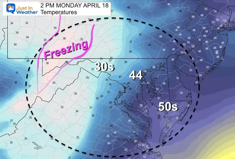
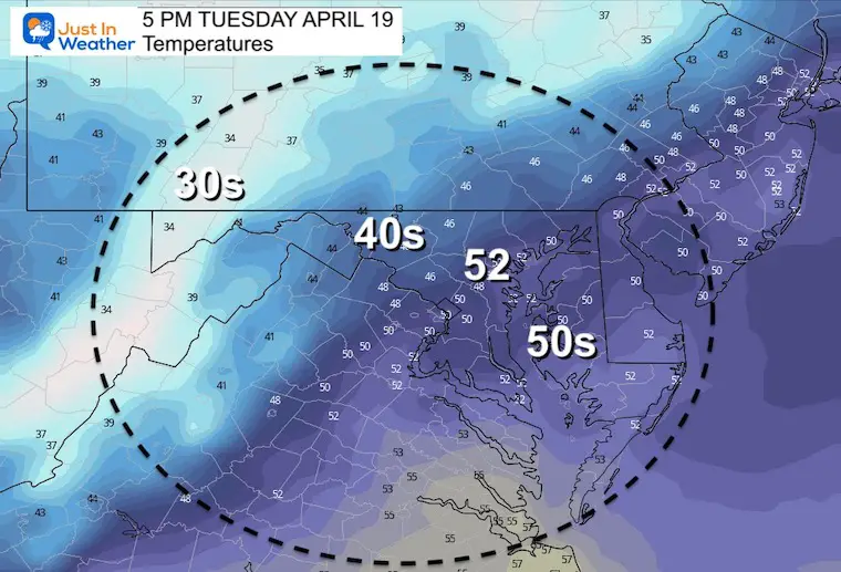
Afternoon Highs
If you see snow falling, it will likely not stick… But 30s may remain in the NW suburbs…
Snow will stick and accumulate in western Maryland Mountains to southern PA.
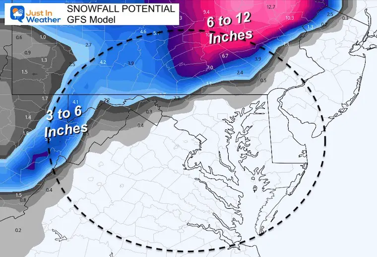
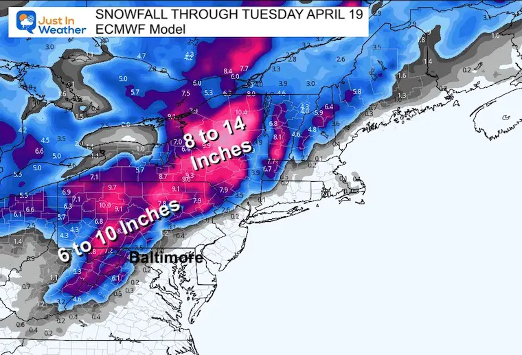
Storm Totals
This is the most conservative of snow forecast maps… I wanted to account for melting AND compaction of heavy wet snow.
Yes, the could be some coating of snow on the grass across northern Frederick, Carroll, Baltimore, and Harford Counties… into southern PA.
Rainfall Total
CLIMATE DATA
TODAY April 18th
Seasonal Snow: 14.4”
Normal Low in Baltimore:44ºF
Record 26º F in 1875
Normal High in Baltimore: 66ºF
Record 94ºF 1896
TUESDAY
Temperatures
Another Freeze Watch and Frost Advisory are possible. The winds may limit that, but a repeat of cold air expected Wednesday morning.
Afternoon Showers may mix with snow, graupel, or sleet.
Total Snow Potential!!!
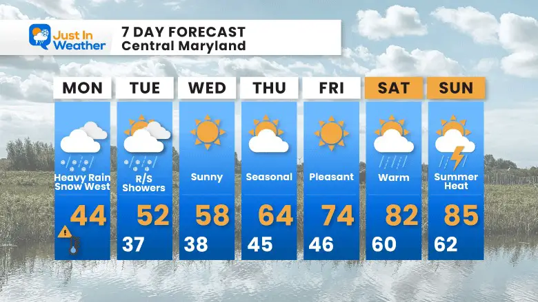
7 Day Forecast
Rain may mix with snow for nearby suburbs later today.
Rain and snow showers possible Tuesday afternoon.
Two more mornings with possible FROST, then Summer Heat builds in next weekend.
I am aware there are some spelling and grammar typos. I have made a few public statements over the years, but if you are new here you may have missed it:
I have dyslexia, and found out at my second year at Cornell. I didn’t stop me from getting my meteorology degree, and being first to get the AMS CBM in the Baltimore/Washington region.
I do miss my mistakes in my own proofreading. The autocorrect spell check on my computer sometimes does an injustice to make it worse.
All of the maps and information are accurate. The ‘wordy’ stuff can get sticky.
There is no editor that can check my work when I need it and have it ready to send out in a newsworthy timeline.
I accept this and perhaps proves what you read is really from me…