November 12, 2023
Sunday Morning Update
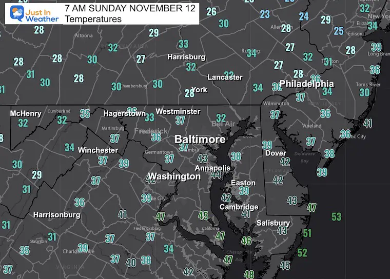
Yesterday, Baltimore reached 61ºF, which is close to average. Normal highs have slipped into the 50s and we will drop to slighter cooler than average for most of the week ahead.
There is an expanding drought in our region and I expect the next report will show it getting worse. This will be due to the lack of rain most of the week ahead.
If we want to look for the next pattern, it may be with rain most likely on Friday (again).
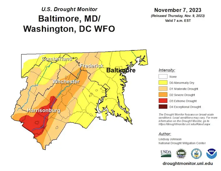
Drought Monitor: Baltimore/Washington Region
Note: I am aware the reservoirs are low and it is very dry in Pennsylvania as well.
- Shenandoah Mountains: SEVERE to EXTREME
- Frederick MD: Drought
- Rest of our region: Abnormally Dry state is EXPANDING.
Morning Temperatures
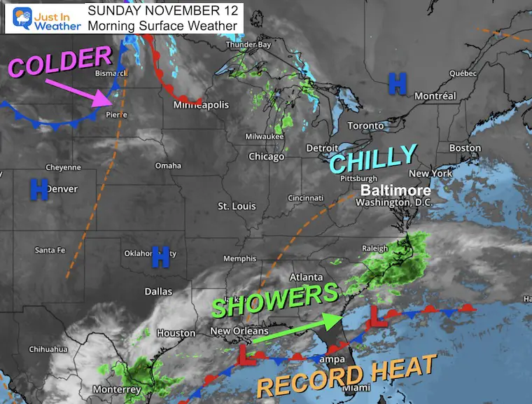
Morning Surface Weather
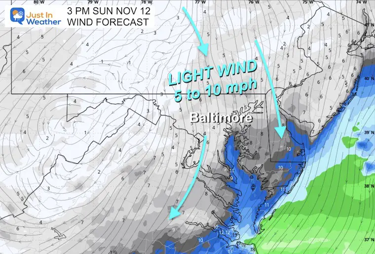
High Pressure to our North will continue to send us a light and chilly wind, keeping temperatures below average.
A stalled boundary to our south has record heat on the other side of it in Florida.
A rainy pattern has been setting up and may persist all week from East Texas across the South to the Carolinas. This is looking like a more typical El Niño storm track we may see evolve this winter.
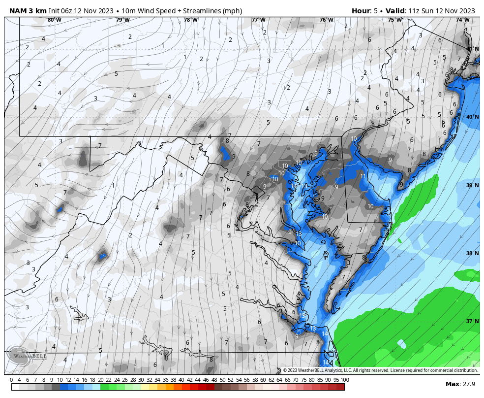
Forecast Wind: 7 AM to 7 PM
Light air flow from the North will make today a little cooler.
Afternoon Snapshot: Ravens Game
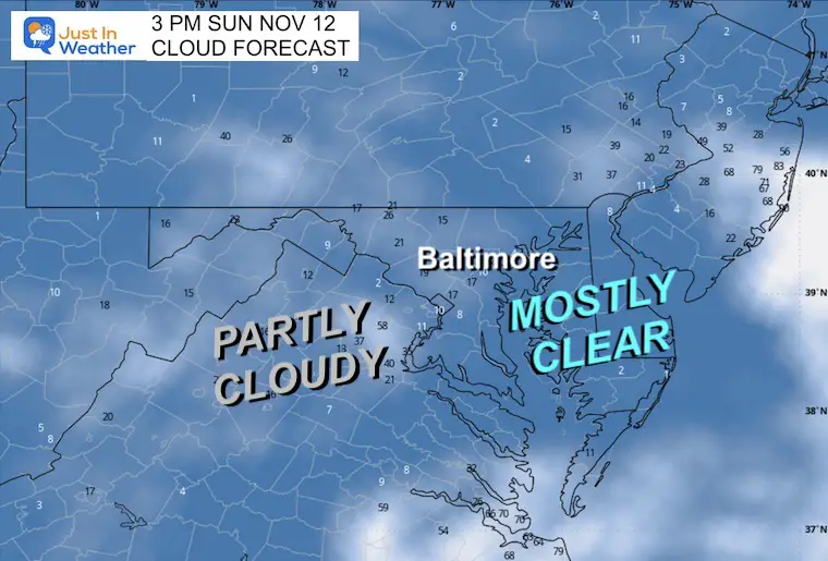
Cloud Forecast
Mostly Sunny to Partly Cloudy
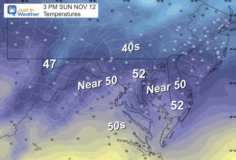
Afternoon Temperatures
El Niño Winter Updates
Computer Models Support East Coast Storm Track

El Niño Advisory
The latest NOAA report is confident in a Very Strong event. Possibly HISTORIC! This refers to the temperatures in the Pacific, with impact on the US Winter Storm Track

CLIMATE DATA: Baltimore
TODAY November 12
Sunrise at 6:46 AM
Sunset at 4:55 PM
Normal Low in Baltimore: 37ºF
Record 18ºF in 1957
Normal High in Baltimore: 59F
Record 78ºF 1879
Winter Outlook Reports:
Winter Weather Folklore: Top 20 and more signals from nature for snow.
NOAA’s Winter Outlook 2024
Winter Outlook 2024 From Two Farmers Almanacs Return to Cold and Snow
Subscribe for eMail Alerts
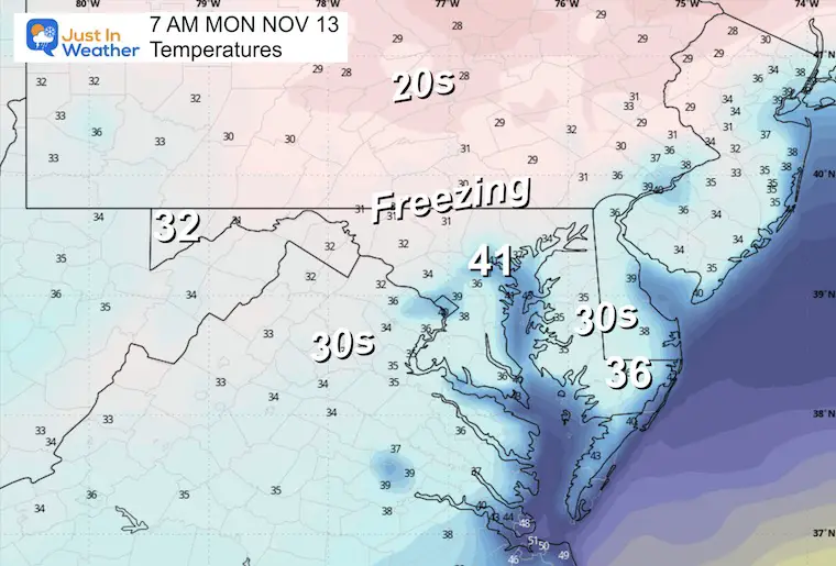
Snapshot 7 AM
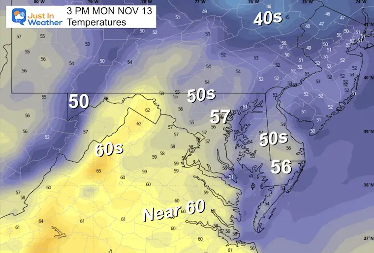
Temperatures Monday Morning
Chilly
Monday Afternoon
Still Cooler Than Average.
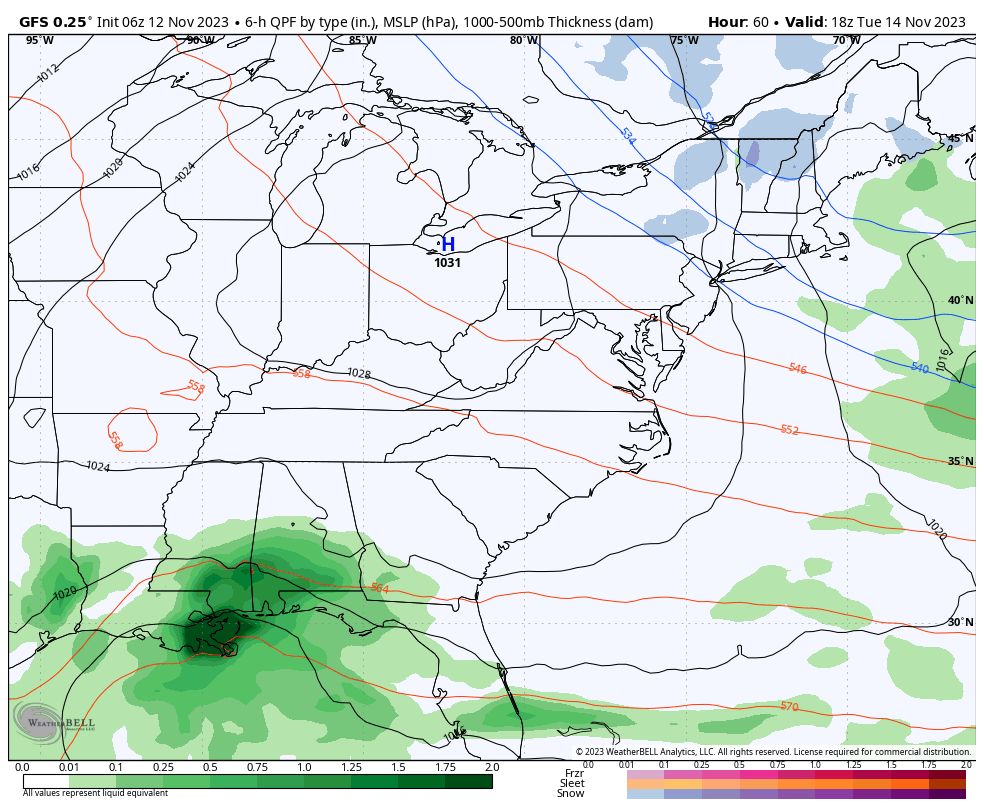
Storm Simulation
Tuesday to Saturday
This may be a preview of a type of weather pattern we could get during the winter. It is NOT the precise weather, but check this out:
While we remain dry this week, a persistent storm track will set up from East Texas to the Carolinas. A more organized Low Pressure will form across the Gulf States, then redevelop off the Southeast US Coast. This will team up with the Northern branch of the jet stream to enhance rain for us on Friday.
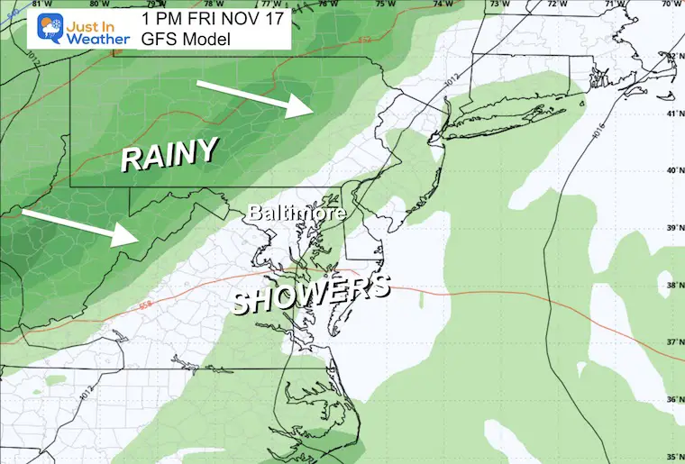
Closer View Snapshots
Friday Afternoon
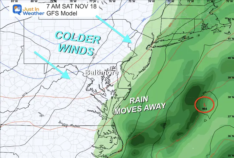
A cold front will move from the Great Lakes/Mid-West with steady rain.
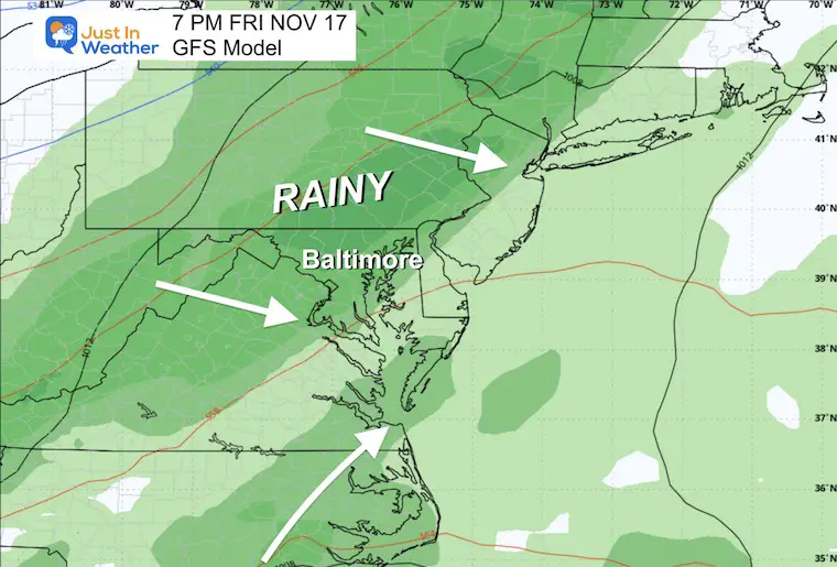
Friday Night
The best chance for rain in our region will be later Friday and overnight.
Saturday Morning
This storm system will get pulled off the coast with Low Pressure. It will be followed by another chilly air mass.
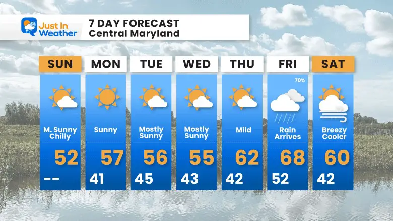
7 Day Forecast
Short and simple: Remaining Chilly and Dry most of this week. The next chance for rain will be on yet another Friday, then drying out and cooling next weekend.
Subscribe for eMail Alerts
Explore More
Maryland Snow Climate History And Other Winter Pages

Faith in the Flakes Gear

STEM Assemblies/In School Fields Trips Are Back
Click to see more and ‘Book’ a visit to your school

Please share your thoughts and best weather pics/videos, or just keep in touch via social media
RESTATING MY MESSAGE ABOUT DYSLEXIA
I am aware there are some spelling and grammar typos and occasional other glitches. I take responsibility for my mistakes and even the computer glitches I may miss. I have made a few public statements over the years, but if you are new here, you may have missed it: I have dyslexia and found out during my second year at Cornell University. It didn’t stop me from getting my meteorology degree and being the first to get the AMS CBM in the Baltimore/Washington region. One of my professors told me that I had made it that far without knowing and to not let it be a crutch going forward. That was Mark Wysocki, and he was absolutely correct! I do miss my mistakes in my own proofreading. The autocorrect spell check on my computer sometimes does an injustice to make it worse. I also can make mistakes in forecasting. No one is perfect at predicting the future. All of the maps and information are accurate. The ‘wordy’ stuff can get sticky. There has been no editor who can check my work when I need it and have it ready to send out in a newsworthy timeline. Barbara Werner is a member of the web team that helps me maintain this site. She has taken it upon herself to edit typos when she is available. That could be AFTER you read this. I accept this and perhaps proves what you read is really from me… It’s part of my charm.
#FITF


