October 30 Colder Air About To Arrive With Windy Halloween And Mountain Snow Showers
October 30, 2023
Monday Morning Update
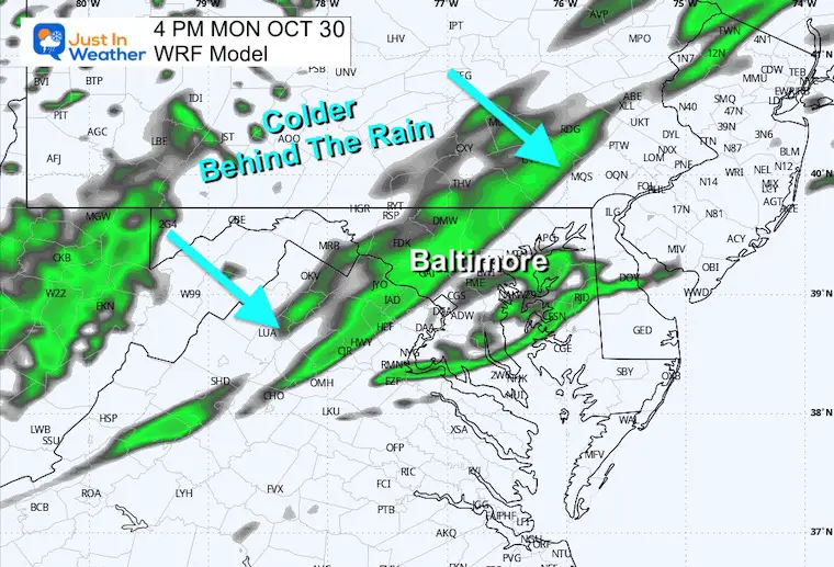
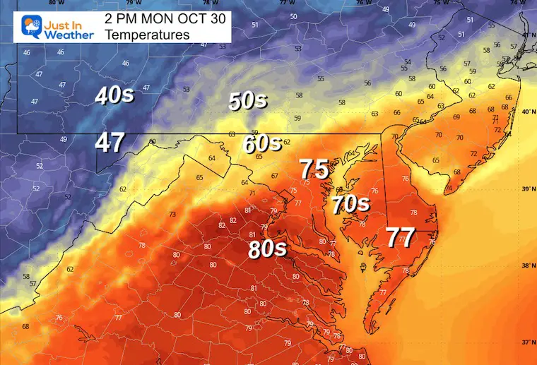
The change is on the way. The weekend ended with 70s in central Maryland and we will continue to step down the temperatures today and tomorrow. There will be a wide spread of readings as northern areas get into the colder air today and the rain with that boundary may break up as it pushes through central Maryland later in the afternoon.
Halloween will be windy and colder! The rain may linger in Southern Maryland while snow showers will arrive in the Western Maryland mountains. There is a chance some flurries may reach farther east by Wednesday.
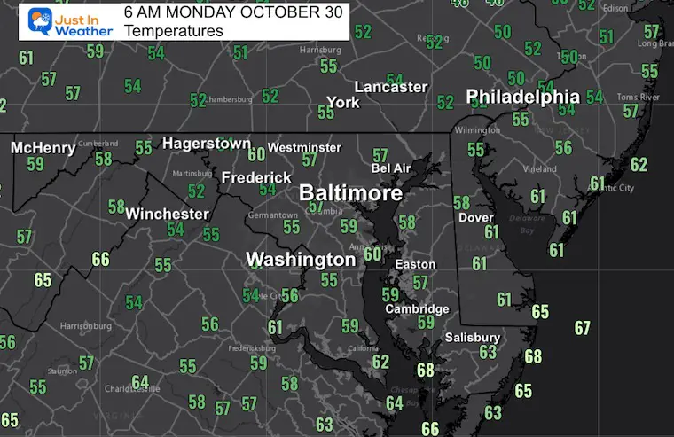
Morning Temperatures
We remain on the mild side.
Morning Surface Weather
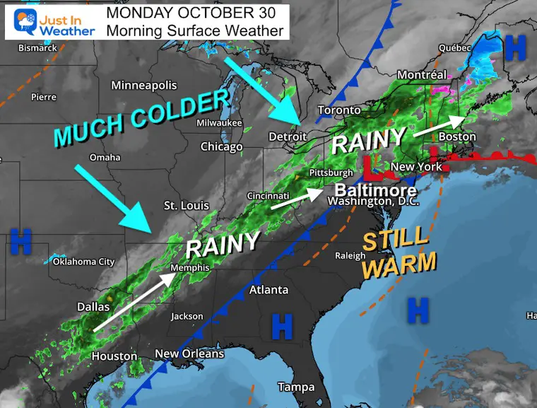
While still mild, there is a strong cold front draped across the nation and it will finally be on the move. There is plenty of rain with this system, but most may hop over our area as it passes. I expect showers to cross central Maryland later today, but they will be in a diminished form. Then resurge to our south.
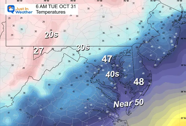
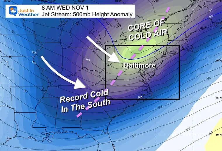
On the other end, much colder air from the Northern Plains will arrive for Halloween. This may bring record cold to the Southern US and frost or freeze advisories locally.
Live Radar Widget
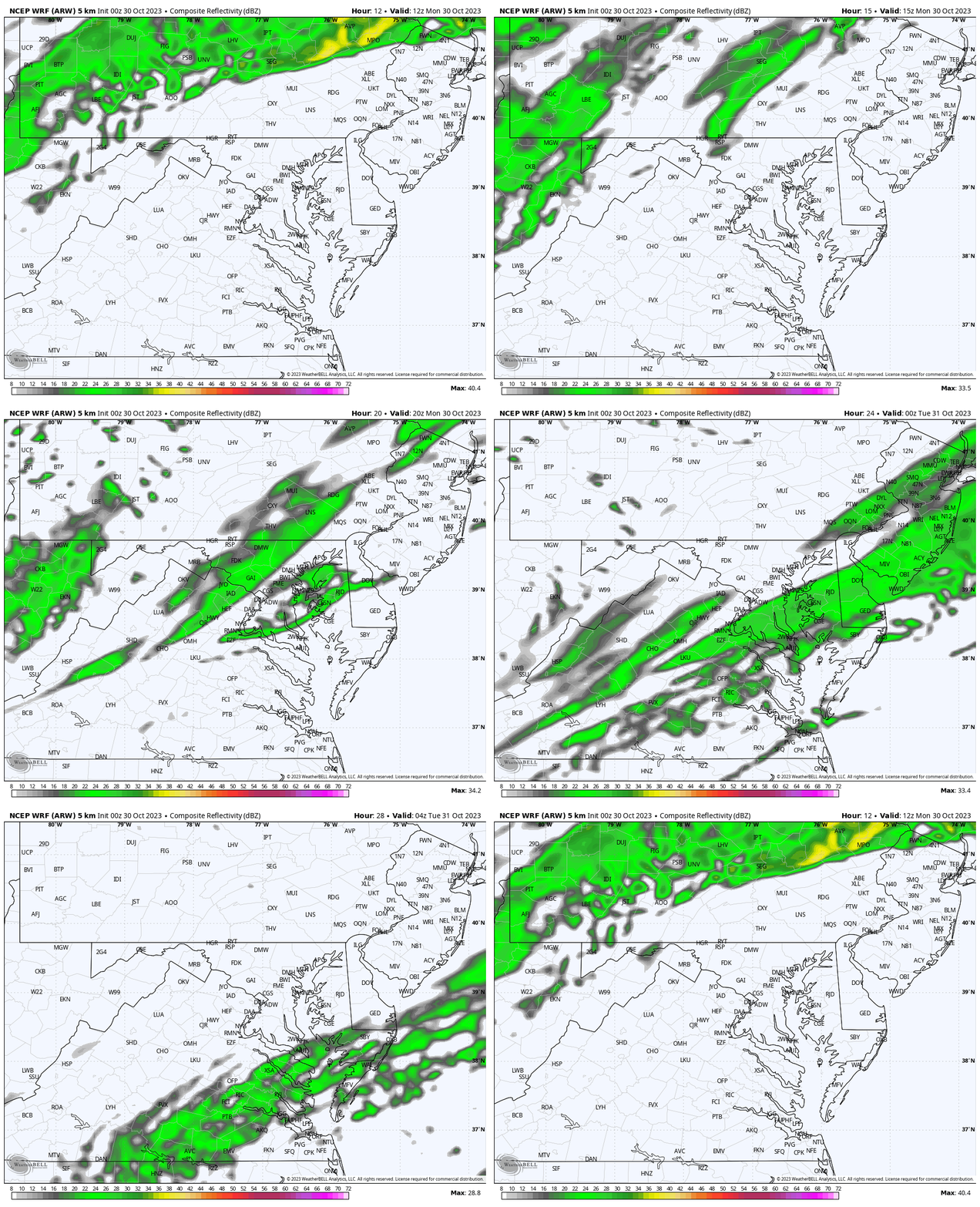
Radar Simulation 8 AM to Midnight
Rain from Pennsylvania and the Western Maryland Mountains will finally be on the move.
Afternoon Snapshot
3 PM Radar: Showers near and north of Baltimore as this line of rain finally moves south and east.
Temperatures
CLIMATE DATA: Baltimore
TODAY October 30
Sunrise at 7:32 AM
Sunset at 6:08 PM
Normal Low in Baltimore: 41ºF
Record 26ºF in 1965
Normal High in Baltimore: 63ºF
Record 83ºF 1946; 2016
New Reports:
NEW: NOAA’s Winter Outlook 2024
Other Reports:
Winter Weather: Can Woolly Bear Caterpillar Stripes Really Foretell Snow?
El Niño Advisory: First Look At NOAA’s Winter Outlook Expectations
Winter Outlook 2024 From Two Farmers Almanacs Return to Cold and Snow
Subscribe for eMail Alerts
Weather posts straight to your inbox
Sign up and be the first to know!
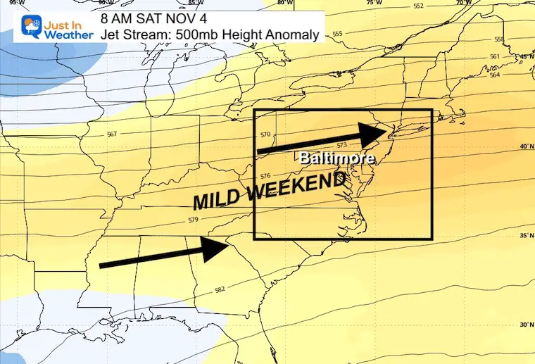
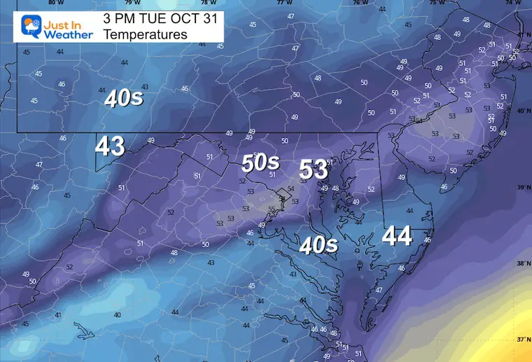
Tuesday (Halloween) Temperatures
Morning
Afternoon
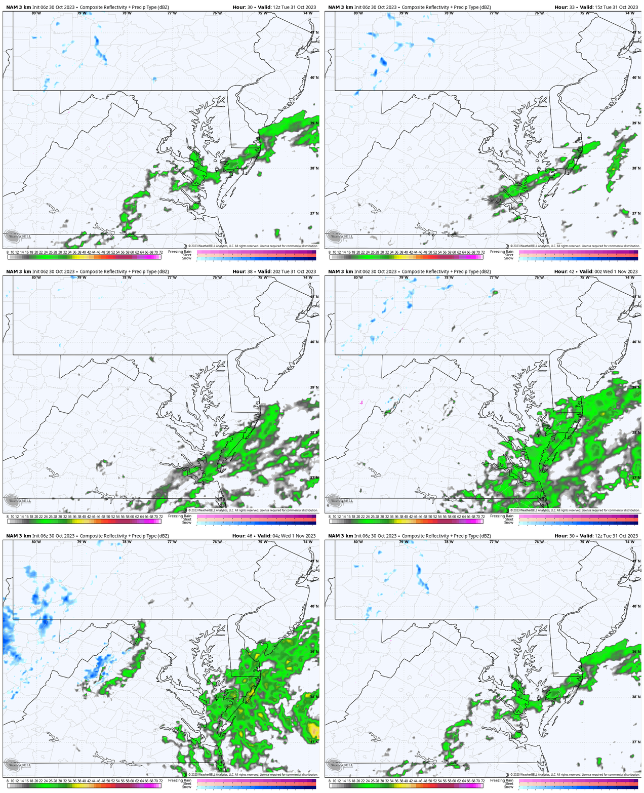
Radar Simulation: 8 AM to Midnight
The front will stall and keep the showers through evening across Southern Maryland/Lower Delmarva.
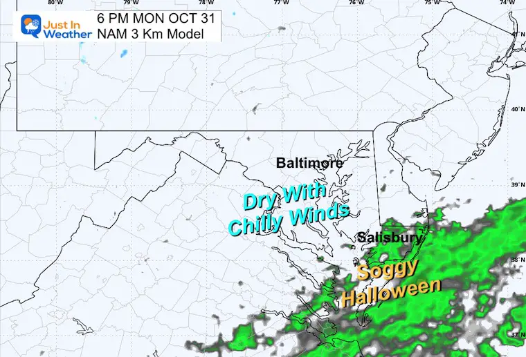
Snapshot: 6 PM Trick-or-Treating
Central Maryland will be DRY, but rain will continue across the Lower Eastern Shore.
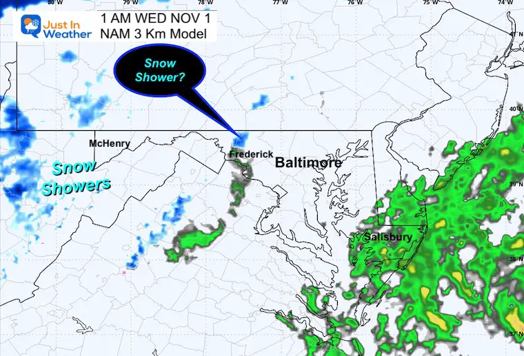
After Midnight
A disturbance may bring showers farther east with a chance of flurries or snow showers in the mountains of Frederick County.
Jet Stream
Snapshot Wednesday
Animation Tuesday to Saturday
The cold air will sweep in mid week, then modify getting us back near or slightly above average by the end of the week.
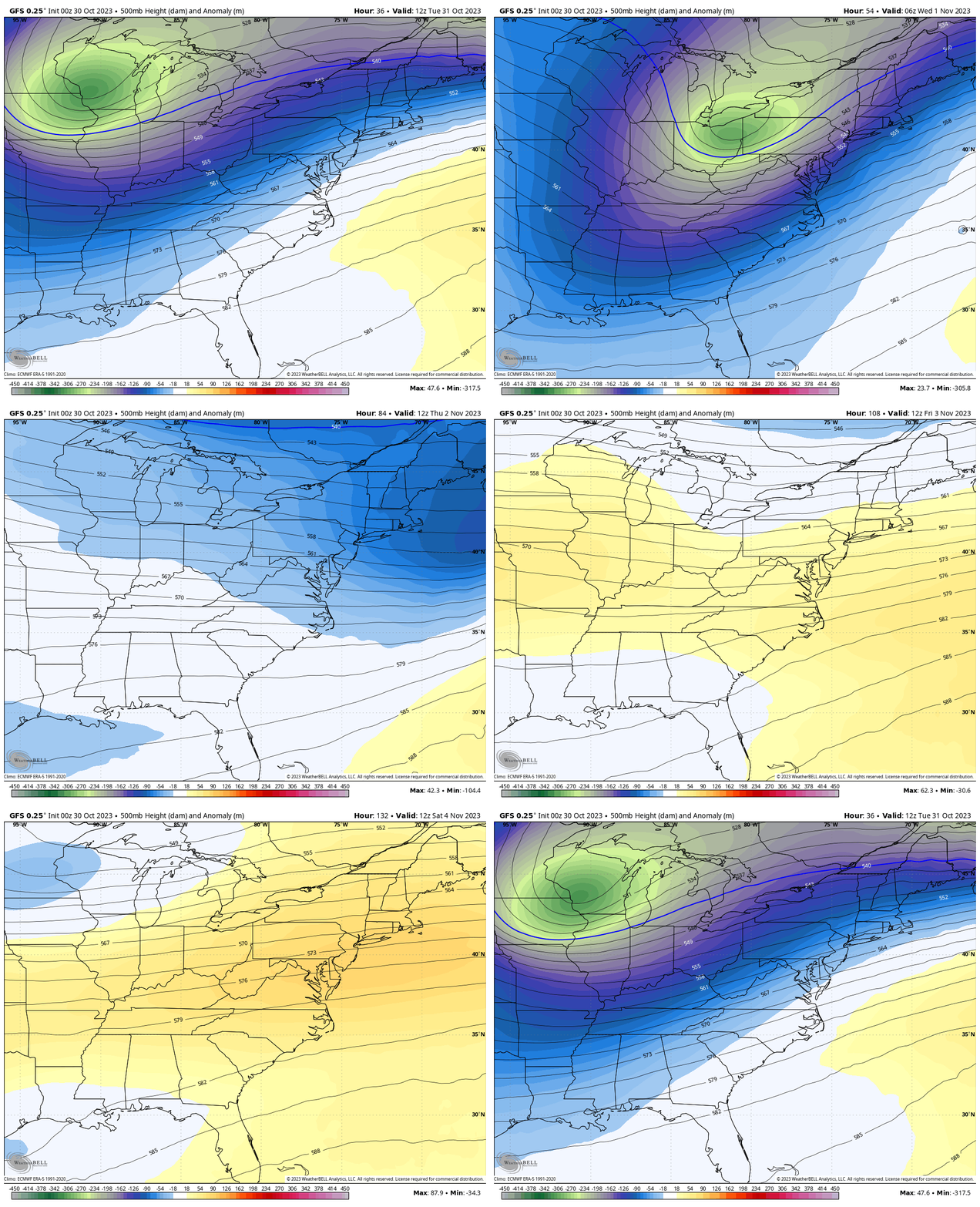
Snapshot Saturday
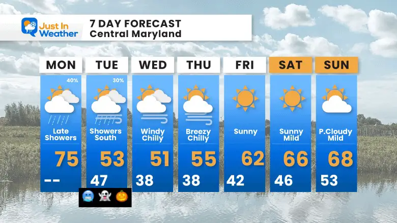
7 Day Forecast
The core of the cold air will be Wednesday into Thursday morning. We may have more frost and freeze alerts for the mornings.
The flip side will arrive for the weekend with a warming trend.
Subscribe for eMail Alerts
Weather posts straight to your inbox
Sign up and be the first to know!
Faith in the Flakes Gear
STEM Assemblies/In School Fields Trips Are Back
Click to see more and ‘Book’ a visit to your school
Please share your thoughts and best weather pics/videos, or just keep in touch via social media
-
Facebook: Justin Berk, Meteorologist
-
Twitter
-
Instagram
RESTATING MY MESSAGE ABOUT DYSLEXIA
I am aware there are some spelling and grammar typos and occasional other glitches. I take responsibility for my mistakes and even the computer glitches I may miss. I have made a few public statements over the years, but if you are new here, you may have missed it: I have dyslexia and found out during my second year at Cornell University. It didn’t stop me from getting my meteorology degree and being the first to get the AMS CBM in the Baltimore/Washington region. One of my professors told me that I had made it that far without knowing and to not let it be a crutch going forward. That was Mark Wysocki, and he was absolutely correct! I do miss my mistakes in my own proofreading. The autocorrect spell check on my computer sometimes does an injustice to make it worse. I also can make mistakes in forecasting. No one is perfect at predicting the future. All of the maps and information are accurate. The ‘wordy’ stuff can get sticky. There has been no editor who can check my work when I need it and have it ready to send out in a newsworthy timeline. Barbara Werner is a member of the web team that helps me maintain this site. She has taken it upon herself to edit typos when she is available. That could be AFTER you read this. I accept this and perhaps proves what you read is really from me… It’s part of my charm.
#FITF


