Frost Advisory Tuesday Followed By A Freeze Flurries and First Mountain Snow
October 30, 2023
Monday Night Update
You may have had the first frost of the season already, but if not there is a good chance you could get that or a hard freeze this week. The coldest air of the season since last winter is about to arrive as the calendar turns to November.
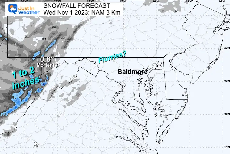
Faith in the Flakes: With the cold blast, the first snow of the season is expected over the Western Maryland mountains with some light accumulation. If there are photos, I will gladly show you! There may be flurries reaching into parts of Central Maryland and near York in PA.
Monday Night Set Up
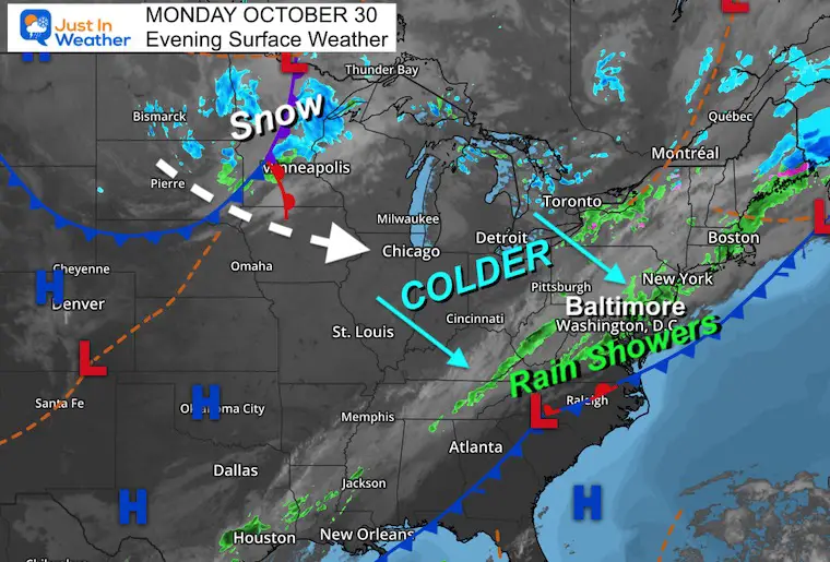
The cold front that finally broke our late season heat has finally moved through the area, but is now stalling along the coast.
Fog and rain showers have reached metro areas. This is heading towards the coast, but it has been underwhelming. This will resurge rain along the coast for Halloween as we turn west for colder winds and the next disturbance to make things interesting.
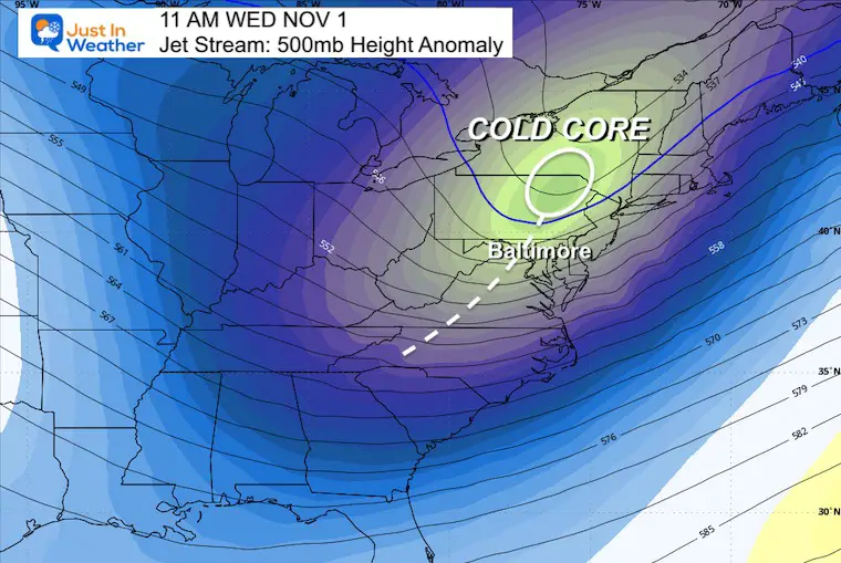
Jet Stream: 500mb Height Anomaly
Tuesday Morning to Wednesday Evening
We can see the cold air rapidly progress across the Great Lakes and reach us on Wednesday.
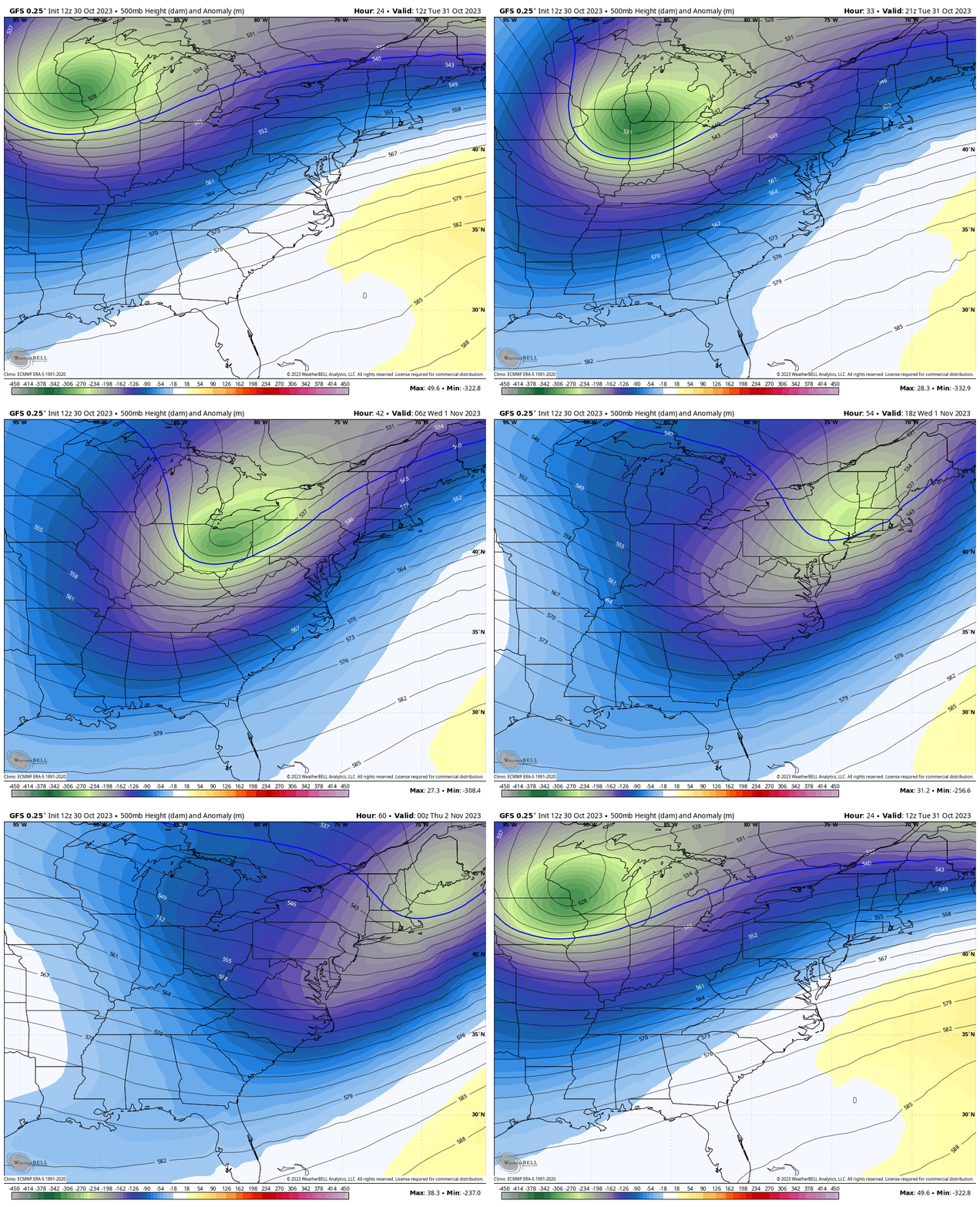
Snapshot 11 AM Wednesday
The core of the cold air will be passing over Pennsylvania’s Poconos to Central New York. The trailing disturbance will be crossing Maryland and Central Virginia.
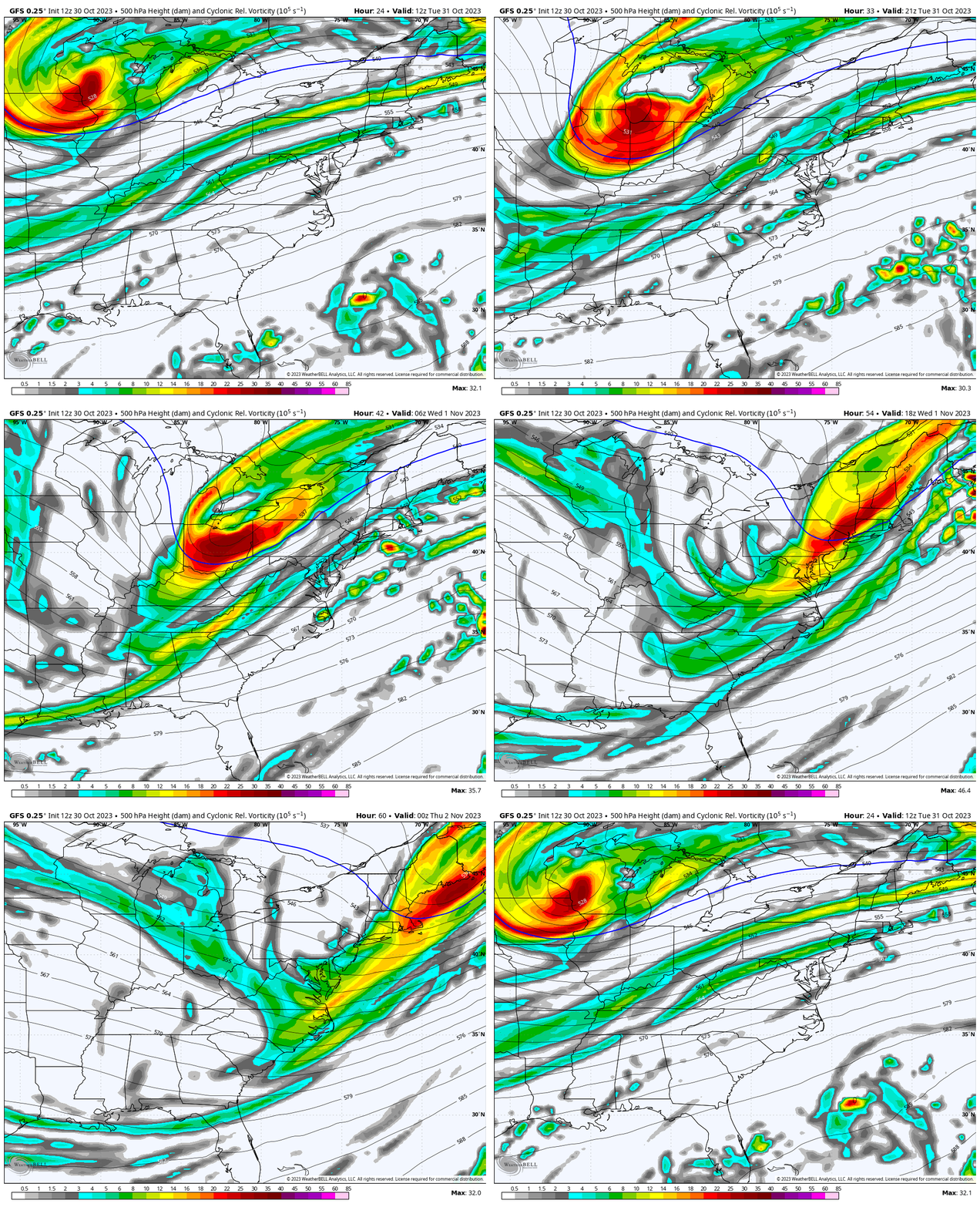
Jet Stream: 500mb Vorticity
Tuesday Morning to Wednesday Evening
This highlights the spin in the atmosphere. This is upper level support for more clouds and showers. With the cold air, this will result in Lake Effect Snow enhanced across the mountains. There may be some support to carry flurries farther east into the hilly suburbs.
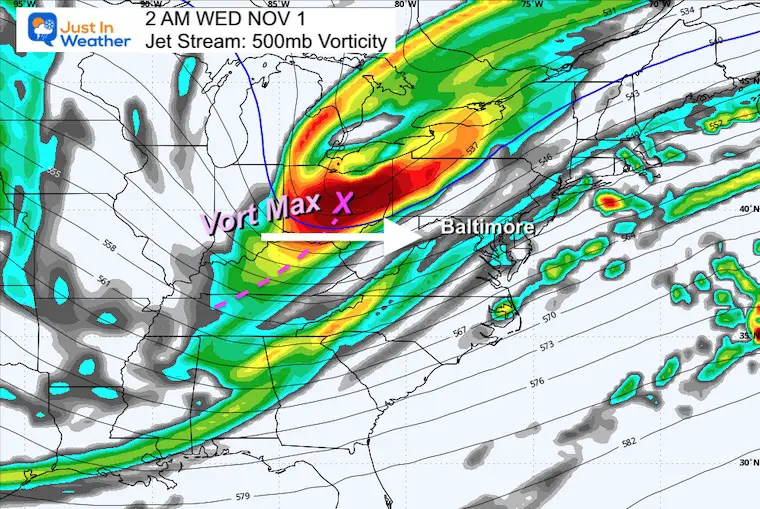
Snapshot 2 AM Wednesday
The main energy (Vort Max) will be located in Ohio overnight (after Halloween). A disturbance will expand ahead of this, which may bring some flurries.
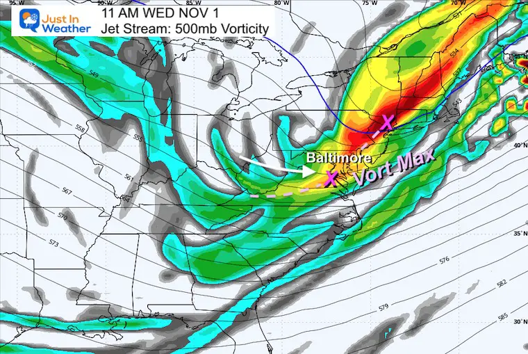
Snapshot 11 AM Wednesday
The Vort Max will be in the Lower Hudson Valley of New York, with a trough extending into Maryland and Virginia. This may continue to support the instability and snow flurries into some metro areas. It is NOT a promise, but it is possible.
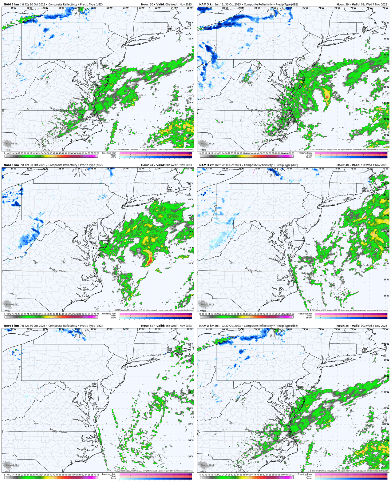
Radar Simulation 8 PM Tuesday to Noon Wednesday
This is a suggestion and not a promise. This product does not always show light activity in this type of situation, but here we can see it hint at snow flurries in central Maryland with heavier snow showers in the higher mountains to our west.
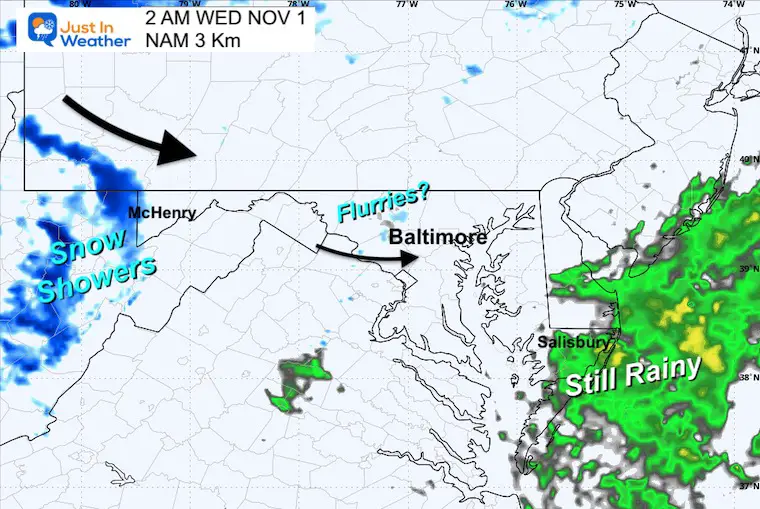
Snapshots
2 AM Wednesday
This product does suggest a few flurries between Mt. Airy and Westminster. Heavier bursts of snow will be falling over West Virginia and entering Garrett County, MD.
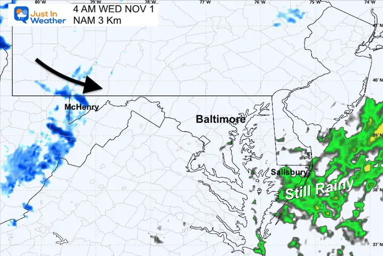
4 AM Wednesday
The burst of snow and minor accumulation for Western Maryland (Garrett County) may be occurring at this time up through sunrise. There may be a daybreak coating on the ground there.
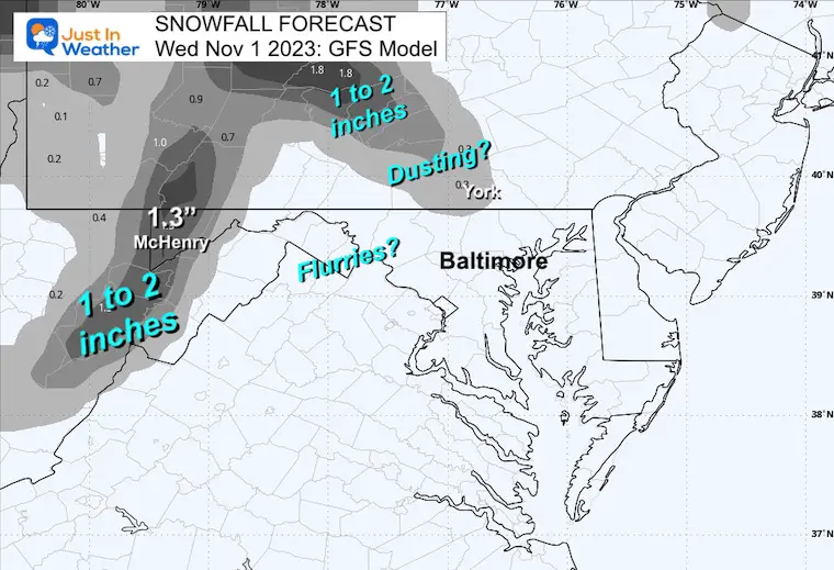
Snow Forecast
NAM 3 Km
Under 1 inch for McHenry with up to 2 inches in some higher peaks over West Virginia.
GFS Model
This product is surprisingly more robust. Here we see 1.3” for McHenry.
It also suggests Lake Effect Snow Bands possibly extending into parts of York County, PA with a dusting.
*If this happens, it would be on the grass where it is colder. The roads are too warm to support stickage.
FROST AND FREEZE
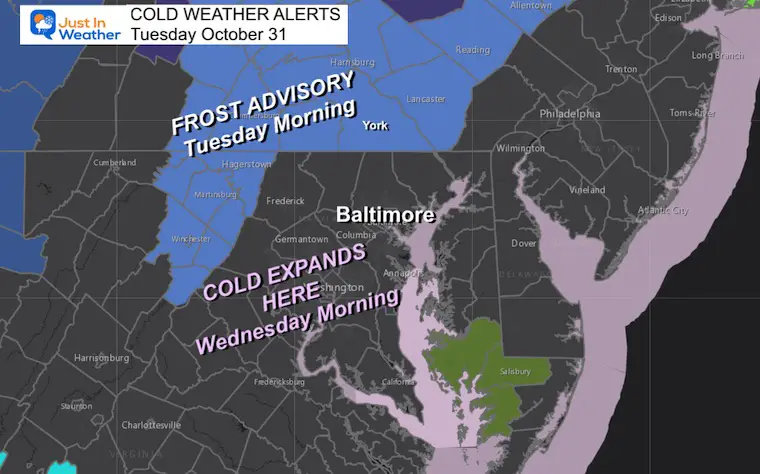
Frost Advisory Tuesday Morning
The colder air has already infiltrated southern Pennsylvania and along I-81 in Maryland and Virginia.
I highlighted that the colder air and possible FREEZE will expand south Wednesday Morning.
Morning Temperature Forecast
Wednesday
Frost Advisories may get posted for interior Maryland and Virginia.
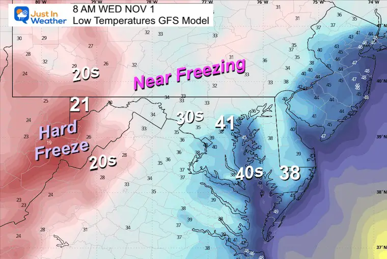
Thursday
Even colder air may bring a hard freeze for those interior areas with a frost across the Bay to Delmarva.

New Reports:
NEW: NOAA’s Winter Outlook 2024
Other Reports:
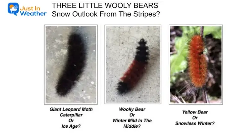
Winter Weather: Can Woolly Bear Caterpillar Stripes Really Foretell Snow?
El Niño Advisory: First Look At NOAA’s Winter Outlook Expectations
Winter Outlook 2024 From Two Farmers Almanacs Return to Cold and Snow
Subscribe for eMail Alerts
Weather posts straight to your inbox
Sign up and be the first to know!
Faith in the Flakes Gear
STEM Assemblies/In School Fields Trips Are Back
Click to see more and ‘Book’ a visit to your school
Please share your thoughts and best weather pics/videos, or just keep in touch via social media
-
Facebook: Justin Berk, Meteorologist
-
Twitter
-
Instagram
RESTATING MY MESSAGE ABOUT DYSLEXIA
I am aware there are some spelling and grammar typos and occasional other glitches. I take responsibility for my mistakes and even the computer glitches I may miss. I have made a few public statements over the years, but if you are new here, you may have missed it: I have dyslexia and found out during my second year at Cornell University. It didn’t stop me from getting my meteorology degree and being the first to get the AMS CBM in the Baltimore/Washington region. One of my professors told me that I had made it that far without knowing and to not let it be a crutch going forward. That was Mark Wysocki, and he was absolutely correct! I do miss my mistakes in my own proofreading. The autocorrect spell check on my computer sometimes does an injustice to make it worse. I also can make mistakes in forecasting. No one is perfect at predicting the future. All of the maps and information are accurate. The ‘wordy’ stuff can get sticky. There has been no editor who can check my work when I need it and have it ready to send out in a newsworthy timeline. Barbara Werner is a member of the web team that helps me maintain this site. She has taken it upon herself to edit typos when she is available. That could be AFTER you read this. I accept this and perhaps proves what you read is really from me… It’s part of my charm.
#FITF


