October 29 Weather Warm With Rain Across Northern Areas: Tracking The Cold Expanding
October 29, 2023
Sunday Morning Update
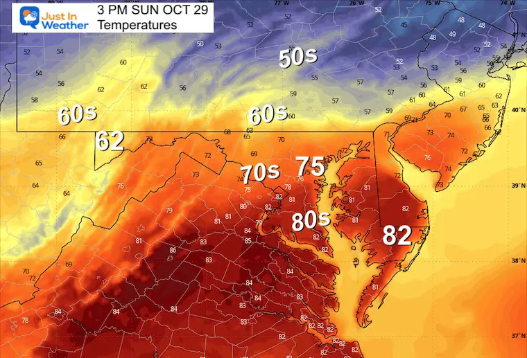
We had our third day in a row in the 80s yesterday, but the end of that is near. Today will be split with rain and cooler air to the north, while it will remain dry and possibly another round of 80s in Southern Maryland.
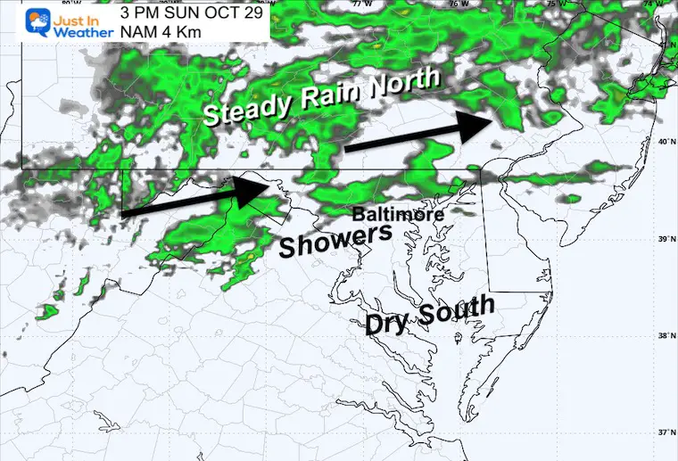
Rain can be tracked on the Live Radar Widget below. It will be steady farther north across central PA, with showers across the Maryland mountains and possibly into parts of metro Baltimore.
They will expand south on Monday, but southern Maryland may remain dry until Tuesday.
Halloween will be noticeably colder for all of us and we might have the first coating of snow for the season in the Western Maryland mountains.
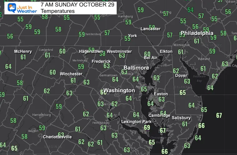
Morning Temperatures
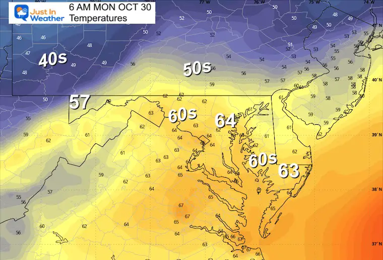
We remain on the mild side.
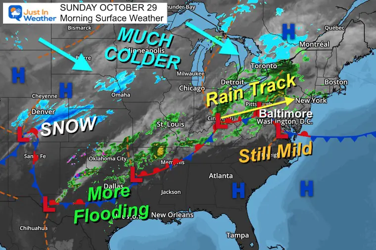
Morning Surface Weather
A setup like this is what makes our local weather more complicated. The rain track is crossing parts of our area, including the mountains to the west and north of Baltimore into Southern PA. But mild weather is holding while it remains dry in Southern Maryland.
The cold front is going to take a few days to cross our region and it may putter out the rain impact, while many in Texas have had too much.
On the colder side, a snowstorm just hit metro Denver with an average of 6 inches around the city, and over one foot in the mountains. If you watch the Kansas City Chiefs at Denver Broncos game, there will be entertaining winter scenes, but the bulk of the snow will be done. Just leftover showers.
Live Radar Widget
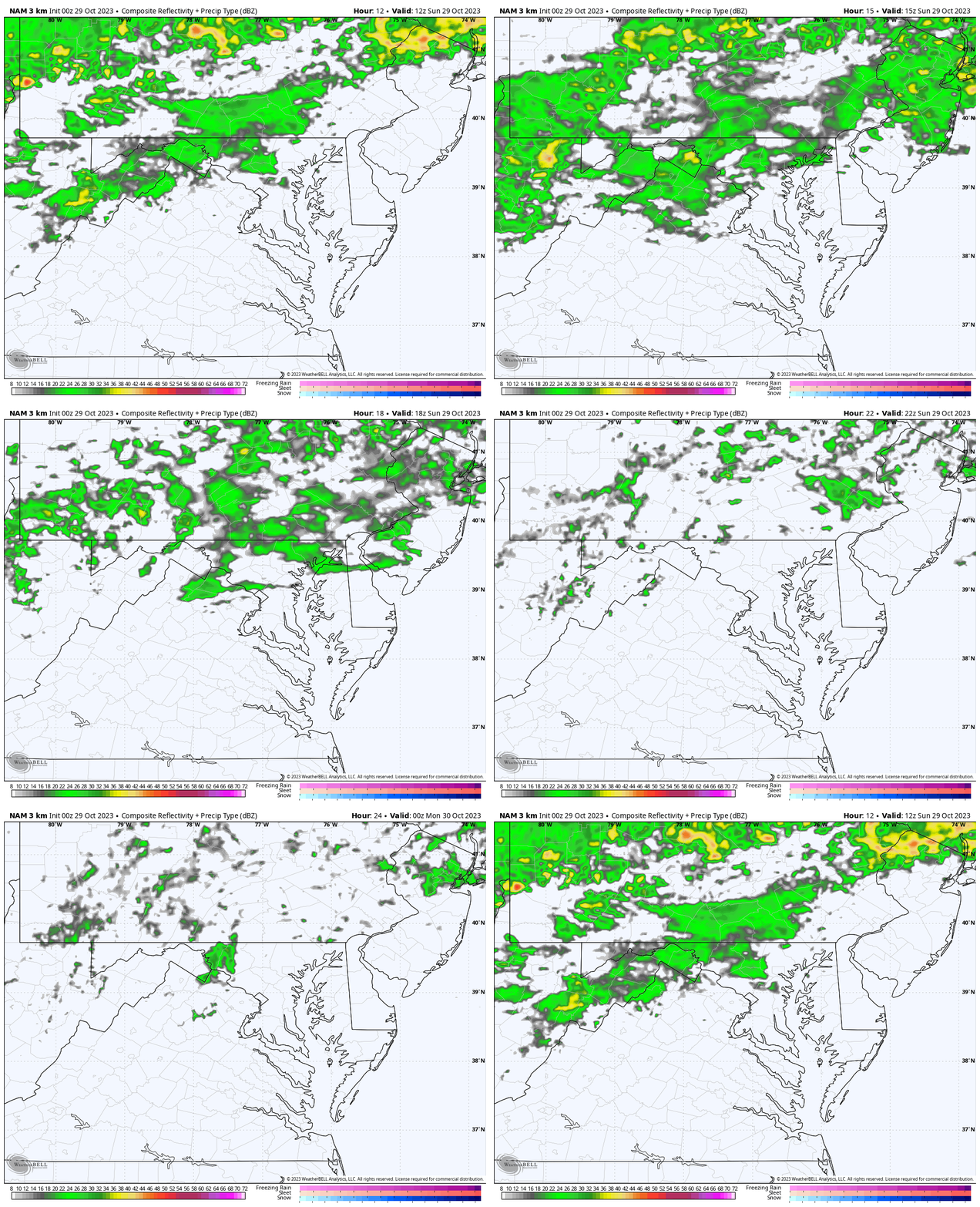
Rain showers may reach metro Baltimore. More likely in the western and northern suburbs… and farther west and north into the mountains.
Radar Simulation 8 AM to 8 PM
Afternoon Snapshots
3 PM Radar:
Showers near and north of Baltimore. Still dry to the south.
3 PM Temperatures
CLIMATE DATA: Baltimore
TODAY October 29
Sunrise at 7:31 AM
Sunset at 6:09 PM
Normal Low in Baltimore: 42ºF
Record 26ºF in 2001
Normal High in Baltimore: 64ºF
Record 82ºF 1945
New Reports:
NEW: NOAA’s Winter Outlook 2024
Other Reports:
Winter Weather: Can Woolly Bear Caterpillar Stripes Really Foretell Snow?
El Niño Advisory: First Look At NOAA’s Winter Outlook Expectations
Winter Outlook 2024 From Two Farmers Almanacs Return to Cold and Snow
Subscribe for eMail Alerts
Weather posts straight to your inbox
Sign up and be the first to know!
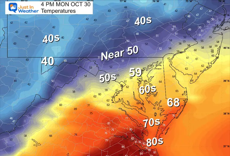
Monday Temperatures
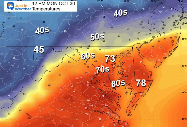
The day will start mild and last a little longer with the slower arrival of colder air. This will finally push in across metro areas during the afternoon. So the warmest time may be around lunch and then colder going home.
Morning
Noon
Afternoon
Radar Simulation: 8 AM to Midnight
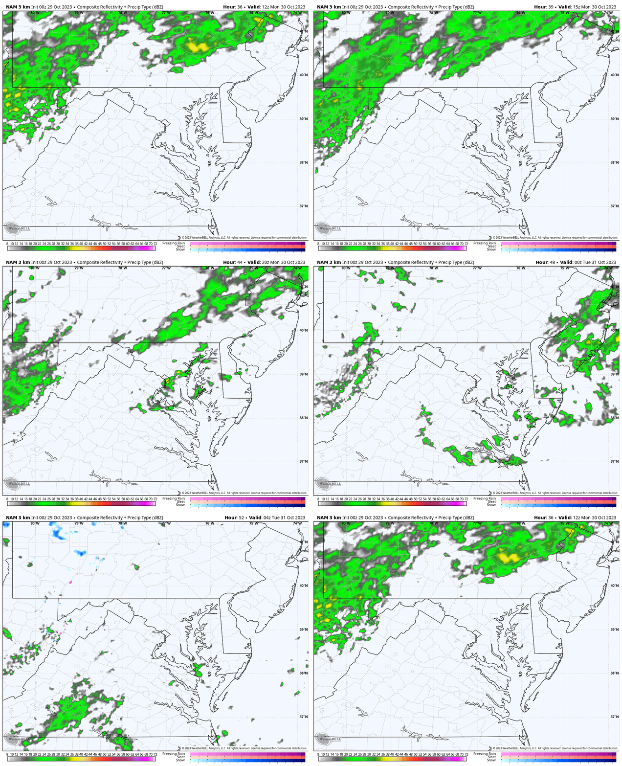
Showers may be more spotty in central areas as the cold front passes through.
Storm Forecast
Monday to Wednesday
This cold front will take a few days to move through our region. We can see steady rain in PA break up as it crosses Central Maryland, then another flare up to the South. This will be followed by much colder winds and a taste of winter around the Great Lakes.
Wednesday
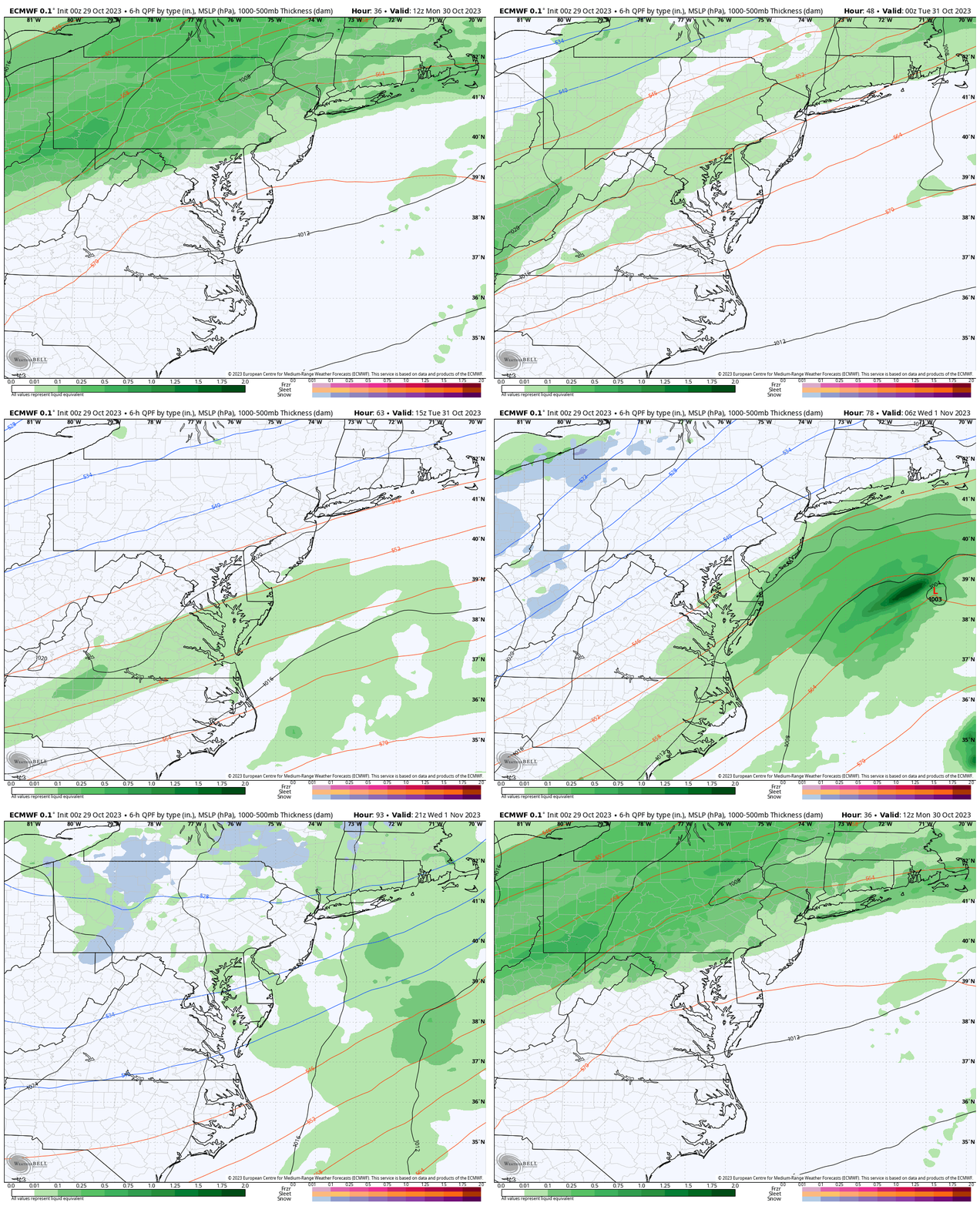
As the rain finally moves off the coast, colder air will filter in. We may have leftover rain showers.
Snow showers and maybe the first coating will fall over the high mountains of far western Maryland.
Jet Stream
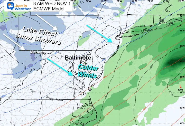
Animation Monday to Friday
The cold air will sweep in midweek, then modify getting us back to near or slightly above average by the end of the week.
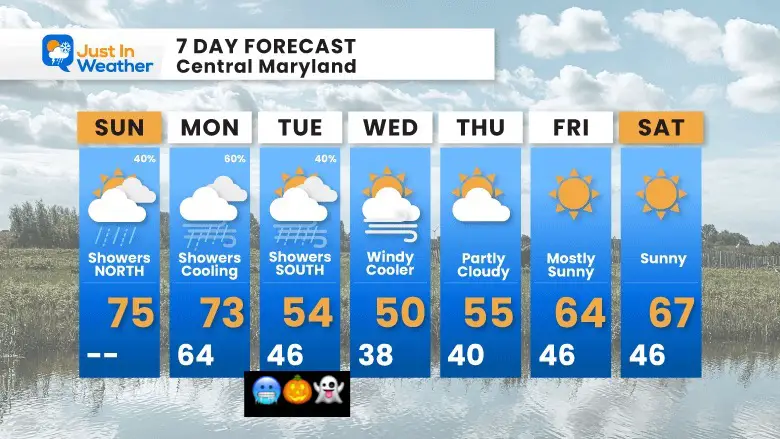
7 Day Forecast
The colder air should be here for all of our region by Halloween. There will be a moderation in temps by the end of the week.
Subscribe for eMail Alerts
Weather posts straight to your inbox
Sign up and be the first to know!
Faith in the Flakes Gear
STEM Assemblies/In School Fields Trips Are Back
Click to see more and ‘Book’ a visit to your school
Please share your thoughts and best weather pics/videos, or just keep in touch via social media
-
Facebook: Justin Berk, Meteorologist
-
Twitter
-
Instagram
RESTATING MY MESSAGE ABOUT DYSLEXIA
I am aware there are some spelling and grammar typos and occasional other glitches. I take responsibility for my mistakes and even the computer glitches I may miss. I have made a few public statements over the years, but if you are new here, you may have missed it: I have dyslexia and found out during my second year at Cornell University. It didn’t stop me from getting my meteorology degree and being the first to get the AMS CBM in the Baltimore/Washington region. One of my professors told me that I had made it that far without knowing and to not let it be a crutch going forward. That was Mark Wysocki, and he was absolutely correct! I do miss my mistakes in my own proofreading. The autocorrect spell check on my computer sometimes does an injustice to make it worse. I also can make mistakes in forecasting. No one is perfect at predicting the future. All of the maps and information are accurate. The ‘wordy’ stuff can get sticky. There has been no editor who can check my work when I need it and have it ready to send out in a newsworthy timeline. Barbara Werner is a member of the web team that helps me maintain this site. She has taken it upon herself to edit typos when she is available. That could be AFTER you read this. I accept this and perhaps proves what you read is really from me… It’s part of my charm.
#FITF


